Crossroads Crich

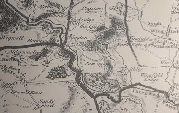
Burdett’s map (above), first published in 1767, is the earliest large-scale map of the roads around Crich, but even the  revised 1791 version fails to show the Cromford/Langley Mill turnpike of 1766. The Oakerthorpe/ Ashbourne road is marked by a double solid line with mileages, minor roads are shown by double broken lines, but footpaths are not marked. Crich grew up at the junction of two ancient routes: one running roughly east-west from Alfreton to Ashbourne and the other north-south, from Belper to Cromford and Matlock. The fords (and later bridges) at Whatstandwell, Bullbridge, South Wingfield and Cromford determined the road pattern; in the past rivers were wider, wilder and more of an obstacle than they are today. Given the steep climbs, for example at Bullbridge, most of the freight traffic until the mid-eighteenth century would have been by packhorse. Other distinct routes fanned out from the river crossings but avoided Crich, such as the track from Whatstandwell Bridge which still climbs up through Duke’s Quarries to Wakebridge, and then higher to Shuckstone Cross and possibly on to Ashover or Chesterfield.

Toll keeper’s cottage at Bullbridge

Little changed in this scenario until the arrival of turnpike roads in the second half of the eighteenth century. Turnpike trusts were allowed to charge road users (except travellers on foot) a toll, and in return had to improve and maintain the road surface to a suitable standard for wheeled traffic such as carts and coaches. The Cromford Bridge and Langley Mill turnpike, for example, was divided into six sections, with gates at Burgin Lane, Holloway, Hartsay and Peasehill Lane, plus chains at Codnor and Langley Mill. Although the tolls were widely resented, these upgraded routes encouraged the growth of industry, and travel generally in the period of the early Industrial Revolution.

Cast iron marker at Bullbridge on Cromford to Langley Mill turnpike

By the mid-nineteenth century the improved roads had transformed life in Crich. Carriers ran a regular service of carts or waggons to Derby, Nottingham and Wirksworth. Several coaching inns, notably the Bulls Head (opposite St Mary’s) and the White Swan offered daily coach services throughout the north: The Champion to Manchester at 10.30 a.m., The Peak Guide to Buxton at 4.30 p.m., another service to Nottingham at the same time and to Derby at 5 p.m. When the Midland railway opened, an ‘omnibus’ ran four times a day to Ambergate station. Despite the new possibilities, most men in Crich still worked in the quarries, as lead miners, as framework knitters or in agriculture. However, Pigot’s Directory for 1835 lists two wheelwrights in the town, Thomas Hunt and John Smith, while Ralph Taylor was a sadler, while others worked as inn keepers.

Crich Cross with Jovial Dutchman pub on left (now a private house)

Despite the centre of the town being called the Market Place, there is little evidence that a regular market was held there. However, Crich Fair was held twice a year, on the 6th of April (Lady Day) and 11th October (Old Michaelmas Day). It was originally for livestock, and was held on the Cromford Road above the Cross. By the early twentieth century it had become more of a fun fair with swings and roundabouts, but would still have generated local travel.
Leashaw: A road to nowhere?

Follow diversions

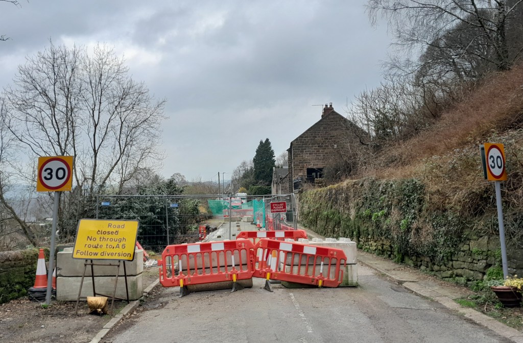
Road building in Derbyshire can be fraught, especially on steep-sided valleys. At times roads become too expensive to maintain, as happened with the road below Mam Tor, which was abandoned in the 1970s after frequent landslips due to the unstable geology. Following the exceptionally wet autumn and winter of 2023-4 several routes are currently closed, such as Beeley Lane. The village of Holloway has been badly affected; first the Cromford to Lea Bridge road was closed for over a year after flooding from the River Derwent in 2019, and then shortly after that was re-opened the Holloway to Crich road was closed due to a landslip undermining the pavement. This has now been blocked for over a year, and the County Council is not planning to start repair work until mid-2025.

This stretch of road was originally part of the Cromford Bridge and Langley Mill turnpike of 1766, built before the A6 provided a smoother, lower route. The house on the left, above, was one of the toll collectors’ cottages. At that time this would have been a narrow lane with just enough width for two carts or carriages to squeeze past. A report in the Derby Mercury in 1897 of a public meeting in Crich shows that the problems with this road are longstanding:

Mr Shaw brought forward an important matter, that of repairing the turnpike road leading from Bull Bridge to Holloway, stating that he thought, with many others, that the road ought to be taken over by the Derbyshire County Council. It was, however, clearly proved by Mr Dawes and other gentlemen that the County Council had been repeatedly requested to take over this road, but would not do so, their excuse being that there was insufficient through traffic. 

Walkers and cyclists only

It appears that the road was widened, surfaced and the pavement built in the 1930s, by which time the DCC had been obliged to take over maintenance. ‘Shaw’ in place names can mean a wood on a steep bank, and this accurately describes the route on both sides of Wakebridge, and explains why it is so difficult to maintain.

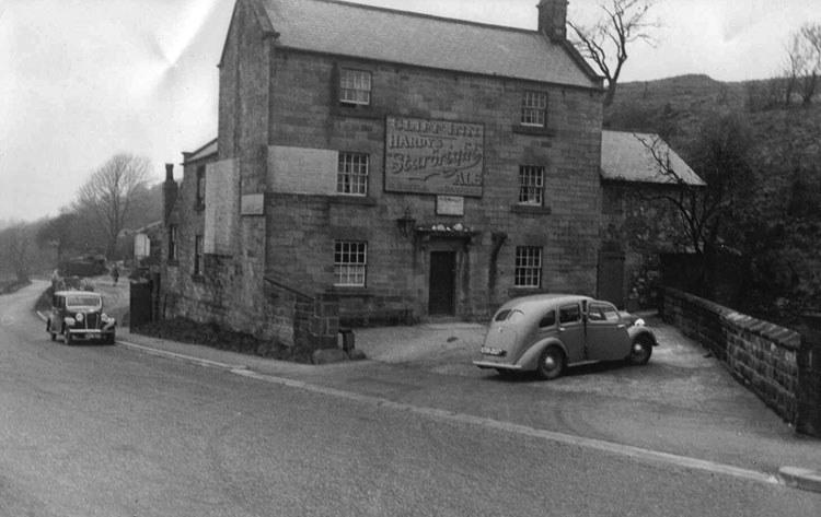
The good old daysthe Cliff pub

The situation is not just inconvenient for Crich and Holloway people. Several businesses are struggling with the lack of passing trade: Maycock’s Butchers and the Chase Cafe at the Holloway end, and the Cliff pub (above) at the edge of Crich. It seems that over 250 years after the turnpike was opened, a much wealthier society is unable to keep it open.

Milestoned?

Milestone from Bakewell to Ashbourne turnpike, near Winster

As might be expected, the Romans were the first to use milestones in Britain. Theirs were usually stone cylinders, and a fragment of one is in Buxton Museum. Clearly, they had two useful functions: not only did they tell travellers how far they had to go, but at the same time they provided reassurance that they were on the right road. Unsurprisingly, no Roman milestones survive in situ, and they were not seen here again until the eighteenth century.

Milestone near Matlock Bath

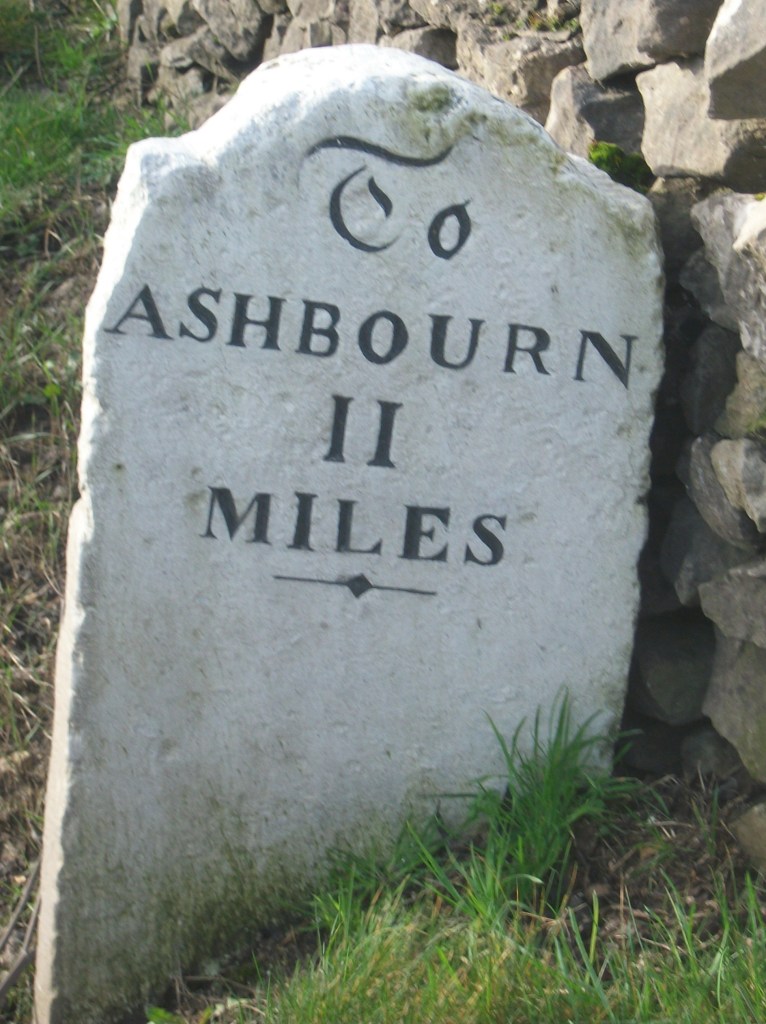
The turnpike trusts seem to have re-introduced milestones on their routes, with each trust using a slightly different style, as seen in the two examples above. Spelling of place names is also non-standardized. Many of these survive, and provide a useful indicator of the routes of different trusts. For instance, on the Alfreton to Ashbourne route, between Crich and Carsington almost all the stones are still in place, although sometimes they are hidden in the undergrowth.

Milepost at Fritchley

In the early nineteenth century some trusts began using iron, possibly because it was cheaper to letter. The above example is on the Cromford to Langley Mill turnpike near Fritchley, and gives more information than the earlier models.

This super-milepost is also made of iron, and is found opposite the Red Lion in Wirksworth. Unusually, it has the name of the iron founders (Harrison of Derby) at the base. Wirksworth was on the route of the Nottingham to Newhaven turnpike, and horses were probably changed at the Red Lion. Newhaven was an important turnpike junction, where coaches would join the Ashbourne to Buxton road.

Finally, it’s worth noting that although today few people use milestones for travel, we still talk about them in everyday conversation, as in ‘she had reached a critical milestone in her life …’. Perhaps a reminder that, at least for pedestrians, every milestone passed was an achievement!