The elusive Elizabeth Strutt

Jedediah Strutt by Wright of Derby

There’s a common misconception that few people travelled before the nineteenth century, due to the state of the roads. In fact, the economic and agricultural progress of the eighteenth century would have never happened without extensive journeying, as illustrated by the letters of Jedediah and Elizabeth Strutt, who both grew up in Derbyshire in the mid-eighteenth century. Due to the survival of some of their personal correspondence from the early years of their marriage we can gain a glimpse of the movements of some (at that time) quite ordinary folk.

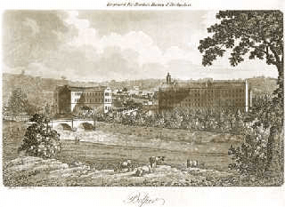
Strutt’s Belper mills in the nineteenth century

Jedediah was born in 1726, and was apprenticed as a wheelwright at the age of 14 in Findern, while his future wife Elizabeth, born in 1729, started her career as servant to a Dr Latham in Derby. It is notable that both were part of the Non-Conformist world, and both were fully literate; in fact their letters reveal a rich enjoyment of language. Their courtship, as shown by their correspondence, was lengthy and intermittent; this was no sudden infatuation but rather a stately and respectable dance.

In 1749 Betty moved to London and became servant to another well-respected Non-Conformist minister, Dr George Benson, a man who was so impressed by her qualities that he left her £40 in his will (worth over £5,000 today). Jed, (or Jerry as she called him) had meanwhile inherited some livestock from his uncle and set up as a farmer at Blackwell, northeast of Alfreton. On the strength of this they married in 1755, when he was 29 and she 26.

Their letters from 1757 reveal some details of their travels. They were trying to raise money to finance his ambitions in the hosiery business, and Jed had been to Derby:

I did not get home till fryday. I stayed at Derby on Wednesday night and came on Thursday to Heage before it began to snow so I stayd there all night …

The unseasonal weather also affected Betty, who had gone to London to visit her ex-employer:

I reechd London a bout 3 O Clock on Satturday, when we reechd Glen, 6 miles from Leicester I was so sick I was not able to travel further but staid behind ye waggon mor then an hour, & then walked 5 miles before I came up with it, we staid none at market harborough, but went forward to Germage Inn, where we lay, we never Dined, only just beat ye next day at Northampton and lay at Lathborough, ye next day we beat at Hockley and lay at redfearn 4 miles short of St Albans, it has been very windy bad weather & Rained and snow’d all Day on Thursday, and I caught a very Bad Cold …

(NB ‘beat’ = ‘ate’)

Both journeys illustrate the slowness and perils of travel at that time: it is notable that Betty was travelling by the cheapest method, the lumbering wagon, rather than the faster and more comfortable coach. The waggon took five days to make the trip. Despite her significant contribution to both the marriage and their business, and bearing five children, she seems to have been pretty much written out of Strutt history: no portrait of her survives. Elizabeth died in 1774 at the age of 45, Jedediah went on to re-marry, and lived to 1797.

Crossroads Crich

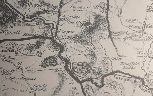
Burdett’s map (above), first published in 1767, is the earliest large-scale map of the roads around Crich, but even the  revised 1791 version fails to show the Cromford/Langley Mill turnpike of 1766. The Oakerthorpe/ Ashbourne road is marked by a double solid line with mileages, minor roads are shown by double broken lines, but footpaths are not marked. Crich grew up at the junction of two ancient routes: one running roughly east-west from Alfreton to Ashbourne and the other north-south, from Belper to Cromford and Matlock. The fords (and later bridges) at Whatstandwell, Bullbridge, South Wingfield and Cromford determined the road pattern; in the past rivers were wider, wilder and more of an obstacle than they are today. Given the steep climbs, for example at Bullbridge, most of the freight traffic until the mid-eighteenth century would have been by packhorse. Other distinct routes fanned out from the river crossings but avoided Crich, such as the track from Whatstandwell Bridge which still climbs up through Duke’s Quarries to Wakebridge, and then higher to Shuckstone Cross and possibly on to Ashover or Chesterfield.

Toll keeper’s cottage at Bullbridge

Little changed in this scenario until the arrival of turnpike roads in the second half of the eighteenth century. Turnpike trusts were allowed to charge road users (except travellers on foot) a toll, and in return had to improve and maintain the road surface to a suitable standard for wheeled traffic such as carts and coaches. The Cromford Bridge and Langley Mill turnpike, for example, was divided into six sections, with gates at Burgin Lane, Holloway, Hartsay and Peasehill Lane, plus chains at Codnor and Langley Mill. Although the tolls were widely resented, these upgraded routes encouraged the growth of industry, and travel generally in the period of the early Industrial Revolution.

Cast iron marker at Bullbridge on Cromford to Langley Mill turnpike

By the mid-nineteenth century the improved roads had transformed life in Crich. Carriers ran a regular service of carts or waggons to Derby, Nottingham and Wirksworth. Several coaching inns, notably the Bulls Head (opposite St Mary’s) and the White Swan offered daily coach services throughout the north: The Champion to Manchester at 10.30 a.m., The Peak Guide to Buxton at 4.30 p.m., another service to Nottingham at the same time and to Derby at 5 p.m. When the Midland railway opened, an ‘omnibus’ ran four times a day to Ambergate station. Despite the new possibilities, most men in Crich still worked in the quarries, as lead miners, as framework knitters or in agriculture. However, Pigot’s Directory for 1835 lists two wheelwrights in the town, Thomas Hunt and John Smith, while Ralph Taylor was a sadler, while others worked as inn keepers.

Crich Cross with Jovial Dutchman pub on left (now a private house)

Despite the centre of the town being called the Market Place, there is little evidence that a regular market was held there. However, Crich Fair was held twice a year, on the 6th of April (Lady Day) and 11th October (Old Michaelmas Day). It was originally for livestock, and was held on the Cromford Road above the Cross. By the early twentieth century it had become more of a fun fair with swings and roundabouts, but would still have generated local travel.

Riding through the glen …

The man who never was

When I was a young boy in Nottingham, in what now seems the Middle Ages but was actually the 1950s, we loved playing at Robin Hood. Inspired by the TV serial and song (Robin Hood, Robin Hood, Riding through the glen) we could make a primitive bow and arrows ourselves, and finding a green cap with a feather was not so difficult. Even today, when kids may have better things to do, the man remains a popular icon thoughout the North Midlands, not only in Nottinghamshire but in Yorkshire and Derbyshire too. How to account for the persistence of this medieval figure who is world-famous for such improbable behaviour as robbing the rich to give to the poor?

A man in tights

He is a man extraordinarily difficult to pin down, historically. But it appears that stories of his deeds were known by the fourteenth century, at first as an oral tradition and then appearing in written form. The stories vary over the centuries; all they have in common is an outlaw figure living in the forest, leading a group of men who rob passers-by. Some versions have him as a victim of corruption, a yeoman whose lands have been stolen, engaged in guerilla warfare with the sinister Sheriff. It seems likely he would focus on travellers on the Great North Road (Stamford, Newark, Bawtry), but forested routes as far west as the Erewash valley may have provided useful cover. Assuming Robin Hood was a composite character, composed of many outlaws in different times and places, it’s still worth trying to explain his remarkable survival and popularity throughout the region, including Derbyshire.

Quite a stride

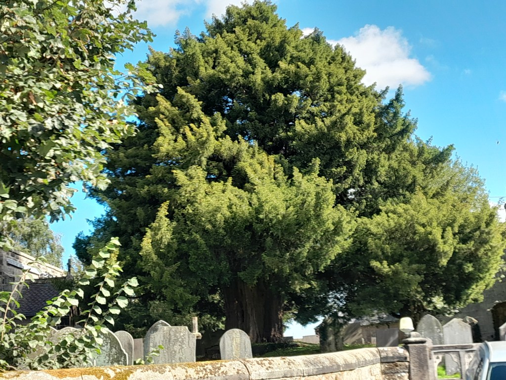
Robin Hood’s Stride, between Youlgreave and Birchover (and right on the Portway) is one of the most famous sights in the region, but there are many other places in Derbyshire linked to the hero/villain. These include two Robin Hood’s Wells, an Inn, a Cross, a Chair, a Leap and two hamlets, one near Whatstandwell and one west of Chesterfield. There is also Little John’s Grave in Hathersage churchyard, while Robin is alleged to have married under the Doveridge Yew. The outlaw’s name brought prestige and glamour to the ordinary, while providing sardonic humour to others. One eighteenth century writer even had a repentant Robin becoming a hermit in Deepdale, near Dale Abbey, grafting him onto an older legend.

The hermitage at Dale Abbey

The legends remind us of the perils of travel in the Middle Ages, but also reflect an almost universal sympathy for the outlaw who has the courage to break free from the common lot. They portray a fantasy world, in which the sun is always shining in the greenwood, and only the rich are robbed.

Source:

https://www.derbyshirefolklore.org/robin-hood-in-derbyshire.html

The travels of the Bakewell Crosses

The western face

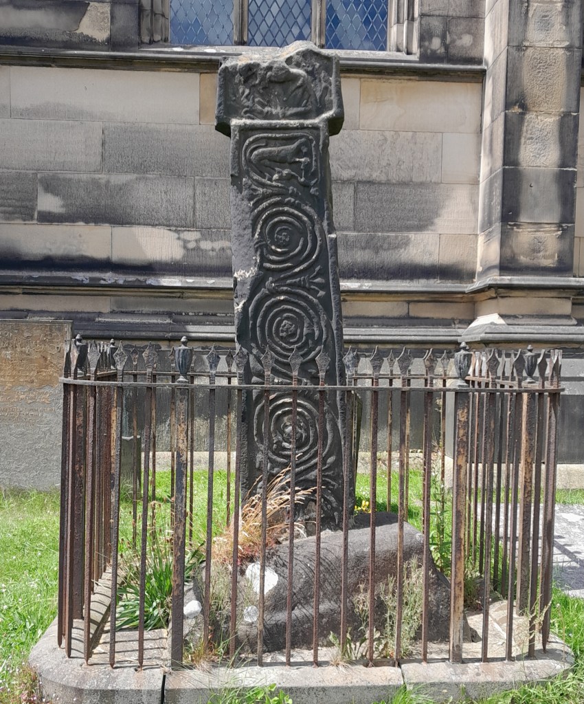
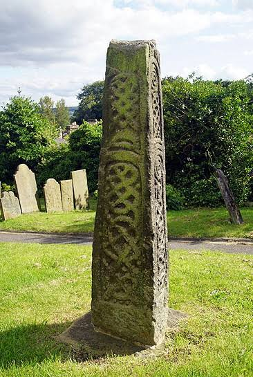
There are a surprising number of pre-Conquest stone crosses in Derbyshire, but Bakewell churchyard must be unique in having two. The larger one can be seen above, near the eastern end of the church, with carvings on all four sides, but with the cross head missing. The carvings are both worn and defaced, but on the eastern side scrolls of vines can be seen, while on the reverse are some scenes from the Christian tradition, such as the Annunciation. There is an interpretation panel in the church which claims that the cross has a Pagan side and a Christian side, so that the western face has the figure of Woden at the top.

The Anglo-Saxon cross

The second cross is near the south door, is a little shorter and has never had a cross head. According to the panels in the church this cross is Anglo-Scandinavian, while the larger one is Anglo-Saxon, but the carvings are really quite similar. The crosses are generally dated to between 800 and 1000 CE, but there was clearly a local tradition of carving which may have persisted for centuries, making dating difficult. In 2012 Archaeological Research Services (ARS) of Bakewell were funded to survey the sculpture of Bakewell churchyard, and their research can be studied in two reports. See:

archaeologicalresearchservices.com/projects/bakewellcross.htm

A survivor: Wheston cross near Tideswell

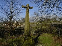
There is good evidence that both crosses were moved to Bakewell churchyard for protection, possibly in the nineteenth century, when an appreciation of antiquities developed. In the early medieval period travel on the Derbyshire moors would have been difficult and even dangerous, and the sight of a richly carved cross conveying the familiar Christian message would have comforted lonely travellers. Even today, rural roads in Catholic regions such as Bavaria have their wayside shrines, often decorated with flowers. But in England in the seventeenth century Puritan fanatics defaced what they saw as Popish images, both in churches and by the wayside. This explains why in-situ survivals like the Wheston cross are so rare. As part of their research ARS excavated a site near the old Hassop station, hoping to find evidence that the taller cross had been moved from there, but the findings were inconclusive. They did, however, establish that the cross had had a different location before arriving in the churchyard (see report). There is better evidence for the movements of the other cross. In the nineteenth century it was displayed in the garden of Holt House, Darley Dale, having apparently been found buried on the moor above Beeley, northwest of Screetham House Farm, on the line of the Chatsworth to Alfreton trackway. What we can never know is how many other crosses have been buried, broken up or used for construction over the last few centuries.

High Life on the High Peak

High Peak Junction in the 1960s

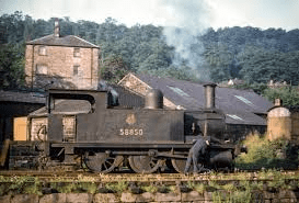
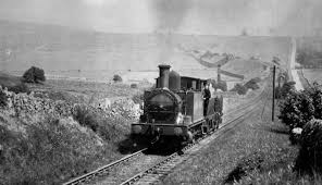
The successive iterations of the Cromford and High Peak Railway are a reflection of modern British history. Originally conceived as a canal in the early 1800s, it was intended to link the Peak Forest Canal with the Cromford Canal, a scheme that involved an ascent of about a thousand feet. But not only was such a high-level canal expensive to build, it would also be difficult to keep in water on the dry limestone plateau. The engineer Josiah Jessop then surveyed the route via Middleton and Hopton as a tramway, and this was authorised by an Act of Parliament in 1825. At that time the 33-mile route was the longest railway in the world, and it was intended to be worked by stationary steam engines on the steep inclines, and horses elsewhere. The line was in use, with horses replaced by engines, until 1967, with a passenger service briefly offered in the mid-nineteenth century. In the early 1970s the Peak Park reopened the route as a walking and cycling trail, which remains popular today.

Struggling up the Hopton Incline

But what was it like to travel on this extraordinary railway? In Frederick William’s Our Iron Roads there is a fascinating account of the writer’s journey from Cromford to Buxton in 1877. He began his trip at a place by the Black Rocks, then called Stone-House, where there was a railway office, now the car park. On enquiring for ‘The Fly’, as the train was known, he was told that it had gone by, but if he walked up the line he would be able to overtake it. Sure enough, he caught up with the train on the Middleton Incline. A railway worker asked if he wanted to catch the train, and on being told that he did, the man worked the signal to halt the train at the top. The only other passengers were a woman and her child, while the guard stood in the middle of the carriage to work the brake through a hole in the floor. At the top of the next incline the train stopped, and the guard explained that they had to wait for the engine to come for them. He warned that it might take a few minutes, or a few hours, and that yesterday it had never arrived!

Not clear what the goddess has to do with railways?

To pass the time, the writer strolled up the track, while his fellow passengers went mushrooming. After three hours the engine arrived from Whaley Bridge, and they set off to a public house further up the line, where driver, fireman and guard went to have a drink. Higher up they found a flock of sheep on the tracks, but as the guard explained , they were quite capable of jumping the drystone wall back to their field. The train finally arrived at Park Gates, near Buxton, at seven pm, having taken six hours to cover 20 miles. Not difficult, then, to explain the subsequent closure of the passenger service …

Source: Carr, D.P. (1934) ‘Sidelights on the Cromford and High Peak Railway’ Derbyshire Archaeological Journal vol. 55 pp 45-49

Phantom platform 2

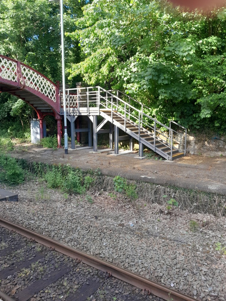
Platform 2, with footbridge

Trains no longer stop at platform 2, Whatstandwell station, for the very good reason that there are no railway tracks beside it. In fact, since the line was demoted in the Beeching era, the route has been single track from Matlock to Belper, whereas before that it was the main line from Derby to Manchester. However, recently a smart new flight of steel steps has been added to the platform, which would give access to the footbridge if there was no locked gate at the top. In fact, the footbridge allows passengers to link up with the Cromford Canal or a twitchel leading to Main Road.

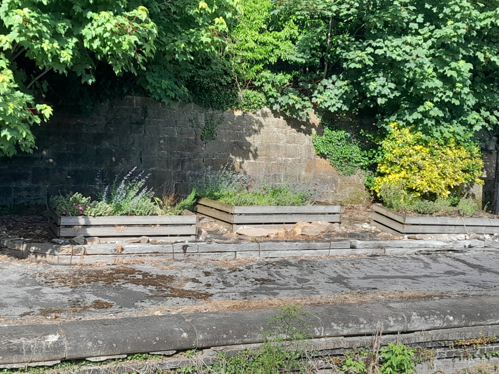
The main attraction?

So why install a shiny new, and presumably very expensive footbridge on a defunct platform? The answer, apparently, is to provide access for the volunteers who tend the flower beds, above. Of course, it’s wonderful that folk contribute their time to help keeping the station spruce, but I do wonder why they couldn’t just walk over the tracks, for free? Given that there are only two trains per hour, both of which stop at Platform 1, ‘elf ‘n safety’ is hardly a threat. Or perhaps the much-discussed plan to reopen the line beyond Matlock is already being implemented?

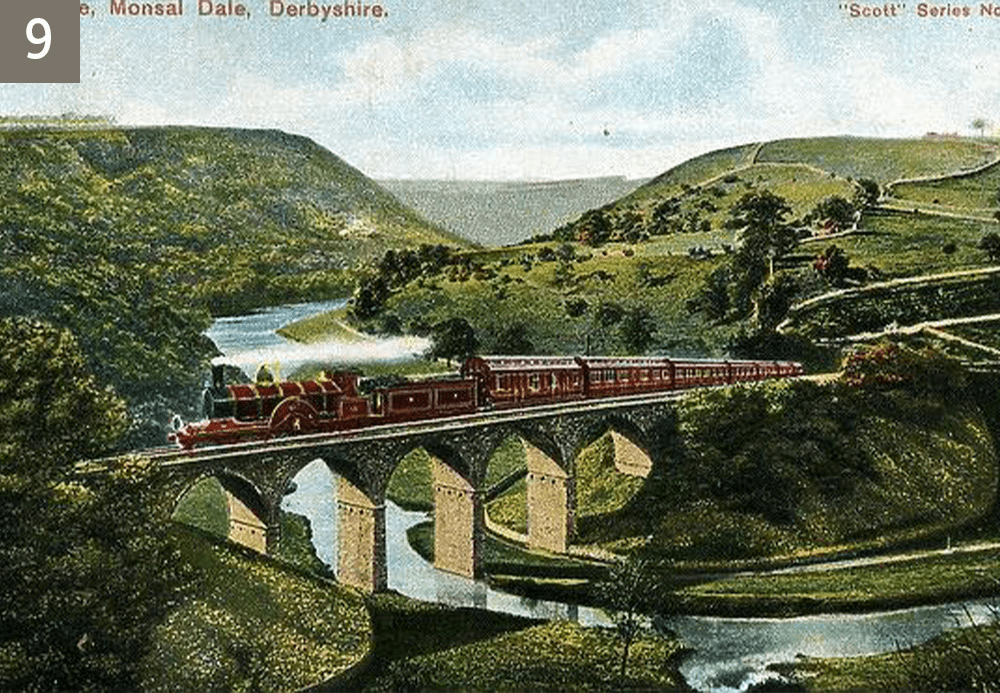
As it was … a southbound train at Monsal

St James to St Giles via St John

Pure Arts and Crafts

Many visitors (and some residents) don’t realise that the core of old Matlock is around St Giles’ church. The modern town, centred on Crown Square, is clearly linked to the bridge of about 1250, but all the development here is late Victorian. There may have been another Derwent crossing place, before the bridge was built, which was more convenient for traffic coming off Masson hill and heading for the old town, the church and beyond. Willies (2010) has argued for a ford opposite the bottom of St John’s Lane, near the site of the modern footbridge, which would lead to St Giles via the steep hill shown on old maps as Ladygate. He suggests that the geology of the river bed and the speed of water flow at this point would make the river fordable for most of the year. This theory can be the basis for an enjoyable walk from Bonsall to Starkholmes of about two miles.

A call to prayer

St James church in Bonsall has a dramatic setting on the hillside, above most of the village, with an altar that is claimed to be the highest in England at nearly 1,000 feet. Heavily restored in the 19th century, it has 13th century elements and an impressive spire. St James is the English version of Santiago, whose shrine in Galicia was the greatest pigrimage attraction in the medieval world. By this dedication the church may have hoped to attract local pilgrims and their offerings. Bonsall was also the home of the ‘t’owd man’ carving of a lead miner, now controversially in Wirksworth church, a reminder that Bonsall was once a major lead mining centre.

The water of life? Spring below St John’s chapel

The route to old Matlock begins on Ember Lane, just above the church. This runs gently uphill, in places a holloway, well sunk between its banks. At the top you pass Ember Farm and find a helpful Peak and Northern footpath sign showing you’re at the junction of four ways. Turn left and the track runs quite steeply downhill, heading for the top of the Heights of Abraham. You cut straight through here, staying on the right of way, and then drop down an open pasture before plunging back into the wood. Although this is now just a footpath, the width of the stone gateposts shows that it would have been passable by cart until eroded by landslips and vegetation. The path emerges onto the tarmac of St John’s Lane just above the chapel. This remarkable building was constructed in 1897 for a Mrs Louisa Harris as a private chapel, though never consecrated. The retaining wall by the road is made of massive limestone blocks, giving the appearance that the whole structure is hacked out of the rock. The Arts and Craft interior is worth seeing if you are lucky enough to arrive on an open day, and the dedication – to St John the Baptist – may be related to the spring at the base of the wall.

The railway bridge over Ladygate, looking up towards Starkholmes.

The walk continues downhill to the A6 where you turn briefly left and then cross the river by the footbridge. Go straight under the railway and then uphill before emerging near St Giles, the vicarage and the old Wheatsheaf pub. This route was obviously thought worth preserving when the railway arrived in the mid-nineteenth century, hence the bridges. St Giles church was largely rebuilt in the 19th century, though the Norman font suggests an earlier building. The most remarkable thing about the church is its position on the cliff, above the junction of the Bentley Brook and the Derwent. From here travellers could have continued to Chesterfield, Ashover, Alfreton and other towns to the east, but our pilgrimage is finished!

Source: Willies, L. (2010) Matlock and the location of Domesday Mestesforde

DAJ 103 pp 176-188

Lonely Youlgrave?

Burdett’s map of 1791 (the thick black line is the hundred boundary)

Today Youlgrave is a popular village in the Peak District – especially busy at weekends with visitors and second-home owners. It is built on the ridge between the steep valleys of the Lathkill to the north and the Bradford to the south; the two rivers joining less than a mile away, before Alport. But Youlgrave was isolated from the main routes: the old Portway ran north/south through Alport (hence the name), while the Bakewell-Newhaven turnpike of 1759 ran to the northwest. The modern Ordance Survey map marks Conksbury as the site of a deserted medieval village, but Burdett’s map shows that some buildings survived into the eighteenth century. With its steep climbs and tight bends the road through Conksbury seems an improbable main route, but Burdett shows no road at all eastward in the valley of the Bradford.

Conksbury bridge over the Lathkill on the Bakewell-Newhaven turnpike

Youlgrave church (All Saints) is easily the oldest building in the village, as well as the tallest, with an splendid tower that can be seen for miles. Pevsner says that it is ‘one of the most impressive churches of Derbyshire’, and parts of the south arcade may date from the twelfth century. But the site could have been a sacred spot for longer; its position near the junction of two rivers having special significance, similar to Matlock’s St Giles or Duffield’s St Alkmund’s. Of particular interest is a small carved figure on the north wall, described by Pevsner as ‘a man in a long frock’ but almost certainly a pilgrim with his or her characteristic staff (for self-defence) and wallet (for food reserves). It seems quite likely that this was a pilgrimage church, high above and nearly surrounded by water, perhaps holding a holy relic.

Ready for the road

There are lovely walks around the area, especially in the twin dales of the Bradford and Lathkill. One of the best starts at the church: you cross the road to the George Hotel and continue along Conksbury Lane for 200 metres before taking a narrow lane to the right. This runs downhill towards the Lathkill, but before reaching it you take a signposted path to the left which leads to the bridge (pictured above). Cross the bridge and then take the very clear path upstream along the river, reputed to be one of the cleanest in England. After about a mile you reach a lane running up the steep bank to Over Haddon. Cross the river here by the footbridge and then take the winding track to the top of the slope. Here you are in sight of Meadow Place Grange, and the path goes through the impressive farmyard. From here you can either take the farm road back to Conksbury bridge or climb up onto the pastures by a variety of paths, which will return you to Youlgrave.

The view is worth the climb

Peak Tor: Mound of mystery

The River Wye at base of Peak Tor; bank and ditch in foreground

Peak Tor is a steep, tree-crowned hill between Rowsley and Stanton. It is best seen from the north side of the Wye valley, on the old road to Bakewell, from where the ditch and bank earthworks are clearly visible. I walked the site on a chilly April morning, when geese were honking on the river and early swifts were swooping through the ancient trees. The footpath from Rowsley runs past the earthworks and then crosses a narrow valley to reach the hamlet of Pilhough. There are wood anenomes, bluebells and celandines in the grass and a cold wind from the east.

The summit of Peak Tor

The substantial ditch and bank which surrounds the north, north west and northeast sides of the Tor do not continue round the back, as it were, and so the idea that it was some kind of hillfort or similar doesn’t make sense. The Derbyshire Historic Environment Record is also puzzled: it is not thought to be prehistoric, it could be a medieval hunting park fence, it could be Anglo-Danish. So there is plenty of room for speculation: perhaps it was half-built when the builders were attacked, or the missing section of the defences could have been a wooden palisade.

The south side, from Peak Tor Lane

What is clear is that the Tor is close to the meeting of the Wye and Derwent, well above the floods which often soak these two valleys. It also has a good view of two important routes from Matlock, northwest to Bakewell and north to Beeley and Chatsworth. Clearly something on the hill was worth protecting, or was the structure offering shelter for travellers, as seen on sections of the Portway? Whichever theory you choose, the Tor provides a lovely walk, from Rowsley by footpath to Pilhough and then back to the Wye bridge on minor lanes, although sadly Caudwell’s Mill is no longer offering travellers a cup of tea.

‘Forgive us our …’

The fear of being caught ‘trespassing’ is still common, which is perhaps why towpaths and ex-railway trails are so crowded with walkers. But defining exactly what trespassing means in law is difficult, and in most cases it is only a civil offence, meaning that few landowners would bother to prosecute. But the fear of being confronted by an angry farmer is still potent, even if the days of gamekeepers and their shotguns, or even mantraps, have long gone.

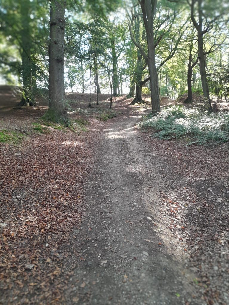
Looking north to Brinsley and Underwood from track by High Park Wood.

The situation is nicely depicted in DH Lawrence’s early (1910) story The Shades of Spring. A young man, Addy, who was brought up in this district on the Derbyshire/ Nottinghamshire border, but who has now moved away, is revisiting his old haunts. He is walking through the woods to the farm where his ex-sweetheart, Hilda, lives, but in the wood his path is blocked by a young gamekeeper:

‘Where might you be going this road, sir?’ The tone of his question had a challenging twang.

The use of ‘sir’ reveals the keeper’s dilemma: was he speaking to a gentleman or one of the local colliers? A guest at the ‘House’ would be free to go where they wished, but in the story Addy tells the keeper, Arthur, that he’s been away from the area for years, and he’s on his way to Hilda’s farm. Arthur then reveals that he’s now courting Hilda, and clearly resents Addy maintaining his friendship with her through correspondence. After a difficult conversation Addy continues on the path to the farm, despite Arthur’s sullen objections.

Haggs Farm in the 1930s

Like much of Lawrence’s early fiction this story is partly based on his own life. His unhappy relationship with Miriam Chambers, who lived at Haggs Farm near Felley Mill, Moorgreen, is famously depicted in his Bildungsroman ‘Sons and Lovers’. Lawrence had idealised Miriam as a spiritual being, when, as this story shows, she was more interested in a physical relationship than French poetry. The story concludes with her showing Addy the woodland love nest that Arthur had created for her, a cabin erotically if improbably furnished with animal skins. This is an interesting forerunner to the hut in ‘Lady Chatterley’s Lover’, written much later, in which Mellors had his tryst with Connie. The model for both could have been this rather shabby shack in High Park Wood (below), almost certainly known to the young writer.

Less than romantic

So the story deals with two kinds of trespass: entering private land, but also Addy’s attempted trespass on Hilda, who Arthur clearly believes is now his private property. The story concludes when Addy is about to reluctantly depart; Arthur is stung by a bee, and, in a powerful image, Hilda sucks the poison from his arm, and oblivious to the now-forgotten Addy, the couple begin a passionate kiss.