Many visitors (and some residents) don’t realise that the core of old Matlock is around St Giles’ church. The modern town, centred on Crown Square, is clearly linked to the bridge of about 1250, but all the development here is late Victorian. There may have been another Derwent crossing place, before the bridge was built, which was more convenient for traffic coming off Masson hill and heading for the old town, the church and beyond. Willies (2010) has argued for a ford opposite the bottom of St John’s Lane, near the site of the modern footbridge, which would lead to St Giles via the steep hill shown on old maps as Ladygate. He suggests that the geology of the river bed and the speed of water flow at this point would make the river fordable for most of the year. This theory can be the basis for an enjoyable walk from Bonsall to Starkholmes of about two miles.
St James church in Bonsall has a dramatic setting on the hillside, above most of the village, with an altar that is claimed to be the highest in England at nearly 1,000 feet. Heavily restored in the 19th century, it has 13th century elements and an impressive spire. St James is the English version of Santiago, whose shrine in Galicia was the greatest pigrimage attraction in the medieval world. By this dedication the church may have hoped to attract local pilgrims and their offerings. Bonsall was also the home of the ‘t’owd man’ carving of a lead miner, now controversially in Wirksworth church, a reminder that Bonsall was once a major lead mining centre.
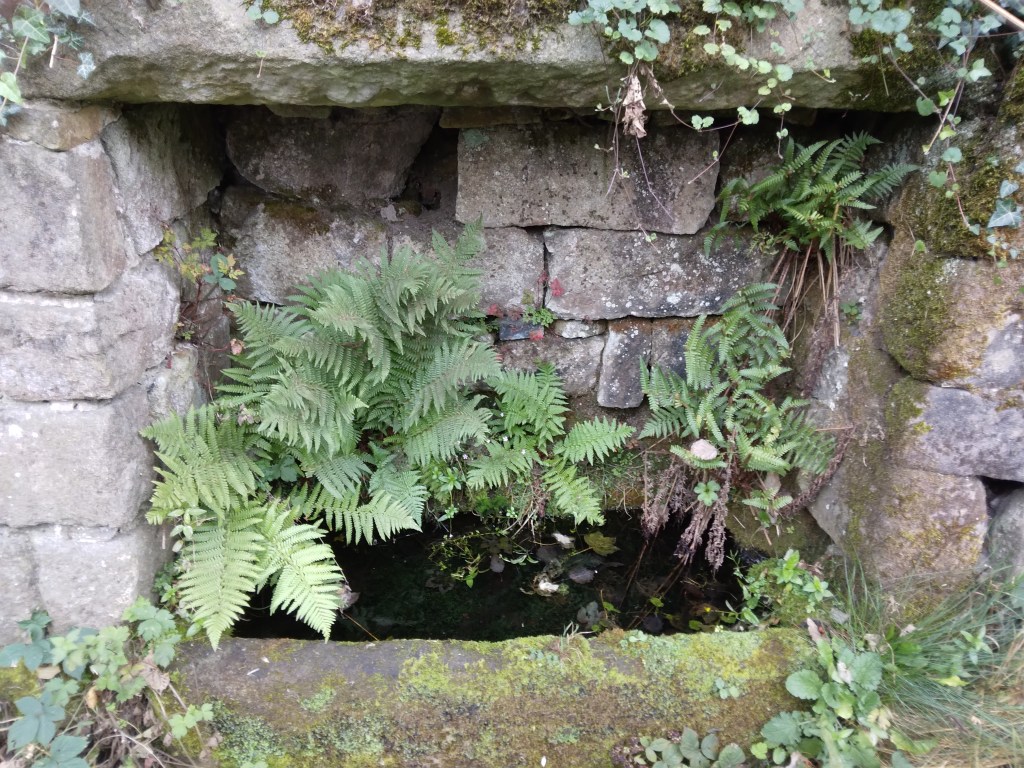
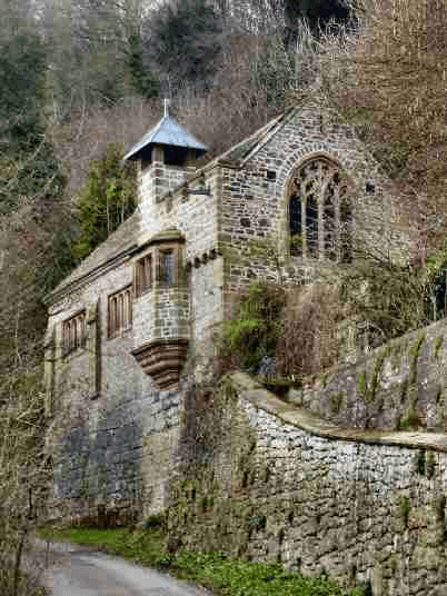
The route to old Matlock begins on Ember Lane, just above the church. This runs gently uphill, in places a holloway, well sunk between its banks. At the top you pass Ember Farm and find a helpful Peak and Northern footpath sign showing you’re at the junction of four ways. Turn left and the track runs quite steeply downhill, heading for the top of the Heights of Abraham. You cut straight through here, staying on the right of way, and then drop down an open pasture before plunging back into the wood. Although this is now just a footpath, the width of the stone gateposts shows that it would have been passable by cart until eroded by landslips and vegetation. The path emerges onto the tarmac of St John’s Lane just above the chapel. This remarkable building was constructed in 1897 for a Mrs Louisa Harris as a private chapel, though never consecrated. The retaining wall by the road is made of massive limestone blocks, giving the appearance that the whole structure is hacked out of the rock. The Arts and Craft interior is worth seeing if you are lucky enough to arrive on an open day, and the dedication – to St John the Baptist – may be related to the spring at the base of the wall.
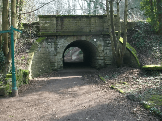
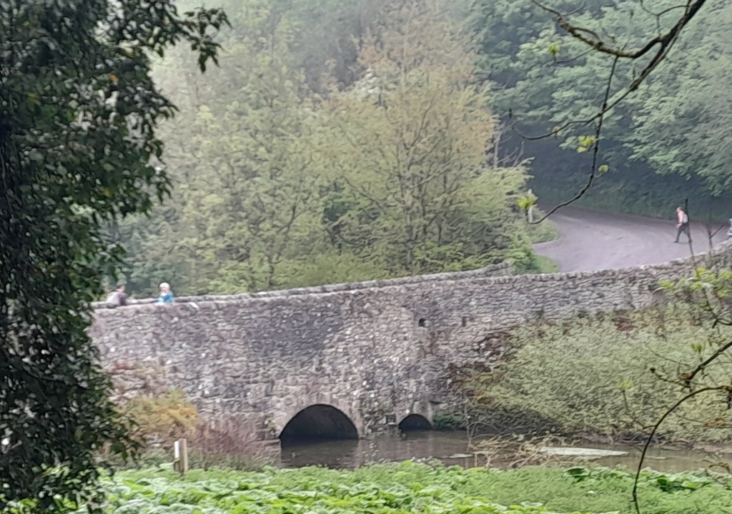
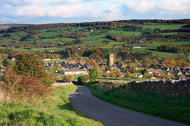
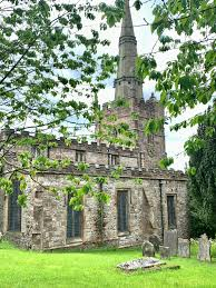
The walk continues downhill to the A6 where you turn briefly left and then cross the river by the footbridge. Go straight under the railway and then uphill before emerging near St Giles, the vicarage and the old Wheatsheaf pub. This route was obviously thought worth preserving when the railway arrived in the mid-nineteenth century, hence the bridges. St Giles church was largely rebuilt in the 19th century, though the Norman font suggests an earlier building. The most remarkable thing about the church is its position on the cliff, above the junction of the Bentley Brook and the Derwent. From here travellers could have continued to Chesterfield, Ashover, Alfreton and other towns to the east, but our pilgrimage is finished!
Source: Willies, L. (2010) Matlock and the location of Domesday Mestesforde
DAJ 103 pp 176-188