Defoe’s Derbyshire tour

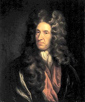
Biography of Daniel Defoe author of "Robinson Crusoe"
An early tourist

Few people living in Derbyshire in the eighteenth century have left an account of their travels; clearly they didn’t feel any need to describe their everyday experiences. Therefore it is left to the handful of early tourists to provide an impression of journeying in the county three hundred years ago. Daniel Defoe was an early novelist and journalist who visited many English counties in the 1720s in order to produce his A Tour of England and Wales.

Beginning at Derby, he had clearly chosen a wet season for his visit, since he had to abandon plans to visit Ashbourne on account of ‘the river drowning the low-grounds by a sudden shower, and hastening to the Trent with a most outrageous stream’, a reminder that, not so long ago, travel was very much at the whim of the weather. There are other references to the Derwent as ‘a frightful creature when the hills load her current with water’.
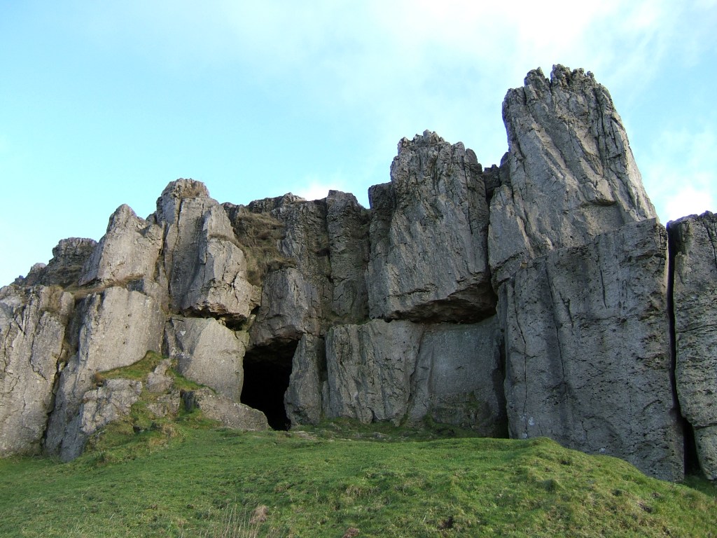
Cave at Harborough Rocks

Defoe’s next stop was Wirksworth, which he found interesting due to the lead trade, despite the inhabitants being ‘a rude boorish kind of people’. The most remarkable part of this visit was an excursion to Harborough Rocks, which was called the Giant’s Tomb at that time. Here he found a lead miner’s family living in a cave, which had been lived in by his family for several generations. Defoe was both horrified, and impressed that people could cope with such crude conditions: ‘they seemed to live very pleasantly, the children look’d plump and fat’. Defoe’s party had a whip-round and gave the miner’s wife several shillings. (Today the cave can be visited quite easily by climbing up from the High Peak Trail).

Other items on his itinerary were more predictable: the Wonders of the Peak, and a focus on spas, which were just beginning to be significant destinations at this time. He is suitably impressed by Chatsworth, but comments about the moor above the house: ‘a waste and howling wilderness, over which, when strangers travel, they are obliged to take guides, or it would be next to impossible not to lose their way’. As for getting to Matlock (which he labels as a village), Defoe maintains that the warm springs would be worth visiting if access was not by ‘ a base, stony, mountainous road’ – presumably the route over Scarthin, which was eventually superseded by blasting the present road through the rocks at Cromford.

Nineteenth-century painting of High Tor, Matlock

Saints and sinners

Carving of pilgrim, Youlgrave church

This figure from Youlgrave church is thought to represent a pilgrim, with his (or her) staff and waist-hung satchel. We often think of pilgrimage in terms of the great medieval shrines of Christianity such as Santiago or Canterbury, but during the high middle ages (about 1100 – 1300 CE) many pilgrimages must have been more local, perhaps within a day’s journey of the pilgrim’s home. In Derbyshire, abbeys such as Dale as well as churches like St Alkmund’s in Derby would have attracted pilgrims. The main draw was the burial place of a saint or the ownership of a holy relic, such as a flask of Mary’s milk.

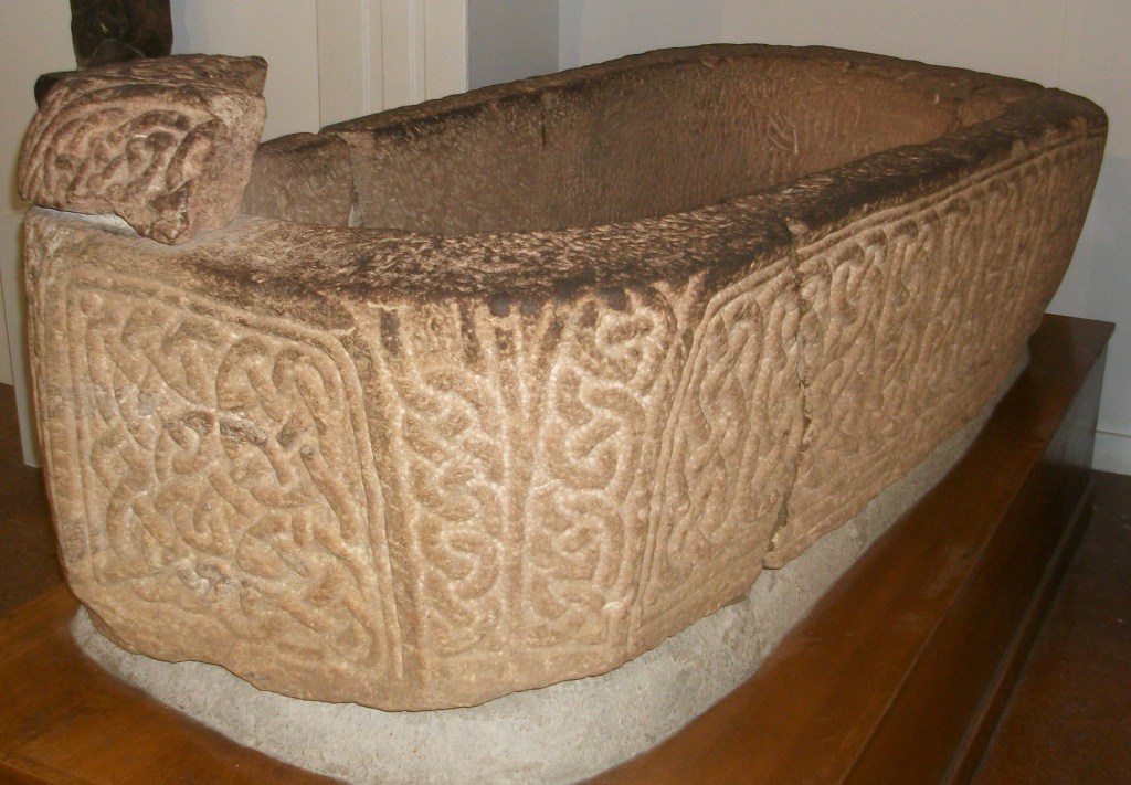
Sarcophagus in DerbyMuseum

Pilgrims hoped that being close to the remains of a holy person would benefit them in some way. Many were seeking a cure for an illness, often with the belief that a particular saint would help with certain conditions. Others might be making the journey as a penance, to compensate for some crime or misdemeanor. St Alkmund was a local saint who was murdered in Derby in the eighth century, and whose impressive stone sarcophagus can be seen in Derby Museum – the (rebuilt) church was demolished to make way for the city’s ring road.

St Bertram’s church, Ilam

Another local saint, although actually in Staffordshire, is St Bertram at Ilam near Ashbourne. He also lived in the Saxon period, becoming a hermit after his wife and child were eaten by wolves. One unusual feature of the church is that the shrine of the saint has survived, perhaps due to the remote location of the village. Most aspects of pilgrimage, such as shrines and relics, were removed during the Protestant Reformation of the sixteenth century. Yet although discouraged, pilgrimage was hard to suppress, and saw an effective revival in the growth of spa towns such as Buxton in the eighteenth century.

Ex-votos, Passau, Bavaria

In Britain there are few relics of pilgrimage, but in Catholic areas of Europe such as Spain or Bavaria it is possible to find displays of ex-votos such as the example above. These are often small paintings of a miracle rescue or healing brought about by the local saint, and given to the church in thanksgiving. In other places models of the afflicted body part, such as arm, foot or head, are displayed. Clearly, in an age of very limited medical knowledge, making a pilgrimage was often seen as an effective remedy.

Conquering the stoop

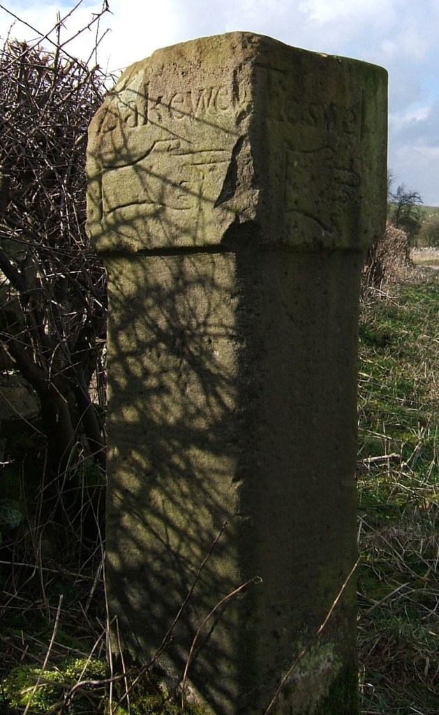
Guide stoop at top of Crowhill Lane near Bakewell

Nearly fifty of these stone pillars survive in Derbyshire, providing vital clues to the medieval road network. ‘Stoop’ is a Scandinavian word for stone, and they have proved suitably durable, many surviving for over three hundred years. They were erected about 1709 to (belatedly) comply with an Act of 1697 which required direction stones to be put up at road junctions in remote moorland areas, where travellers would be likely to get lost. The majority have inscriptions on four sides, and these should indicate the direction of the nearest market towns. The example above shows a hand pointing to ‘Bakewel’, while the other sides indicate the directions of Tideswell, Buxton and Winster. It is notable that the stone now stands at a T-junction; the fourth route was closed with the opening of the turnpike road on what is now the nearby A6.

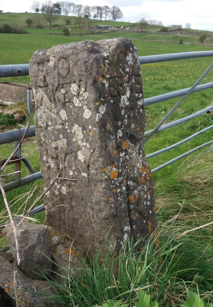
Guidestoop above Winster on road to Grangemill

This illustrates one of the values of these stoops: they show the routes that were in use pre-turnpike and pre-maps. The Winster stoop, above, provides another example. It is thought that originally it stood at the end of Bonsall Lane, and indicates Wirksworth, Bonsall and Bakewell. The fourth town marked, however, is Leek, over 15 miles away via Pikehall, but clearly a significant destination at that time. As with some other guide stoops, this one has been used as a gatepost, since most stoops would have become redundant with the arrival of better signposted turnpikes later in the eighteenth century. Nearby, at Shothouse Spring, another stoop (on private land) is no longer on any road or path, although it was clearly erected at a one-time crossroads.

Guidestoop at Alport Height

The Alport stone (showing Derby, Wirksworth and Ashbourne) is another example of a stoop at an apparently remote junction, but clearly thought worth marking in 1709. In fact its position on the Portway suggests that it would have been a more important route at that time. To properly envisage early eighteenth century travel we need to remove most of the dry stone walls and grassy pasture, and go back to a landscape of open scrubby moorland, crossed by the occasional track. In this setting it is easier to imagine the reassurance that the guidestoop would have given the uncertain traveller.

(For a detailed guide to all surviving stoops see ‘The Guide Stoops of Derbyshire’ by Howard Smith)