Lonely Youlgrave?

Burdett’s map of 1791 (the thick black line is the hundred boundary)

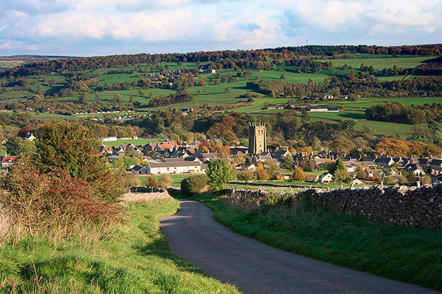
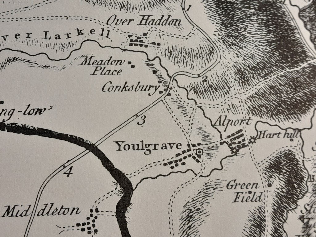
Today Youlgrave is a popular village in the Peak District – especially busy at weekends with visitors and second-home owners. It is built on the ridge between the steep valleys of the Lathkill to the north and the Bradford to the south; the two rivers joining less than a mile away, before Alport. But Youlgrave was isolated from the main routes: the old Portway ran north/south through Alport (hence the name), while the Bakewell-Newhaven turnpike of 1759 ran to the northwest. The modern Ordance Survey map marks Conksbury as the site of a deserted medieval village, but Burdett’s map shows that some buildings survived into the eighteenth century. With its steep climbs and tight bends the road through Conksbury seems an improbable main route, but Burdett shows no road at all eastward in the valley of the Bradford.

Conksbury bridge over the Lathkill on the Bakewell-Newhaven turnpike

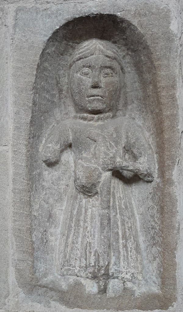
Youlgrave church (All Saints) is easily the oldest building in the village, as well as the tallest, with an splendid tower that can be seen for miles. Pevsner says that it is ‘one of the most impressive churches of Derbyshire’, and parts of the south arcade may date from the twelfth century. But the site could have been a sacred spot for longer; its position near the junction of two rivers having special significance, similar to Matlock’s St Giles or Duffield’s St Alkmund’s. Of particular interest is a small carved figure on the north wall, described by Pevsner as ‘a man in a long frock’ but almost certainly a pilgrim with his or her characteristic staff (for self-defence) and wallet (for food reserves). It seems quite likely that this was a pilgrimage church, high above and nearly surrounded by water, perhaps holding a holy relic.

Ready for the road

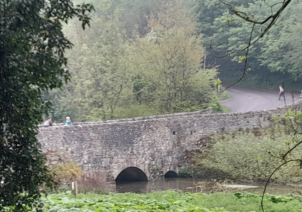
There are lovely walks around the area, especially in the twin dales of the Bradford and Lathkill. One of the best starts at the church: you cross the road to the George Hotel and continue along Conksbury Lane for 200 metres before taking a narrow lane to the right. This runs downhill towards the Lathkill, but before reaching it you take a signposted path to the left which leads to the bridge (pictured above). Cross the bridge and then take the very clear path upstream along the river, reputed to be one of the cleanest in England. After about a mile you reach a lane running up the steep bank to Over Haddon. Cross the river here by the footbridge and then take the winding track to the top of the slope. Here you are in sight of Meadow Place Grange, and the path goes through the impressive farmyard. From here you can either take the farm road back to Conksbury bridge or climb up onto the pastures by a variety of paths, which will return you to Youlgrave.

The view is worth the climb

What’s in a name?

Sign near Holbrook

There are several ‘portways’ in England, such as the route over the Long Mynd in Shropshire, but the Derbyshire Portway seems to be the longest and the best-researched. The route in Derbyshire was first suggested by Cockerton, an historian from Bakewell in the 1930s, who based his idea of a long-distance route on a string of ‘port’ place names such as Alport and Alport Height, which can be linked together in a roughly north-south alignment by existing tracks and paths. These place names are reinforced by references to a ‘Portwaye’ in some medieval documents and two Portway lead mines. Cockerton discussed the origin of the name ‘Portway’ at length, without coming to a definite conclusion. But it seems clear that the word is Anglo-Saxon, and was applied by them to pre-existing, non-Roman routes. Some have suggested an origin linked to ‘porter’, that is someone who carries, but then all roads are for carrying goods. The common Anglo-Saxon word for road was ‘way’, except for the old Roman roads which were ‘streets’. So a ‘portway’ was something special.

The line of the Portway running south from Cratcliffe Rocks, turnpike road to left

A ‘port’ suggests a place of safety and shelter, so I think a portway was a a long-distance route which had ‘ports’ for travellers at intervals of roughly ten miles. These might have been similar to the caravanserai found in the Middle East – defensive sites where wayfarers could sleep, cook and graze their animals overnight. In Derbyshire these are likely to have been on high ground for defence, and a string of probable sites can be identified, from north to south: Mam Tor, Fin Cop, Cratcliff Rocks, Harborough Rocks, Alport Height, Arbour Hill at Dale and Arbour Hill in Wollaton Park. It is noteworthy that three of these have a similar ‘arbour’ component, and a harbour of course is similar to a port.

Harborough Rocks, between Wirksworth and Brassington

Several of these sites, including Mam Tor, Fin Cop and Harborough, have been excavated and evidence of occupation, such as pottery, has been found. But permanent settlement in such high and waterless places seems unlikely, while the designation ‘hill fort’ is too vague. Far more likely that they served to protect tired travellers, and thus answered a question too rarely asked by pre-historians – how did merchants, drovers, priests, soldiers and pilgrims make lengthy journeys before the arrival of inns?