Striding along …

Another bullseye?

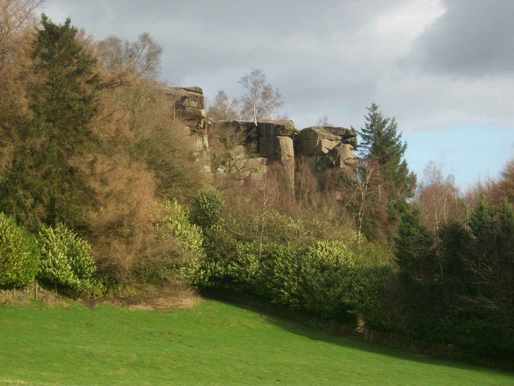
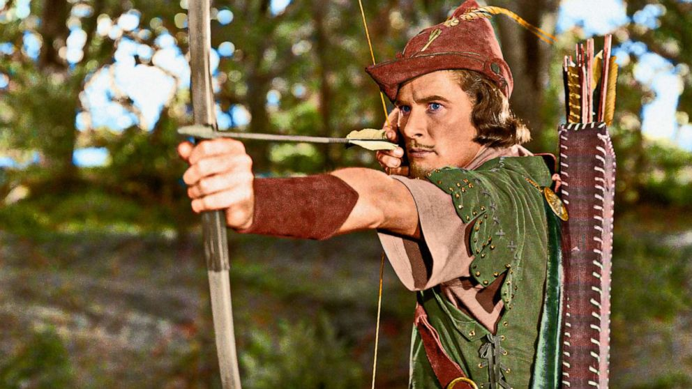
It’s hard to escape from Robin Hood in the north Midlands, with pubs bearing his name spread out over the region, from Macclesfield to Stoke and Sheffield to Nottingham. There are also Robin Hood wells, hamlets, fish and chip shops and the rock outcrop west of Winster, Robin Hood’s Stride. Clearly, the legendary figure has long had popular appeal, although in the case of the Stride the name must have been humorous, since the twin ‘towers’ are many yards apart.

A giant leap …

The Stride provides an excellent natural landmark, visible for miles around, handily for travellers on the Portway, which runs between the Stride and Cratcliff Rocks. Before the days of maps people must have memorized a series of landmarks to avoid getting lost: perhaps certain trees, river crossings or rocks like this. But the Stride seems to have been at the junction of several routes, not just the roughly north-south line of the Portway, but also an east-west track.

Darley bridge

This very scenic walk can be followed on public footpaths, starting from the layby below Cratcliff Rocks on the B5056. 100 yards north a footpath climbs the sharp slope, and then joins a track heading east and following the contour line. Go past a ruined stone barn and continue along the top of Birchover Wood. At Uppertown the path becomes a track; follow along Clough Lane and Oldfield Lane till you reach a road and then turn right into Darley Bridge village. Turn left on the main road, cross the bridge, and just to the right of the Square and Compass pub take the field path over the water meadows. The importance of the river crossing is shown by the position of this Robinson’s pub – it has been regularly flooded but stoically continues to provide refreshment for travellers. This probable packhorse route continues past the DFS showrooms and up into Two Dales, where it follows an ancient way known as Back Lane, heading for Darley Flash and (probably) Chesterfield.

A walk on the Portway

The Portway as Islington Lane

This walk, which can stand alone or be incorporated into a longer route, gives a taste of one of Derbyshire’s oldest roads, and incorporates many features of historic (or even prehistoric) travel. Starting behind the Miners’ Standard pub above Winster (car parking generally possible opposite) , the track runs north between stone walls. Today the track is labelled as part of the Limestone Way, although Islington Lane, an older name, is a reminder of the miners’ settlement here in the boom days of lead mining. This old road was replaced by the Ashbourne turnpike, now the B5056, which zig zags down the slope to allow carriages an easier incline.

Looking towards Cratcliffe Rocks from the end of Dudwood Lane

After about a mile you cross the Elton road and continue on Dudwood Lane, downhill on what is now a tarmac surface. On the right is the site of the Portaway lead mine, once a substantial producer, which provides clear evidence for the route of the old road. At the bottom of the hill you bypass the cattle grid and start climbing towards Cratcliffe Rocks, with the twin peaks of Robin Hood’s Stride on the left. These rock outcrops must have provided clear landmarks for medieval travellers, and the path runs between them. Evidence has been found at the top of the Rocks of prehistoric habitation, probably to provide shelter for travellers: the summit certainly provides excellent views of the route. Another feature is the medieval hermit’s cave, found in the woods below, which is discussed in a previous blog (Hermits and their Hermitages, 6th August).

Cratcliffe Rocks

Now the track runs beside Robin Hood’s Stride, one of the many Derbyshire features named after this hero. Its striking profile with the rocky pinnacles also gave it the name ‘Mock Beggar’s Hall’. However, the most interesting features of this area are found on the other side of the path, on Harthill Moor, where the stone circle suggests a Neolithic dating. Known as Nine Stone Close, there are actually only four uprights, and there is a suggestion that they may have been re-erected quite recently. Less obvious is an example of cup-and-ring marking on a boulder, a Bronze Age feature not fully understood by archaeologists, but possibly associated with long-distance trackways.

Nine Stone Close

From here the walk can extended on the Limestone Way to Youlgreave, or even to Bakewell via Alport, but the simplest option is to head back towards the Miners’ Standard, where a good lunch and a decent pint can usually be found!

Conquering the stoop

Guide stoop at top of Crowhill Lane near Bakewell

Nearly fifty of these stone pillars survive in Derbyshire, providing vital clues to the medieval road network. ‘Stoop’ is a Scandinavian word for stone, and they have proved suitably durable, many surviving for over three hundred years. They were erected about 1709 to (belatedly) comply with an Act of 1697 which required direction stones to be put up at road junctions in remote moorland areas, where travellers would be likely to get lost. The majority have inscriptions on four sides, and these should indicate the direction of the nearest market towns. The example above shows a hand pointing to ‘Bakewel’, while the other sides indicate the directions of Tideswell, Buxton and Winster. It is notable that the stone now stands at a T-junction; the fourth route was closed with the opening of the turnpike road on what is now the nearby A6.

Guidestoop above Winster on road to Grangemill

This illustrates one of the values of these stoops: they show the routes that were in use pre-turnpike and pre-maps. The Winster stoop, above, provides another example. It is thought that originally it stood at the end of Bonsall Lane, and indicates Wirksworth, Bonsall and Bakewell. The fourth town marked, however, is Leek, over 15 miles away via Pikehall, but clearly a significant destination at that time. As with some other guide stoops, this one has been used as a gatepost, since most stoops would have become redundant with the arrival of better signposted turnpikes later in the eighteenth century. Nearby, at Shothouse Spring, another stoop (on private land) is no longer on any road or path, although it was clearly erected at a one-time crossroads.

Guidestoop at Alport Height

The Alport stone (showing Derby, Wirksworth and Ashbourne) is another example of a stoop at an apparently remote junction, but clearly thought worth marking in 1709. In fact its position on the Portway suggests that it would have been a more important route at that time. To properly envisage early eighteenth century travel we need to remove most of the dry stone walls and grassy pasture, and go back to a landscape of open scrubby moorland, crossed by the occasional track. In this setting it is easier to imagine the reassurance that the guidestoop would have given the uncertain traveller.

(For a detailed guide to all surviving stoops see ‘The Guide Stoops of Derbyshire’ by Howard Smith)