The (very) old roads

The big beast – an Auroch

Just how old are the ‘old roads’? How were the first roads developed?

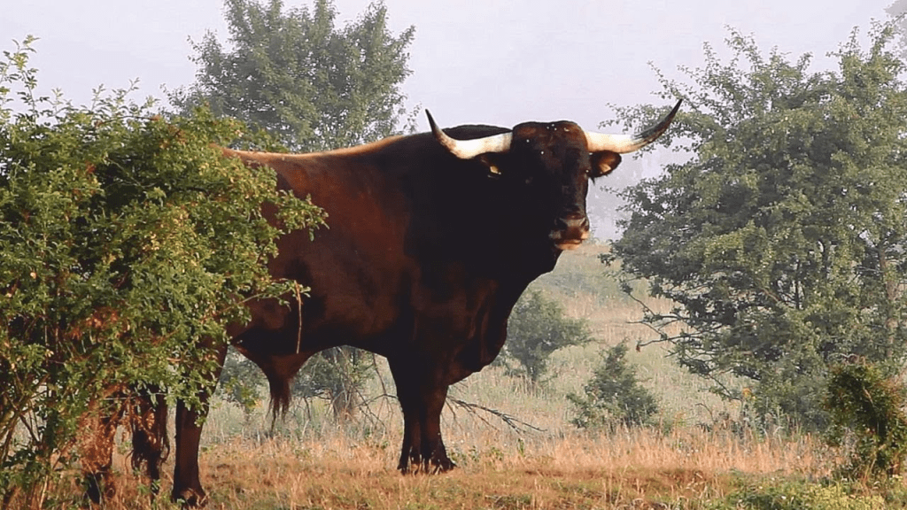
These questions are difficult to answer, but worth a try! The last ice age ended about 10,000 years ago, and the landscape of Britain must have gradually become more wooded as temperatures rose. Mammals would have arrived via the land bridge to the continent, including large beasts such as aurochs (early cattle), horses, deer and boar. These creatures are mainly herd animals, and would have travelled with the seasons, moving north in spring looking for fresh pasture and water, then south in autumn.

On alert

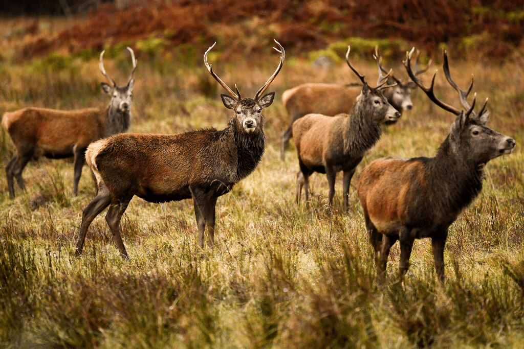
A herd of any large mammals would follow the easiest routes, avoiding the choking, dense growth in river valleys, and in doing so created channels of movement along the high ground. Their progress would hinder plant growth and so keep these routes open. They could drink from streams, but kept river crossings to a minimum, due to the risk of autumn floods. So when the first paleolithic (Old Stone Age) nomadic people arrived they must have followed these herds, both for the chance of making a kill and also because a proto-road offered the easiest route.

Some of the crags

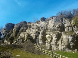
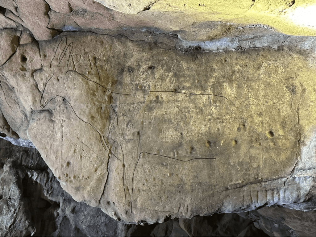
The very rare cave art found at Cresswell Crags, on the north east Derbyshire border, portrays deer, elk, wolves, hyenas and bears, clearly suggesting that Stone Age man had a close relationship with these creatures. Today many of their prehistoric ridgeway routes are still in use, notably many sections of the Derbyshire Portway, the lane from Belper Lane End to Bolehill, the A61 from Higham to Clay Cross, and dozens more.

Spot the stag

The ridgeway rumpus

The road(s) to Buxton

The OS map of the area north of Newhaven shows how popular this route has been for transport: the modern A515 follows the line of the eighteenth-century turnpike; the Midshires Way runs along the route of the Cromford and High Peak Railway, while the Roman road (The Street) runs a little to the east of this. All of these are following the high ridge between Newhaven and Buxton, avoiding the valleys on either side. It seems a classic example of a ridgeway, which have been generally seen as long-distance travel routes, with well-known examples in the south of England such as the Icknield Way, running south west from Norfolk towards Avebury, the western section now simply called ‘The Ridgeway’.

Walking the Ridgeway

It is suggested that ridgeway routes were developed in prehistoric times for long-distance travel, since their route involved fewer descents into boggy river valleys, while higher ground was less densely wooded and gave travelers a better view of landmarks ahead. Moreover, there seem to be many prehistoric remains such as hillforts or tumuli near these routes, further justifying their existence. In many cases the Romans seem to have taken over these routes and engineered them to their standards. However, other prehistorians claim that the ridgeways which have survived owe their survival to being in remote upland areas, and that modern aerial photography shows evidence of wide prehistoric settlement, not only on the higher ground. Some also argue that there is no evidence that the ridgeways are prehistoric, and may well be medieval.

Minninglow, visible for miles around

In view of this debate it is worth looking at the line of the Roman road from Brassington to Buxton, part of which is shown on the map above. Not only are there many tumuli along the way – ancient burial mounds – but also a large number of ‘lows’: Slipper Low, Minninglow, Aleck Low, Arbor Low, Great Low, Brierlow and others. ‘Low’ is derived from Anglo-Saxon ‘hlaw’ meaning (confusingly) ‘high place’, and again was the site of burials, as can be seen at Minninglow. Added to the proximity of the Arbor Low henge – one of the largest in England – the evidence for a prehistoric date for this route appears convincing.

NB: Today there are hardly any rights of way along the Roman road, but the route can be roughly followed from the High Peak Trail.