A very short history of Minninglow

Visible for miles

The double ring of beech trees that mark Minninglow hilltop (at about 370 metres above sea level) form a distinctive landmark that can be recognised from far away. Today it can be accessed by permissive footpaths from the High Peak Trail and another unnamed lane that runs east-west below it. But the story of Minninglow relates to another, much older route that lies a few hundred metres to its north.

One of the graves

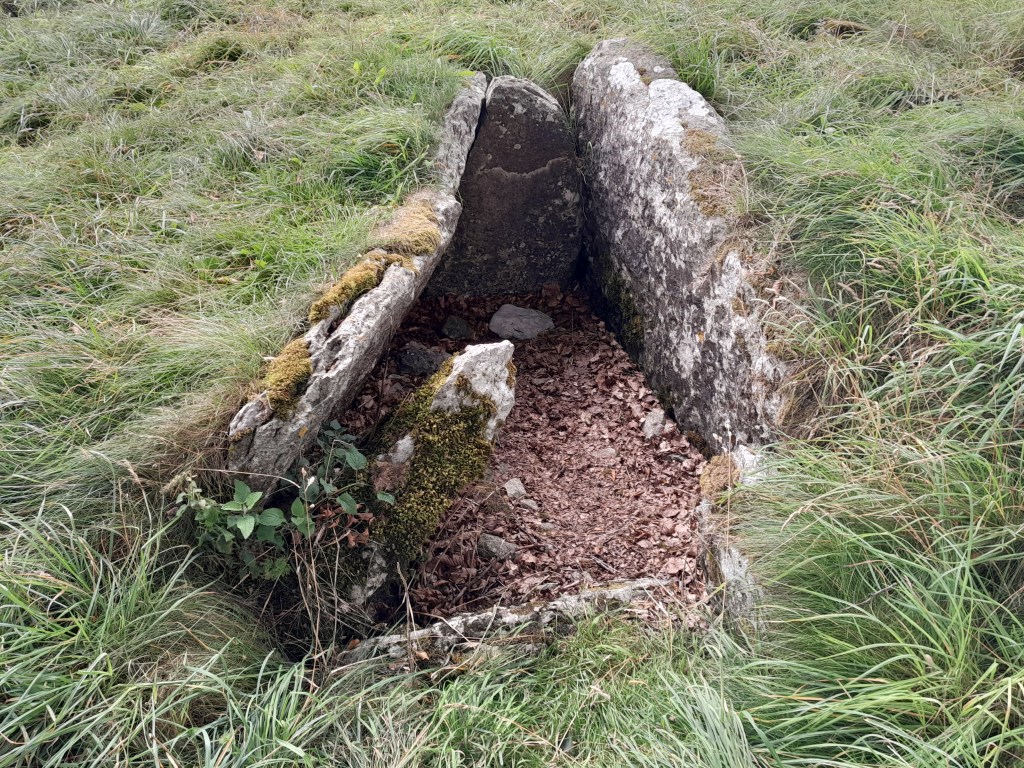
Like many prehistoric sites in Derbyshire, Minninglow was first excavated by Thomas Bateman in 1843. He found that it contained a Neolithic chamber tomb, about 4,000 years old, as well as two Bronze Age barrows. There were also finds showing some activity in Roman times. This shows that the site had been significant for people for thousands of years. Today it is widely assumed that prehistoric people buried their dead in communal or individual tombs, often in high places, as an assertion of their right to live there. The dead were a kind of marker, suggesting the generations who had farmed this land. And what better place to bury the dead than a hilltop next to an ancient route?

Burdett’s map of 1791 shows that the Roman road was then still in use

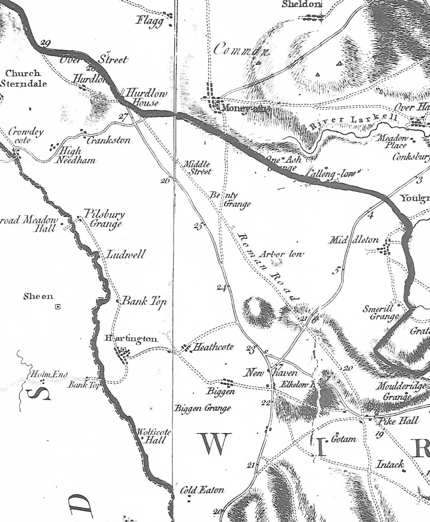
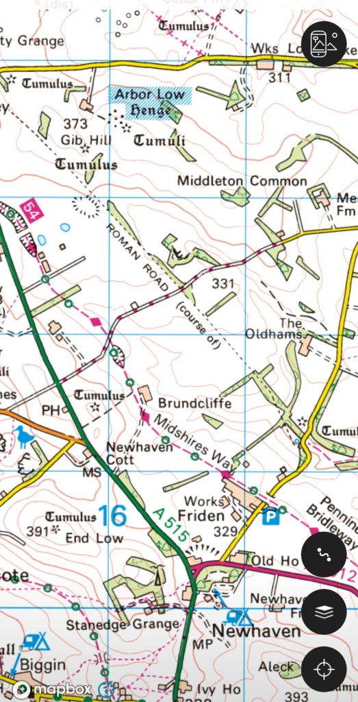
The Street, as the ‘Roman’ road to Buxton is now called, may well be much older, although refurbished during the Roman occupation. This is suggested by the number of ‘lows’ (from the Anglo-Saxon ‘hlaw’ meaning ‘high place’) and tumuli found near the route, including Arbor Low, Derbyshire’s most significant prehistoric monument – the OS map shows 17 between Longcliffe and Arbor Low. Burdett’s map, above, has the Street clearly marked, while today its only trace is the line of the parish boundary, which peters out just east of Minninglow. When parishes were first created what better marker than a road that was already thousands of years old?

The ridgeway rumpus

The road(s) to Buxton

The OS map of the area north of Newhaven shows how popular this route has been for transport: the modern A515 follows the line of the eighteenth-century turnpike; the Midshires Way runs along the route of the Cromford and High Peak Railway, while the Roman road (The Street) runs a little to the east of this. All of these are following the high ridge between Newhaven and Buxton, avoiding the valleys on either side. It seems a classic example of a ridgeway, which have been generally seen as long-distance travel routes, with well-known examples in the south of England such as the Icknield Way, running south west from Norfolk towards Avebury, the western section now simply called ‘The Ridgeway’.

Walking the Ridgeway

It is suggested that ridgeway routes were developed in prehistoric times for long-distance travel, since their route involved fewer descents into boggy river valleys, while higher ground was less densely wooded and gave travelers a better view of landmarks ahead. Moreover, there seem to be many prehistoric remains such as hillforts or tumuli near these routes, further justifying their existence. In many cases the Romans seem to have taken over these routes and engineered them to their standards. However, other prehistorians claim that the ridgeways which have survived owe their survival to being in remote upland areas, and that modern aerial photography shows evidence of wide prehistoric settlement, not only on the higher ground. Some also argue that there is no evidence that the ridgeways are prehistoric, and may well be medieval.

Minninglow, visible for miles around

In view of this debate it is worth looking at the line of the Roman road from Brassington to Buxton, part of which is shown on the map above. Not only are there many tumuli along the way – ancient burial mounds – but also a large number of ‘lows’: Slipper Low, Minninglow, Aleck Low, Arbor Low, Great Low, Brierlow and others. ‘Low’ is derived from Anglo-Saxon ‘hlaw’ meaning (confusingly) ‘high place’, and again was the site of burials, as can be seen at Minninglow. Added to the proximity of the Arbor Low henge – one of the largest in England – the evidence for a prehistoric date for this route appears convincing.

NB: Today there are hardly any rights of way along the Roman road, but the route can be roughly followed from the High Peak Trail.