Farey’s footsteps

John Farey Esq.

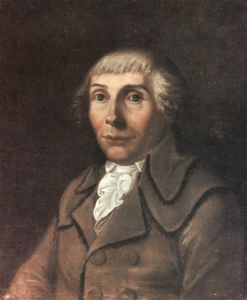
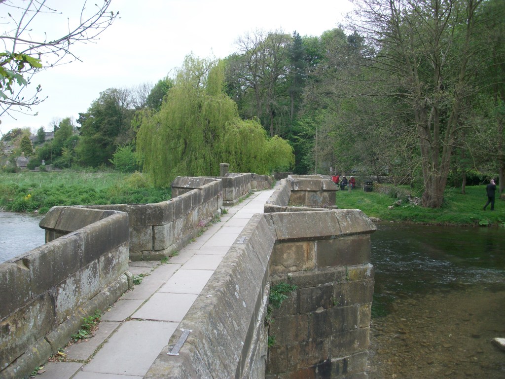
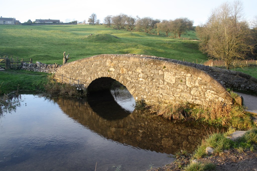
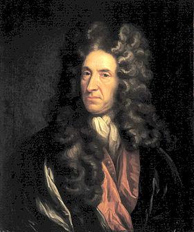
John Farey (1766-1826) was a geologist and mathematician who wrote an extensive report on agriculture in Derbyshire, early in the nineteenth century. To research the subject he clearly had to travel widely, and this experience led him to produce a shorter report on the roads of Derbyshire in 1807. Finding his way around was clearly a concern, as he writes scathingly about the state of the milestones (‘too much neglected’) on account of the lack of maintenance: instead they are ‘shamefully defaced’ by ‘idle and disorderly persons’. Similarly the ‘way-posts or finger boards’ (i.e. signposts) ‘are entirely defaced’ with ‘scarcely a single inscription legible’. Despite this anti-social behaviour, Farey also notes the use of Latin on some ‘wayboards’, notably Via Gellia in Bonsall Dale and ‘Equus Via Longford’ near Shirley.

The Rutland Arms, Bakewell

He does, however, approve of the ‘many excellent Inns’ on the county’s turnpikes, and mentions the Rutland Arms at Bakewell, the Eagle and Child at Buxton, the King’s Arms at Derby and the New Inn at Kedleston, among others. As a geologist he notices that Peak Limestone is hard and so good for road building, but that Magnesian Limestone is easily crushed into a ‘gritty mire’. This was probably the first time that a such scientific approach to road construction had been made.

Farey also approvingly describes a feature of roads in the horse era that few historians have noted. He sees that ‘throughout the County’ cottagers’ children, women and old men are seen ‘perambulating certain lengths of the public Roads’, which they patrol regularly ‘carefully picking up every piece of horse-dung that falls’, and then carry their collections in baskets on their heads for sale to local farmers. Apparently shepherds on the few remaining commons did the same. Farey does not provide details of the going rate for a basket of horse dung, but the practice is an indicator of the depths of poverty in the pre-industrial world. He goes on to complain of the practice of turning cattle and horses out into the lanes to feed on the verges, saying that his horse had been upset by these semi-feral creatures. However, despite his criticisms, Farey rates this county’s roads positively: ‘… after paying a good deal of attention to this subject in most parts of England, I think few of the counties excel Derbyshire as to its roads …’ .

Waterloo sunset?

The hero of the hour

In an age of instant news, when an election result in the USA is available instantly on our phones, it’s hard to imagine a time when news of events even a hundred miles away could take weeks to reach Derbyshire. Before railways and national newspapers began to shrink distances a frequent source of information was the stagecoach, carrying the latest news from London. So on the 8th of July 1815, the people of Derby were finally sure that Napoleon had been decisively defeated at Waterloo when the Traveller Coach, one of the regular services from the capital, arrived in town. Celebrations were clearly called for, as the coach was decorated with laurels and lilies, and was pulling a French tricolor in the dust behind – a flag that was shortly burned by the crowd. So 20 days after the French defeat on June 18th the news began to percolate through the county.

Another Derbyshire coach, the Peveril of the Peak, starting from Islington

The battle was protracted and bloody, with some estimates putting the number of casualties at about 50,000, with equal numbers of dead and wounded on each side. Yet for civilians in Britain it decisively concluded over 20 years of warfare, and Wellington was widely honored for his victory, despite the fact that British forces were a minority of the Allied armies, and it was only the timely arrival of German troops that tipped the balance – even Wellington admitted that it was ‘the nearest run thing you ever saw in your life’.

The Wellington Cross, Baslow Edge and a visitor

Many monuments commemorate the battle, such as the cross above, although this was not erected until 1866, years after Wellington’s death. But not everyone welcomed the defeat of Napoleon. For many radicals and romantics, such as Byron, the French emperor was the heir to the revolutionary spirit of 1792, and British troops had died to replace a hated Bourbon on the throne of France. These sympathisers included the sixth Duke of Devonshire, who displayed a large marble bust of the emperor at Chatsworth, and as part of a liberal, Whig family had no time for the arch-Tory Arthur Wellesley, first Duke of Wellington.

Chelsea pensioners reading the Waterloo Despatch’. Wellington commissioned this picture from Wilkie for the enormous sum of £12,000.

Derby at the crossroads

This early plan of the town of Derby, drawn about 1760, shows how small the town was 250 years ago. The central area is framed by the Derwent to the east and Markeaton Brook to the west, at that time still an open stream. The town is divided into five parishes: All Saints (now the cathedral), St Alkmund’s, St Peter’s, St Michael’s and St Werbergh’s. There is only one bridge (St Mary’s, still in use) giving access to the Nottingham road. The Silk Mill is shown, as are other signs of small-scale industry such as a ‘pot works’ and a ‘copper mill’. The urban core is surrounded by what look like orchards, but may be market gardens.

The second map, made at the same time, gives an equally vivid idea of the size of Derby then, when settlements like Chester Green or Darley were well outside the built-up area. The turnpike roads are clearly shown, with numbered miles. The London road runs through Osmaston, the Nottingham road goes past Spondon (or Spoondon), the Chesterfield road via Little Chester, and so on. By the second half of the eighteenth century regular coach services ran from the county town to all the major Midlands towns, and Derby was an important stage on the Manchester- London route, where passengers would spend the night.

The Old Bell Hotel, Sadler Gate

Road travel in the eighteenth century was transformed by both the use of steel springs on coaches after 1764, and the growth of the turnpike system. This is shown by the reduction in journey time on the Manchester to London route, from 62 hours (with two overnight stops) to 18 hours by the end of the century. ‘Flying Machines’ were advertised in the Derby Mercury in 1760 starting from Derby’s George Inn at a fare of £1-8 shillings. This is the equivalent of about £237 at modern values; a reminder that coach travel was not only uncomfortable but also very expensive. Among other Derby coaching inns were the Talbot and the Old Bell, the latter apparently the only survivor. Even on relatively smooth turnpikes, horses would soon tire, and would need changing regularly to maintain timing. By 1767 a coach left Derby three times a week at 9 pm and arrived in London by 7 pm the following day. Despite the (relative) speed, it’s easy to imagine the discomfort of this journey with only brief meal stops, and perhaps gain a new perspective on the comforts of travel on Midland Mainline!

Sources:

Burdett, P. (1791) Map of Derbyshire Derbyshire Archaeological Society

Twells, H. (1943) ‘Derby’s Flying Machines and earliest coaches’ DAJ 64: 64-82

Searching for St Alkmund

His stone sarcophagus?

Few people outside the Midlands have heard of this Saxon saint, but in Derbyshire he is commemorated by two churches, a well and a street, besides being the patron saint of the city of Derby. As with many saints from the Saxon period it is hard to sort the legends from the facts, but apparently he was King of Northumbria in the late eighth century until he was forced to flee south into Mercia when a rival branch of his family took the throne. He was murdered by Northumbrian agents about 800 CE and buried in Shropshire, after which a cult grew up around his name due to his reputation for acts of charity.

St Alkmund’s Well in Well Street

His remains were removed to Derby in 1140 and reburied in the church dedicated to him, which had a Saxon foundation, near the modern Jury’s Inn hotel. This church was re-built in the mid-nineteenth century but demolished in 1968 as part of Derby’s inner ring road development. A stone plaque marks the site today. The only positive aspect of this piece of urban vandalism (widely criticised at the time) was the discovery of what is believed to be St Alkmund’s stone sarcophagus, a fine piece of Anglo-Saxon stone carving, now in Derby museum. We must assume that this was brought from Shropshire, along with the saint’s remains, in the twelfth century, though this must have been a difficult operation, weighing as it does about a ton. The most likely route would have been by river, as the church was only two hundred yards from the Derwent. Not far away from the church, at the bottom of Well Street, which runs off North Parade, is St Alkmund’s Well. Now protected by iron railings, this had a rural setting until the early nineteenth century as it was in St Helen’s park. Today it must be one of the few holy wells in an urban setting, and was at one time the focus of church procession and well dressing.

Early postcard of St Alkmund’s Duffield

St Alkmund’s in Derby was conveniently near Ryknield Street, the old Roman road, which would have allowed regional pilgrims to travel to the shrine, while only a few miles north is another church with the same rare dedication, at Duffield. Here the church is sited curiously detached from the town and close to the river. Although the present church building is post-Conquest, this must have been a Saxon foundation in what was originally a very large parish. It is thought that the church’s siting may have been due to the use of the Derwent for baptism, although this has also led to severe and quite regular flooding of the building.

The hermit of the bridge

The causeway in the old days

Swarkeston Bridge was once the only crossing of the Trent between Burton and Nottingham, carrying traffic on the north-south route through the Midlands to Derby and beyond. At this point the river flows through low-lying meadows which flood regularly, and so the road is carried across these on a causeway about three quarters of a mile long. Most of this is medieval, although the actual river bridge was rebuilt in 1801. The whole structure is a clear illustration of the importance of river crossings in the past, and the resources that were devoted to constructing them. In this case, the legend tells of two unmarried sisters who lived on the north bank, and during a flood watched helplessly as their lovers tried to cross the torrent on horseback, before being swept away. As a result they spent all their resources on building the causeway, thereby impoverishing themselves.

Less peaceful today

Even when wealthy donors funded a bridge, maintenance was a constant issue. The Church seems to have been responsible for most bridges, and consecrated a body of men called ‘bridge hermits’, who were given an adjacent chapel to live in and were responsible for collecting tolls to pay for repairs. There are records, for example, of the Bishop of Ely in 1493 appointing a Robert Mitchell to the post and giving him a special outfit to wear. Although the bridge chapel at Swarkeston has disappeared there was also a chapel of St James by Chesterfield Bridge, while ruins of a chapel remain by Cromford Bridge. The best surviving example is by St Mary’s Bridge in Derby, which until the nineteenth century was the only crossing of the Derwent in the town.

Bridge and chapel in 1835

A list of the tolls charged (pontage was the term) for Swarkestone Bridge in 1275 is evidence of the extraordinary variety of goods traded in the region in medieval times. Tolls ranged from a farthing to 6 pence a load, although pedestrians were apparently not charged. This is a short extract from the list, but one wonders how the bridge hermit could assess all these tolls:

  • Any load of grass, hay, brush or brushwood – a farthing
  • Any horse, mare, ox or cow – a farthing
  • Any skin of horse, mare ox or cow- a farthing
  • Any pipe of wine – a penny
  • 5 flitches of bacon, salted or dried – a farthing
  • A centena of skins of lambs, goats, hares, squirrels, foxes or cats – a halfpenny
  • Every quarter of salt – a farthing
  • Every pack saddle load of cloth – three pence
  • Every sumpter load of sea fish – a farthing
  • Every load of brushwood or charcoal – a farthing
  • Every burden of ale – a farthing

Afoot with Karl Moritz

Karl the wanderer

Karl Moritz was a prolific German writer who, in 1782, spent two months touring England, reaching as far north as Derbyshire. Clearly an adventurous character, what is especially striking is that he traveled on foot, when all but the poorest went on horseback. This gives his writings an unusual perspective, and his experiences, at a time when foreigners were rare in these parts, provide an interesting insight into the realities of travel in the late eighteenth century. Leaving Derby (‘a small, but not very considerable town’) he finds the village children very civil, bowing to him as he walked. In Duffield (‘a long and extensive village’) he is pleasantly surprised when, at the inn, he is shown into the parlour for a meal. This is in contrast to previous inns, where foot travellers were relegated to the kitchen.

The Bear, Alderwasley, today

It is interesting to try to reconstruct his journey from Duffield to Matlock. The turnpike was a ridgeway through Belper Lane End and on to Bolehill and Cromford, and he speaks of staying the night at an inn ‘about five miles from Matlock’. This could have been the Bear at Alderwasley, which is shown on a map of 1761 as ‘Brown Bare’. Here he finds the kitchen full of boozy farmers, and as he accidentally fails to drink the landlord’s health he is sneered at for his ignorance. Naturally he was pleased to leave ‘this unfriendly roof’ the next morning and head for Matlock Bath, which produced the standard romantic reaction:

The situation of Matlock itself surpassed every idea I had formed of it. On the right were some elegant houses for the bathing company … to the left, deep in the bottom, there was a fine bold river, which was almost hid from the eye by a majestic arch formed by high trees, which hung over it.

Nineteenth-century painting of High Tor, Matlock

After seeing this ‘Paradise’ Matlock town was disappointing (‘scarcely deserves the name of a village, as it consists of but a few and miserable houses’). From there he walked to Bakewell, enjoying the scenery:

The whole country, in this part, is hilly and romantic. Often, my way led me, by small passes, over astonishing eminences, where, in the deep below me, I saw a few huts or cottages lying.

After passing through Ashford, en route to Wardlow, he fell into company with two other walkers, one being a talkative saddler. Karl was surprised to find that he could quote from classical authors such as Homer, reciting passages from memory. The saddler also warned him to avoid Wardlow and head for Tideswell instead, which would offer better lodging.

Moritz’s visit must have been partly inspired by Matlock’s early reputation for romantic scenery, and of course he would be followed by many more tourists in the next two centuries, eager to experience the wonders of the Peak.

Rain

Sir George Crewe of Calke with son John

It’s easy to assume that every extreme weather event – heatwave, drought or flood – must be the product of global warming. However, the storm that hit Derbyshire almost exactly 192 years ago, on the 26th of June 1830, could hardly have been caused by this. The event is recorded in the diary of Sir George Crewe of Calke Abbey, who describes how at 11.30 in the evening:

‘…the rain began to fall in torrents – I might say to descend in one sheet of water. Such rain I never heard before … Thus it continued, I should think, for at least an hour and a half‘.

Calke Abbey

In the morning Sir George went downstairs and found that the house had been flooded overnight through the front door, with red mud all over the carpets. Outside the lawns were covered in mud and the drive had been swept clear, down to its foundations. As a magistrate he had to drive to the Petty Sessions in Ashby that morning, and he records the difficulty of getting there due to the washed-out state of the roads.

A nineteenth-century view of Swarkestone Bridge

His diary records that on July 13th he had to attend the Quarter Sessions in Chesterfield – a substantial journey on horseback of about 45 miles (he must have had to stay overnight). The route would have taken him over the ancient Swarkestone Bridge, which had fortunately survived the torrents. At the Sessions he was told that the county needed £7,000 for bridge repairs as a result of the downpour – in modern terms, nearly a million pounds. No less than six bridges on the Amber alone had been swept away. Clearly, even the best turnpike roads at this time were unsealed, and so liable to be washed out in the event of severe rain.

Bridge building

Below Matlock bridge

In the current dry weather it’s quite easy to climb down and inspect the underside of the arches of Matlock bridge, a structure thought to date from the fifteenth century. As can be seen in the photo, this reveals a clear joint between the original structure and the widening carried out in 1904, which allowed two-way traffic on the bridge (since reduced to one-way in the latest traffic scheme). This is a reminder that most pre-twentieth century bridges would have only been wide enough for one cart or coach at a time, as is still the case with One-Arch Bridge at Chatsworth.

Holme Bridge north of Bakewell

Some were still narrower, such as Holme Bridge, on the River Wye upstream of Bakewell; just wide enough for a train of packhorses to cross. This is a reminder that bridge building was high skilled and thus expensive, yet bridges were absolutely critical to the transport network. The earliest bridges probably had a wooden superstructure resting on stone piers: easier to construct but liable to be washed away in any flood. All-stone bridges, with arches and breakwaters to deflect floating debris, were commonly constructed from the twelfth century but their cost was often met by a local monastery or abbey. In addition, tolls were frequently charged to pay for their upkeep.

St Mary’s bridge chapel, Derby

Important river crossing often had chapels attached, as with St Mary’s bridge in Derby (the only bridge in medieval times) or Cromford bridge (now ruined). The chapels would have provided a shrine for travellers to pray for a safe onward journey, and doubtless to leave an offering for bridge maintenance.

Bridge over River Bradford at Youlgrave

With most ancient bridges, establishing a date is almost as difficult as dating a road. The example above, with its simple round arch, and too narrow for a cart, could be anything from a hundred and fifty to a thousand years old, and would probably have been repaired many times after especially violent floods.

Defoe’s Derbyshire tour

Biography of Daniel Defoe author of "Robinson Crusoe"
An early tourist

Few people living in Derbyshire in the eighteenth century have left an account of their travels; clearly they didn’t feel any need to describe their everyday experiences. Therefore it is left to the handful of early tourists to provide an impression of journeying in the county three hundred years ago. Daniel Defoe was an early novelist and journalist who visited many English counties in the 1720s in order to produce his A Tour of England and Wales.

Beginning at Derby, he had clearly chosen a wet season for his visit, since he had to abandon plans to visit Ashbourne on account of ‘the river drowning the low-grounds by a sudden shower, and hastening to the Trent with a most outrageous stream’, a reminder that, not so long ago, travel was very much at the whim of the weather. There are other references to the Derwent as ‘a frightful creature when the hills load her current with water’.

Cave at Harborough Rocks

Defoe’s next stop was Wirksworth, which he found interesting due to the lead trade, despite the inhabitants being ‘a rude boorish kind of people’. The most remarkable part of this visit was an excursion to Harborough Rocks, which was called the Giant’s Tomb at that time. Here he found a lead miner’s family living in a cave, which had been lived in by his family for several generations. Defoe was both horrified, and impressed that people could cope with such crude conditions: ‘they seemed to live very pleasantly, the children look’d plump and fat’. Defoe’s party had a whip-round and gave the miner’s wife several shillings. (Today the cave can be visited quite easily by climbing up from the High Peak Trail).

Other items on his itinerary were more predictable: the Wonders of the Peak, and a focus on spas, which were just beginning to be significant destinations at this time. He is suitably impressed by Chatsworth, but comments about the moor above the house: ‘a waste and howling wilderness, over which, when strangers travel, they are obliged to take guides, or it would be next to impossible not to lose their way’. As for getting to Matlock (which he labels as a village), Defoe maintains that the warm springs would be worth visiting if access was not by ‘ a base, stony, mountainous road’ – presumably the route over Scarthin, which was eventually superseded by blasting the present road through the rocks at Cromford.

Nineteenth-century painting of High Tor, Matlock

Saints and sinners

Carving of pilgrim, Youlgrave church

This figure from Youlgrave church is thought to represent a pilgrim, with his (or her) staff and waist-hung satchel. We often think of pilgrimage in terms of the great medieval shrines of Christianity such as Santiago or Canterbury, but during the high middle ages (about 1100 – 1300 CE) many pilgrimages must have been more local, perhaps within a day’s journey of the pilgrim’s home. In Derbyshire, abbeys such as Dale as well as churches like St Alkmund’s in Derby would have attracted pilgrims. The main draw was the burial place of a saint or the ownership of a holy relic, such as a flask of Mary’s milk.

Sarcophagus in DerbyMuseum

Pilgrims hoped that being close to the remains of a holy person would benefit them in some way. Many were seeking a cure for an illness, often with the belief that a particular saint would help with certain conditions. Others might be making the journey as a penance, to compensate for some crime or misdemeanor. St Alkmund was a local saint who was murdered in Derby in the eighth century, and whose impressive stone sarcophagus can be seen in Derby Museum – the (rebuilt) church was demolished to make way for the city’s ring road.

St Bertram’s church, Ilam

Another local saint, although actually in Staffordshire, is St Bertram at Ilam near Ashbourne. He also lived in the Saxon period, becoming a hermit after his wife and child were eaten by wolves. One unusual feature of the church is that the shrine of the saint has survived, perhaps due to the remote location of the village. Most aspects of pilgrimage, such as shrines and relics, were removed during the Protestant Reformation of the sixteenth century. Yet although discouraged, pilgrimage was hard to suppress, and saw an effective revival in the growth of spa towns such as Buxton in the eighteenth century.

Ex-votos, Passau, Bavaria

In Britain there are few relics of pilgrimage, but in Catholic areas of Europe such as Spain or Bavaria it is possible to find displays of ex-votos such as the example above. These are often small paintings of a miracle rescue or healing brought about by the local saint, and given to the church in thanksgiving. In other places models of the afflicted body part, such as arm, foot or head, are displayed. Clearly, in an age of very limited medical knowledge, making a pilgrimage was often seen as an effective remedy.