Leashaw: A road to nowhere?

Follow diversions

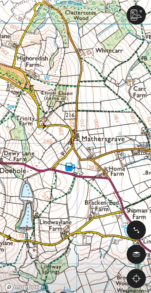
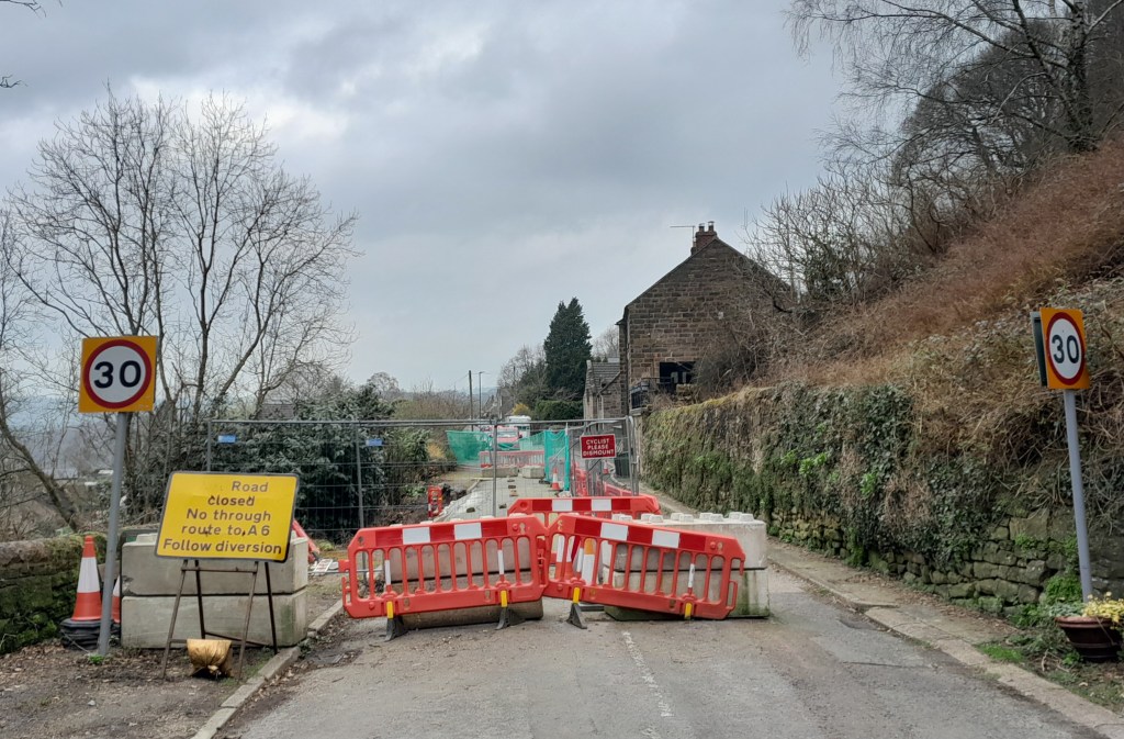
Road building in Derbyshire can be fraught, especially on steep-sided valleys. At times roads become too expensive to maintain, as happened with the road below Mam Tor, which was abandoned in the 1970s after frequent landslips due to the unstable geology. Following the exceptionally wet autumn and winter of 2023-4 several routes are currently closed, such as Beeley Lane. The village of Holloway has been badly affected; first the Cromford to Lea Bridge road was closed for over a year after flooding from the River Derwent in 2019, and then shortly after that was re-opened the Holloway to Crich road was closed due to a landslip undermining the pavement. This has now been blocked for over a year, and the County Council is not planning to start repair work until mid-2025.

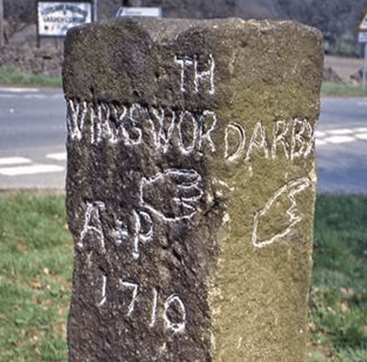
This stretch of road was originally part of the Cromford Bridge and Langley Mill turnpike of 1766, built before the A6 provided a smoother, lower route. The house on the left, above, was one of the toll collectors’ cottages. At that time this would have been a narrow lane with just enough width for two carts or carriages to squeeze past. A report in the Derby Mercury in 1897 of a public meeting in Crich shows that the problems with this road are longstanding:

Mr Shaw brought forward an important matter, that of repairing the turnpike road leading from Bull Bridge to Holloway, stating that he thought, with many others, that the road ought to be taken over by the Derbyshire County Council. It was, however, clearly proved by Mr Dawes and other gentlemen that the County Council had been repeatedly requested to take over this road, but would not do so, their excuse being that there was insufficient through traffic. 

Walkers and cyclists only

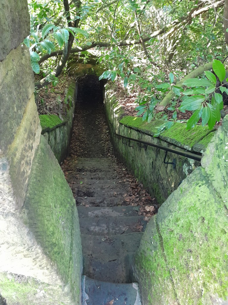
It appears that the road was widened, surfaced and the pavement built in the 1930s, by which time the DCC had been obliged to take over maintenance. ‘Shaw’ in place names can mean a wood on a steep bank, and this accurately describes the route on both sides of Wakebridge, and explains why it is so difficult to maintain.

The good old daysthe Cliff pub

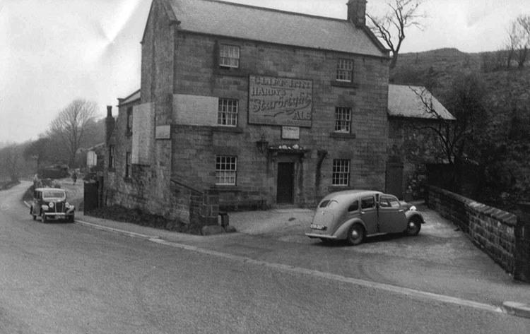
The situation is not just inconvenient for Crich and Holloway people. Several businesses are struggling with the lack of passing trade: Maycock’s Butchers and the Chase Cafe at the Holloway end, and the Cliff pub (above) at the edge of Crich. It seems that over 250 years after the turnpike was opened, a much wealthier society is unable to keep it open.

Down Ashover way

Tomb of Thomas and Edith Babington in Ashover church

These unusually colorful figures on the Babington tomb at Ashover are a reminder of a long-distance packhorse route that can be traced as far as Wirksworth to the west. Ashover parish used to be much larger, and included Holloway, Lea and Dethick, the home of the Babingtons. St John’s church at Dethick was built as a private chapel for the manor, but Ashover had to be used for burials. Most of the route can be comfortably walked today; leaving Ashover by the track beside the Old Poet’s Corner pub which drops to a bridge over the Amber, and then provides a steep climb up a remarkably complete stone causeway (below).

Onwards and upwards

‘Causeys’ like this are found all over Derbyshire and are about two feet wide, thus providing a solid surface for horses’ feet at minimal expense. The track continues to climb towards Ravensnest and then meets Holestone Gate Road at the top. From there it’s road walking to the B6014 and along Lickpenny Lane to the Matlock-Alfreton road. At this point a guidestoop can be seen on the verge, dated 1710, marked A+P for Ashover Parish. Wirksworth is one of the directions shown, via Dethick Lane (NB the stoop has been moved from its original position, but not significantly). Dethick Lane is partly a holloway, Cross Lane marks the site of an old cross (only the base remains), and beyond the church the path leads down to a crossing of the Lea Brook on stepping stones, then uphill to cross Hearthstone Lane and down to Cromford Station and bridge.

Looking down the steps at Eastwood Grange

Where did the route go to the east from Ashover? One likely possibility is the footpath which starts beside the Black Swan and runs up through the grounds of Eastwood Grange, today a school but which must have been built in Victorian times as a substantial private villa. The route (even if no longer used by packhorses) was clearly significant enough to be given a well-engineered stone-lined route through the gardens of the Grange, as can be seen above. Beyond this the path continues steeply up to the summit of Farhill, a popular viewpoint at 299 metres, from where Hardwick Hall, Chesterfield and Sheffield can be seen.

Reading the stone

The stone in the north wall of St Mary’s, Wirksworth

The Wirksworth Stone must be one of the most remarkable examples of sculpture from the Saxon era in England. Discovered in 1820 face down, buried under the church floor, it is thought to have been the lid of a sarcophagus belonging to an early saint, possibly Betti. It dates from about 700 CE, and displays a sophisticated iconography which reveals a strong Eastern influence e.g. the use of the Greek cross with equal arms. Perhaps the most interesting question is who produced this work 1,300 years ago, and was it carried here or made on the spot?

St Mary’s in its oval churchyard

Clearly the present thirteenth-century building (above) was not the first on this site; in fact the name of the local river, Ecclesbourne, suggest a very ancient foundation, probably a minster church for the whole wapentake of Wirksworth. Just as churches were built by travelling stone masons we can assume that sculpture like this was the work of itinerant artists, who would also produce crosses like those at Bradbourne and Eyam. It is claimed that the Wirksworth stone shows the work of two masons, the one responsible for the lower half being more skilled than his (or her) workmate. Although overall the workmanship is somewhat crude, the scenes portrayed cover the whole range of Christian teaching.

The ascent of Christ, in mandala (detail)

The left hand side of the stone has been broken off, so originally there were ten scenes but now only eight are visible. It appears that the stone should be read vertically, top to bottom, rather than left to right like a modern comic strip. So the top left scene shows Christ washing the feet of the disciples, and the one below the Harrowing of Hell, when the crucified Christ is supposed to have descended into Hades. The next pair are clearly the Crucifixion (with four evangelists) paired with the Ascension below. The third scene on the top represents the death of the Virgin, and below this the Annunciation is shown, with Mary seated. The final scene on top is the Presentation of the infant Christ in the temple, and under this the disciples prepare for their preaching mission (note the figure in the boat). Overall, and assuming the missing section showed the Nativity and the Baptism of Christ, the whole panel presents a remarkable statement of fundamental Christian beliefs. The position of Wirksworth on the Derbyshire Portway reinforces the theory that this was the work of travelling craftsmen, bringing the essentials of their religion in pictorial form to the (presumably) illiterate of the Peak.

Highways and Byways in Derbyshire – a good read

My somewhat battered copy

Macmillan published the first book in their Highways and Byways series in 1898 and, remarkably, the last in 1948; a total of nearly 40 titles covering most of Britain. All are detailed guides with plentiful illustrations by respected illustrators. Well-bound in hard covers with gilt lettering, the series must have been popular as copies can still be bought quite cheaply from second-hand sources. The volume on Derbyshire was quite early, in 1905, written by JB Firth and illustrated by Nelly Erichsen, who was from a Danish family.

An inviting title page

The author, unusually, writes from the viewpoint of a walker, so that the reader can follow his progress in detail, which is especially interesting if the reader knows an area well. Clearly there are many changes to the scenery 120 years later; for instance at Ambergate then-triangular station: ‘the station becomes simply a hideous deformity, and the adjoining kilns of Bullbridge throw up fleecy masses of white clouded smoke’. In Edwardian fashion there are many digressions in the form of stories of famous folk who have lived locally, and Firth is not afraid of copious quotations of poetry, but these rather add to the book’s charm.

Another value of the book is the recording of otherwise lost data. For example, the footpath that runs uphill from Pentrich mill to Pentrich church (see map above) is today simply a field path. but in the 1900s was clearly more: ‘This broad track used to bear the name of Deadman’s Lane, not from any relics which have been found there but because by this way dead men were borne to their last resting place in Pentrich churchyard‘. Firth also says that higher up, near the church, the line of the Roman road, Ryknild Street, was still marked with hedges.

Foul deeds in the wild Winnats

The sunny side of Winnats

Travel has always been seen as a risky undertaking, the dangers ranging from dirty sheets and greedy innkeepers to wild animal attacks and highway robbery. Poor roads were (and still are) probably more of a threat to life and limb than highwaymen, but some of these became notorious in the eighteenth and early nineteenth centuries, famed for their supposed style and cool demeanour on the gallows. Characters such as ‘Swift Nick’ (John Nevison) became folk heroes who allegedly displayed a kind of gallantry while robbing the wealthy coach passengers.

Up to no good

There are few references to such characters in Derbyshire history, presumably because an impoverished area like this had few travellers worth robbing. The majority of these ‘gentlemen of the road’ lay in wait on the outskirts of London, whence travellers might be carrying cash or other valuables, or en route to the Channel ports. The main period of robbery seems to have been from post-Civil War (about 1650) to early in the nineteenth century. Apparently better roads, more traffic and some attempts at policing diminished enthusiasm for ‘your money or your life’.

Not a robber in sight: Looking to Mam Tor from Castleton

However, one crime on Peak District roads is widely remembered: a double murder in the Winnats, then as now a steep-sided pass running west from Castleton. In 1758 a young couple, Allen and Clara, had eloped and were heading for Peak Forest Chapel where they could be married without banns. The legend is that she came from a wealthy family who had forbidden the match. While refreshing themselves at a Castleton inn they were observed by a group of lead miners, who noticed their smart clothing and suspected they were carrying cash. When the pair resumed their journey they were followed and attacked; both were killed and £200 stolen from them. Their bodies were then hidden in a cave and not discovered for ten years. The story has a highly moral ending: the last surviving murderer confessed on his deathbed, and all the others met evil ends. Although the details vary and may seem unlikely (£200 was a huge amount at the time, equal to over £20,000 today) the persistence of the story suggests some factual basis. Its evolution has been analysed in an academic article published in the journal Folklore: Murders in the Winnats Pass: Evolution of a Peak District Legend by Mark Henderson (2010).

‘There is not a finer county in England than Derbyshire’

Jane Austen 1775-1817

A significant tourist industry has grown up around Jane Austen and Derbyshire. It is often claimed that she visited the county in 1811, stayed at the Rutland Arms in Bakewell, looked around Chatsworth and based Mr Darcy’s fictional house of Pemberley on this model. At least one film of Pride and Prejudice has used Chatsworth as a setting. However, there is no actual evidence that Jane ever visited the county, let alone wrote about it.

As it wascould this have been Pemberley?

In Pride and Prejudice the heroine, Elizabeth Bennet, is taken on a tour of the Peak District by her aunt and uncle. There is mention of Matlock, Chatsworth, Dovedale and the Peak as being the main attractions. They base themselves in ‘Lambton’, often taken to be Bakewell, from where Pemberley is a three-mile drive. When they visit the house its setting makes a positive impression on Elizabeth: ‘…it was a large handsome stone building, standing well on rising ground, and backed by a ridge of high, woody hills – and in front a stream of some natural importance is swelled into greater …’ . This description has encouraged the identification with Chatsworth, but there are three objections to the theory. First, as mentioned above, there’s no record of her visiting the area, second the description of the house is generic, and could apply to many mansions from this period. Landscape fashion from the eighteenth century had created dozens of similar park-like vistas and Austen would have seen engravings such as the one above. Finally Pride and Prejudice, although only published in 1813, was largely written in 1797, 11 years before her supposed visit to the county.

A post-chaise

The search for originals of fictional people and places is quite pointless, since it assumes that authors have no powers of invention. More interesting is the light that the story sheds on early tourists in the Peak. Even if she had never visited Derbyshire, Austen was well aware of the tourist sights, which wealthy travellers could best enjoy by hiring a chaise, a small light carriage for two or three people. Complete with driver, this would cost about a guinea a day, roughly £100 in modern money.

The ridgeway rumpus

The road(s) to Buxton

The OS map of the area north of Newhaven shows how popular this route has been for transport: the modern A515 follows the line of the eighteenth-century turnpike; the Midshires Way runs along the route of the Cromford and High Peak Railway, while the Roman road (The Street) runs a little to the east of this. All of these are following the high ridge between Newhaven and Buxton, avoiding the valleys on either side. It seems a classic example of a ridgeway, which have been generally seen as long-distance travel routes, with well-known examples in the south of England such as the Icknield Way, running south west from Norfolk towards Avebury, the western section now simply called ‘The Ridgeway’.

Walking the Ridgeway

It is suggested that ridgeway routes were developed in prehistoric times for long-distance travel, since their route involved fewer descents into boggy river valleys, while higher ground was less densely wooded and gave travelers a better view of landmarks ahead. Moreover, there seem to be many prehistoric remains such as hillforts or tumuli near these routes, further justifying their existence. In many cases the Romans seem to have taken over these routes and engineered them to their standards. However, other prehistorians claim that the ridgeways which have survived owe their survival to being in remote upland areas, and that modern aerial photography shows evidence of wide prehistoric settlement, not only on the higher ground. Some also argue that there is no evidence that the ridgeways are prehistoric, and may well be medieval.

Minninglow, visible for miles around

In view of this debate it is worth looking at the line of the Roman road from Brassington to Buxton, part of which is shown on the map above. Not only are there many tumuli along the way – ancient burial mounds – but also a large number of ‘lows’: Slipper Low, Minninglow, Aleck Low, Arbor Low, Great Low, Brierlow and others. ‘Low’ is derived from Anglo-Saxon ‘hlaw’ meaning (confusingly) ‘high place’, and again was the site of burials, as can be seen at Minninglow. Added to the proximity of the Arbor Low henge – one of the largest in England – the evidence for a prehistoric date for this route appears convincing.

NB: Today there are hardly any rights of way along the Roman road, but the route can be roughly followed from the High Peak Trail.

Four legs good?

Cave painting of hunter and dog c.10,000 BCE

Dogs were the first animals to be domesticated, apparently during the last ice age, about 15 or 20,000 years ago. Hunters may have shared their kill with young wolves, who became camp followers and provided some services in return. Dogs could be trained to help the hunters by retrieving game, as well as guarding their campsites. Travellers soon found that dogs made useful companions on a trek, especially if they were herding animals such as cattle or sheep. As cities grew in the eighteenth century and the demand for fresh meat rose, drovers and their dogs walked the cows from the upland districts in the north and west to the butchers of Sheffield or Nottingham.

On a packhorse trail in North America

Perhaps even more significant was the domestication of the horse, thought to have occurred about 5,000 years ago, in the early Bronze Age, near the eastern borders of Europe. Evidence for this are the elements of horse harness such as bits and bridles found in grave burials around 2,000 BCE. For the next four thousand years horses provided the fastest travel on the planet, as well as weapons of war (cavalry and chariots) and transport of goods (either as packhorses or pulling carts). Over long distances a rider could average about four miles an hour, so about 30 miles was a good daily total for both rider and horse, with about seven hours in the saddle. It seems remarkable that just 200 years ago our entire economy was based on horse power, from agriculture to personal mobility to powering the first railways!

Today’s walkers in Derbyshire are likely to be concerned about crossing fields with cows grazing, especially if they have dogs with them. Although the number of deaths caused by stampeding animals is small, it is a real risk, and most hikers have had uncomfortable experiences, if not worse. Although likely to be an underestimate, the HSE keeps records of injuries from cattle, and between 2000 and 2020 98 people were killed by them: many more were presumably injured. Of these the majority (76) were farm workers, and the rest were walkers. The general consensus is that bullocks represent a greater danger than the odd bull, and that cows with calves should be given a particularly wide berth. Carrying a stick probably makes the walker feel better, and dogs should be let off their leads to escape quickly if a situation feel threatening.

Mather’s Grave

Mathersgrave near Brackenfield

Just north of the Matlock-Alfreton road (A615), the hamlet of Mathersgrave commemorates both a family tragedy and a medieval mindset. Set in the retaining wall to a cottage garden is a block of stone inscribed ‘SM 1643’ and nearby is a guidestoop with three inscriptions: ‘Matlack (sic) Road’, ‘Bakewell Roade’ and ‘Alfreton Road 1730’. The presence of the guidestoop shows that this was a significant crossroads in the early eighteenth century; building the turnpike bypassed the junction.

Guidestoop and grave stone

Christian teaching in the Middle Ages insisted that suicide was a serious sin, and this was reinforced by English law which viewed it as a crime, punishable by the forfeit of property to the crown. Suicides were denied burial in consecrated churchyards, and thereby lost their chance of going to heaven. Instead they were buried at crossroads, where it was thought their spirits would be unable to choose the right route back to the land of the living, and so be unable to plague their kin. To make doubly sure, a stake might be driven through the heart of the sinner to further immobilise them. Incredibly, the last case of a crossroads burial was in 1823, while suicide remained a crime until 1961.

Trinity Chapel near Brackenfield

Apparently SM was Samuel Mather, a local man who had fathered an illegitimate daughter, and social condemnation forced him to kill himself, and possibly kill his wife also. (Details of the story are vague). This happened in 1716, so the date on the marker stone is wrong. This occurred well before the Matlock-Alfreton turnpike was constructed, and further evidence of the shift in road pattern is the romantic nearby ruin of Trinity Chapel. Half a mile to the north, (see map above), this was in use before Brackenfield Church was opened in 1857, but is now quite deserted. In the past this must have stood on a busy lane, but today is only reached by footpath.

Old roads meet iron roads

Early North Midland train at Ambergate viaduct with waggon on road below

With the opening of the North Midland Railway line from Derby towards Chesterfield in 1840 the pattern of transport in the area was transformed. Faster and cheaper movement of both freight and passengers would lead to the eclipse of the turnpike roads. But in the very early period rail travel was regarded as exotic and probably dangerous. A gentleman’s private coach could be loaded onto a flatbed truck, saving his family the need to mix with the hoipolloi. Yet railway companies were keen to make travel a comfortable experience for their better class of customer, in a way that’s hard to imagine today.

South Wingfield Station after restoration

This is demonstrated by the facilities at South Wingfield Station, recently restored to its original form by Derbyshire Historic Buildings Trust, working with local volunteers, and with a substantial grant from the Lottery Heritage Fund. This was one of the earliest stations in the country, designed by architect Francis Thompson. The building had a booking office and two waiting rooms, complete with handsome fireplaces, all maintained by several staff, including a stationmaster who lived in a nearby house. Today’s travellers, huddled in a draughty platform shelter, can only dream of such luxury!

As it was

South Wingfield Station, which became redundant in the 1960s, is some distance from its village, yet it was originally advertised as convenient for Alfreton too! This was because Robert Stephenson engineered the line to run up the gentle slope of the Derwent and Amber valleys, since early locomotives weren’t powerful enough to deal with steep climbs. The Nottingham to Newhaven turnpike ran near the station, heading for Crich, and would have another twenty or so years of life before the spreading railway network put it out of business.

South Wingfield Station can be seen from the public footpath which runs through the station yard. See the website below for more background information and details of guided tours:

https://www.derbyshirehistoricbuildingstrust.org.uk/wingfield-station-our-project