Foul deeds in the wild Winnats

The sunny side of Winnats

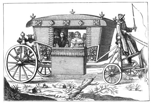
Travel has always been seen as a risky undertaking, the dangers ranging from dirty sheets and greedy innkeepers to wild animal attacks and highway robbery. Poor roads were (and still are) probably more of a threat to life and limb than highwaymen, but some of these became notorious in the eighteenth and early nineteenth centuries, famed for their supposed style and cool demeanour on the gallows. Characters such as ‘Swift Nick’ (John Nevison) became folk heroes who allegedly displayed a kind of gallantry while robbing the wealthy coach passengers.

Up to no good

There are few references to such characters in Derbyshire history, presumably because an impoverished area like this had few travellers worth robbing. The majority of these ‘gentlemen of the road’ lay in wait on the outskirts of London, whence travellers might be carrying cash or other valuables, or en route to the Channel ports. The main period of robbery seems to have been from post-Civil War (about 1650) to early in the nineteenth century. Apparently better roads, more traffic and some attempts at policing diminished enthusiasm for ‘your money or your life’.

Not a robber in sight: Looking to Mam Tor from Castleton

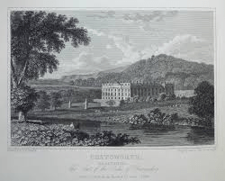
However, one crime on Peak District roads is widely remembered: a double murder in the Winnats, then as now a steep-sided pass running west from Castleton. In 1758 a young couple, Allen and Clara, had eloped and were heading for Peak Forest Chapel where they could be married without banns. The legend is that she came from a wealthy family who had forbidden the match. While refreshing themselves at a Castleton inn they were observed by a group of lead miners, who noticed their smart clothing and suspected they were carrying cash. When the pair resumed their journey they were followed and attacked; both were killed and £200 stolen from them. Their bodies were then hidden in a cave and not discovered for ten years. The story has a highly moral ending: the last surviving murderer confessed on his deathbed, and all the others met evil ends. Although the details vary and may seem unlikely (£200 was a huge amount at the time, equal to over £20,000 today) the persistence of the story suggests some factual basis. Its evolution has been analysed in an academic article published in the journal Folklore: Murders in the Winnats Pass: Evolution of a Peak District Legend by Mark Henderson (2010).

‘There is not a finer county in England than Derbyshire’

Jane Austen 1775-1817

A significant tourist industry has grown up around Jane Austen and Derbyshire. It is often claimed that she visited the county in 1811, stayed at the Rutland Arms in Bakewell, looked around Chatsworth and based Mr Darcy’s fictional house of Pemberley on this model. At least one film of Pride and Prejudice has used Chatsworth as a setting. However, there is no actual evidence that Jane ever visited the county, let alone wrote about it.

As it wascould this have been Pemberley?

In Pride and Prejudice the heroine, Elizabeth Bennet, is taken on a tour of the Peak District by her aunt and uncle. There is mention of Matlock, Chatsworth, Dovedale and the Peak as being the main attractions. They base themselves in ‘Lambton’, often taken to be Bakewell, from where Pemberley is a three-mile drive. When they visit the house its setting makes a positive impression on Elizabeth: ‘…it was a large handsome stone building, standing well on rising ground, and backed by a ridge of high, woody hills – and in front a stream of some natural importance is swelled into greater …’ . This description has encouraged the identification with Chatsworth, but there are three objections to the theory. First, as mentioned above, there’s no record of her visiting the area, second the description of the house is generic, and could apply to many mansions from this period. Landscape fashion from the eighteenth century had created dozens of similar park-like vistas and Austen would have seen engravings such as the one above. Finally Pride and Prejudice, although only published in 1813, was largely written in 1797, 11 years before her supposed visit to the county.

A post-chaise

The search for originals of fictional people and places is quite pointless, since it assumes that authors have no powers of invention. More interesting is the light that the story sheds on early tourists in the Peak. Even if she had never visited Derbyshire, Austen was well aware of the tourist sights, which wealthy travellers could best enjoy by hiring a chaise, a small light carriage for two or three people. Complete with driver, this would cost about a guinea a day, roughly £100 in modern money.

The ridgeway rumpus

The road(s) to Buxton

The OS map of the area north of Newhaven shows how popular this route has been for transport: the modern A515 follows the line of the eighteenth-century turnpike; the Midshires Way runs along the route of the Cromford and High Peak Railway, while the Roman road (The Street) runs a little to the east of this. All of these are following the high ridge between Newhaven and Buxton, avoiding the valleys on either side. It seems a classic example of a ridgeway, which have been generally seen as long-distance travel routes, with well-known examples in the south of England such as the Icknield Way, running south west from Norfolk towards Avebury, the western section now simply called ‘The Ridgeway’.

Walking the Ridgeway

It is suggested that ridgeway routes were developed in prehistoric times for long-distance travel, since their route involved fewer descents into boggy river valleys, while higher ground was less densely wooded and gave travelers a better view of landmarks ahead. Moreover, there seem to be many prehistoric remains such as hillforts or tumuli near these routes, further justifying their existence. In many cases the Romans seem to have taken over these routes and engineered them to their standards. However, other prehistorians claim that the ridgeways which have survived owe their survival to being in remote upland areas, and that modern aerial photography shows evidence of wide prehistoric settlement, not only on the higher ground. Some also argue that there is no evidence that the ridgeways are prehistoric, and may well be medieval.

Minninglow, visible for miles around

In view of this debate it is worth looking at the line of the Roman road from Brassington to Buxton, part of which is shown on the map above. Not only are there many tumuli along the way – ancient burial mounds – but also a large number of ‘lows’: Slipper Low, Minninglow, Aleck Low, Arbor Low, Great Low, Brierlow and others. ‘Low’ is derived from Anglo-Saxon ‘hlaw’ meaning (confusingly) ‘high place’, and again was the site of burials, as can be seen at Minninglow. Added to the proximity of the Arbor Low henge – one of the largest in England – the evidence for a prehistoric date for this route appears convincing.

NB: Today there are hardly any rights of way along the Roman road, but the route can be roughly followed from the High Peak Trail.

Four legs good?

Cave painting of hunter and dog c.10,000 BCE

Dogs were the first animals to be domesticated, apparently during the last ice age, about 15 or 20,000 years ago. Hunters may have shared their kill with young wolves, who became camp followers and provided some services in return. Dogs could be trained to help the hunters by retrieving game, as well as guarding their campsites. Travellers soon found that dogs made useful companions on a trek, especially if they were herding animals such as cattle or sheep. As cities grew in the eighteenth century and the demand for fresh meat rose, drovers and their dogs walked the cows from the upland districts in the north and west to the butchers of Sheffield or Nottingham.

On a packhorse trail in North America

Perhaps even more significant was the domestication of the horse, thought to have occurred about 5,000 years ago, in the early Bronze Age, near the eastern borders of Europe. Evidence for this are the elements of horse harness such as bits and bridles found in grave burials around 2,000 BCE. For the next four thousand years horses provided the fastest travel on the planet, as well as weapons of war (cavalry and chariots) and transport of goods (either as packhorses or pulling carts). Over long distances a rider could average about four miles an hour, so about 30 miles was a good daily total for both rider and horse, with about seven hours in the saddle. It seems remarkable that just 200 years ago our entire economy was based on horse power, from agriculture to personal mobility to powering the first railways!

Today’s walkers in Derbyshire are likely to be concerned about crossing fields with cows grazing, especially if they have dogs with them. Although the number of deaths caused by stampeding animals is small, it is a real risk, and most hikers have had uncomfortable experiences, if not worse. Although likely to be an underestimate, the HSE keeps records of injuries from cattle, and between 2000 and 2020 98 people were killed by them: many more were presumably injured. Of these the majority (76) were farm workers, and the rest were walkers. The general consensus is that bullocks represent a greater danger than the odd bull, and that cows with calves should be given a particularly wide berth. Carrying a stick probably makes the walker feel better, and dogs should be let off their leads to escape quickly if a situation feel threatening.

Mather’s Grave

Mathersgrave near Brackenfield

Just north of the Matlock-Alfreton road (A615), the hamlet of Mathersgrave commemorates both a family tragedy and a medieval mindset. Set in the retaining wall to a cottage garden is a block of stone inscribed ‘SM 1643’ and nearby is a guidestoop with three inscriptions: ‘Matlack (sic) Road’, ‘Bakewell Roade’ and ‘Alfreton Road 1730’. The presence of the guidestoop shows that this was a significant crossroads in the early eighteenth century; building the turnpike bypassed the junction.

Guidestoop and grave stone

Christian teaching in the Middle Ages insisted that suicide was a serious sin, and this was reinforced by English law which viewed it as a crime, punishable by the forfeit of property to the crown. Suicides were denied burial in consecrated churchyards, and thereby lost their chance of going to heaven. Instead they were buried at crossroads, where it was thought their spirits would be unable to choose the right route back to the land of the living, and so be unable to plague their kin. To make doubly sure, a stake might be driven through the heart of the sinner to further immobilise them. Incredibly, the last case of a crossroads burial was in 1823, while suicide remained a crime until 1961.

Trinity Chapel near Brackenfield

Apparently SM was Samuel Mather, a local man who had fathered an illegitimate daughter, and social condemnation forced him to kill himself, and possibly kill his wife also. (Details of the story are vague). This happened in 1716, so the date on the marker stone is wrong. This occurred well before the Matlock-Alfreton turnpike was constructed, and further evidence of the shift in road pattern is the romantic nearby ruin of Trinity Chapel. Half a mile to the north, (see map above), this was in use before Brackenfield Church was opened in 1857, but is now quite deserted. In the past this must have stood on a busy lane, but today is only reached by footpath.

Old roads meet iron roads

Early North Midland train at Ambergate viaduct with waggon on road below

With the opening of the North Midland Railway line from Derby towards Chesterfield in 1840 the pattern of transport in the area was transformed. Faster and cheaper movement of both freight and passengers would lead to the eclipse of the turnpike roads. But in the very early period rail travel was regarded as exotic and probably dangerous. A gentleman’s private coach could be loaded onto a flatbed truck, saving his family the need to mix with the hoipolloi. Yet railway companies were keen to make travel a comfortable experience for their better class of customer, in a way that’s hard to imagine today.

South Wingfield Station after restoration

This is demonstrated by the facilities at South Wingfield Station, recently restored to its original form by Derbyshire Historic Buildings Trust, working with local volunteers, and with a substantial grant from the Lottery Heritage Fund. This was one of the earliest stations in the country, designed by architect Francis Thompson. The building had a booking office and two waiting rooms, complete with handsome fireplaces, all maintained by several staff, including a stationmaster who lived in a nearby house. Today’s travellers, huddled in a draughty platform shelter, can only dream of such luxury!

As it was

South Wingfield Station, which became redundant in the 1960s, is some distance from its village, yet it was originally advertised as convenient for Alfreton too! This was because Robert Stephenson engineered the line to run up the gentle slope of the Derwent and Amber valleys, since early locomotives weren’t powerful enough to deal with steep climbs. The Nottingham to Newhaven turnpike ran near the station, heading for Crich, and would have another twenty or so years of life before the spreading railway network put it out of business.

South Wingfield Station can be seen from the public footpath which runs through the station yard. See the website below for more background information and details of guided tours:

https://www.derbyshirehistoricbuildingstrust.org.uk/wingfield-station-our-project

On the slow road to Wirksworth

The Road to Wirksworth/ George Turner

This painting is one of several with the same or similar titles and visual ingredients. The artist, George Turner, seems to have specialized in rustic views of his corner of Derbyshire, such as the example above, which must have been painted looking north at a junction on today’s B5023, Duffield to Wirksworth road. Dating from the start of the twentieth century, there is clearly little traffic, given the small flock of sheep dozing on the carriageway. The unsurfaced track looks quite stony, while the shepherd and his collie seem rather under-employed. Turner must have found this a successful formula for his work, since many other landscapes have similar content.

The other Turner

George Turner (1841-1910) was born in Cromford, and became a self-taught artist and art teacher. With his first wife Eliza he also farmed near Barrow-on-Trent, as depicted in some of his work. When she died in 1900 he moved back to the region of his childhood, first to Kirk Ireton and then to Idridgehay, which is on the Wirksworth Road. He then remarried Kate Smith, 30 years younger than him, who was also an artist. They lived there for the rest of his life, and he is buried in the churchyard. His son William, by his first wife, continued painting in the same vein. Turner’s work is in several local municipal galleries and currently can sell for several thousand pounds.

Lane at Gorseybank, Wirksworth/ George Turner

This view seems to be just outside Wirksworth, at Gorseybank, possibly on Prathall Lane. Some perennial themes are included, such as the shepherd with his mini-flock dozing away, but this time he has company: presumably his wife, and their child playing on the verge. Once again traffic must be minimal, and judging by the foliage it is early autumn. In the background can be seen the higher ground that encloses the town. Clearly Turner found it profitable to present the Derbyshire countryside as a static, timeless setting; even the sheep are motionless. The sky is quite blue, the branches wave about a bit, but nothing much else happens. A far cry from the nearby mills, quarries, mines, forges and railways which by this date had moved into the Ecclesbourne Valley!

How Bess went to London

Bess of Hardwick in later life

In August 1557 Bess, living at Chatsworth, was summoned to London by her then husband, William Cavendish; he was facing charges of financial malpractice and needed her support. The details of her journey provide an insight into lordly travel in the Elizabethan period. Although her exact route is uncertain, she was travelling for three days, and her final stops were in Northampton and St Albans. The total journey length was about 150 miles, so she was travelling quite fast, given the state of the roads.

An early coach

Among her entourage were her six-year-old son, Henry Cavendish, his nurse, two footmen and a guide. Presumably the family would have ridden in their coach, while the men rode alongside. Given that she must have made the journey south many times (she was 30) it is curious that they still needed a guide – presumably road conditions could vary from year to year. Bess kept a record of her expenses on the trip, which show that she ordered a fire in her chamber at every stop.

Hot work

Travel in the mid sixteenth century was not for the faint-hearted. Their horses had to be re-shod twice, the second time at Northampton, where Bess took the opportunity of shopping for some shoes for her younger daughter. There was another halt to repair broken tack, while several ferries had to be boarded and disembarked. Then one of the horses needed treatment for a sore back. When they got to St Albans Bess, in her haste, decided to continue by herself, travelling overnight with some local guides for the last stretch into the City. She bought them drinks at Barnet and then paid them ten shillings on arrival at the Cavendish house. Despite her efforts her husband William was increasingly ill, and she was soon forced to take responsibility for their indebted estate, a process that would involve much more travel between London and Derbyshire.

Snakes and dukes

The Snake Inn: Still a challenge for cyclists

The Snake Pass on the A57 Sheffield to Manchester route was one of the highest turnpike roads in the country, and is still plagued by winter closures due to snow and landslips. Reaching a height of 1,680 feet, it offers the most direct route between the two cities and may have been in use for thousands of years, yet there is little agreement about its history. On the 1:25,000 OS map much of the route as shown as a Roman road, and is named ‘Doctor’s Gate’, but although there was a 16th century Vicar of Glossop called Doctor Talbot there is little hard evidence to date the road further back in time.

A winding story

The Derbyshire Portway can be clearly traced from the Trent to Mam Tor, and from there the best route north is eastwards along Edale, then to climb up into the Woodlands Valley which heads northwest to the Pass. Today the bridleway lies to the west of the main road at first, then switches to the east above Alport Bridge, since the going is easier on that side. However, apart from the place name ‘Alport’ there is little evidence for speculation about its history, not even for the ‘Roman’ road – Dodd and Dodd (Peakland Roads and Trackways) claim that some Roman paving can be found, but such stonework is almost impossible to date and at this altitude it seems unlikely to have survived on the surface. However, Doctor’s Gate may well have been a medieval packhorse route.

A slippery snake

In the early nineteenth century the Dukes of Norfolk and Devonshire – principal landowners in the area – decided to build a turnpike road over the Pass to encourage trade between South Yorkshire and Lancashire. Part of the route, from Glossop up to the top of the Pass, was a completely new route, and this partly accounts for the debts that the Trust, established in 1818, ran up. There is some confusion about the engineer responsible: the Glossop Heritage website claims it was John Macadam, while other sources (e.g. Dodd and Dodd) say Telford. The road opened in 1821, but the arrival of a railway in 1845 was powerful competition, and when the Trust was wound up in 1870 it had debts of many millions, in modern terms. Since then the Pass has posed continual problems for the highway authority, being regularly closed by snow and landslips: all of which must add to the difficulty of keeping the Snake Inn, near the top of the Pass, running.

What about that snake? Nothing to do with the winding road – it’s the emblem of the Cavendish family, joint financiers of the road, seen here at Chatsworth.

Striding along …

Another bullseye?

It’s hard to escape from Robin Hood in the north Midlands, with pubs bearing his name spread out over the region, from Macclesfield to Stoke and Sheffield to Nottingham. There are also Robin Hood wells, hamlets, fish and chip shops and the rock outcrop west of Winster, Robin Hood’s Stride. Clearly, the legendary figure has long had popular appeal, although in the case of the Stride the name must have been humorous, since the twin ‘towers’ are many yards apart.

A giant leap …

The Stride provides an excellent natural landmark, visible for miles around, handily for travellers on the Portway, which runs between the Stride and Cratcliff Rocks. Before the days of maps people must have memorized a series of landmarks to avoid getting lost: perhaps certain trees, river crossings or rocks like this. But the Stride seems to have been at the junction of several routes, not just the roughly north-south line of the Portway, but also an east-west track.

Darley bridge

This very scenic walk can be followed on public footpaths, starting from the layby below Cratcliff Rocks on the B5056. 100 yards north a footpath climbs the sharp slope, and then joins a track heading east and following the contour line. Go past a ruined stone barn and continue along the top of Birchover Wood. At Uppertown the path becomes a track; follow along Clough Lane and Oldfield Lane till you reach a road and then turn right into Darley Bridge village. Turn left on the main road, cross the bridge, and just to the right of the Square and Compass pub take the field path over the water meadows. The importance of the river crossing is shown by the position of this Robinson’s pub – it has been regularly flooded but stoically continues to provide refreshment for travellers. This probable packhorse route continues past the DFS showrooms and up into Two Dales, where it follows an ancient way known as Back Lane, heading for Darley Flash and (probably) Chesterfield.