Milestoned?

Milestone from Bakewell to Ashbourne turnpike, near Winster

As might be expected, the Romans were the first to use milestones in Britain. Theirs were usually stone cylinders, and a fragment of one is in Buxton Museum. Clearly, they had two useful functions: not only did they tell travellers how far they had to go, but at the same time they provided reassurance that they were on the right road. Unsurprisingly, no Roman milestones survive in situ, and they were not seen here again until the eighteenth century.

Milestone near Matlock Bath

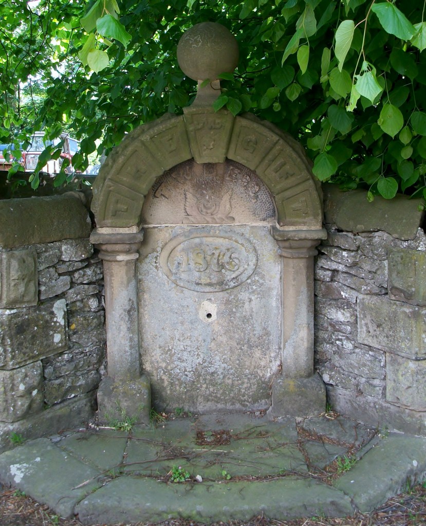
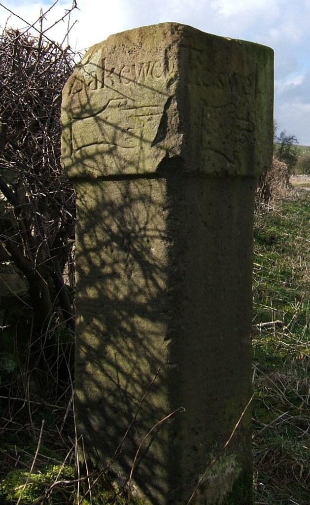
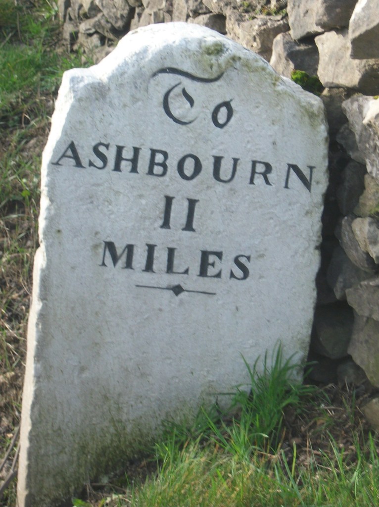
The turnpike trusts seem to have re-introduced milestones on their routes, with each trust using a slightly different style, as seen in the two examples above. Spelling of place names is also non-standardized. Many of these survive, and provide a useful indicator of the routes of different trusts. For instance, on the Alfreton to Ashbourne route, between Crich and Carsington almost all the stones are still in place, although sometimes they are hidden in the undergrowth.

Milepost at Fritchley

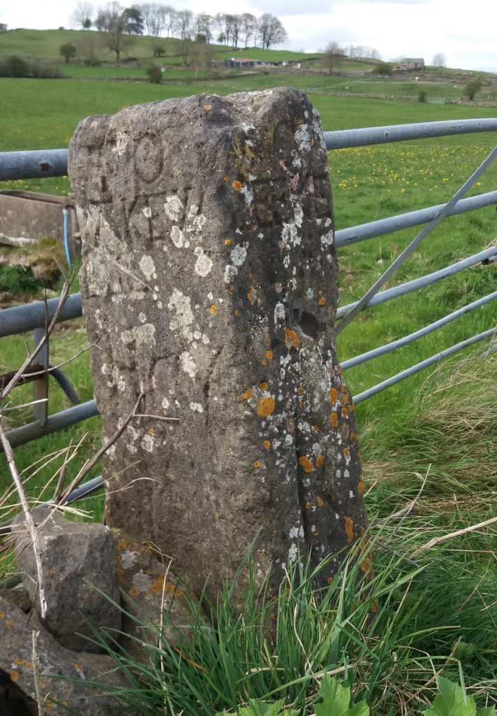
In the early nineteenth century some trusts began using iron, possibly because it was cheaper to letter. The above example is on the Cromford to Langley Mill turnpike near Fritchley, and gives more information than the earlier models.

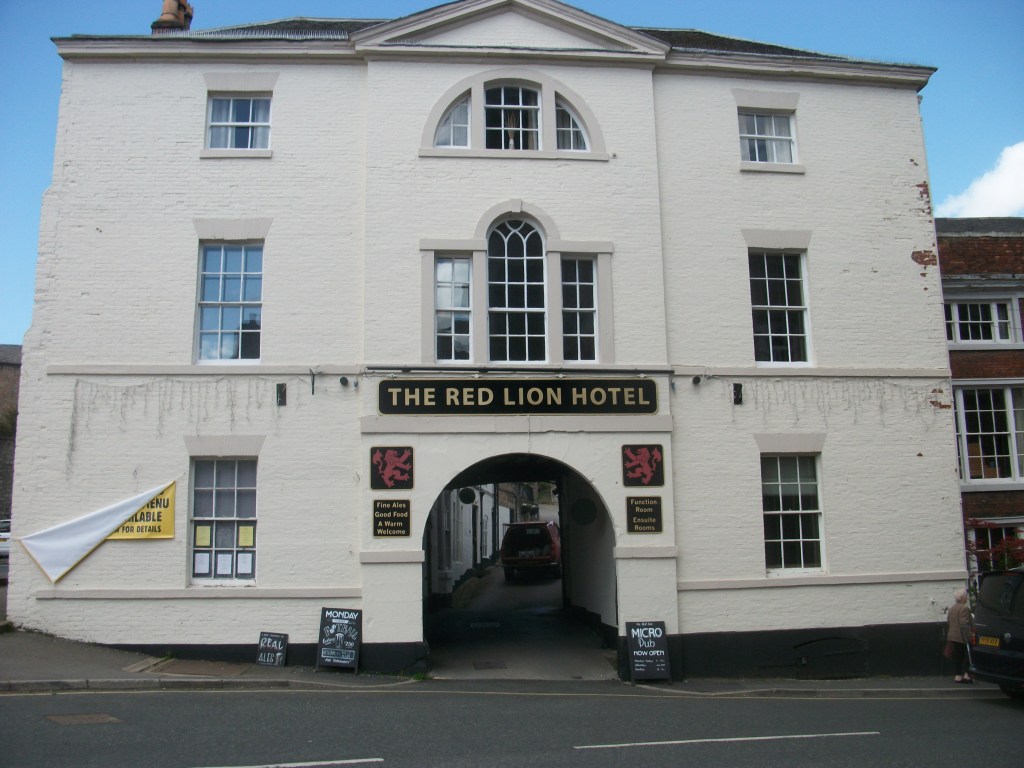
This super-milepost is also made of iron, and is found opposite the Red Lion in Wirksworth. Unusually, it has the name of the iron founders (Harrison of Derby) at the base. Wirksworth was on the route of the Nottingham to Newhaven turnpike, and horses were probably changed at the Red Lion. Newhaven was an important turnpike junction, where coaches would join the Ashbourne to Buxton road.

Finally, it’s worth noting that although today few people use milestones for travel, we still talk about them in everyday conversation, as in ‘she had reached a critical milestone in her life …’. Perhaps a reminder that, at least for pedestrians, every milestone passed was an achievement!

Inn or ale-house?

The Red Lion at Wirksworth

How long have inns offered roadside refreshment to travellers? Not an easy question to answer, since many claim to be the ‘Oldest Pub in England’ or something similar. Nottingham has at least two claimants, The Trip to Jerusalem and The Bell, while in Derbyshire the Holly Bush at Makeney has clearly served a few pints over the centuries. The pilgrims in ‘The Canterbury Tales’, written in the late fourteenth century, stayed at the Tabard Inn in Southwark, so clearly inns were part of medieval travel.

However, the early eighteenth century saw a significant growth in travel, due to road improvement by the turnpike trusts and the invention of coaches with steel springs, cutting journey times and making travelling a little more comfortable. To cater for the expansion of stagecoach routes coaching inns were built or developed, often with the characteristic arched entrance to allow the coach and horses to enter the interior yard, where stabling was provided. To maintain good timing, horses had to be changed regularly, and grooms and ostlers were needed for their care.

The Holly Bush at Makeney

There was an important distinction between inns and ale houses. The former offered accommodation as well as food and drink, while the latter were more down market and, as the name suggests, dealt mainly in (possibly home-brewed) beer. But even in the inns there were class distinctions: gentry in their private carriages or on horseback were more welcome than the occupants of stage coaches, while those on foot were often turned away. The owners of inns were frequently caricatured as greedy and grasping, in particular landladies, while the chambermaids were often portrayed as warm-hearted and generous.

This is the situation shown in Fielding’s humorous novel ‘Joseph Andrews’ (1742), which vividly portrays life on the road. Joseph, the hero, is robbed at the roadside, but is rescued by a passing coach and taken to the nearest inn, the Dragon. The company are sitting in the kitchen by the fire:

The discourse ran altogether on the robbery, which was committed the night before, and on the poor wretch, who lay above, in the dreadful condition, in which we have already seen him. Mrs Tow-Wouse said, ‘she wondered what the devil Tom Whipwell meant by bringing such guests to her house, when there were so many ale-houses on the road proper for their reception? But she assured him, if he died, the parish should be at the expense of the funeral.’

Wells, springs and troughs

Dressed well, Tissington

Travellers have always needed to drink, and so have their horses and dogs. Yet on the ancient ridgeways, crossing the limestone hills of north Derbyshire, there are few streams or ponds, and so providing drinking places has been critical. Stone troughs fed by springs are found by many old roads, though it is not clear who first installed them. The four horses needed to haul a stagecoach uphill for a mile or two would have needed a long drink by the time they reached the top of the climb.

St Alkmunds Well, Derby

Wells were another source of water, though usually designed just for human use. and more commonly found in villages. Well dressing is a famous Derbyshire custom, and is normally seen as a celebration of a reliable and plentiful water supply – possibly pre-Christian, although now, as the example above shows, co-opted by the Church. Wells have frequently given their name to streets, as with Coldwell Street in Wirksworth or Coldwell End in Youlgrave. Others were sanctified with a saint’s name, such as St Alkmund’s well above, or St Anne’s well in Buxton. It seems likely that the tradition of ‘holy wells’ pre-dates the Reformation in 1539, and in some cases the water from these wells was thought to have a healing value.

Well in Youlgrave ‘The Gift’ 1876

Today it seems shocking how long it took to provide a piped, clean water supply in many Derbyshire villages. Youlgrave was unusual in that it installed its stone reservoir in the centre of the village in 1829 (below), from which local wells such as the one above were supplied. Even today Youlgrave still has its own water supply, independent of Severn Trent. But right up to 1940 nearby Elton people relied on carrying water in buckets from a spring at Burycliffe, half a mile from the village.

Water reservoir, Youlgrave

The names of some old wells can be found on large-scale OS maps, for example Lady Wall Well, north of Baslow on the old route over the moor to Sheffield. Sadly, many of these have become filled with rubbish and are easily overlooked. Cleaning and renovating a local well would be a valuable project for a volunteer neighbourhood group, and help to preserve a link with the not-so-distant past.

Conquering the stoop

Guide stoop at top of Crowhill Lane near Bakewell

Nearly fifty of these stone pillars survive in Derbyshire, providing vital clues to the medieval road network. ‘Stoop’ is a Scandinavian word for stone, and they have proved suitably durable, many surviving for over three hundred years. They were erected about 1709 to (belatedly) comply with an Act of 1697 which required direction stones to be put up at road junctions in remote moorland areas, where travellers would be likely to get lost. The majority have inscriptions on four sides, and these should indicate the direction of the nearest market towns. The example above shows a hand pointing to ‘Bakewel’, while the other sides indicate the directions of Tideswell, Buxton and Winster. It is notable that the stone now stands at a T-junction; the fourth route was closed with the opening of the turnpike road on what is now the nearby A6.

Guidestoop above Winster on road to Grangemill

This illustrates one of the values of these stoops: they show the routes that were in use pre-turnpike and pre-maps. The Winster stoop, above, provides another example. It is thought that originally it stood at the end of Bonsall Lane, and indicates Wirksworth, Bonsall and Bakewell. The fourth town marked, however, is Leek, over 15 miles away via Pikehall, but clearly a significant destination at that time. As with some other guide stoops, this one has been used as a gatepost, since most stoops would have become redundant with the arrival of better signposted turnpikes later in the eighteenth century. Nearby, at Shothouse Spring, another stoop (on private land) is no longer on any road or path, although it was clearly erected at a one-time crossroads.

Guidestoop at Alport Height

The Alport stone (showing Derby, Wirksworth and Ashbourne) is another example of a stoop at an apparently remote junction, but clearly thought worth marking in 1709. In fact its position on the Portway suggests that it would have been a more important route at that time. To properly envisage early eighteenth century travel we need to remove most of the dry stone walls and grassy pasture, and go back to a landscape of open scrubby moorland, crossed by the occasional track. In this setting it is easier to imagine the reassurance that the guidestoop would have given the uncertain traveller.

(For a detailed guide to all surviving stoops see ‘The Guide Stoops of Derbyshire’ by Howard Smith)

The story of the stones

Stone near Wirksworth-Brassington road about one mile west of Wirksworth

It seems likely that single standing stones like the one above, which is over two metres high, have been used as route markers for possibly thousands of years. Stone is readily quarried in north Derbyshire, and once erected they are extremely durable, although some may have been broken up when the commons were enclosed. But in an open, moorland landscape they would have clearly stated ‘here is the route’ and would have been visible a mile away.

No-one knows how many such stones survive today, and not all are marked on the OS map, unlike the stone illustrated. They can be confused with gateposts, but these are generally shorter and have holes bored in them to attach hinges. Some have been worked so that they have been roughly squared, although they have no inscription, as with the stone below, which can be found at SK 299521, just off the public footpath but clearly visible from it. The location is in a direct line from the top of Alport Height to the alignment of Prathall Lane, leading into Gorseybank, southeast of Wirksworth, which might have been the route of the Portway in early medieval times.

Looking north to Middleton and Cromford moors

A third stone near Wirksworth can be seen opposite the Malt Shovel Inn, near the crossroads of the Alfreton-Ashbourne turnpike with the route down to Belper from Bolehill, although it must be much older than these. It is marked on an early nineteenth century map as ‘menhir’ and may well indicate a very early route of the Portway, avoiding the steep descent into the town by circling it on the east and north sides. As with the other stones, this is on private land, but is clearly visible from the road.

In common with many other prehistoric and historic sites, we can never know the full story behind these enigmatic stones, but this basic supposition – that we are looking at ancient route markers – is supported by the use of similar stone markers (but with lettering) for guide stoops in the early eighteenth century and then the introduction of regular milestones on the turnpike roads.

Stone near the Malt Shovel pub