Christmas at Mountain Cottage

Mountain Cottage, Middleton by Wirksworth, today

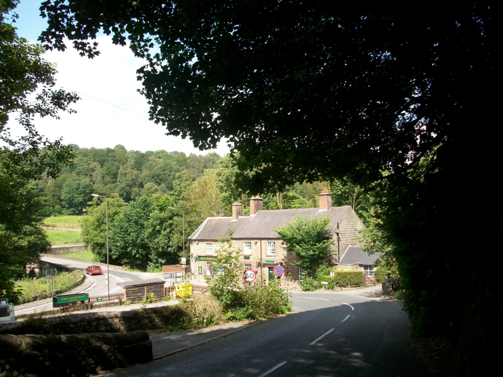
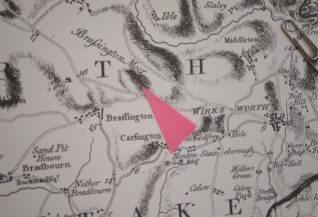
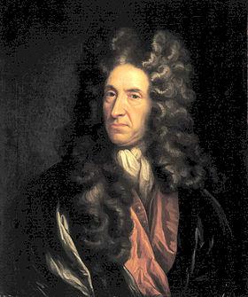
In summer 1918, near the end of the First World War, DH Lawrence and his wife Frieda were forced to move from the south of England to Derbyshire, in the Midlands he thought he had escaped from years before. Out of work and hard up, having been harassed by officialdom for his wife’s supposed pro-German sympathies, Mountain Cottage offered them a refuge, with the rent paid by his relatively affluent sister, Ada, in Ripley. Refuge maybe, but in those days not a luxurious one. Steep field paths ran downhill to the Via Gellia, Cromford and Matlock Bath, or the road through Middleton would take him to Wirksworth station a couple of miles away. Water had to be fetched from a well in the lower garden, and of course there was no electricity, though this would be normal in rural Derbyshire at that date.

Happier daysLawrence (right) and Frieda in 1914

On Friday, December 27th, 1918, Lawrence wrote to Katherine Mansfield:

“We got your parcel on Christmas morning. We had started off, and were on the brow of the hill, when the postman loomed round the corner, over the snow … I wish you could have been there on the hill summit – the valley all white and hairy with trees below us, and grey with rocks – and just round us on our side the grey stone fences drawn in a network over the snow, all very clear in the sun. We ate the sweets and slithered downhill, very steep and tottering … at Ambergate my sister had sent a motor-car for us – so we were at Ripley in time for turkey and Christmas pudding”.

Remarkable to discover that the postman delivered on Christmas Day, and even more surprising that they must have walked at least seven miles to Ambergate – unless the trains were also running!

Smouldering passions

Later that winter, on February 9th, he again wrote to Katherine:

“But it is immensely cold – everything frozen solid – milk, mustard, everything …Wonderful it is to see the footmarks in the snow – beautiful ropes of rabbit prints, trailing away over the brows; heavy hare marks, a fox, so sharp and dainty … Pamela is lamenting because the eggs in the pantry have all frozen and burst. I have spent half an hour hacking ice out of the water tub – now I am going out”. (Pamela was his name for another sister).

By spring the Lawrences had moved south, and were soon en route for Italy, which must have been a welcome relief after living above a frozen Via Gellia. But he never forgot this corner of Derbyshire, since he set his novella, The Virgin and the Gypsy in a village clearly based on Cromford, called Papplewick in the story:

“Further on, beyond where the road crosses the stream, were the big old stone cotton mills, once driven by water. The road curved uphill, into the bleak stone streets of the village”.

NB: Mountain Cottage can be seen from the road, on the right descending from Middleton to the Via Gellia. If walking take care as the road is quite narrow, busy, and there is no pavement.

Cross purposes?

Stone south of Wirksworth at SK299521

Derbyshire has plenty of stone, as shown by its characteristic dry-stone walls, and walkers may find pillars of stone, like the example above, set in the landscape for no apparent reason. Impossible to date, and clearly not redundant gateposts, they can only be assumed to mark some long-lost route. In other places there does seem to be a link to an old track, as with the large stone below, less than a mile above Wirksworth on the Brassington road, on the line of the Portway.

Again, it’s impossible to date a megalith like this, but clearly a lot of trouble was taken to erect what must have been a route marker. Given that many stones like these have been re-used for building, and others deliberately destroyed as symbols of paganism, we can imagine a prehistoric landscape well populated with such pillars. Surviving stone circles reinforce the idea of stones having power and importance, and this may have continued into the early Christian period, from about 600 CE.

Cross in Bradbourne churchyard

Presumably the first Christian missionaries set up ‘crosses’ like this example in Bradbourne as symbols of the new beliefs; although badly worn a crucifixion scene can be found near the base. Similar crosses can be seen at Bakewell church (found on Beeley Moor) and Stapleford, on the Portway in Nottinghamshire. Although referred to as crosses they are actually simple carved pillars, which suggests an attempt to Christianize a pagan symbol.

Stapleford Cross, with scrollwork and saint.

Both of these monuments are thought to date from the ninth century, far older than the church they adjoin. The cross was only adopted as a Christian symbol in 692 CE, and one of the earliest examples of the ‘new’ pattern can be seen at Eyam churchyard (part of the shaft appears to be missing). It is always possible that these crosses were moved into the churchyards at some point, and they may originally have been route markers.

Celtic scrollwork at Eyam

In Medieval Britain crosses became more common and varied: wayside crosses, boundary crosses, market crosses and later, memorial crosses. In some cases they may have had the dual role of showing the way and indicating the next pilgrim shrine; this cross base at Cross Lane near Dethick seems to mark a route that extended south to Shuckstone Cross, only a mile away, and beyond. These (now lost) crosses would have protected travellers as well as guiding them to the holy places.

Cross base near Dethick with anti-theft device

See: Sharpe, N. ( 2002) Crosses of the Peak District, Landmark

Driven by drovers

Well into the twentieth century herds of cattle or flocks of sheep were a common feature of rural roads. Even after the coming of the railways, farmers often had little alternative to walking their animals to and from markets. As towns such as Sheffield and Chesterfield grew, the demand for meat meant that beasts had to be walked from further afield. The major drove roads from Wales and Scotland to London passed around the Peak District, but within Derbyshire there was regular movement from upland grazing areas to the Derby and Nottingham markets.

Green lane near Minninglow

For more distant markets where better prices might be found, farmers entrusted their animals to a drover, a well-respected and licensed man who could take the animals to sale in good condition, and even more importantly, bring the cash home! Very few records of these men survive, but droving must have been a hard life, with a seasonal bent – busiest in the autumn when the grass stopped growing. A herd of a hundred cattle or more wouldn’t travel more than ten or twelve miles per day, and would have to be securely kept at night in a field with grazing and water. Drovers (and their essential dogs) would use the same routes regularly, and make arrangements with farmers and innkeepers en route, perhaps sleeping themselves in barns or outhouses. Identifying these routes today is difficult, but wide verges, such as can be seen in Minninglow lane above, may provide a clue, since the cows could have found some fodder on the hoof.

Bit of confusion

Drovers must have avoided turnpike roads where possible, not only to escape the tolls but also to save clashing with faster traffic. The foul state of the road surface after the passage of a hundred cattle can be imagined, especially in wet weather. The herds were not only taken directly to butchers, but were also driven to fairs such as Flash Fair above Beeley, which attracted buyers from a wide radius. One possible drove route identified by Dodd and Dodd runs from Hartington on the Staffordshire border to Biggin, Newhaven, Cardlemere Lane, Minninglow, Summer Lane near Wirksworth, Ambergate, Bullbridge and on to Nottingham. The first half of this provides a decent walk today, and is certainly more relaxing if you don’t have a hundred frisky bullocks to keep in order.

Sources:

Dodd and Dodd (1980) Peakland Roads and Trackways

Hey (2001) Packmen, Carriers and Packhorse Roads

The name of the bridge

The Derwent Hotel at Whatstandwell Bridge, now The Family Tree

Whatstandwell must be one of the more bizarre place names in Derbyshire, mispelt on some old maps as ‘Hotstandwell’. In fact it commemorates Walter (Wat) Stonewell, who lived near the bridge, built by John de Stepul in 1391, according to records from Darley Abbey. The bridge was rebuilt in the late eighteenth century, and widened more recently. Although the bridge today carries the north/south A6, it was originally constructed for east/west traffic, moving between Crich, Wirksworth and beyond. Building a bridge here would have been a major expense, and John may have paid for it as an act of charity. Clearly the original bridge must have been narrower and more basic, but such an early date suggests the importance of this river crossing, which would have been a ford previously.

Causey between Whatstandwell and Crich

On the east side of the bridge there are two main routes which converge on the river crossing. The main road (B5035) climbs steeply over the canal and up towards Crich. This was part of the Nottingham to Newhaven turnpike of 1759, which eased the gradient of the climb up to Crich by adding a loop above Chasecliff farm. The original track can still be followed, climbing directly up the hillside, with a stone causey still visible in places, as shown above. The other route has been obscured by the building of the canal and railway, but can still be followed by taking the Holloway road towards Robin Hood and then taking the first path on the right. This leads up through Duke’s Quarry, named after the owner, the Duke of Devonshire, and this track would have carried stone to either the trains or barges. However, the path is much older than either types of transport, and continues up through pleasant, semi-wooded fields to Wakebridge.

The route to Shuckstone Cross

After crossing the Crich/Holloway road (currently closed) the track now runs to the left of Wakebridge Farm and climbs steadily to high ground at about 270 metres. As can be seen on the map, Shuckstone Cross in Shuckstone Field is the meeting point of at least five paths. Only the stone cross base now remains, but this is (possibly) marked with the destinations of the routes. The track from the bridge now continues northwards to meet the road, but can be walked to High Oredish and beyond that, Ashover. Although in practice it’s impossible to date routes such as these, the section from Wakebridge up to Shuckstone is exactly on the boundary of two of the historic Derbyshire hundreds, which suggest that it may have existed before the county was divided in the Saxon period.

Base of Shuckstone Cross

Down Ashover way

Tomb of Thomas and Edith Babington in Ashover church

These unusually colorful figures on the Babington tomb at Ashover are a reminder of a long-distance packhorse route that can be traced as far as Wirksworth to the west. Ashover parish used to be much larger, and included Holloway, Lea and Dethick, the home of the Babingtons. St John’s church at Dethick was built as a private chapel for the manor, but Ashover had to be used for burials. Most of the route can be comfortably walked today; leaving Ashover by the track beside the Old Poet’s Corner pub which drops to a bridge over the Amber, and then provides a steep climb up a remarkably complete stone causeway (below).

Onwards and upwards

‘Causeys’ like this are found all over Derbyshire and are about two feet wide, thus providing a solid surface for horses’ feet at minimal expense. The track continues to climb towards Ravensnest and then meets Holestone Gate Road at the top. From there it’s road walking to the B6014 and along Lickpenny Lane to the Matlock-Alfreton road. At this point a guidestoop can be seen on the verge, dated 1710, marked A+P for Ashover Parish. Wirksworth is one of the directions shown, via Dethick Lane (NB the stoop has been moved from its original position, but not significantly). Dethick Lane is partly a holloway, Cross Lane marks the site of an old cross (only the base remains), and beyond the church the path leads down to a crossing of the Lea Brook on stepping stones, then uphill to cross Hearthstone Lane and down to Cromford Station and bridge.

Looking down the steps at Eastwood Grange

Where did the route go to the east from Ashover? One likely possibility is the footpath which starts beside the Black Swan and runs up through the grounds of Eastwood Grange, today a school but which must have been built in Victorian times as a substantial private villa. The route (even if no longer used by packhorses) was clearly significant enough to be given a well-engineered stone-lined route through the gardens of the Grange, as can be seen above. Beyond this the path continues steeply up to the summit of Farhill, a popular viewpoint at 299 metres, from where Hardwick Hall, Chesterfield and Sheffield can be seen.

Reading the stone

The stone in the north wall of St Mary’s, Wirksworth

The Wirksworth Stone must be one of the most remarkable examples of sculpture from the Saxon era in England. Discovered in 1820 face down, buried under the church floor, it is thought to have been the lid of a sarcophagus belonging to an early saint, possibly Betti. It dates from about 700 CE, and displays a sophisticated iconography which reveals a strong Eastern influence e.g. the use of the Greek cross with equal arms. Perhaps the most interesting question is who produced this work 1,300 years ago, and was it carried here or made on the spot?

St Mary’s in its oval churchyard

Clearly the present thirteenth-century building (above) was not the first on this site; in fact the name of the local river, Ecclesbourne, suggest a very ancient foundation, probably a minster church for the whole wapentake of Wirksworth. Just as churches were built by travelling stone masons we can assume that sculpture like this was the work of itinerant artists, who would also produce crosses like those at Bradbourne and Eyam. It is claimed that the Wirksworth stone shows the work of two masons, the one responsible for the lower half being more skilled than his (or her) workmate. Although overall the workmanship is somewhat crude, the scenes portrayed cover the whole range of Christian teaching.

The ascent of Christ, in mandala (detail)

The left hand side of the stone has been broken off, so originally there were ten scenes but now only eight are visible. It appears that the stone should be read vertically, top to bottom, rather than left to right like a modern comic strip. So the top left scene shows Christ washing the feet of the disciples, and the one below the Harrowing of Hell, when the crucified Christ is supposed to have descended into Hades. The next pair are clearly the Crucifixion (with four evangelists) paired with the Ascension below. The third scene on the top represents the death of the Virgin, and below this the Annunciation is shown, with Mary seated. The final scene on top is the Presentation of the infant Christ in the temple, and under this the disciples prepare for their preaching mission (note the figure in the boat). Overall, and assuming the missing section showed the Nativity and the Baptism of Christ, the whole panel presents a remarkable statement of fundamental Christian beliefs. The position of Wirksworth on the Derbyshire Portway reinforces the theory that this was the work of travelling craftsmen, bringing the essentials of their religion in pictorial form to the (presumably) illiterate of the Peak.

On the slow road to Wirksworth

The Road to Wirksworth/ George Turner

This painting is one of several with the same or similar titles and visual ingredients. The artist, George Turner, seems to have specialized in rustic views of his corner of Derbyshire, such as the example above, which must have been painted looking north at a junction on today’s B5023, Duffield to Wirksworth road. Dating from the start of the twentieth century, there is clearly little traffic, given the small flock of sheep dozing on the carriageway. The unsurfaced track looks quite stony, while the shepherd and his collie seem rather under-employed. Turner must have found this a successful formula for his work, since many other landscapes have similar content.

The other Turner

George Turner (1841-1910) was born in Cromford, and became a self-taught artist and art teacher. With his first wife Eliza he also farmed near Barrow-on-Trent, as depicted in some of his work. When she died in 1900 he moved back to the region of his childhood, first to Kirk Ireton and then to Idridgehay, which is on the Wirksworth Road. He then remarried Kate Smith, 30 years younger than him, who was also an artist. They lived there for the rest of his life, and he is buried in the churchyard. His son William, by his first wife, continued painting in the same vein. Turner’s work is in several local municipal galleries and currently can sell for several thousand pounds.

Lane at Gorseybank, Wirksworth/ George Turner

This view seems to be just outside Wirksworth, at Gorseybank, possibly on Prathall Lane. Some perennial themes are included, such as the shepherd with his mini-flock dozing away, but this time he has company: presumably his wife, and their child playing on the verge. Once again traffic must be minimal, and judging by the foliage it is early autumn. In the background can be seen the higher ground that encloses the town. Clearly Turner found it profitable to present the Derbyshire countryside as a static, timeless setting; even the sheep are motionless. The sky is quite blue, the branches wave about a bit, but nothing much else happens. A far cry from the nearby mills, quarries, mines, forges and railways which by this date had moved into the Ecclesbourne Valley!

Harboro’ highlife?

Harboro’ Rocks seen from the High Peak Trail

A couple of miles west of Wirksworth, just above the High Peak Trail, Harboro’ Rocks are a distinctive limestone outcrop rising to 379 metres. The summit offers a splendid view of Carsington Water to the south and the Via Gellia valley to the north, while providing practice pitches for climbers. The Rocks have been the subject of several archaeological digs, the latest reported in the Derbyshire Archaeological Journal (Makepeace 1990 and 2004). According to these, evidence was found of a Late Bronze Age or Early Iron Age settlement: pottery fragments, domestic animal bones, a flint tool and a button. There is also a remarkable cave in which Daniel Defoe found a lead-ming family living in 1720, and which clearly could have been occupied in prehistoric times.

Cave at Harboro’

However, this picture ignores three factors. First, why should anyone settle on such a bleak and elevated spot, with no source of water? The thesis also fails to mention that the Rocks are near the junction of two important ancient routes: The Street, which was engineered by the Romans over an older ridgeway and ran from Wirksworth to Buxton, and the Portway, which headed north from Harboro’ towards Mam Tor and beyond. Finally, the name ‘Harboro” goes back to at least c. 1200 CE and may mean ‘shelter’ or ‘fortified place’, according to Cameron (1959). What must be significant is that this name crops up on two other hilltops along the Portway’s route: Arbour Hill outside Dale and another Arbour Hill in Wollaton.

Burdett’s map of 1762 showing roads west of Wirksworth and position of the Rocks (arrowed)

So my suggestion is that this was not the site of a Bronze Age ‘settlement’, but could have been a fortified campsite for travellers on these two important routes. This would account for the sparse nature of the finds from the excavations – people were travelling light. Similar to the caravanserai found in the Middle East, these campsites seem to have been spaced every six or seven miles along the Portway and would have given the travellers some security for themselves and their animals when they stopped for the night. The next, going southeast, is Alport Height, and to the north, Cratcliffe Rocks.

Inns for travellers were part of the Roman road system, but I doubt whether any were provided in such a backward area as Derbyshire. We can only guess how these campsites were organised; whether locals sold water and provisions to travellers, and how they were maintained. However, there is enough evidence to suggest that these places provided vital protection for long-distance wayfarers until the growth of towns and the development of the modern inn during the medieval period.

Surprising Bradbourne

All Saints churchyard with cross

Halfway between Brassington and Tissington is the small village of Bradbourne, with a population of just over a hundred. Yet the substantial church was once part of a priory, and was the centre of a network of local chapelries. The church tower, complete with elaborately carved doorway, is Romanesque. while in the churchyard is a rare Saxon cross from about 800, showing a crucifixion scene. Why would such a small settlement have such rich monuments?

Crosses of this date are quite rare in Derbyshire: Bakewell and Eyam have good examples. Clearly older than the church itself, they may have signalled the conversion of the area to Christianity, and formed a base for preaching before the church was built. It is possible that such crosses were more common, but many may have been destroyed during iconoclastic periods such as the Reformation. Wirksworth, only a few miles away, would probably be the local minster church.

Doorway to tower with a variety of carved creatures

There is little sign that Bradbourne was ever on a major route. According to the parish council website, the north eastern parish boundary was the course of the Roman road from Little Chester to Buxton, but no source is given for this claim. However, this is now good walking country; the Limestone Way runs about a mile to the north, and to the south Haven Hill (partly access land) offers a convenient circular walk.

Defoe’s Derbyshire tour

Biography of Daniel Defoe author of "Robinson Crusoe"
An early tourist

Few people living in Derbyshire in the eighteenth century have left an account of their travels; clearly they didn’t feel any need to describe their everyday experiences. Therefore it is left to the handful of early tourists to provide an impression of journeying in the county three hundred years ago. Daniel Defoe was an early novelist and journalist who visited many English counties in the 1720s in order to produce his A Tour of England and Wales.

Beginning at Derby, he had clearly chosen a wet season for his visit, since he had to abandon plans to visit Ashbourne on account of ‘the river drowning the low-grounds by a sudden shower, and hastening to the Trent with a most outrageous stream’, a reminder that, not so long ago, travel was very much at the whim of the weather. There are other references to the Derwent as ‘a frightful creature when the hills load her current with water’.

Cave at Harborough Rocks

Defoe’s next stop was Wirksworth, which he found interesting due to the lead trade, despite the inhabitants being ‘a rude boorish kind of people’. The most remarkable part of this visit was an excursion to Harborough Rocks, which was called the Giant’s Tomb at that time. Here he found a lead miner’s family living in a cave, which had been lived in by his family for several generations. Defoe was both horrified, and impressed that people could cope with such crude conditions: ‘they seemed to live very pleasantly, the children look’d plump and fat’. Defoe’s party had a whip-round and gave the miner’s wife several shillings. (Today the cave can be visited quite easily by climbing up from the High Peak Trail).

Other items on his itinerary were more predictable: the Wonders of the Peak, and a focus on spas, which were just beginning to be significant destinations at this time. He is suitably impressed by Chatsworth, but comments about the moor above the house: ‘a waste and howling wilderness, over which, when strangers travel, they are obliged to take guides, or it would be next to impossible not to lose their way’. As for getting to Matlock (which he labels as a village), Defoe maintains that the warm springs would be worth visiting if access was not by ‘ a base, stony, mountainous road’ – presumably the route over Scarthin, which was eventually superseded by blasting the present road through the rocks at Cromford.

Nineteenth-century painting of High Tor, Matlock