The name of the bridge

The Derwent Hotel at Whatstandwell Bridge, now The Family Tree

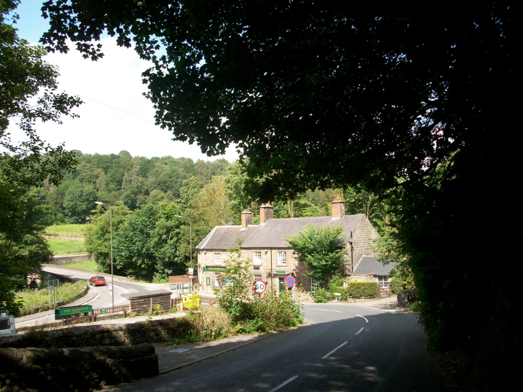
Whatstandwell must be one of the more bizarre place names in Derbyshire, mispelt on some old maps as ‘Hotstandwell’. In fact it commemorates Walter (Wat) Stonewell, who lived near the bridge, built by John de Stepul in 1391, according to records from Darley Abbey. The bridge was rebuilt in the late eighteenth century, and widened more recently. Although the bridge today carries the north/south A6, it was originally constructed for east/west traffic, moving between Crich, Wirksworth and beyond. Building a bridge here would have been a major expense, and John may have paid for it as an act of charity. Clearly the original bridge must have been narrower and more basic, but such an early date suggests the importance of this river crossing, which would have been a ford previously.

Causey between Whatstandwell and Crich

On the east side of the bridge there are two main routes which converge on the river crossing. The main road (B5035) climbs steeply over the canal and up towards Crich. This was part of the Nottingham to Newhaven turnpike of 1759, which eased the gradient of the climb up to Crich by adding a loop above Chasecliff farm. The original track can still be followed, climbing directly up the hillside, with a stone causey still visible in places, as shown above. The other route has been obscured by the building of the canal and railway, but can still be followed by taking the Holloway road towards Robin Hood and then taking the first path on the right. This leads up through Duke’s Quarry, named after the owner, the Duke of Devonshire, and this track would have carried stone to either the trains or barges. However, the path is much older than either types of transport, and continues up through pleasant, semi-wooded fields to Wakebridge.

The route to Shuckstone Cross

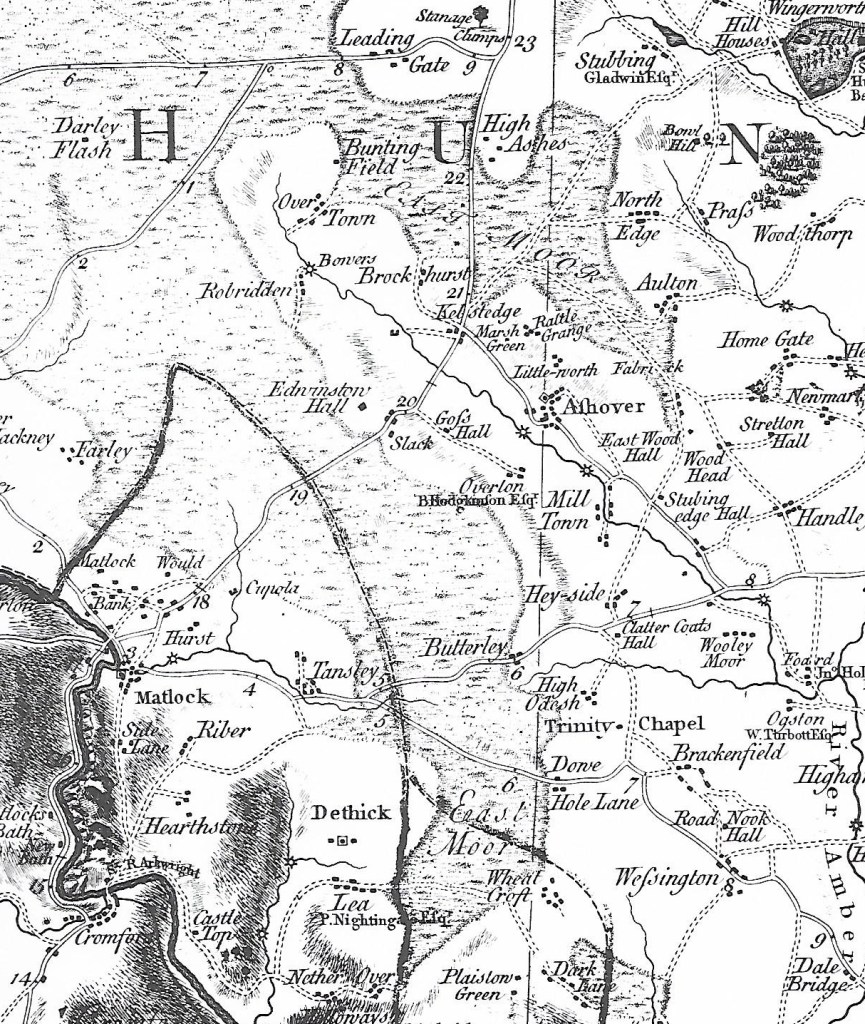
After crossing the Crich/Holloway road (currently closed) the track now runs to the left of Wakebridge Farm and climbs steadily to high ground at about 270 metres. As can be seen on the map, Shuckstone Cross in Shuckstone Field is the meeting point of at least five paths. Only the stone cross base now remains, but this is (possibly) marked with the destinations of the routes. The track from the bridge now continues northwards to meet the road, but can be walked to High Oredish and beyond that, Ashover. Although in practice it’s impossible to date routes such as these, the section from Wakebridge up to Shuckstone is exactly on the boundary of two of the historic Derbyshire hundreds, which suggest that it may have existed before the county was divided in the Saxon period.

Base of Shuckstone Cross

…and miles to go before I sleep

The Roman legions are supposed to have been capable of marching 20 miles per day. Even allowing for the Roman mile being slightly shorter than the modern mile, reducing the length to about 18 miles, this still seems very ambitious. It assumes they were walking on fairly well-surfaced roads rather than rough ground, but they must have been burdened by heavy equipment like shields. I imagine that this distance might have been possible in brief spurts, but for longer journeys something like 15 miles seems more realistic. However, the question of how far people could and did walk in a day is interesting, and can have surprising answers.

Looking down into Edale from Hollins Cross

There are many nineteenth-century examples of people walking remarkable distances to their work, especially in rural areas such as Derbyshire. It is easy to forget the complete lack of public transport in the days before bicycles became a practical solution. The 1851 Census records about 50 mill hands living at Castleton who worked at the cotton mill in Edale – their daily commute was about 3 miles each way but involved a climb of about 800 feet over Hollins Cross – in all weathers! Thomas Hardy’s novel Jude the Obscure describes Jude’s ten-mile walk to work as a stonemason; a figure which seems fantastic now but which must have been less remarkable when published in 1895. Even the walk to school could be arduous for children from outlying farms: Alison Uttley recalls her daily trudge from Castletop Farm near Cromford to Lea School, via Bow Wood – about a mile and a half each way. At the beginning of the twentieth century DH Lawrence, when a schoolboy in Nottingham, had to walk over two miles from his home in Eastwood to Kimberley station to catch a train into the town. As fictionalised in Sons and Lovers:

‘Mrs Morel was rather anxious about his health. But she herself had had to put up with so much that she expected her children to take the same odds’.

The romantic ruins of Wingfield

Lawrence also provides a good illustration of the popularity of hiking in the early twentieth century among the more radical working classes. For the first time, people had sufficient energy to go walking in their free time – something that would have been unthinkable for a labourer a hundred years earlier. In Sons and Lovers he describes a walk taken by a group of young folk, all from the Congregational Church in Eastwood, from Alfreton station via Crich to Ambergate station. Here he fictionalises an actual walk he led at Easter 1905, in which they visited Alfreton church, Wingfield Manor and Crich Stand (clearly not the present tower). On arrival at Whatstandwell:

They managed to procure a loaf and a currant loaf, which they hacked into pieces with shut-knives, and ate sitting on the wall near the bridge, watching the bright Derwent rushing by, and the brakes from Matlock pulling up at the inn’.

Given that all the walkers had to walk to and from the station at the start and end of the walk, the minimum distance they would have walked is about sixteen miles – a distance that would give many modern (and better-shod) hikers a real challenge!

Sources:

Robert Frost ‘Stopping by woods on a snowy evening’

Fletcher, A.J. (1971) ‘The Hope Valley in 1851’. Derbyshire Archaeological Journal 91:169-182

Lawrence, D.H. Sons and Lovers, Penguin, Harmondsworth, 1948

Using maps to research old roads

Maps are an obvious choice in researching the road network of the past, but they have several limitations. There are no accurate maps of Derbyshire’s roads before the mid-eighteenth century, when Peter Burdett published his inch-to-a-mile map of the county in 1767 (see section above). We can assume that the road network presented by Burdett was essentially the same system that had operated since medieval times, but many minor roads and paths were not included.

Burdett marks the new turnpike roads with solid lines, and shows the milestones, while broken lines are reserved for less important roads. The map reveals many changes over the past 250 years: East Moor covered a much larger area, for example, while the centre of Matlock was focused on St Giles, rather than Crown Square as today. Some of the place names are unreliable, so Whatstandwell is written Hotstanddell – perhaps the surveyor misheard a local accent!

Burdett’s map was revised in 1791 to include new industrial sites such as coal mines and the Cromford canal, but the next large-scale map was Sanderson’s map of 1835, ‘Twenty miles around Mansfield’, which covers the eastern part of Derbyshire and shows field boundaries and many road names.

This section of the map, covering a similar area around Crich, shows the growth of enclosures in the early nineteenth century over East Moor, as well as displaying the road network in more detail. At a scale of two and a quarter inches to the mile it was the largest scale map so far produced, and so is more valuable in some areas than the Ordnance Survey one inch to the mile map of Derbyshire, first produced in 1840.

Clearly all such early maps have their drawbacks and omissions, but for road historians they provide an invaluable reference source, full of clues to the landscape of the past.