The Coldwall bridges

Bridging the counties

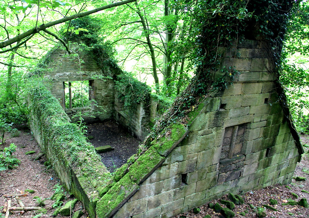
Only a mile from the honeypot of Dovedale are the impressive arches of Coldwall Bridge, a relic of a forgotten turnpike set up in 1762 linking Thorpe with Blythe Marsh. This fine stone structure is today only navigable by farm machinery, though only fifty years ago it was used by cars, a reminder of how quickly a route can become disused. Now it is part of the Limestone Way path, and crosses the River Dove, linking Derbyshire, to the east, with Staffordshire.

The track down from Thorpe

It is difficult to date bridges, since they have often been repeatedly modified, either due to flood damage or increased traffic. This bridge may have been a wooden structure in the sixteenth century, but was probably rebuilt in stone in about 1726 and later widened to its present form when it was incorporated into the turnpike system.

Milestone on the bridge

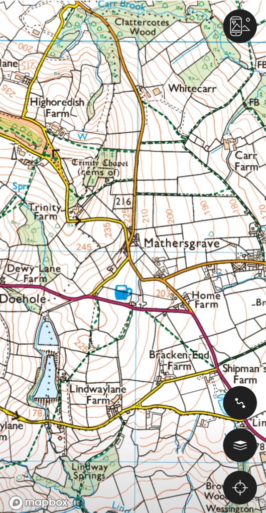
The bridge can be the focus of a circular walk, starting from the car park near Lady Low, then on the road to Blore, turning left at Blore Hall, and taking the field path to the left. From here there’s a steady descent to the bridge, which looks most impressive from above. At the bridge the walker can either follow the Manifold Trail to Ilam, staying on the Staffordshire side of the river, or for a longer walk, cross the bridge and follow the river path up to Dovedale, then behind the Izaak Walton Hotel to Ilam.

Mather’s Grave

Mathersgrave near Brackenfield

Just north of the Matlock-Alfreton road (A615), the hamlet of Mathersgrave commemorates both a family tragedy and a medieval mindset. Set in the retaining wall to a cottage garden is a block of stone inscribed ‘SM 1643’ and nearby is a guidestoop with three inscriptions: ‘Matlack (sic) Road’, ‘Bakewell Roade’ and ‘Alfreton Road 1730’. The presence of the guidestoop shows that this was a significant crossroads in the early eighteenth century; building the turnpike bypassed the junction.

Guidestoop and grave stone

Christian teaching in the Middle Ages insisted that suicide was a serious sin, and this was reinforced by English law which viewed it as a crime, punishable by the forfeit of property to the crown. Suicides were denied burial in consecrated churchyards, and thereby lost their chance of going to heaven. Instead they were buried at crossroads, where it was thought their spirits would be unable to choose the right route back to the land of the living, and so be unable to plague their kin. To make doubly sure, a stake might be driven through the heart of the sinner to further immobilise them. Incredibly, the last case of a crossroads burial was in 1823, while suicide remained a crime until 1961.

Trinity Chapel near Brackenfield

Apparently SM was Samuel Mather, a local man who had fathered an illegitimate daughter, and social condemnation forced him to kill himself, and possibly kill his wife also. (Details of the story are vague). This happened in 1716, so the date on the marker stone is wrong. This occurred well before the Matlock-Alfreton turnpike was constructed, and further evidence of the shift in road pattern is the romantic nearby ruin of Trinity Chapel. Half a mile to the north, (see map above), this was in use before Brackenfield Church was opened in 1857, but is now quite deserted. In the past this must have stood on a busy lane, but today is only reached by footpath.

The mystery of the milestone

Milestone near Tissington

Walking near Tissington the other day I stopped for a drink of water, and propped my walking pole on what I took for an old gatepost, embedded in the rather ragged hedge. Then I realised it wasn’t a gatepost, but was inscribed on the side facing the lane. The inscription was finely carved, in serif lettering, but was difficult to read, being partly covered in moss. I finally decided it reads, in part:

From

London

(illegible)

Miles

(Illegible)

Guide stoop above Winster

Clearly this was not a guide stoop, which, as the example above shows, were inscribed on all four sides with the distance to the nearest market towns. The Tissington stone seems to only show the distance to London – not the most useful information for the traveller here. Moreover, it is located on a lane running east to the ford and nearby Bradbourne Mill, which seems an unlikely route to London: the obvious way to the capital was via Ashbourne and Derby.

Distance marker, corner of town hall, Wirksworth

Another, much later example of a marker showing the distance from London is found in Wirksworth, by the town hall. This version also gives the mileage to key towns on local turnpike routes. Again few travellers would have needed to know how far they were from London, but the marker does link the local community to the prestige and glamour of the capital. Could this be the motive for the Tissington stone – to associate this remote village with the majesty of London?

Any better ideas welcome!

The Gatekeepers

Tollhouse near Holbrook

The arrival of turnpike roads in the mid-eighteenth century created a new type of job: tollgate keeper. Because the gates had to be manned day and night, accommodation had to be provided for the keepers, although presumably there was little traffic after dark. Many of these tollhouses, such as the one above on the Derby-Chesterfield turnpike, have survived, their original function indicated by their closeness to the road.

The task of collecting tolls was often auctioned off by the turnpike trusts on an annual basis, but the tollhouses and tollgates would belong to the trusts. Providing these added to the considerable cost of developing the turnpike roads, creating debts which, in many cases, would never be repaid.

The joys of gate keeping at night are vividly suggested by Dickens in his early novel ‘The Pickwick Papers’. Pickwick and Wardle are chasing Mr Jingle’s post chaise after midnight, when they reach a tollgate:

After a lapse of five minutes, consumed in incessant knocking and shouting, an old man in his shirt and trousers emerged from the turnpike-house and opened the gate. ‘How long is it since the post-chaise went through here?’ inquired Mr Wardle.

‘How long?’

‘Ah!’

‘Why, I don’t rightly know. It worn’t a long time ago, not it worn’t a short time ago – just between the two perhaps.’

Although toll gates are not marked on Burdett’s map, some are shown on Sanderson’s 1835 map marked as TB (toll bar). In some cases they gave the name to the settlement that grew up around the gate, notably Ambergate, where the tollhouse was near to the confluence of the River Amber with the Derwent. This may also apply to Bargate near Belper and Codnor Gate on the Cromford and Langley Mill turnpike.

Tollhouse on Steep Turnpike in Matlock

Surviving tollhouses can be a concrete reminder of the route of a turnpike road, which often followed a course which seems strange to us today. The example above at the foot of Steep Turnpike, in Matlock, should be no surprise, given the name of the road (note the walled-up doorway beside the road). But the cottage below, In Hopton, is a reminder that the Oakerthorpe to Ashbourne turnpike ran through the villages of Hopton and Carsington: the road beside Carsington Water is modern. Again, note the bricked-up doorway.

Probable tollhouse at junction with the Dene, Hopton

The way through the woods

In Bow Wood near Lea Bridge

Over time, many routes have been abandoned, due to changes in settlement patterns, agriculture or the construction of better, easier roads. The medieval route through Bow Wood from Castletop farm to Lea Bridge, shown above, is now a rough track, but its previous status is revealed by the stone gateposts, indicating a width suitable for carts or carriages.

The image of the lost road has always had romantic appeal, an appeal explored by Kipling in his poem ‘The way through the woods’:

They shut the road through the woods

Seventy years ago.

Weather and rain have undone it again,

And now you would never know

There was once a road through the woods

Before they planted the trees.

It is underneath the coppice and heath

And the thin anenomes.

Only the keeper sees

That, where the ring-dove broods,

And the badgers roll at ease,

There was once a road through the woods.

Yet, if you enter the woods,

On a summer evening late,

When the night-air pools on the trout-ringed pools

Where the otter whistles his mate,

(They fear not men in the woods,

Because they see so few)

You will hear the beat of a horse’s feet,

And the swish of a skirt in the dew,

Steadily cantering through

The misty solitudes,

As though they perfectly knew

The old lost road through the woods …

But there is no road through the woods.

The pre-turnpike road from Rowsley to Bakewell

Today some of the ‘lost roads’ survive as footpaths with public rights of way, kept open by dog walkers and hikers. However, especially in high summer when the vegetation reaches shoulder height, and encroaches on the path from both sides, it is easy to see how fast an unsurfaced route can disappear. Perhaps the surprising thing is the number of roads that have survived over hundreds or thousands of years, rather than those that have disappeared.