Watery ways

The Derwent Valleybackbone of the county

When the rains come the streams fill, and we become suddenly aware of the network of waterways that surround us. Normally just half visible, these then threaten to flood the roads and menace our houses. The most fundamental feature of the landscape, brooks and rivers have been flowing in their current courses for over ten thousand years since the last ice age, and have had a dominant influence on our history, as water sources, barriers and boundaries, and also as liquid energy.

The meanings of river names are remarkably impenetrable: unlike most village names many seem to be pre-Saxon, and some even hint at a pre-Celtic language. Kenneth Cameron[i] had a hard time explaining Amber, Dove, Wye, Noe, Lathkill, Derwent and Ecclesbourne (this one of the few ‘bournes’ in the county). Of course there are several River Derwents in England, and it appears to mean something like ‘oak river’. But when does a brook become upgraded to river? And when does the tiny sic (pronounced ‘sitch’) gain the status of a brook?

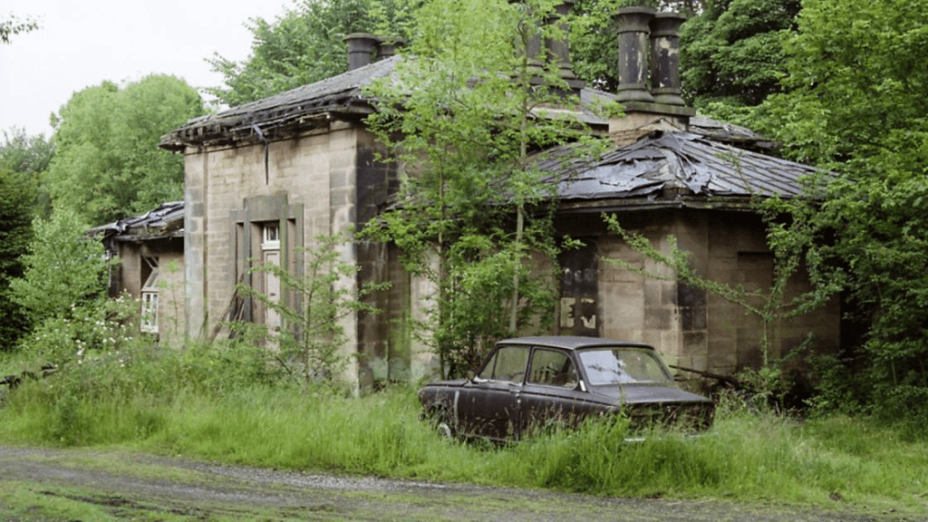
Due to their permanence, rivers have historically been used as convenient boundary markers, as with the Dove as the Staffordshire border or the Erewash marking part of the Nottinghamshire boundary. Within the county, streams may also mark parish or hundred (wapentake) limits. In lowland counties rivers were often navigable, yet in Derbyshire most were barriers rather than aids to travel. In wet winters larger rivers were often impassable, except where rare and expensive bridges had been built, such as at Cromford or Whatstandwell. Early routes avoided river crossings where possible and kept to ridgeways, above the thickest woods on the river banks.  Seasonal flooding was so bad in the lower Dove valley when Daniel Defoe visited in the 1720’s that he abandoned trying to reach Ashbourne from Derby.

The River Amber floods South Wingfield church – again

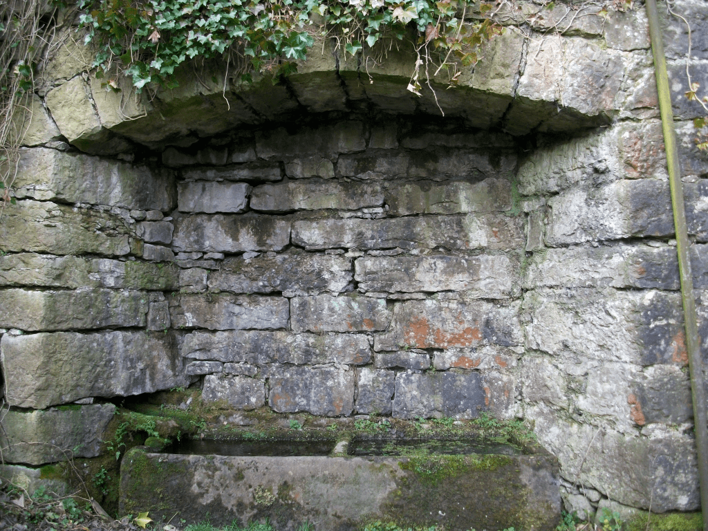
It is believed that in pagan times water spirits (or gods or whatever) were worshipped; water being seen as the source of life. There is substantial archaeological evidence of votive offerings (such as money or jewellery) being found at sites of wells or springs. So this may explain a Derbyshire mystery: why were some medieval churches built so close to frequently flooding rivers? All Saints at South Wingfield is regularly swamped by the Amber, and is well away from the main village, and the same goes for Duffield’s St. Alkmund’s, built right on the banks of the Derwent, as is, further upstream, St. Helen’s at Darley Churchtown. Were these built on ancient sacred sites, or were these locations convenient for baptisms – or both?

Well and spring below St John the Baptist’s church at Matlock Bath

Watermills were common before the Normans arrived, but it is noticeable that many in Derbyshire were located on minor rivers rather than on the Derwent. Presumably the large rise and fall of the Derwent made it more difficult to harness the river’s power. Some of the sites, for example on the Lea Brook at Smedley’s in Lea, seem today to have too little flow to power a mill wheel, but most had millponds to provide reserves of water during dry spells. When Arkwright built his first mill at Cromford he used the water from the Bonsall Brook rather than the nearby river. Later mills (e.g. at Milford and Darley Abbey) which did use the river required massive engineering works to create their weirs and leats.


[i] Cameron, K. (1959) The Place Names of Derbyshire Vol. 1

Old roads meet iron roads

Early North Midland train at Ambergate viaduct with waggon on road below

With the opening of the North Midland Railway line from Derby towards Chesterfield in 1840 the pattern of transport in the area was transformed. Faster and cheaper movement of both freight and passengers would lead to the eclipse of the turnpike roads. But in the very early period rail travel was regarded as exotic and probably dangerous. A gentleman’s private coach could be loaded onto a flatbed truck, saving his family the need to mix with the hoipolloi. Yet railway companies were keen to make travel a comfortable experience for their better class of customer, in a way that’s hard to imagine today.

South Wingfield Station after restoration

This is demonstrated by the facilities at South Wingfield Station, recently restored to its original form by Derbyshire Historic Buildings Trust, working with local volunteers, and with a substantial grant from the Lottery Heritage Fund. This was one of the earliest stations in the country, designed by architect Francis Thompson. The building had a booking office and two waiting rooms, complete with handsome fireplaces, all maintained by several staff, including a stationmaster who lived in a nearby house. Today’s travellers, huddled in a draughty platform shelter, can only dream of such luxury!

As it was

South Wingfield Station, which became redundant in the 1960s, is some distance from its village, yet it was originally advertised as convenient for Alfreton too! This was because Robert Stephenson engineered the line to run up the gentle slope of the Derwent and Amber valleys, since early locomotives weren’t powerful enough to deal with steep climbs. The Nottingham to Newhaven turnpike ran near the station, heading for Crich, and would have another twenty or so years of life before the spreading railway network put it out of business.

South Wingfield Station can be seen from the public footpath which runs through the station yard. See the website below for more background information and details of guided tours:

https://www.derbyshirehistoricbuildingstrust.org.uk/wingfield-station-our-project

What’s going on at Wingfield?

The window of the Great Hall

The ruins of Wingfield Manor are an impressive sight, on a hill overlooking the River Amber and above the village of South Wingfield. The manor was only a mile west of the old Roman road known as Ryknield Street, from Derby to Chesterfield and Sheffield, still a major route but now the A61. This road would have been convenient for the second owners of the Manor, the Talbot family, Earls of Shrewsbury, who also owned Sheffield Castle and Sheffield Manor.

The buildings were deliberately ruined during the Civil War to prevent their use by Royalist forces, after a Parliamentary siege in 1644. Since the eighteenth century the structure has been effectively abandoned, although substantial ruins have survived. The most famous occupant was Mary Queen of Scots, imprisoned here for some years from 1569, in the care of the sixth Earl of Shrewsbury and his wife, Bess of Hardwick.

Mary Queen of Scots – all dressed up and nowhere to go

Clearly such an extensive ruin with famous associations should attract flocks of visitors. The Manor is in the ‘care’ of English Heritage (“unlimited access to hundreds of historic places” – website) but is firmly shut up, as it has been for several years. Their web page says:  ‘currently closed for the safety of visitors, and no public access is allowed’.  A meaningless statement that explains nothing.

Over a hundred years ago no such restrictions applied. DH Lawrence paid a visit at Easter 1905 with a group of friends, a visit which he fictionalised in his novel Sons and Lovers:

‘The young folk were in raptures. They went in trepidation, almost afraid that the delight of exploring this ruin might be denied them’.

Back entrance to the Manor

However, despite the best efforts of English Heritage, it is possible to get a good view of some parts of the ruin by following the public footpath around the back. Starting from the village and heading south, follow the track downhill, beside the garden wall of Wingfield Hall. Cross the stream at the bottom and bear right uphill. The ruins of the Manor can be clearly seen on the right.