Salt Paths and Saltways

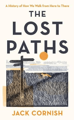
The film of the book The Salt Path was released in the spring, adding to the fame of its author, who called herself Raynor Winn. This bestseller is the story of how she and her husband, called Moth, lost their Welsh home at the same time as he was diagnosed with a degenerative disease. Remarkably, the couple set off for a 600-mile walk on the South West Coastal Path, which led to massive book sales and a film deal. An inspiring, heart-warming story – until an Observer journalist starting probing some of her claims:

https://observer.co.uk/news/national/article/the-real-salt-path-how-the-couple-behind-a-bestseller-left-a-trail-of-debt-and-deceit

Whatever the truth of the claims and counter-claims in this affair, it is clear that many people were deceived, especially the editors at Penguin (‘unflinchingly honest’ – website) and the producers of the film. How could so many smart people fail to ask some pretty basic questions?

Salters Lane between Matlock and Bonsall

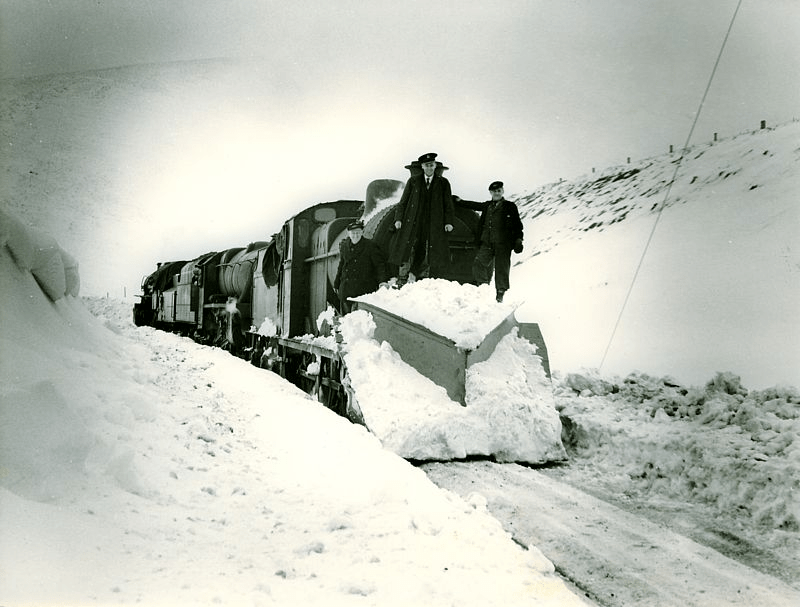
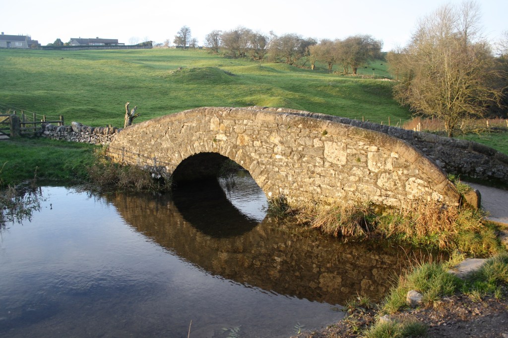
The book is presumably called The Salt Path because they followed a coastal route, the South West Coastal Path, created in the 1970s, which also offers some stunning scenery for the film. But much older Saltways cross Derbyshire, possibly dating from Roman times, which carried packhorse traffic from the salt pits of the Cheshire ‘wiches’ (such as Northwich) to towns like Chesterfield and Sheffield. Various routes can be followed using place names such as Saltergate, Saltersford and Saltsich; for instance the route from Leek via Hartington, Pikehall, Bonsall, Matlock and Ashover. These names are a reminder of the essential nature of salt in the medieval economy, not only for cooking but also for preserving meat and making ceramics.

The Peak District Pilgrimage Trail – Ilam to Eyam

The gullibility of those concerned with The Salt Path fiasco – including readers and viewers – can perhaps be explained by an atavistic faith in the power of pilgrimage, which the Coast Path certainly provided. There is a widespread belief in the benefit, spiritually and health-wise, of stepping out of ordinary life and setting off for a distant goal with few possessions. The most famous example is the Santiago Pilgrimage, now attempted by millions annually, while on a lesser scale the Peak Pilgrimage trail from Ilam to Eyam is a 39-mile (‘soul-healing’) route taking in a selection of historic churches.

The Farley Moor megalith

The two metre-high gritstone on Farley Moor

A recent Time Team programme reports an excavation on Farley Moor north of Matlock, where a single standing stone is thought to have possibly been part of a larger Bronze Age site. The researchers were able to date the site to 3,700 years ago, on the strength of radio carbon dating of charcoal fragments. But what is not clear is whether other stones in the vicinity were part of the monument or just erratic boulders. The stone is in a recent clearing in the Forestry Commission’s Farley Wood, which was planted about 50 years ago. One significant discovery was that below the stone there is a natural spring, so that the stone could have been a marker of this useful source, which might have been more significant when the water table was higher.

The timeless team

Although a good number of stone circles have survived in the Peak District, there is evidence that others have been lost, either through stone robbery or deliberate destruction by landowners who felt they were pagan symbols. However, it does not follow that every standing stone was part of a circle. Others were simply waymarks, such as the stone above Wirksworth on the route of the Portway. It is difficult to imagine the landscape in this area before the conifers were planted, but the ‘Moor’ name suggests an open and fairly treeless area in which a waymark would have been valued, especially if it also marked a spring. There was an ancient route which crossed the Derwent at Darley Bridge and headed up the hillside towards Chesterfield – was this connected?

The Cuckoo Stone

Despite centuries of speculation we really have no idea of the purpose or use of stone circles. Theories range from astronomical temples to assertions of tribal land ownership. Whether the Farley Moor stone is a circle or a solitary waymark, it is curious that in the vicinity are other named stones, such as The Cuckoo Stone on Matlock golf course or the Wire Stone half a mile to the north. While these both appear to be natural rock outcrops, the fact that they are named suggests that traditionally they were important landscapes features.

See: Youtube/ Time team/ Farley Moor

Watery ways

The Derwent Valleybackbone of the county

When the rains come the streams fill, and we become suddenly aware of the network of waterways that surround us. Normally just half visible, these then threaten to flood the roads and menace our houses. The most fundamental feature of the landscape, brooks and rivers have been flowing in their current courses for over ten thousand years since the last ice age, and have had a dominant influence on our history, as water sources, barriers and boundaries, and also as liquid energy.

The meanings of river names are remarkably impenetrable: unlike most village names many seem to be pre-Saxon, and some even hint at a pre-Celtic language. Kenneth Cameron[i] had a hard time explaining Amber, Dove, Wye, Noe, Lathkill, Derwent and Ecclesbourne (this one of the few ‘bournes’ in the county). Of course there are several River Derwents in England, and it appears to mean something like ‘oak river’. But when does a brook become upgraded to river? And when does the tiny sic (pronounced ‘sitch’) gain the status of a brook?

Due to their permanence, rivers have historically been used as convenient boundary markers, as with the Dove as the Staffordshire border or the Erewash marking part of the Nottinghamshire boundary. Within the county, streams may also mark parish or hundred (wapentake) limits. In lowland counties rivers were often navigable, yet in Derbyshire most were barriers rather than aids to travel. In wet winters larger rivers were often impassable, except where rare and expensive bridges had been built, such as at Cromford or Whatstandwell. Early routes avoided river crossings where possible and kept to ridgeways, above the thickest woods on the river banks.  Seasonal flooding was so bad in the lower Dove valley when Daniel Defoe visited in the 1720’s that he abandoned trying to reach Ashbourne from Derby.

The River Amber floods South Wingfield church – again

It is believed that in pagan times water spirits (or gods or whatever) were worshipped; water being seen as the source of life. There is substantial archaeological evidence of votive offerings (such as money or jewellery) being found at sites of wells or springs. So this may explain a Derbyshire mystery: why were some medieval churches built so close to frequently flooding rivers? All Saints at South Wingfield is regularly swamped by the Amber, and is well away from the main village, and the same goes for Duffield’s St. Alkmund’s, built right on the banks of the Derwent, as is, further upstream, St. Helen’s at Darley Churchtown. Were these built on ancient sacred sites, or were these locations convenient for baptisms – or both?

Well and spring below St John the Baptist’s church at Matlock Bath

Watermills were common before the Normans arrived, but it is noticeable that many in Derbyshire were located on minor rivers rather than on the Derwent. Presumably the large rise and fall of the Derwent made it more difficult to harness the river’s power. Some of the sites, for example on the Lea Brook at Smedley’s in Lea, seem today to have too little flow to power a mill wheel, but most had millponds to provide reserves of water during dry spells. When Arkwright built his first mill at Cromford he used the water from the Bonsall Brook rather than the nearby river. Later mills (e.g. at Milford and Darley Abbey) which did use the river required massive engineering works to create their weirs and leats.


[i] Cameron, K. (1959) The Place Names of Derbyshire Vol. 1

All you ever wanted to know about paths

Jack Cornish is Head of Paths at the Ramblers, which must be an excellent qualification to write on the subject. His recent book, The Lost Paths, sets out to be ‘A History of How We Walk from Here to There’. Ambitious in scope, the 19 chapters include such familiar subjects as pilgrim routes and turnpikes, but also cover topics like the growth of railways and the effects of the new post-war towns on traditional paths. Some of his material, such as the enclosures of the eighteenth and nineteenth centuries, may be familiar to any reader with an interest in history, but other topics, for instance the loss of rights of way due to military requirements during the Second World War, are unusual.

The author has assembled a fascinating range of detail, such as the vogue for ‘pedestrianism’ in the nineteenth century, when large bets were put on improbable feats of walking, such as London to York and back in six days. But his concerns are not only historical, since he discusses the need to make access to the countryside more diverse and welcoming for minority groups. If anything, the reader may feel that he has tried to include too much: it is interesting to know how many bricks were used to build London’s first railway (six million) but not really relevant to the stated theme – there’s a certain loss of focus.

Yet his palette is impressively broad in terms of geography, and Derbyshire readers may enjoy his description of a walk from Cromford to Rowsley via Bonsall Moor, which he undertakes as a recreation of the ‘mystery hikes’ which were apparently popular between the wars – hikers would board a train for an unknown destination:

‘The drama of the landscape hits me quickly. Minutes after stepping off my train, my path takes me along the bottom of a massive cliff face. Trees grow up high, directly out of breaks in the rocks, their leaves rusting and falling to the ground’.

Cornish’s own involvement in the walking he writes about is clear, and he effectively balances these personal reports with the more historical details. He is also good at recounting disputes with landowners over rights of way, and sets the inevitable Kinder trespass story in the wider context of the long-standing struggles for access all over this country.

I would certainly recommend The Lost Paths to all fellow walkers, though with a couple of caveats. The title doesn’t really do justice to the scope of the book, which is much broader than it suggests, and the illustrations – small black and white engravings – add little beyond decoration.

Snowmotion

A recent winter view of Youlgreave

Winter has never been the best season for travel, but in the past it must have been far more difficult than today. Not only were roads much worse, but at times the weather seems to have been much colder. Especially in the upland areas of Derbyshire farms and villages were likely to be cut off by snowdrifts, with the constant threat of hunger if people were unable to reach markets. According to the Youlgreave Churchwardens’ records:

This year 1614 began the greatyst snow that ever fell within many memorye. And for heaps or drifts of snow they were very deep; so that passengers both horse and foot, passed over gates and hedges and walls it fell at ten severall times, and the last was the greatest … it continued by daily increasing until 12th day of March …

Snowdrifts at Farley above Matlock in 1947

The freezing winter of 1947, still within living memory, was made worse by the decrepit nature of the country’s infrastructure, worn out by years of war. Heavy snow began in late January and continued well into March. Conditions were primitive in many parts of Derbyshire, as recorded by a Mrs Alsop of Hulland Ward near Ashbourne:

All the local men were called by the council to leave their jobs to help clear the roads. This was all done by hand and shovels – no mechanical diggers in those days. The strong northeast, gale-force winds daily filled the roads. The men worked seven days a week for six weeks or more. … Younger folk trudged to Ashbourne (five miles or more) for bread.

In the Peak conditions were worse and neither roads or railways could be kept open, despite heroic efforts. Around Buxton, Longnor and the Staffordshire side of the Dove valley bombers were used to supply isolated settlements. Thousands of pounds of flour, sugar, jam and tinned goods were dropped by parachute. Tragically, one of the planes crashed on Grindon Moor, killing all eight on board. The weather finally relented in early March, when the landlord and landlady of the Barrel Inn at Bretton could leave the bedroom where they had been trapped for the past five weeks, having been dug out by rescuers.

Source: The Derbyshire and Nottinghamshire Weather Book (1994) Markam, L.

Traveller’s Tree

The yew tree in St Helen’s churchyard at Darley Churchtown is a well-known example of an ancient tree in a sacred setting. Growing near the west church porch, it is 33 feet in girth (which makes it hard to illustrate clearly), and is estimated to be 2,000 years old. Clearly it pre-dates the (twelfth-century) church, suggesting that this was a significant site even possibly in pre-Roman times. Certainly the nearby river crossing at Darley bridge has been part of an important west-east route for thousands of years.

There has been much speculation about churchyard yews, such as the idea that they were grown to provide wood for longbows, but their great age suggests a less prosaic function, as markers of significant sites for travellers.

The Darley yew is not the only ancient one in the county. The yew at St Edmund’s, Allestree may have given the name to the village, suggesting that the tree was already sizable when ‘Adelard’ had his settlement there. There are others at Beeley, Brailsford, Doveridge, Marston Montgomery and Muggington.

The Old Yew Tree, South Wingfield

Although native, the yew is not a common species in Derbyshire. However, it appears to be quite a common name for pubs and farms: with pubs at Dronfield, South Wingfield, Ednaston and (sadly now closed) Holloway. In some cases there is a yew growing on site – it would be interesting to know which came first, the tree or the pub? Pubs and inns were clearly important for travellers in the past, and before inn signs were displayed inn keepers hung an evergreen bush outside their door – usually holly or yew. This is the origin of the saying ‘A good wine needs no bush’. There are currently five Hollybush pubs in Derbyshire, at Grangemill, Makeney (which claims to be one of the oldest pubs in the county), Ripley, Breedon-on-the Hill and Church Broughton.

The Thorn Tree, Ripley

The most common pub tree name is the Royal Oak, which is the third most popular pub name in England. However, this is really a Royalist-type name, commemorating the escape of the future Charles II from Parliamentary troops by hiding up an oak. Other ‘tree pubs’, in descending order of popularity, are: Orange, Walnut, Pear, Oak and Cherry. It is notable that Matlock has a good variety of such pubs, all with rather unusual names: Thorn Tree, Laburnum, Sycamore and (until recently) Lime.

Sources

The Sacred Yew, Chetan and Brueton (1994)

The Place-Names of Derbyshire, Cameron (1959)

Bilberry crumble?

View of presumed stone circle on Bilberry Knoll

Writers of Matlock tourist guides in the nineteenth century described megalithic remains on Riber Hill, above Starkholmes, which are variously labelled dolmen, cromlech and rocking stone, and appear to have been four large stones, one balanced on another. But there was no trace of these a hundred years ago, and they appear to have been broken up, possibly on John Smedley’s orders, as idolatrous pagan survivals. It is easy to forget the role played by religious fanatics in destroying such remains.

However, there seems to have been a stone circle nearby, on the top of Bilberry Knoll, beside Hearthstone Lane, less than a mile south of Riber Castle. This site was explored by a John Simpson around 1905 and described in an article in the Derbyshire Archaeological Journal for 1915. He thought that such circles were evidence of prehistoric sun worship, and claimed that this circle aligned with the Nine Ladies circle on Stanton Moor at sunset on the Summer Solstice. Regrettably he did not draw a plan of the site, or include any useful photos, but estimated that the circle had a diameter of 144 feet.

The start of the path down through the beeches to Cromford

Today the site is remarkable for the jumble of stones in one area, although it is difficult to make out the shape of a circle. Some stones may have been broken up for walling. But whatever we may think of Simpson’s theories, two things are clear. Firstly, Bilberry Knoll is a remarkable viewpoint, ideally suited to some kind of monument, and secondly it is near the crossroads of two ancient tracks: Hearthstone Lane which runs from west to east, and another route which Simpson describes, coming from Lea Green, fording the Lea Brook and then climbing past Upper Lees farm to the ridge and down to Cromford bridge, Scarthin, Bonsall, Brightgate, joining the Portway to Robin Hood’s Stride and on to Youlgrave and possibly Arbor Low.

Field barns near Castletop, Hearthstone Lane above

Too much speculation, maybe, but Alison Uttley should have the last word. She was brought up in the late nineteenth century at Castletop farm, near the west end of Hearthstone Lane:

“… the old highway, dating from long before any of the roads in the valley. We knew, from family tradition, that the packhorses travelled along it, and that lead from the Roman mines in the hills was once carried on its winding slopes on ponies’ backs.”

Sources: Simpson, J. Megalithic Remains on Bilberry Knoll, Matlock. DAJ Vol 37, 1915

Uttley, A. Ambush of Young Days. Faber and Faber, 1937 p.107

Bridge building

Below Matlock bridge

In the current dry weather it’s quite easy to climb down and inspect the underside of the arches of Matlock bridge, a structure thought to date from the fifteenth century. As can be seen in the photo, this reveals a clear joint between the original structure and the widening carried out in 1904, which allowed two-way traffic on the bridge (since reduced to one-way in the latest traffic scheme). This is a reminder that most pre-twentieth century bridges would have only been wide enough for one cart or coach at a time, as is still the case with One-Arch Bridge at Chatsworth.

Holme Bridge north of Bakewell

Some were still narrower, such as Holme Bridge, on the River Wye upstream of Bakewell; just wide enough for a train of packhorses to cross. This is a reminder that bridge building was high skilled and thus expensive, yet bridges were absolutely critical to the transport network. The earliest bridges probably had a wooden superstructure resting on stone piers: easier to construct but liable to be washed away in any flood. All-stone bridges, with arches and breakwaters to deflect floating debris, were commonly constructed from the twelfth century but their cost was often met by a local monastery or abbey. In addition, tolls were frequently charged to pay for their upkeep.

St Mary’s bridge chapel, Derby

Important river crossing often had chapels attached, as with St Mary’s bridge in Derby (the only bridge in medieval times) or Cromford bridge (now ruined). The chapels would have provided a shrine for travellers to pray for a safe onward journey, and doubtless to leave an offering for bridge maintenance.

Bridge over River Bradford at Youlgrave

With most ancient bridges, establishing a date is almost as difficult as dating a road. The example above, with its simple round arch, and too narrow for a cart, could be anything from a hundred and fifty to a thousand years old, and would probably have been repaired many times after especially violent floods.

Defoe’s Derbyshire tour

Biography of Daniel Defoe author of "Robinson Crusoe"
An early tourist

Few people living in Derbyshire in the eighteenth century have left an account of their travels; clearly they didn’t feel any need to describe their everyday experiences. Therefore it is left to the handful of early tourists to provide an impression of journeying in the county three hundred years ago. Daniel Defoe was an early novelist and journalist who visited many English counties in the 1720s in order to produce his A Tour of England and Wales.

Beginning at Derby, he had clearly chosen a wet season for his visit, since he had to abandon plans to visit Ashbourne on account of ‘the river drowning the low-grounds by a sudden shower, and hastening to the Trent with a most outrageous stream’, a reminder that, not so long ago, travel was very much at the whim of the weather. There are other references to the Derwent as ‘a frightful creature when the hills load her current with water’.

Cave at Harborough Rocks

Defoe’s next stop was Wirksworth, which he found interesting due to the lead trade, despite the inhabitants being ‘a rude boorish kind of people’. The most remarkable part of this visit was an excursion to Harborough Rocks, which was called the Giant’s Tomb at that time. Here he found a lead miner’s family living in a cave, which had been lived in by his family for several generations. Defoe was both horrified, and impressed that people could cope with such crude conditions: ‘they seemed to live very pleasantly, the children look’d plump and fat’. Defoe’s party had a whip-round and gave the miner’s wife several shillings. (Today the cave can be visited quite easily by climbing up from the High Peak Trail).

Other items on his itinerary were more predictable: the Wonders of the Peak, and a focus on spas, which were just beginning to be significant destinations at this time. He is suitably impressed by Chatsworth, but comments about the moor above the house: ‘a waste and howling wilderness, over which, when strangers travel, they are obliged to take guides, or it would be next to impossible not to lose their way’. As for getting to Matlock (which he labels as a village), Defoe maintains that the warm springs would be worth visiting if access was not by ‘ a base, stony, mountainous road’ – presumably the route over Scarthin, which was eventually superseded by blasting the present road through the rocks at Cromford.

Nineteenth-century painting of High Tor, Matlock

Lea Road: A sorry, soggy story

Gateposts in Bow Wood show that this was more than a path

The tendency of Derbyshire roads, over time, has been a shift from high-level routes to more convenient ways in the valleys, with gentler gradients. A good example is the road from Cromford Bridge to Lea Bridge, which in medieval times ran past the site of Cromford Station and then turned uphill at Wood End, away from the Derwent, and ran past Castletop farm and through Bow Wood and down to the Lea Brook. This route can still be followed on foot, taking the path just past the railway bridge, up through the wood, and then joining the old track beyond the house.

However, when the Cromford Bridge and Langley Mill Turnpike Trust was established, an easier route was selected, following the river up to what is now High Peak Junction, and then turning north east to Lea Bridge, at that time quite an industrial complex. This new road went on to Holloway, Crich, Bull Bridge and Codnor Gate (where until recently the turnpike was commemorated by the Gate pub).

The road had a tendency to flood in very wet weather, especially near the Cromford railway bridge, but remained a useful route for over two hundred years. But following heavy rain in November 2019, the river had undercut the bank and part of the road collapsed in January 2020, causing the council to close the road the next day.

The road today

In the nearly two years since the road closure the residents of Lea Bridge and Holloway have had no direct access to Cromford or Matlock, and so have had to make lengthy detours on narrow lanes, such as the route over Riber hill. What they find most annoying is the lack of any sense of urgency in re-opening this critical route. Derbyshire County Council and their contractors, Eurovia, have produced a variety of excuses for the prolonged closure, claiming that there have been further landslips. Yet on a a warm dry autumnal day like today no-one is working on the site, while the road, for some reason, is even closed to walkers and cyclists.

They shall not pass

Given that the old turnpike road was engineered by men with wheelbarrows and picks, it seems incredible that today, with modern equipment, we are incapable of repairing a few hundred yards of road in less than two years.