

This 4-5 mile walk includes a medieval castle and a section of the Portway, plus another ancient holloway. Parking is available at various points, but perhaps the simplest is at Coxbench, on the road parallel to the A38 embankment that leads to the kennels, marked MP on the map above. Follow the path up by the kennels, and then take the right-hand path up into the wood. The area to the west has been extensively quarried and the path is effectively following the edge of these quarries. The path then changes direction, turning east, and the ruins of Horsley Castle can be seen on the right.
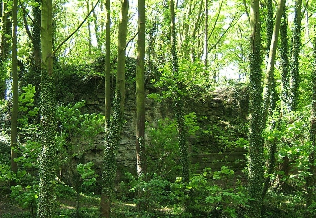
Like several other Derbyshire castles (Duffield, Pilsbury) little remains of this one, beyond a clump of rough masonry on a mound. It is easier to see the layout in winter, before the trees are in leaf. Little is known of the history of the castle, which is dated to the twelfth century. Clearly most of the stone was robbed when it went into decline. It is nearly a mile from Horsley village, and is presumably sited here to take advantage of the high ground and possibly the proximity of the Portway, which is the route of the footpath, offering good views to the north and west. On the Historic England website it is said that the castle ‘overlooks the strategic Derwent Valley’: clearly impossible given the high ground between here and Duffield!
From here continue eastwards to Sandy Lane, and then follow this uphill to the settlement of Brackley Gate. The route turns sharp right here, downhill towards Horsley Carr, but note that if you continue on the top road to Quarry Road you will cross the line of Ryknild Street, one of the most important Roman roads in Derbyshire, although now invisible here. The track descends through dense woodland, and when this opens up on the right, take the path that leads you to a tunnel under the A38 road. You now cross, in quick succession, the road to Little Eaton, the Bottle Brook, and the course of the old railway, before turning left on the Alfreton Road for a few hundred yards. Just past the Bell and Harp pub take the road to the right which runs up past houses before climbing more sharply through the wood. This track, in part a holloway, may have been a church path to Duffield church (but also to Duffield bridge).
After half a mile turn right onto the field path running north, and then bear right beyond Daypark, where several tracks lead down to the Holbrook road, here named as Port Way – the only surviving ‘official’ naming of this old route. From here it is less than a mile downhill to Coxbench, where you turn right and then left under the A38 again, back to the starting point.

