Unwillingly to school …

The young Alison

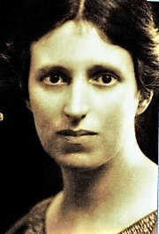
Today few young children walk to primary school alone, for a variety of reasons including parental perceptions of danger. In fact, the image of mum in a large Range Rover driving her offspring to the school gates has become a cliche. Yet 150 years ago children who were lucky enough to go to school often had to walk for miles, especially in rural areas. To some extent this walking may have formed part of their education, as was the case with Alison Uttley, who later became famous for her Little Grey Rabbit books. Alison grew up in a struggling farming family at Castletop Farm between Cromford and Lea Bridge. She didn’t go to school until she was seven, due to the remoteness of their farm on Hearthstone Lane.

Lea Primary today

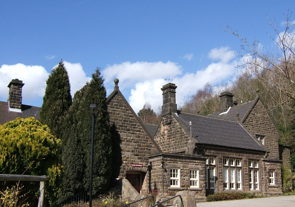
Lea Primary School on Church Street, Holloway was chosen by her parents due to its good reputation. But the journey home, although only a mile and a half long, meant walking from school down to Lea Road, past John Smedley’s mill at Lea Bridge and then climbing up through Bow Wood on what is now a rough track (but which was the old road before the turnpike was built by the Derwent), and emerging from the wood just below the farm. Alison had to do this walk twice a day, in all weathers, and in winter the homeward stretch would be in the dark, for which she was given a lantern.

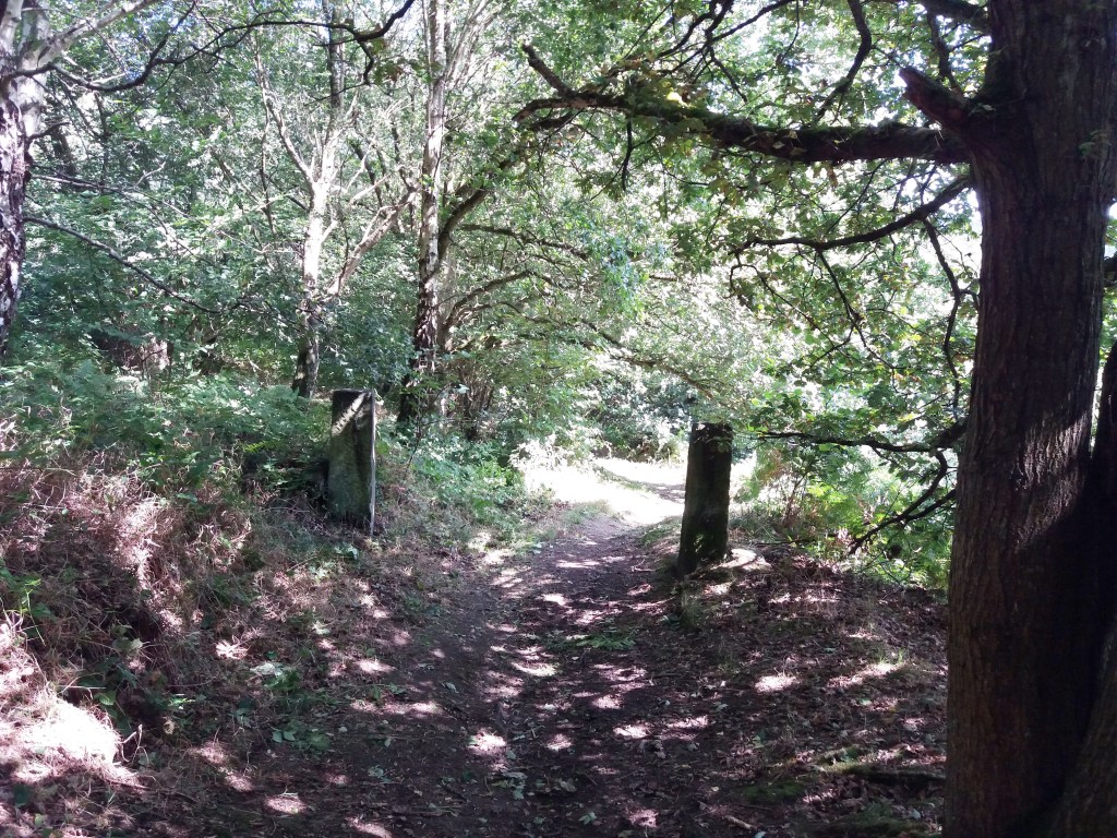
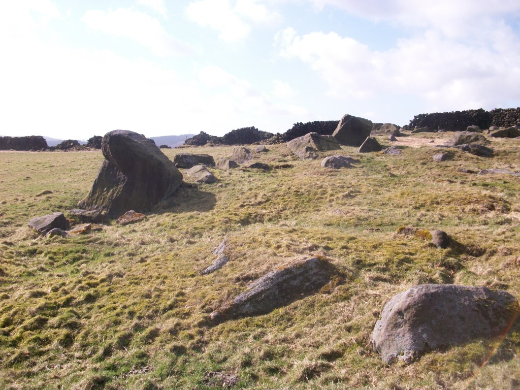
The path through Bow Wood

Clearly the fears she felt on her walk had a major impact, for she describes the journey in several books:

“I set off home, running for the first mile, for it was downhill and easy. Then I passed a mill and walked up a steep field where cows grazed. I came to the wood, and stopped at the big gate to light the candle in my lantern. I shut the gate softly so that ‘they’ would not hear. The treees were alive and awake, they were waiting for me…”

She obviously had a powerful imagination, and perhaps this walk could be credited with launching her career as a storyteller, since she sometimes persuaded a school friend to walk with her, with the incentive of listening to the stories that Alison made up as they walked.

Alison’s walk to school can easily be followed today, either starting from Cromford Station and walking uphill to Castletop, and then through Bow Wood to Holloway, or the reverse route starting from Lea Primary School.

Sources

Judd, D (2010) Alison Uttley, Spinner of Tales, Manchester University Press

Uttley, A (1951) Ambush of Young Days, Faber & Faber

Bilberry crumble?

View of presumed stone circle on Bilberry Knoll

Writers of Matlock tourist guides in the nineteenth century described megalithic remains on Riber Hill, above Starkholmes, which are variously labelled dolmen, cromlech and rocking stone, and appear to have been four large stones, one balanced on another. But there was no trace of these a hundred years ago, and they appear to have been broken up, possibly on John Smedley’s orders, as idolatrous pagan survivals. It is easy to forget the role played by religious fanatics in destroying such remains.

However, there seems to have been a stone circle nearby, on the top of Bilberry Knoll, beside Hearthstone Lane, less than a mile south of Riber Castle. This site was explored by a John Simpson around 1905 and described in an article in the Derbyshire Archaeological Journal for 1915. He thought that such circles were evidence of prehistoric sun worship, and claimed that this circle aligned with the Nine Ladies circle on Stanton Moor at sunset on the Summer Solstice. Regrettably he did not draw a plan of the site, or include any useful photos, but estimated that the circle had a diameter of 144 feet.

The start of the path down through the beeches to Cromford

Today the site is remarkable for the jumble of stones in one area, although it is difficult to make out the shape of a circle. Some stones may have been broken up for walling. But whatever we may think of Simpson’s theories, two things are clear. Firstly, Bilberry Knoll is a remarkable viewpoint, ideally suited to some kind of monument, and secondly it is near the crossroads of two ancient tracks: Hearthstone Lane which runs from west to east, and another route which Simpson describes, coming from Lea Green, fording the Lea Brook and then climbing past Upper Lees farm to the ridge and down to Cromford bridge, Scarthin, Bonsall, Brightgate, joining the Portway to Robin Hood’s Stride and on to Youlgrave and possibly Arbor Low.

Field barns near Castletop, Hearthstone Lane above

Too much speculation, maybe, but Alison Uttley should have the last word. She was brought up in the late nineteenth century at Castletop farm, near the west end of Hearthstone Lane:

“… the old highway, dating from long before any of the roads in the valley. We knew, from family tradition, that the packhorses travelled along it, and that lead from the Roman mines in the hills was once carried on its winding slopes on ponies’ backs.”

Sources: Simpson, J. Megalithic Remains on Bilberry Knoll, Matlock. DAJ Vol 37, 1915

Uttley, A. Ambush of Young Days. Faber and Faber, 1937 p.107

The story of the lane

Hearthstone Lane near Castle Top farm

It is rare to find a historic written description of a Derbyshire road: most literate people in the past took the state of the roads for granted. Therefore it’s especially interesting to have an account of Hearthstone Lane, which runs north from Castle Top farm to Riber, and is today a bridle path. This was written by Alison Uttley, who was brought up at the farm in the late nineteenth century, in her memoir ‘Ambush of Young Days’. She says:

This latter was the old highway, dating from long before any of the roads in the valley. We knew, from family tradition, that the packhorses travelled along it, and that lead from the Roman mines in the hills was once carried down its winding slopes on ponies’ backs. It wandered up to the crest of the hills, cutting through some of our fields, and then it followed the high ridge, between two stone walls, with the land dropping on either side to two valleys. This hill road was grass-covered, and only horses and cows went along it in those days, with sometimes a countryman who was visiting us, the pig-killer, the mole-catcher, the hedger or the thatcher’.

Higher up Hearthstone Lane

Less than a mile from Castle Top farm is the site of an old cottage, easy to miss if you haven’t read Uttley: ‘The Boggart House was sinister, ghostly, and I crept up on tiptoes, although the grass in the lane hid all sound.There were stories about this cottage, which was said to be haunted. I had no fear of the ghost, but of one of the inhabitants. A man and his wife lived there, a good couple, living the most lonely life imaginable … But with them dwelt their son, who had had an accident in the quarries, long ago. He had two noses, it was said, and this is what alarmed me’. Today there are still gooseberry bushes growing in what was their garden, but it seems extraordinary that a family could have lived there, so remote even from a well.

The site of the Boggart House

The Lane is partly a ridgeway, as Uttley appreciated, and the highest point, before it drops down towards Riber, is called Bilberry Knoll. In the field here are a collection of large stones, and it is thought that these are the remains of a megalithic structure which once crowned this hilltop. Given the names of many roads in the vicinity (Holestone, Cuckoostone, etc) it seems likely that this was the Hearthstone (or Heartstone?) after which the Lane was named. Many of these prehistoric sites were destroyed by puritanical landowners who saw them as idolatrous, pagan remains, and this may have been the case here.

Bilberry Knoll

The name of the lane

Road name near Holbrook

Although name signs like this are relatively modern, roads have been named for hundreds of years, and today road names are a useful resource for historians. We do not know what names the Romans actually gave their routes, but after their departure they were called ‘streets’ as in Ryknild Street, which ran from Derby to Chesterfield. Many place names e.g. ‘Stretton’ reflect this. Anglo-Saxons used the noun ‘way’ for their roads, and this survives in many expressions such as ‘highway’ and ‘byway’. The word ‘road’ was not common until the seventeenth century, and may be derived from the verb ‘rode’.

The most obvious type of name gives the destination of the road, hence Chesterfield Road or Brassington Lane. Another refers to some feature found on the road, either natural or man-made, such as Chapel Lane or Cuckoostone Lane. In the case of an ancient route like Hearthstone Lane, running from Cromford to Riber, there is no obvious Stone, raising the question ‘Where was it?’

Hermitage Walk, Nottingham

This sign in The Park in Nottingham is a valuable clue that the ‘Walk’ led to an ancient group of caves (now inaccessible) that contained a rock-cut chapel. Other names refer to the state of the road: Long Lane, Marsh Lane, New Road. In this last case, the name suggests that there is an ‘old road’ that could be investigated.

Many road names refer to natural features using archaic vocabulary. ‘Shaw’ or ‘Carr’ names are common in Derbyshire, and mean a wood on a steep slope, as in Leashaw, Upper Holloway. ‘Sitch’ is Anglo-Saxon for a small stream. ‘Well’ endings as in Bakewell suggest a natural spring.

A few names refer to an individual, either familiarly in ‘Samuel’s Lane’ or more grandly with ‘Via Gellia’, named by Anthony Gell, the road developer, after himself in pseudo-Roman style.

Road sign on the Ridgeway near Heage

But there will always be names that elude discovery, or can only be the subject of wild guesswork. What’s the story behind Lickpenny Lane, for instance, or the Clatterway at Bonsall? Or did Wapentake Lane near Kirk Ireton really lead to the site of the ancient Wapentake?