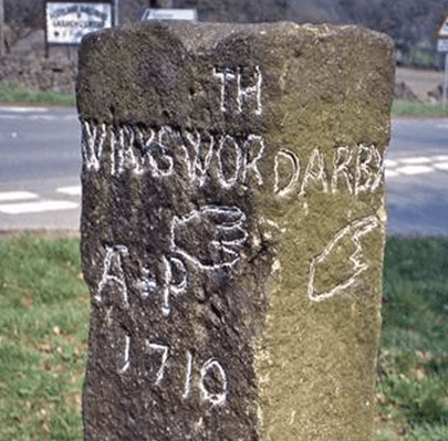
Christmas at Mountain Cottage

Mountain Cottage, Middleton by Wirksworth, today

In summer 1918, near the end of the First World War, DH Lawrence and his wife Frieda were forced to move from the south of England to Derbyshire, in the Midlands he thought he had escaped from years before. Out of work and hard up, having been harassed by officialdom for his wife’s supposed pro-German sympathies, Mountain Cottage offered them a refuge, with the rent paid by his relatively affluent sister, Ada, in Ripley. Refuge maybe, but in those days not a luxurious one. Steep field paths ran downhill to the Via Gellia, Cromford and Matlock Bath, or the road through Middleton would take him to Wirksworth station a couple of miles away. Water had to be fetched from a well in the lower garden, and of course there was no electricity, though this would be normal in rural Derbyshire at that date.

Happier daysLawrence (right) and Frieda in 1914

On Friday, December 27th, 1918, Lawrence wrote to Katherine Mansfield:

“We got your parcel on Christmas morning. We had started off, and were on the brow of the hill, when the postman loomed round the corner, over the snow … I wish you could have been there on the hill summit – the valley all white and hairy with trees below us, and grey with rocks – and just round us on our side the grey stone fences drawn in a network over the snow, all very clear in the sun. We ate the sweets and slithered downhill, very steep and tottering … at Ambergate my sister had sent a motor-car for us – so we were at Ripley in time for turkey and Christmas pudding”.

Remarkable to discover that the postman delivered on Christmas Day, and even more surprising that they must have walked at least seven miles to Ambergate – unless the trains were also running!

Smouldering passions

Later that winter, on February 9th, he again wrote to Katherine:

“But it is immensely cold – everything frozen solid – milk, mustard, everything …Wonderful it is to see the footmarks in the snow – beautiful ropes of rabbit prints, trailing away over the brows; heavy hare marks, a fox, so sharp and dainty … Pamela is lamenting because the eggs in the pantry have all frozen and burst. I have spent half an hour hacking ice out of the water tub – now I am going out”. (Pamela was his name for another sister).

By spring the Lawrences had moved south, and were soon en route for Italy, which must have been a welcome relief after living above a frozen Via Gellia. But he never forgot this corner of Derbyshire, since he set his novella, The Virgin and the Gypsy in a village clearly based on Cromford, called Papplewick in the story:

“Further on, beyond where the road crosses the stream, were the big old stone cotton mills, once driven by water. The road curved uphill, into the bleak stone streets of the village”.

NB: Mountain Cottage can be seen from the road, on the right descending from Middleton to the Via Gellia. If walking take care as the road is quite narrow, busy, and there is no pavement.

That elusive cromlech at Riber

The Welsh model

Cromlechs are ancient megalithic structures, thought to pre-date stone circles, so possibly over 6,000 years old. Welsh examples consist of a flat cap stone supported by several upright stones, as in the photo above. They may have been burial sites, but they certainly were not ‘Druidical altars’, as was imagined by early antiquarians. As far as I know there are now none in Derbyshire, but there is some evidence that at least one existed until the early nineteenth century.

Hearthstone Lane, south of Riber

Hearthstone Lane is an ancient route that runs south from Riber to Cromford and beyond. Writing in the Derbyshire Archaeological Journal for 1887, Benjamin Bryan looked at the evidence for a cromlech in this area. There were a surprising number of guide books to the county in the late eighteenth and early nineteenth centuries, and Bray’s Tour of Derbyshire of 1783 mentions a structure on Riber hill consisting of one capstone resting on uprights. A similar monument is mentioned in Pilkington’s View of Derbyshire of 1789, and then Beauties of England and Wales (1803) names this as the Hirst Stones, and describes a hole sunk into the top slab. Frustratingly, none of these writers provides an illustration or an exact position.

Hearthstone Lane above Castletop Farm

The Matlock Companion of 1835 describes the cromlech as recently broken up, and claims that it had been destroyed by the farmer looking for material for stone walls. In 1866 the editor of the DAJ questioned two old ‘cottagers’ of Riber about the stones, and was told that they both used to play on the monument as children. So there seems little doubt that there had been a cromlech on Riber hill until the early nineteenth century, and it seems likely that the name Hearthstone Lane is a corruption of Hirststone. Several roads in the area are named after prominent stones e.g. Holestone Lane and Cuckoostone Lane. The obvious site of the cromlech is at the top of Bilberry Knoll, the highest point on the lane, providing impressive views in every direction.

The French version, Brittany

This story is a reminder of the chance nature of survival of ancient structures, and how recently and easily they could have been lost. Yet Hearthstone Lane remains as a rewarding historical walk, easily accessible from Cromford station: one of the finest green lanes in the district.

Lord Byng pays a visit

The only known portrait

John Byng (1743-1813) was born into a family of soldiers and sailors, the younger son of the 3rd Viscount Torrington. He bought his commission in the Grenadier Guards when he left Westminster School, and retired as Colonel of the Regiment in 1780. Having no landed estate to look after, he decided to spend his early retirement travelling, and between 1780 and 1791 he rode thousands of miles around England, keeping an extensive record of his travels in a series of diaries. He had married, at the age of 24, Bridget Forrest, the daughter of an admiral, who went on to have 14 children with him, all but one of whom (unusually) survived infancy. Presumably Bridget was accustomed to having a semi-absent husband from his military years?

Willersley Castle, Cromford

There is clearly a sarcastic element of class consciousness in Byng’s comments on Richard Arkwright’s Willersley Castle when he visited Derbyshire in 1779:

‘Went to where Sr R.A. is building for himself a grand house in the same castellated stile (sic) as one sees at Clapham, and really he has made a happy choice of ground, for by sticking it up on an unsafe bank, he contrives to overlook, not see, the beauties of the river, and the surrounding scenery. It is the house of an overseer surveying the works, not of a gentleman …’.

Byng’s tone must be connected with his position as the younger son: he had inherited no castles, and in the aristocratic world of this period anyone who had actually worked for their fortune was worth a sneer.

Cromford Mills as were. Note the distant tower on Crich Stand, the predecessor of the war memorial

Needless to say, John Byng was equally unimpressed by the nearby mill: ‘Every rural sound is sunk in the clamour of cotton works, and the simple peasant is changed into the impudent artisan’. The fact that the ‘simple peasant’ had chosen to work in the mill, as a welcome alternative to lead mining or worse, may not have crossed his mind. But Byng’s reaction was typical of the many tourists who were beginning to scour the Peak District for the romance of wild scenery and Gothic views. His diaries, however, do give the flavour of travel 250 years ago: his servant often rode ahead to reserve rooms at an inn, and would carry a set of sheets so that his master didn’t have to sleep on the damp or dirty bedding often provided by the house!

Watery ways

The Derwent Valleybackbone of the county

When the rains come the streams fill, and we become suddenly aware of the network of waterways that surround us. Normally just half visible, these then threaten to flood the roads and menace our houses. The most fundamental feature of the landscape, brooks and rivers have been flowing in their current courses for over ten thousand years since the last ice age, and have had a dominant influence on our history, as water sources, barriers and boundaries, and also as liquid energy.

The meanings of river names are remarkably impenetrable: unlike most village names many seem to be pre-Saxon, and some even hint at a pre-Celtic language. Kenneth Cameron[i] had a hard time explaining Amber, Dove, Wye, Noe, Lathkill, Derwent and Ecclesbourne (this one of the few ‘bournes’ in the county). Of course there are several River Derwents in England, and it appears to mean something like ‘oak river’. But when does a brook become upgraded to river? And when does the tiny sic (pronounced ‘sitch’) gain the status of a brook?

Due to their permanence, rivers have historically been used as convenient boundary markers, as with the Dove as the Staffordshire border or the Erewash marking part of the Nottinghamshire boundary. Within the county, streams may also mark parish or hundred (wapentake) limits. In lowland counties rivers were often navigable, yet in Derbyshire most were barriers rather than aids to travel. In wet winters larger rivers were often impassable, except where rare and expensive bridges had been built, such as at Cromford or Whatstandwell. Early routes avoided river crossings where possible and kept to ridgeways, above the thickest woods on the river banks.  Seasonal flooding was so bad in the lower Dove valley when Daniel Defoe visited in the 1720’s that he abandoned trying to reach Ashbourne from Derby.

The River Amber floods South Wingfield church – again

It is believed that in pagan times water spirits (or gods or whatever) were worshipped; water being seen as the source of life. There is substantial archaeological evidence of votive offerings (such as money or jewellery) being found at sites of wells or springs. So this may explain a Derbyshire mystery: why were some medieval churches built so close to frequently flooding rivers? All Saints at South Wingfield is regularly swamped by the Amber, and is well away from the main village, and the same goes for Duffield’s St. Alkmund’s, built right on the banks of the Derwent, as is, further upstream, St. Helen’s at Darley Churchtown. Were these built on ancient sacred sites, or were these locations convenient for baptisms – or both?

Well and spring below St John the Baptist’s church at Matlock Bath

Watermills were common before the Normans arrived, but it is noticeable that many in Derbyshire were located on minor rivers rather than on the Derwent. Presumably the large rise and fall of the Derwent made it more difficult to harness the river’s power. Some of the sites, for example on the Lea Brook at Smedley’s in Lea, seem today to have too little flow to power a mill wheel, but most had millponds to provide reserves of water during dry spells. When Arkwright built his first mill at Cromford he used the water from the Bonsall Brook rather than the nearby river. Later mills (e.g. at Milford and Darley Abbey) which did use the river required massive engineering works to create their weirs and leats.


[i] Cameron, K. (1959) The Place Names of Derbyshire Vol. 1

Canal competition

Leawood pump house in steam

For thousands of years goods had to be carried by roads, and a horse and cart could move about a ton of stone or coal. But with industrial growth in the eighteenth century increasing demand for raw materials canals became a feasible mode of transport, a horse-drawn narrowboat could carry 30 tons. From about 1760 the canal network grew quickly, and by 1788 a route was planned from Cromford to Langley Mill, where it would link up with the Erewash Canal and so gain access to the Trent basin. Local entrepreneurs such as Gell at Hopton and lead smelters at Lea and Crich were keen to promote this facility for their minerals, while also benefiting from cheaper coal deliveries.

The aqueduct at Bullbridge

Building the canal with nothing more advanced than shovels and wheelbarrows seems remarkable today, especially as aqueducts were needed to cross the Derwent by the Leawood pump house and over the Amber (above – the railway came later!). In addition, Butterley tunnel, about 3,000 yards long, proved difficult to cut and maintain. The entire route from Cromford to the Butterley tunnel was on a level, so no locks were needed. This saved water, which was always an issue given the original supply was the Bonsall Brook, shared with Arkwright’s mill. The pump house was a later addition, lifting water from the Derwent. The estimate for the canal’s construction was about £42,000, but inevitably the actual cost was nearly twice this when it finally opened in 1794.

The staff of Wheatcroft’s office at Cromford Wharf

The sign in the photo gives a good idea of the goods carried by the canal: not just coal and coke but also salt, pipes and straw. However, by the time this was taken the canal was in decline: from the 1850s the railway was providing a cheaper and faster service. At its peak in the early 1800s the canal carried 300,000 tons per year, and paid shareholders a whopping 20%. But in 1852, as profits declined, the canal was sold to its railway rival – which was already operating the High Peak line from Cromford to Manchester. The tunnel suffered several rock falls, which finally closed the through route in 1900, though local traffic between Hartsay and Cromford continued until 1944. It seems curious that such a substantial, splendid piece of engineering should have such a short life, effectively becoming redundant after only 50 years!

All you ever wanted to know about paths

Jack Cornish is Head of Paths at the Ramblers, which must be an excellent qualification to write on the subject. His recent book, The Lost Paths, sets out to be ‘A History of How We Walk from Here to There’. Ambitious in scope, the 19 chapters include such familiar subjects as pilgrim routes and turnpikes, but also cover topics like the growth of railways and the effects of the new post-war towns on traditional paths. Some of his material, such as the enclosures of the eighteenth and nineteenth centuries, may be familiar to any reader with an interest in history, but other topics, for instance the loss of rights of way due to military requirements during the Second World War, are unusual.

The author has assembled a fascinating range of detail, such as the vogue for ‘pedestrianism’ in the nineteenth century, when large bets were put on improbable feats of walking, such as London to York and back in six days. But his concerns are not only historical, since he discusses the need to make access to the countryside more diverse and welcoming for minority groups. If anything, the reader may feel that he has tried to include too much: it is interesting to know how many bricks were used to build London’s first railway (six million) but not really relevant to the stated theme – there’s a certain loss of focus.

Yet his palette is impressively broad in terms of geography, and Derbyshire readers may enjoy his description of a walk from Cromford to Rowsley via Bonsall Moor, which he undertakes as a recreation of the ‘mystery hikes’ which were apparently popular between the wars – hikers would board a train for an unknown destination:

‘The drama of the landscape hits me quickly. Minutes after stepping off my train, my path takes me along the bottom of a massive cliff face. Trees grow up high, directly out of breaks in the rocks, their leaves rusting and falling to the ground’.

Cornish’s own involvement in the walking he writes about is clear, and he effectively balances these personal reports with the more historical details. He is also good at recounting disputes with landowners over rights of way, and sets the inevitable Kinder trespass story in the wider context of the long-standing struggles for access all over this country.

I would certainly recommend The Lost Paths to all fellow walkers, though with a couple of caveats. The title doesn’t really do justice to the scope of the book, which is much broader than it suggests, and the illustrations – small black and white engravings – add little beyond decoration.

Down Ashover way

Tomb of Thomas and Edith Babington in Ashover church

These unusually colorful figures on the Babington tomb at Ashover are a reminder of a long-distance packhorse route that can be traced as far as Wirksworth to the west. Ashover parish used to be much larger, and included Holloway, Lea and Dethick, the home of the Babingtons. St John’s church at Dethick was built as a private chapel for the manor, but Ashover had to be used for burials. Most of the route can be comfortably walked today; leaving Ashover by the track beside the Old Poet’s Corner pub which drops to a bridge over the Amber, and then provides a steep climb up a remarkably complete stone causeway (below).

Onwards and upwards

‘Causeys’ like this are found all over Derbyshire and are about two feet wide, thus providing a solid surface for horses’ feet at minimal expense. The track continues to climb towards Ravensnest and then meets Holestone Gate Road at the top. From there it’s road walking to the B6014 and along Lickpenny Lane to the Matlock-Alfreton road. At this point a guidestoop can be seen on the verge, dated 1710, marked A+P for Ashover Parish. Wirksworth is one of the directions shown, via Dethick Lane (NB the stoop has been moved from its original position, but not significantly). Dethick Lane is partly a holloway, Cross Lane marks the site of an old cross (only the base remains), and beyond the church the path leads down to a crossing of the Lea Brook on stepping stones, then uphill to cross Hearthstone Lane and down to Cromford Station and bridge.

Looking down the steps at Eastwood Grange

Where did the route go to the east from Ashover? One likely possibility is the footpath which starts beside the Black Swan and runs up through the grounds of Eastwood Grange, today a school but which must have been built in Victorian times as a substantial private villa. The route (even if no longer used by packhorses) was clearly significant enough to be given a well-engineered stone-lined route through the gardens of the Grange, as can be seen above. Beyond this the path continues steeply up to the summit of Farhill, a popular viewpoint at 299 metres, from where Hardwick Hall, Chesterfield and Sheffield can be seen.

On the slow road to Wirksworth

The Road to Wirksworth/ George Turner

This painting is one of several with the same or similar titles and visual ingredients. The artist, George Turner, seems to have specialized in rustic views of his corner of Derbyshire, such as the example above, which must have been painted looking north at a junction on today’s B5023, Duffield to Wirksworth road. Dating from the start of the twentieth century, there is clearly little traffic, given the small flock of sheep dozing on the carriageway. The unsurfaced track looks quite stony, while the shepherd and his collie seem rather under-employed. Turner must have found this a successful formula for his work, since many other landscapes have similar content.

The other Turner

George Turner (1841-1910) was born in Cromford, and became a self-taught artist and art teacher. With his first wife Eliza he also farmed near Barrow-on-Trent, as depicted in some of his work. When she died in 1900 he moved back to the region of his childhood, first to Kirk Ireton and then to Idridgehay, which is on the Wirksworth Road. He then remarried Kate Smith, 30 years younger than him, who was also an artist. They lived there for the rest of his life, and he is buried in the churchyard. His son William, by his first wife, continued painting in the same vein. Turner’s work is in several local municipal galleries and currently can sell for several thousand pounds.

Lane at Gorseybank, Wirksworth/ George Turner

This view seems to be just outside Wirksworth, at Gorseybank, possibly on Prathall Lane. Some perennial themes are included, such as the shepherd with his mini-flock dozing away, but this time he has company: presumably his wife, and their child playing on the verge. Once again traffic must be minimal, and judging by the foliage it is early autumn. In the background can be seen the higher ground that encloses the town. Clearly Turner found it profitable to present the Derbyshire countryside as a static, timeless setting; even the sheep are motionless. The sky is quite blue, the branches wave about a bit, but nothing much else happens. A far cry from the nearby mills, quarries, mines, forges and railways which by this date had moved into the Ecclesbourne Valley!

Unwillingly to school …

The young Alison

Today few young children walk to primary school alone, for a variety of reasons including parental perceptions of danger. In fact, the image of mum in a large Range Rover driving her offspring to the school gates has become a cliche. Yet 150 years ago children who were lucky enough to go to school often had to walk for miles, especially in rural areas. To some extent this walking may have formed part of their education, as was the case with Alison Uttley, who later became famous for her Little Grey Rabbit books. Alison grew up in a struggling farming family at Castletop Farm between Cromford and Lea Bridge. She didn’t go to school until she was seven, due to the remoteness of their farm on Hearthstone Lane.

Lea Primary today

Lea Primary School on Church Street, Holloway was chosen by her parents due to its good reputation. But the journey home, although only a mile and a half long, meant walking from school down to Lea Road, past John Smedley’s mill at Lea Bridge and then climbing up through Bow Wood on what is now a rough track (but which was the old road before the turnpike was built by the Derwent), and emerging from the wood just below the farm. Alison had to do this walk twice a day, in all weathers, and in winter the homeward stretch would be in the dark, for which she was given a lantern.

The path through Bow Wood

Clearly the fears she felt on her walk had a major impact, for she describes the journey in several books:

“I set off home, running for the first mile, for it was downhill and easy. Then I passed a mill and walked up a steep field where cows grazed. I came to the wood, and stopped at the big gate to light the candle in my lantern. I shut the gate softly so that ‘they’ would not hear. The treees were alive and awake, they were waiting for me…”

She obviously had a powerful imagination, and perhaps this walk could be credited with launching her career as a storyteller, since she sometimes persuaded a school friend to walk with her, with the incentive of listening to the stories that Alison made up as they walked.

Alison’s walk to school can easily be followed today, either starting from Cromford Station and walking uphill to Castletop, and then through Bow Wood to Holloway, or the reverse route starting from Lea Primary School.

Sources

Judd, D (2010) Alison Uttley, Spinner of Tales, Manchester University Press

Uttley, A (1951) Ambush of Young Days, Faber & Faber

The hermit of the bridge

The causeway in the old days

Swarkeston Bridge was once the only crossing of the Trent between Burton and Nottingham, carrying traffic on the north-south route through the Midlands to Derby and beyond. At this point the river flows through low-lying meadows which flood regularly, and so the road is carried across these on a causeway about three quarters of a mile long. Most of this is medieval, although the actual river bridge was rebuilt in 1801. The whole structure is a clear illustration of the importance of river crossings in the past, and the resources that were devoted to constructing them. In this case, the legend tells of two unmarried sisters who lived on the north bank, and during a flood watched helplessly as their lovers tried to cross the torrent on horseback, before being swept away. As a result they spent all their resources on building the causeway, thereby impoverishing themselves.

Less peaceful today

Even when wealthy donors funded a bridge, maintenance was a constant issue. The Church seems to have been responsible for most bridges, and consecrated a body of men called ‘bridge hermits’, who were given an adjacent chapel to live in and were responsible for collecting tolls to pay for repairs. There are records, for example, of the Bishop of Ely in 1493 appointing a Robert Mitchell to the post and giving him a special outfit to wear. Although the bridge chapel at Swarkeston has disappeared there was also a chapel of St James by Chesterfield Bridge, while ruins of a chapel remain by Cromford Bridge. The best surviving example is by St Mary’s Bridge in Derby, which until the nineteenth century was the only crossing of the Derwent in the town.

Bridge and chapel in 1835

A list of the tolls charged (pontage was the term) for Swarkestone Bridge in 1275 is evidence of the extraordinary variety of goods traded in the region in medieval times. Tolls ranged from a farthing to 6 pence a load, although pedestrians were apparently not charged. This is a short extract from the list, but one wonders how the bridge hermit could assess all these tolls:

  • Any load of grass, hay, brush or brushwood – a farthing
  • Any horse, mare, ox or cow – a farthing
  • Any skin of horse, mare ox or cow- a farthing
  • Any pipe of wine – a penny
  • 5 flitches of bacon, salted or dried – a farthing
  • A centena of skins of lambs, goats, hares, squirrels, foxes or cats – a halfpenny
  • Every quarter of salt – a farthing
  • Every pack saddle load of cloth – three pence
  • Every sumpter load of sea fish – a farthing
  • Every load of brushwood or charcoal – a farthing
  • Every burden of ale – a farthing