
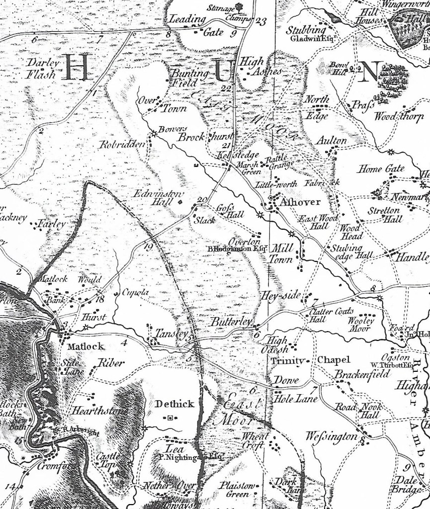
Maps are an obvious choice in researching the road network of the past, but they have several limitations. There are no accurate maps of Derbyshire’s roads before the mid-eighteenth century, when Peter Burdett published his inch-to-a-mile map of the county in 1767 (see section above). We can assume that the road network presented by Burdett was essentially the same system that had operated since medieval times, but many minor roads and paths were not included.
Burdett marks the new turnpike roads with solid lines, and shows the milestones, while broken lines are reserved for less important roads. The map reveals many changes over the past 250 years: East Moor covered a much larger area, for example, while the centre of Matlock was focused on St Giles, rather than Crown Square as today. Some of the place names are unreliable, so Whatstandwell is written Hotstanddell – perhaps the surveyor misheard a local accent!
Burdett’s map was revised in 1791 to include new industrial sites such as coal mines and the Cromford canal, but the next large-scale map was Sanderson’s map of 1835, ‘Twenty miles around Mansfield’, which covers the eastern part of Derbyshire and shows field boundaries and many road names.

This section of the map, covering a similar area around Crich, shows the growth of enclosures in the early nineteenth century over East Moor, as well as displaying the road network in more detail. At a scale of two and a quarter inches to the mile it was the largest scale map so far produced, and so is more valuable in some areas than the Ordnance Survey one inch to the mile map of Derbyshire, first produced in 1840.
Clearly all such early maps have their drawbacks and omissions, but for road historians they provide an invaluable reference source, full of clues to the landscape of the past.
