Bridge building

Below Matlock bridge

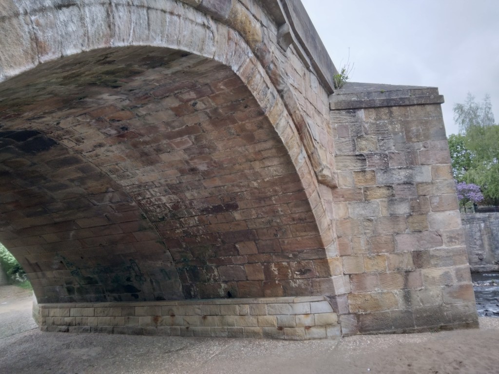
In the current dry weather it’s quite easy to climb down and inspect the underside of the arches of Matlock bridge, a structure thought to date from the fifteenth century. As can be seen in the photo, this reveals a clear joint between the original structure and the widening carried out in 1904, which allowed two-way traffic on the bridge (since reduced to one-way in the latest traffic scheme). This is a reminder that most pre-twentieth century bridges would have only been wide enough for one cart or coach at a time, as is still the case with One-Arch Bridge at Chatsworth.

Holme Bridge north of Bakewell

Some were still narrower, such as Holme Bridge, on the River Wye upstream of Bakewell; just wide enough for a train of packhorses to cross. This is a reminder that bridge building was high skilled and thus expensive, yet bridges were absolutely critical to the transport network. The earliest bridges probably had a wooden superstructure resting on stone piers: easier to construct but liable to be washed away in any flood. All-stone bridges, with arches and breakwaters to deflect floating debris, were commonly constructed from the twelfth century but their cost was often met by a local monastery or abbey. In addition, tolls were frequently charged to pay for their upkeep.

St Mary’s bridge chapel, Derby

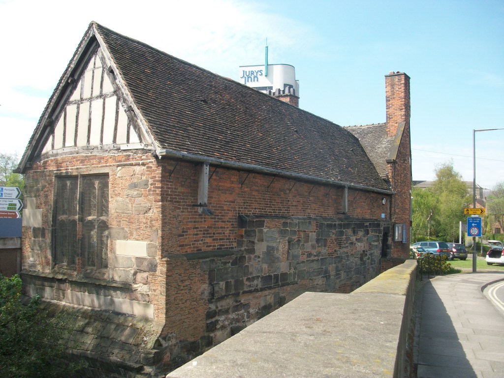
Important river crossing often had chapels attached, as with St Mary’s bridge in Derby (the only bridge in medieval times) or Cromford bridge (now ruined). The chapels would have provided a shrine for travellers to pray for a safe onward journey, and doubtless to leave an offering for bridge maintenance.

Bridge over River Bradford at Youlgrave

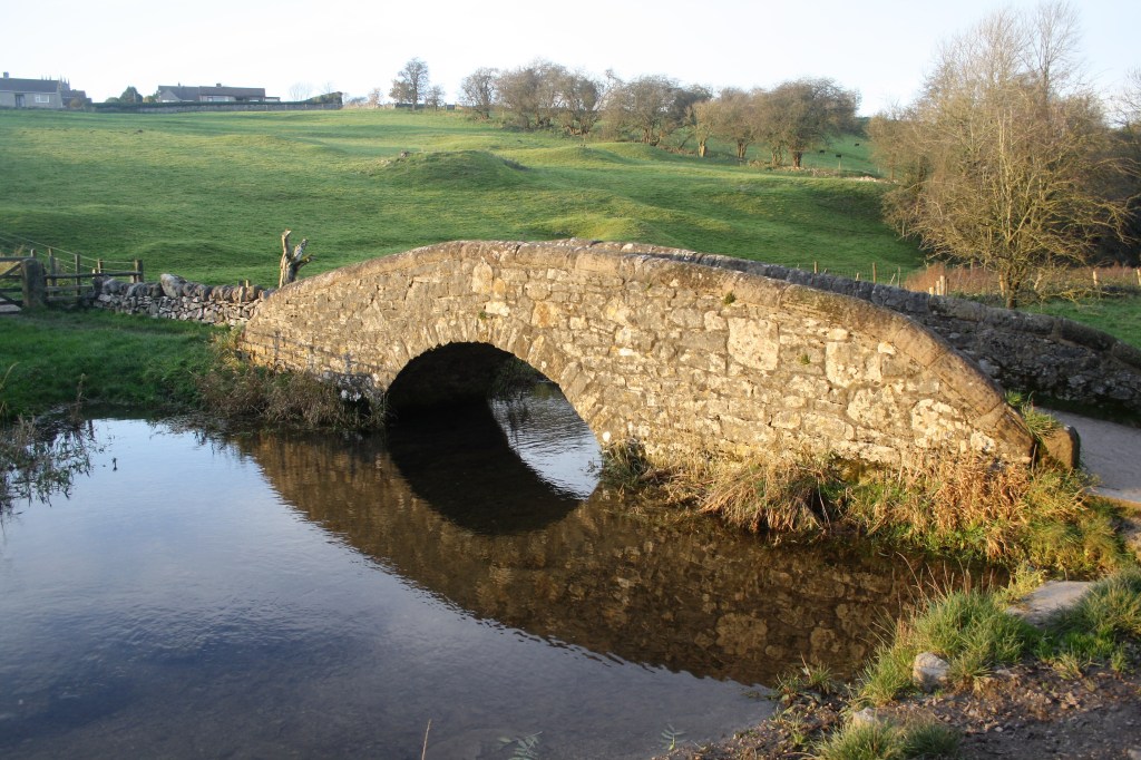
With most ancient bridges, establishing a date is almost as difficult as dating a road. The example above, with its simple round arch, and too narrow for a cart, could be anything from a hundred and fifty to a thousand years old, and would probably have been repaired many times after especially violent floods.

Cromford Bridge

Upstream view of bridge

It is easy to forget how crucial bridges were to the medieval traveller, who could otherwise be delayed at a ford for days, waiting for the river to be passable. Many bridges, including Cromford, were probably originally timber structures with stone piers.

The name ‘Cromford’ means a ford on a (river) bend, and it seems likely that the ford was roughly in the same place as the bridge, just below the point where the Derwent curves out of Matlock Bath. This must have been a vital crossing point, linking the route descending Cromford Hill from Wirksworth and beyond with the road to Starkholmes and old Matlock, plus the older route up along Hearthstone Lane, and the road to Lea Bridge going through Bow Wood.

Dating bridges is always difficult since most have been widened and frequently repaired. In this case it can be seen that the arches are pointed on the upstream side, but more rounded on the downstream, suggesting a substantial rebuild from an original packhorse width. It is generally thought to be fifteenth century, but may be older.

What makes this bridge so special are the ruins of a bridge chapel on the west bank – not to be confused with the later fishing house. Bridge chapels were built to allow travellers the chance to pray for a safe journey and perhaps leave an offering for the upkeep of the bridge. Only a handful survive in Britain, and this example may have been built at the same time as the bridge. It became ruined after the Reformation, but was excavated and repaired by the Derbyshire Archaeological Society in 1951.

Next door to the chapel ruins is the more recent fishing lodge, which has very recently been given a new stone roof. Over the door is the inscription ‘Piscatoribus sacrum’ meaning sacred to fishermen. It may well have been built by the Arkwrights, possibly for their water bailiff. Their grand house, Willersley Castle, dominates the view on the opposite side.

The fishing lodge

Another, easily overlooked feature of this busy bridge is a stone inscription ‘THE LEAP OF MR B H MARE JUNE 1697’ on the southern parapet, marking the spot where a Benjamin Hayward leapt on horseback from the bridge into the river. Presumably the river was in full flow at the time as apparently both horse and rider survived.

Mare’s leap

The bridge is near the terminus wharf of the Cromford canal, opened in 1794. But it was also the rather unlikely starting point of the Cromford Bridge and Langley Mill turnpike road, which ran from there along the east bank of the river towards Lea Bridge, and then on to Holloway, Crich and Bullbridge. This road seems to have opened in the early nineteenth century, and would have provided a faster link with Nottingham and district, replacing the old hilly route past Castletop and through Bow Wood. This is the road which was badly affected by flooding in late 2019 and has been closed ever since.