“A fine lady upon a white horse …”

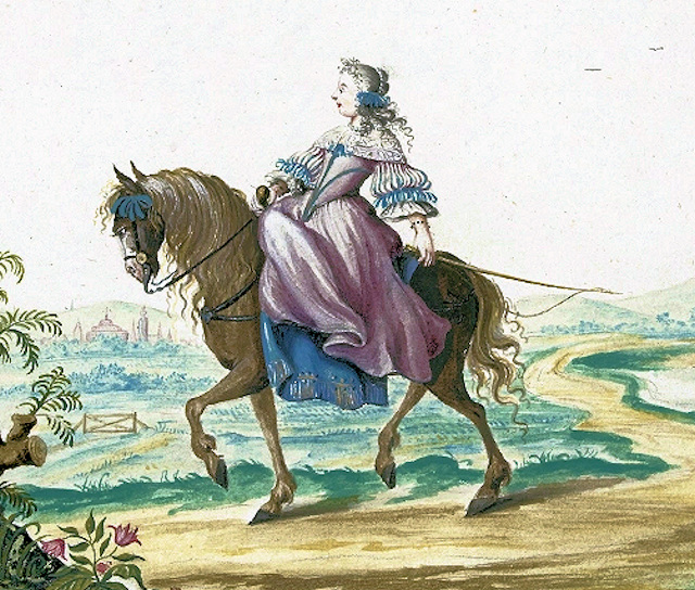
Woman riding side-saddle: No portrait of Celia appears to exist.

Celia Fiennes (1662-1741) was a well-connected lady who toured much of England on horseback around the end of the seventeenth century. Her journal provides a rare insight into the Peak District at this time, before turnpikes but when ‘tourism’ was just beginning. Although independent female travelers were rare at that time, her wealth allowed her to have two servants: an entourage that did not always protect her from the difficulties of travel. As the unmarried daughter of a Cromwell-supporting nobleman, Celia lived partly with a married sister in Hackney and seems to have traveled for both health and curiosity.

Woodcut of the old Buxton bathhouse

Like many more modern travelers Celia found much to complain of. At Buxton, where her party stayed at the Duke of Devonshire’s Buxton Hall, the beer was so bad that ‘very little can be dranke’. Worse were the bedrooms, which were overcrowded: ‘sometimes they are so crowded that three must lye in a bed’. Needless to say: ‘Few people stay above two or three nights it is so inconvenient’. It is easily forgotten that modern notions of privacy were quite foreign at this time. The main attractions were the bath and the water from St Anne’s Well. The former was about 40 feet long by 30 feet wide, and it was barely warm: ‘Just enough to open the pores of ones body’. Worryingly, the flow of water was weak, so that: ‘Its not capable of being cleansed after everybody has been in’. She must have questioned the health benefits of the process, but nevertheless plunged in.

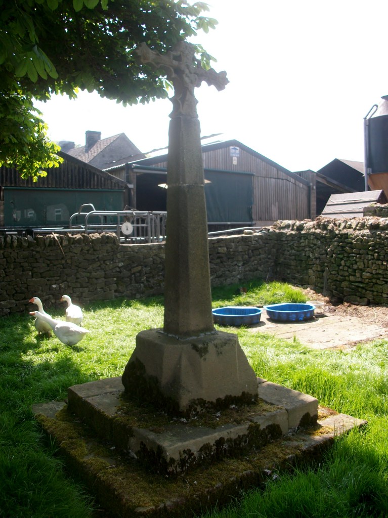
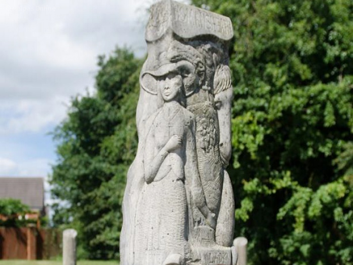
Memorial to Celia in the (suitably named) No Mans Heath, Cheshire

Celia Fiennes visited the so-called ‘Wonders of the Peak’ in the same way a modern tourist might tick off the local attractions in their guidebook. But equally interesting are her comments on travel generally, which she seems to have found extremely difficult in this area:

Indeed all Derbyshire is but a world of peaked hills, which from some of ye highest you discover ye rest like steeples or tops of hills as thick as can be, and tho’ they appear so close yet ye steepness down and up takes up yr time…

Even the guides couldn’t be relied on:

The country here about is so full of moore or quagmires and such precipices that one that is a stranger cannot travel without a guide, and some of them are put to a loss sometymes.

Her journals were not published in her lifetime, but eventually appeared in 1888 with the title Through England on a Side-saddle. The full text can be found at:

https://l4.tm-web-01.co.uk/lib/celia-fiennes-M171235.webp

…and miles to go before I sleep

The Roman legions are supposed to have been capable of marching 20 miles per day. Even allowing for the Roman mile being slightly shorter than the modern mile, reducing the length to about 18 miles, this still seems very ambitious. It assumes they were walking on fairly well-surfaced roads rather than rough ground, but they must have been burdened by heavy equipment like shields. I imagine that this distance might have been possible in brief spurts, but for longer journeys something like 15 miles seems more realistic. However, the question of how far people could and did walk in a day is interesting, and can have surprising answers.

Looking down into Edale from Hollins Cross

There are many nineteenth-century examples of people walking remarkable distances to their work, especially in rural areas such as Derbyshire. It is easy to forget the complete lack of public transport in the days before bicycles became a practical solution. The 1851 Census records about 50 mill hands living at Castleton who worked at the cotton mill in Edale – their daily commute was about 3 miles each way but involved a climb of about 800 feet over Hollins Cross – in all weathers! Thomas Hardy’s novel Jude the Obscure describes Jude’s ten-mile walk to work as a stonemason; a figure which seems fantastic now but which must have been less remarkable when published in 1895. Even the walk to school could be arduous for children from outlying farms: Alison Uttley recalls her daily trudge from Castletop Farm near Cromford to Lea School, via Bow Wood – about a mile and a half each way. At the beginning of the twentieth century DH Lawrence, when a schoolboy in Nottingham, had to walk over two miles from his home in Eastwood to Kimberley station to catch a train into the town. As fictionalised in Sons and Lovers:

‘Mrs Morel was rather anxious about his health. But she herself had had to put up with so much that she expected her children to take the same odds’.

The romantic ruins of Wingfield

Lawrence also provides a good illustration of the popularity of hiking in the early twentieth century among the more radical working classes. For the first time, people had sufficient energy to go walking in their free time – something that would have been unthinkable for a labourer a hundred years earlier. In Sons and Lovers he describes a walk taken by a group of young folk, all from the Congregational Church in Eastwood, from Alfreton station via Crich to Ambergate station. Here he fictionalises an actual walk he led at Easter 1905, in which they visited Alfreton church, Wingfield Manor and Crich Stand (clearly not the present tower). On arrival at Whatstandwell:

They managed to procure a loaf and a currant loaf, which they hacked into pieces with shut-knives, and ate sitting on the wall near the bridge, watching the bright Derwent rushing by, and the brakes from Matlock pulling up at the inn’.

Given that all the walkers had to walk to and from the station at the start and end of the walk, the minimum distance they would have walked is about sixteen miles – a distance that would give many modern (and better-shod) hikers a real challenge!

Sources:

Robert Frost ‘Stopping by woods on a snowy evening’

Fletcher, A.J. (1971) ‘The Hope Valley in 1851’. Derbyshire Archaeological Journal 91:169-182

Lawrence, D.H. Sons and Lovers, Penguin, Harmondsworth, 1948

On yer bikes!

A group of Ripley cyclists about 1914

Bicycles only became practical transport in the 1890s, with the arrival of the chain-driven ‘safety cycle’ fitted with pneumatic tyres. Priced at about £12, for the first time they brought leisure travel within reach of the skilled working man or women – playing a significant role in female emancipation. Pioneering cyclists organised cycling clubs for weekend excursions, partly due to the state of the roads at that time, which caused frequent punctures. In the north the left-wing Clarion movement – strongest in Sheffield – organised a cycling association which held its first meeting at Ashbourne in 1895. Open to both sexes (unlike others) they saw their outings as an opportunity to spread socialist tracts around the countryside. Still in existence, the Clarion Cycling Club has (sadly) now dropped socialism from its masthead.

In the Edwardian period writers such as Thomas Hardy, HG Wells and DH Lawrence wrote of the pleasure and independence of cycling, which must have been greater at a time when cars were rarely seen. But a more recent writer has recorded his love of cycling from Nottingham into the Peak District. Alan Sillitoe (1928-2010) wrote that he first bought a bicycle at the age of 14, and headed for Matlock via Eastwood (before the modern A610 was built). He free-wheeled down to the Erewash and then pushed the bike up part of the hill to Codnor, ‘and many another walk with the bicycle before coming into Matlock’. Clearly his bike was lacking the gears that today’s cyclists take for granted!

Alan Sillitoe, author of ‘Saturday Night and Sunday Morning’

Sillitoe writes: ‘I’d go on Easter weekends through Bakewell and Buxton to Chapel-en-le Frith, and back to Nottingham via Chesterfield and Clay Cross, sleeping in fields and barns by the roadside, or under the lee of those rough stone walls, marking off the fields, thinking the hills beautiful and restful, but in no way hating the small hilltop mining towns and settlements when I got back among them … at Easter the road was often wet, and the wind could be bitter enough, but the real impulse was to wear out the body after a week in a factory, and reach as far a point from Nottingham as a bicycle could go in one weekend’.

Source:

Sillitoe, A. Lawrence and the Real England. A Staple Special (1985)

The Horsey World

A jolly holiday crowd at Matlock Bath

Today it is easy to forget the importance of the horse before the twentieth century. Leaving cavalry and racing aside, they were critical in agriculture and travel, reaching a peak in the nineteenth century when there were an estimated three million horses in Britain. Selective breeding during the medieval period led to horses replacing oxen in plough teams, while others were bred for speed and endurance. Travellers, unless poor, generally went on horseback, certainly before reliable coach travel was available in the 1830s. For many professions, such as doctors and lawyers, travel by horse was simply the most convenient mode, combining flexibility with reasonable speed, for long and short journeys. For example, James Clegg of Chapel- en-le Frith, a dissenting minister, rode nearly 1,000 miles in the first half of 1730, according to his diary.

Clegg’s chapel at Chinley near Chapel-en-le Frith

The ability to ride was necessary for these kinds of jobs, and gentlemen in particular were expected to ride with a certain style, especially when out hunting, or otherwise displaying their social status. When and how boys (and it was generally males before the modern period) learned to ride is a good question, and although there have always been riding schools, we can presume that most were taught by their fathers, or servants such as grooms. The population was mainly rural until the mid-nineteenth century, when riding ability would have been as common as knowing how to cycle is today.

Matlock Bath as was

DH Lawrence provides an example of this in his novel The Rainbow. Set in the 1870s, he depicts the young farmer Tom Brangwen riding from Cossall to Matlock Bath:

“One Whitsuntide he went a jaunt, with two other young fellows, on horseback to Matlock, and thence to Bakewell. Matlock was at that time just becoming a famous beauty spot, visited from Manchester and from the Staffordshire towns. In the hotel where the young men took lunch, there were two girls , and the parties struck up a friendship”.

In the story Tom gets off with one of the girls, tells his companions not to wait for him, and leaves his horse with an ostler while he takes the young lady for a walk in the woods. This is a reminder of the variety of jobs that were involved with the horsey world, such as ostlers, grooms, saddle makers and many more. The 1871 census for the parish of Matlock lists 12 wheelwrights, 15 blacksmiths, 17 cab drivers, 6 coachmen, 8 grooms, and 4 saddlers, not to mention a horse breaker, a coach maker and an ostler.

Reinventing the wheel?

The wheel is often cited as a critical invention in the development of our civilisation, and today wheels are so abundant it is difficult to imagine life without them. Yet they arrived in Britain relatively late – Stonehenge was built by a wheel-less society. The earliest wheel found so far, in Flagg Fen in Cambridgeshire, dates from about 1,600 BCE and is a solid wooden disc. The wheel above, from a museum in Avila, Spain, is over 3,000 years newer, and illustrates the complexity of making wheels almost without metal. It consists of five curved wooden sections, reinforced by a rim of five narrower pieces, all held together by ten spokes radiating out from a wooden hub strengthened by iron bands. Clearly the use of spokes makes for a much lighter wheel, reducing the effort for the carthorse.

These iron wheel rims were found in a chariot burial in northern Greece. They are thought to be Thracian, dating from the Roman period, and, remarkably, the skeletons of two horses were found in the tomb, buried in a standing position. The wooden part of the wheel has disappeared, but traces left in the soil show that it had spokes. Similar chariot burials have been found in Britain, notably in East Yorkshire, where a site at Pocklington in 2018 yielded the remains of a high-status burial of a chariot, thought to belong to the Iron Age (roughly contemporary with the Greek tomb), containing a man’s skeleton, along with the bones of two horses.

Wheeled vehicles such as carts, waggons and coaches were historically less common in north Derbyshire, due to the steep, poor roads and use of packhorses. However, for working lowland farms and for market journeys carts were more efficient than packhorses, needing only one horse to carry a ton of goods. With the improvements in road surfacing brought about by turnpike roads in the second half of the eighteenth century, all major Derbyshire towns were connected by regular coach services by the early nineteenth century. The picture above shows a passenger-carrying brake or charabanc outside the Sun Inn at Buxton, perhaps waiting for a tourist party to finish their lunch?

Salt

Saltways in central and northern Derbyshire (Dodd & Dodd, 1980)

Today salt is cheap and easily available, so it’s easy to overlook its vital importance in the past. It was critical for the agricultural economy, since before freezers were available it was used to preserve the meat that had to be stored over the winter, owing to the lack of winter feed. But in addition to preserving meat (and fish) salt was essential for baking bread (a large proportion of the common diet) as well as flavouring many dishes. From the seventeenth century salt was also used in the Midlands to produce salt -glazed pottery, in which salt was added to the kiln to create an attractive finish.

19th century Derbyshire salt-glazed coffeepot

In the past salt was produced by evaporating coastal salt pans, or by mining rock salt. The nearest source to Derbyshire were the Cheshire ‘wiches’: Northwich, Middlewich and Nantwich, and routes, often called saltways, led east from there to towns such as Sheffield and Chesterfield. Using the plentiful ‘salt’ road names such as Saltersford and Salterslane historians such as David Hey have tried to reconstruct the routes the packhorse trains would have taken. Clearly these tracks would have been used for carriage of other goods, but demand for salt, especially in autumn when livestock had to be salted for winter, must have ensured a fairly regular salt trade. The journey from Cheshire to Chesterfield, where Saltersgate is one of the main streets, leading to the medieval market place, must have taken about three days.

Salt mining in 19th century Cheshire

Salt production and transport has also left a mark on the map of Europe. Salzburg was a major centre, and from there the ‘golden route’ went north east into Bohemia. In Roman times the Via Salaria ran from the Adriatic coast to Rome (but the often-repeated claim that Roman soldiers were paid in salt, hence the word ‘salary’, is false, as common sense should tell us!).

Sources:

Hey, D. Packmen, Carriers and Packhorse Roads (2004)

Dodd, AE & Dodd, EM Peakland Roads and Trackways (1980)

http://kiwihellenist.blogspot.com/2017/01/salt-and-salary.html

The ferryman at Anchor?

Anchor Church today

On the steep south bank of the River Trent, a short walk from Ingleby village, this rock-cut structure may have been used since the ninth century. Although the photo suggests that the river comes to the doorstep, in fact this is a pond, probably a remnant of an earlier course of the river, which has now shifted into a new channel to the north. Clearly cut out of sandstone, it is now thought that this was the refuge of the Saxon saint Hardulph, who had been deposed as King of Northumbria in 806 CE. He was buried at the nearby church of Breedon on the Hill, which is dedicated to him.

An interior view

The next stage in its history began in the thirteenth century, when it was the cell of an anchorite or hermit, hence the name Anchor. It is a mistake to imagine a hermit as a wild and solitary figure, leading a life of lonely meditation, and shunning contact with the world. Repton church and priory was quite near and may have been linked to the hermitage. It is also possible that the hermit was a part-time ferryman, at a time when the Trent ran at the foot of the rock. Burdett’s map of 1767 shows two ferry crossings nearby and upstream, one at Twyford and the other at Willington. Ferries were clearly quite common up to the nineteenth century, as a simple alternative to a costly bridge. Not only would this have given the hermit a useful function, but it could also have provided a small income.

An eighteenth century idyll

The hermitage presumably fell out of use with the dissolution of the monasteries in 1538, and the next records are from the eighteenth century when the landowners, the Burdett family of Foremark Hall, modified the structure for use as a summerhouse. This provided a suitably Gothic atmosphere for elegant alfresco parties, as can be seen in the print above. Sir Francis Burdett was a notable Radical who was actually briefly imprisoned in the Tower of London for libelling the House of Commons. Today the site is Grade II listed, and can be visited by footpath from Ingleby.

The hermit of the bridge

The causeway in the old days

Swarkeston Bridge was once the only crossing of the Trent between Burton and Nottingham, carrying traffic on the north-south route through the Midlands to Derby and beyond. At this point the river flows through low-lying meadows which flood regularly, and so the road is carried across these on a causeway about three quarters of a mile long. Most of this is medieval, although the actual river bridge was rebuilt in 1801. The whole structure is a clear illustration of the importance of river crossings in the past, and the resources that were devoted to constructing them. In this case, the legend tells of two unmarried sisters who lived on the north bank, and during a flood watched helplessly as their lovers tried to cross the torrent on horseback, before being swept away. As a result they spent all their resources on building the causeway, thereby impoverishing themselves.

Less peaceful today

Even when wealthy donors funded a bridge, maintenance was a constant issue. The Church seems to have been responsible for most bridges, and consecrated a body of men called ‘bridge hermits’, who were given an adjacent chapel to live in and were responsible for collecting tolls to pay for repairs. There are records, for example, of the Bishop of Ely in 1493 appointing a Robert Mitchell to the post and giving him a special outfit to wear. Although the bridge chapel at Swarkeston has disappeared there was also a chapel of St James by Chesterfield Bridge, while ruins of a chapel remain by Cromford Bridge. The best surviving example is by St Mary’s Bridge in Derby, which until the nineteenth century was the only crossing of the Derwent in the town.

Bridge and chapel in 1835

A list of the tolls charged (pontage was the term) for Swarkestone Bridge in 1275 is evidence of the extraordinary variety of goods traded in the region in medieval times. Tolls ranged from a farthing to 6 pence a load, although pedestrians were apparently not charged. This is a short extract from the list, but one wonders how the bridge hermit could assess all these tolls:

  • Any load of grass, hay, brush or brushwood – a farthing
  • Any horse, mare, ox or cow – a farthing
  • Any skin of horse, mare ox or cow- a farthing
  • Any pipe of wine – a penny
  • 5 flitches of bacon, salted or dried – a farthing
  • A centena of skins of lambs, goats, hares, squirrels, foxes or cats – a halfpenny
  • Every quarter of salt – a farthing
  • Every pack saddle load of cloth – three pence
  • Every sumpter load of sea fish – a farthing
  • Every load of brushwood or charcoal – a farthing
  • Every burden of ale – a farthing

Snowmotion

A recent winter view of Youlgreave

Winter has never been the best season for travel, but in the past it must have been far more difficult than today. Not only were roads much worse, but at times the weather seems to have been much colder. Especially in the upland areas of Derbyshire farms and villages were likely to be cut off by snowdrifts, with the constant threat of hunger if people were unable to reach markets. According to the Youlgreave Churchwardens’ records:

This year 1614 began the greatyst snow that ever fell within many memorye. And for heaps or drifts of snow they were very deep; so that passengers both horse and foot, passed over gates and hedges and walls it fell at ten severall times, and the last was the greatest … it continued by daily increasing until 12th day of March …

Snowdrifts at Farley above Matlock in 1947

The freezing winter of 1947, still within living memory, was made worse by the decrepit nature of the country’s infrastructure, worn out by years of war. Heavy snow began in late January and continued well into March. Conditions were primitive in many parts of Derbyshire, as recorded by a Mrs Alsop of Hulland Ward near Ashbourne:

All the local men were called by the council to leave their jobs to help clear the roads. This was all done by hand and shovels – no mechanical diggers in those days. The strong northeast, gale-force winds daily filled the roads. The men worked seven days a week for six weeks or more. … Younger folk trudged to Ashbourne (five miles or more) for bread.

In the Peak conditions were worse and neither roads or railways could be kept open, despite heroic efforts. Around Buxton, Longnor and the Staffordshire side of the Dove valley bombers were used to supply isolated settlements. Thousands of pounds of flour, sugar, jam and tinned goods were dropped by parachute. Tragically, one of the planes crashed on Grindon Moor, killing all eight on board. The weather finally relented in early March, when the landlord and landlady of the Barrel Inn at Bretton could leave the bedroom where they had been trapped for the past five weeks, having been dug out by rescuers.

Source: The Derbyshire and Nottinghamshire Weather Book (1994) Markam, L.

Wayside worship

Altar to the Quadruviae in Germany

For at least two thousand years European roads were marked by shrines and sanctuaries, giving travelers the chance to rest, make offerings and pray for a safe journey. The Romans dedicated some to well-known gods such as Hercules and Mars, but they also had divinities specific to travel: Biviae at the meeting place of two roads, Triviae for three and Quadruviae for four, as in the example above, found in Germany. These junction divinities were all female, and give us some insight into the mindset of the ancient world. Even in medieval times in England a crossroads was seen as a place of significance, suitable for the burial of suicides (finally abolished by act of parliament in 1832).

Roadside scene (detail). Eighteenth century

The painting above, in the Thyssen Museum in Madrid, provides a rare glimpse of what may have been a common sight in the pre-industrial world: at a small stone shrine one man is on his knees, while another, on horseback, makes an offering. Yet in Catholic areas of Europe this tradition continued into the twentieth century, as described by DH Lawrence in his essay ‘The Crucifix across the Mountains’. In 1912 Lawrence and Frieda made an epic journey, mainly on foot, from Bavaria to Lake Garda in Italy. Lawrence was struck by the carved wooden crucifixes they found by the roadside:

Coming along the clear, open roads that lead to the mountains, one scarcely notices the crucifixes and the shrines … But gradually, one after another looming shadowily under their hoods, the crucifixes seem to create a new atmosphere over the whole of the countryside, a darkness, a weight in the air …

Wheston Cross near Tideswell

Derbyshire roads had their share of shrines, although little is known of pre-Christian examples. However, it is difficult to judge which of the surviving crosses were boundary markers and which were wayside crosses. At the reformation in the sixteenth century the crosses, usually dedicated to a saint, were generally destroyed as being Popish. However, a few survived, such as the cross at Wheston, which has the Madonna and Child on one face and the Crucifixion on the other. It is about 11 feet tall, but part of the shaft is more recent. Such crosses must have helped travelers navigate generally, but may also have been used to point the way to pilgrimage churches. One clue to the previous existence of a cross is the name ‘Cross Lane’, found in various locations in the county, such as just above Dethick. The topic is fully explored in Neville Sharpe’s ‘Crosses of the Peak District’.