On getting lost

No danger of getting lost here

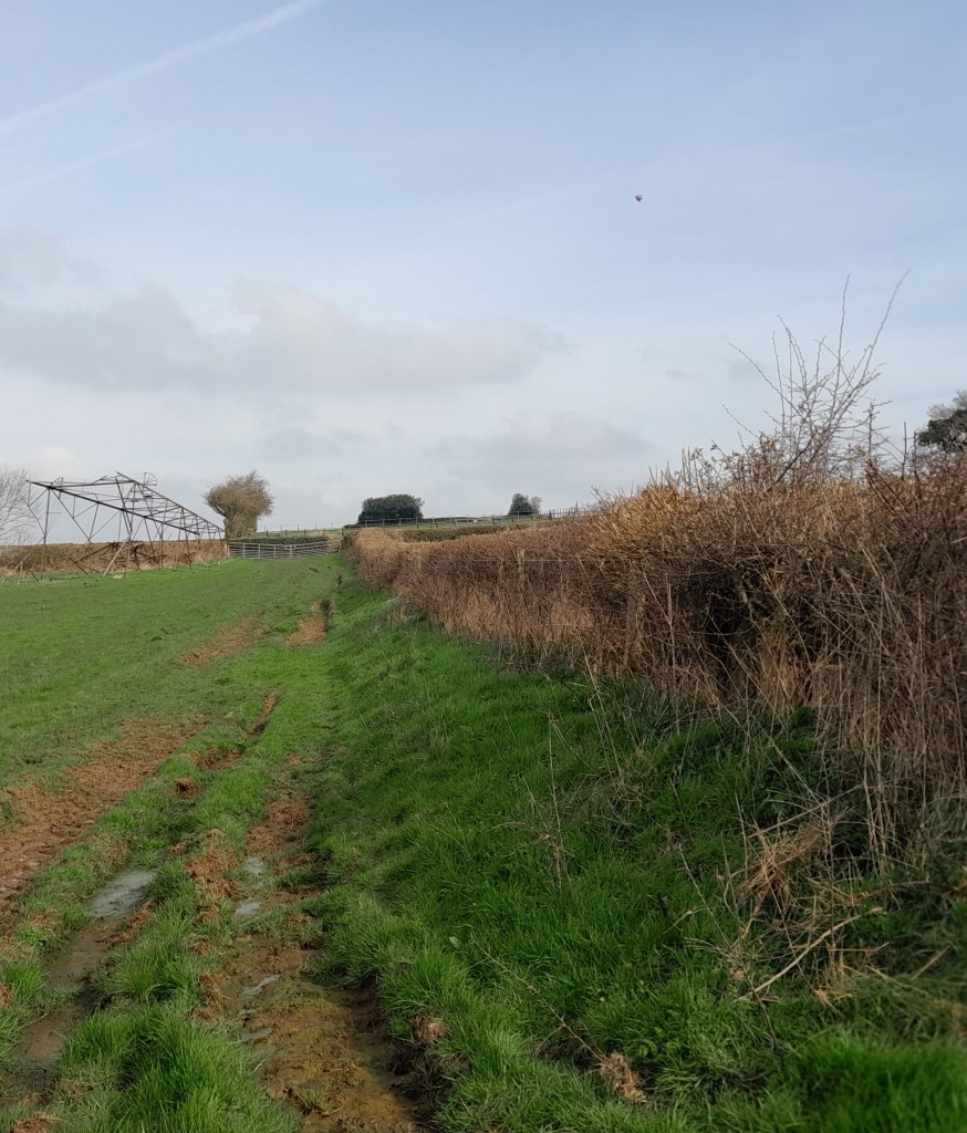
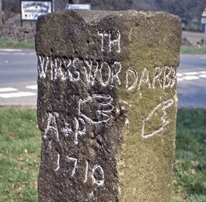
It’s difficult to get lost today. Google maps will display every street in the city, and spell out your quickest route, while in the country apps such as OS Maps will tell you exactly where on the path you are standing. The appeal of this technology is obvious – not just saving time, but also removing the fear that you’re heading the wrong way, into the unknown. In Derbyshire and the Peak District, with thousands of miles of footpaths, this reluctance to risk being lost results in crowds of visitors heading for the same honeypots such as Dovedale, Mam Tor, or the Cromford Canal, with predictable results.

The delights of a day in the country

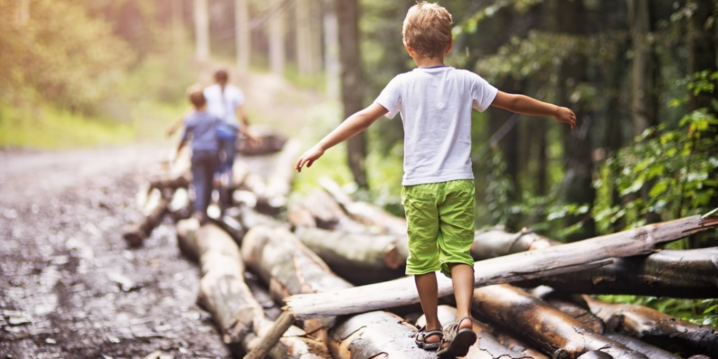
It has been argued that the experience of getting lost can be valuable for our development, and we can cope better with that fear if we develop a strong sense of direction. Moreover, research has shown that the more children are allowed to roam freely, the better sense of direction they acquire. Although there must be marked individual variation, it seems that children today are restricted to a much small radius of ‘free movement’ – perhaps a few hundred yards – instead of the miles that children wandered away from home in previous generations. Of course, it can be argued that there is good reason for the restriction, but if children are barely allowed out of sight of their home they have little possibility of feeling lost – and then finding their way back.

Call Social Services?

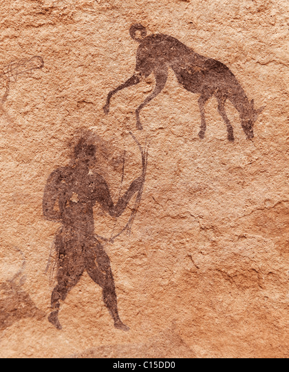
How do we get a sense of direction? Moving through a landscape we notice and memorise a series of landmarks, while the position of the sun should provide an additional bearing (provided it’s at least partly visible). To return, the landmarks are revisited. The second time you make the journey, the landmarks are stored in your memory, even after a gap of months or years, as most walkers have found. Our nomadic ancestors, travelling through an unmapped countryside thousands of years ago, must have achieved an advanced ability to find their way, using perceptions unknown to us.

Peripatetic post people!

Old-model Postie

In the age of electronic messaging it is easy to forget the revolution in communication caused by the introduction of the penny post in 1840. This novel system of using stamps to pre-pay letters to anywhere in the country allowed working people, for the first time, to keep in touch with friends and relations, at a reasonable price. There was a huge increase in mail, and consequently post offices were opened in rural areas to organise the collection and delivery of letters. At this time country districts were more densely populated than today, and letters had to be delivered to widely scattered cottages and farms. Consequently, rural postmen (and women) were recruited, with routes of up to 15 miles, to be walked in all weathers for the delivery and collection of mail.

Hearts a’ fluttering…

When the new system was introduced the postmen tried to reduce their ‘walks’ by finding short cuts between the scattered houses, thereby opening up new paths in places. However, today there is little record of their remarkable work, although some posties were still delivering mail on foot up to the 1970s, despite the general introduction of bikes and later, vans. Derbyshire must have had dozens of such forgotten postmen, while in Cumbria Alan Cleaver has been collecting memories of their lives, as recently featured on BBC Radio 4 in ‘Open Country’.

A cheery wave

It’s hard to imagine anyone opting for a job today that involved a daily walk of 15 miles. Not only were letters delivered and collected daily, but the arrival of the post broke the intense isolation of much country life 150 years ago – there were cases of people sending letters to themselves, in order to have the postman call! Postmen were known to read letters out for folk who were illiterate, as well as bringing news from neighbours. Deliveries were even made on Christmas Day, as DH Lawrence recorded when living at Middleton by Wirksworth in 1918. Another notable change is the soaring cost of a stamp – compared with the Penny Black at one old penny, a modern second class stamp costs 85 new pence – 204 times more expensive!

See: https://www.bbc.co.uk/news/uk-england-cumbria-64452468

Rambling around Ryknild

Ryknild Street was the only long-distance Roman road that crossed Derbyshire, coming from Lichfield to the camp at Little Chester and then on to Chesterfield. Part of its route is still used today, notably the A61 from Higham through Stretton and Clay Cross to Chesterfield. There is little trace of the first part, through Breadsall and up to Brackley Gate, but then the route is picked up by Golden Valley and runs very straight to Smithy Houses and Street Lane. This last name, of course, and the village of Stretton, are reminders that Roman roads were always ‘streets’. Ryknild Street is the name given on the OS map, but there are many variations of the spelling, and this name was almost certainly not used by the Romans. The map above, of the area around Pentrich, is one place where public footpaths give access to the line of the road.

There’s a road here somewhere

The footpath due west from Pentrich Church crosses the line of the old road at the top of a rise, and the raised platform for the road (known as an ‘agar’) can be just made out in the grass. Following this line north you come to another section of path which runs alongside a hedge – this is one of the few places Ryknild Street can actually be followed (see lower photo). On the other side of Riley Lane there is no trace of the road as it runs through ploughed fields east of Coneygrey Farm. However, just west of the road’s course, on Castle Hill, is what the OS map calls a ‘Roman Fortlet’.

The view is worth the climb

Roughly half-way between Little Chester and Chesterfield, this fort might have offered some shelter to road users but was unlikely to be manned regularly. It can be reached by climbing the quite steep bank from the Oakerthorpe road, but the view from the top is brilliant, and shows that the road builders were keeping to high ground, well away from the Amber floodplain to the west. Possibly they were just upgrading an older route which followed the ridge?

All roads lead to ….

One obvious question is why such well-built roads as the Romans constructed were allowed to go out of use? Of course, in places they were maintained and improved, such as the modern A38 from Lichfield to Derby but other areas such as this may have preferred older routes, or have been unable to organise maintenance, for instance when trees were blown down or drains and culverts became blocked.

For a detailed report on the fortlet see:

Leashaw: A road to nowhere?

Follow diversions

Road building in Derbyshire can be fraught, especially on steep-sided valleys. At times roads become too expensive to maintain, as happened with the road below Mam Tor, which was abandoned in the 1970s after frequent landslips due to the unstable geology. Following the exceptionally wet autumn and winter of 2023-4 several routes are currently closed, such as Beeley Lane. The village of Holloway has been badly affected; first the Cromford to Lea Bridge road was closed for over a year after flooding from the River Derwent in 2019, and then shortly after that was re-opened the Holloway to Crich road was closed due to a landslip undermining the pavement. This has now been blocked for over a year, and the County Council is not planning to start repair work until mid-2025.

This stretch of road was originally part of the Cromford Bridge and Langley Mill turnpike of 1766, built before the A6 provided a smoother, lower route. The house on the left, above, was one of the toll collectors’ cottages. At that time this would have been a narrow lane with just enough width for two carts or carriages to squeeze past. A report in the Derby Mercury in 1897 of a public meeting in Crich shows that the problems with this road are longstanding:

Mr Shaw brought forward an important matter, that of repairing the turnpike road leading from Bull Bridge to Holloway, stating that he thought, with many others, that the road ought to be taken over by the Derbyshire County Council. It was, however, clearly proved by Mr Dawes and other gentlemen that the County Council had been repeatedly requested to take over this road, but would not do so, their excuse being that there was insufficient through traffic. 

Walkers and cyclists only

It appears that the road was widened, surfaced and the pavement built in the 1930s, by which time the DCC had been obliged to take over maintenance. ‘Shaw’ in place names can mean a wood on a steep bank, and this accurately describes the route on both sides of Wakebridge, and explains why it is so difficult to maintain.

The good old daysthe Cliff pub

The situation is not just inconvenient for Crich and Holloway people. Several businesses are struggling with the lack of passing trade: Maycock’s Butchers and the Chase Cafe at the Holloway end, and the Cliff pub (above) at the edge of Crich. It seems that over 250 years after the turnpike was opened, a much wealthier society is unable to keep it open.

Down Ashover way

Tomb of Thomas and Edith Babington in Ashover church

These unusually colorful figures on the Babington tomb at Ashover are a reminder of a long-distance packhorse route that can be traced as far as Wirksworth to the west. Ashover parish used to be much larger, and included Holloway, Lea and Dethick, the home of the Babingtons. St John’s church at Dethick was built as a private chapel for the manor, but Ashover had to be used for burials. Most of the route can be comfortably walked today; leaving Ashover by the track beside the Old Poet’s Corner pub which drops to a bridge over the Amber, and then provides a steep climb up a remarkably complete stone causeway (below).

Onwards and upwards

‘Causeys’ like this are found all over Derbyshire and are about two feet wide, thus providing a solid surface for horses’ feet at minimal expense. The track continues to climb towards Ravensnest and then meets Holestone Gate Road at the top. From there it’s road walking to the B6014 and along Lickpenny Lane to the Matlock-Alfreton road. At this point a guidestoop can be seen on the verge, dated 1710, marked A+P for Ashover Parish. Wirksworth is one of the directions shown, via Dethick Lane (NB the stoop has been moved from its original position, but not significantly). Dethick Lane is partly a holloway, Cross Lane marks the site of an old cross (only the base remains), and beyond the church the path leads down to a crossing of the Lea Brook on stepping stones, then uphill to cross Hearthstone Lane and down to Cromford Station and bridge.

Looking down the steps at Eastwood Grange

Where did the route go to the east from Ashover? One likely possibility is the footpath which starts beside the Black Swan and runs up through the grounds of Eastwood Grange, today a school but which must have been built in Victorian times as a substantial private villa. The route (even if no longer used by packhorses) was clearly significant enough to be given a well-engineered stone-lined route through the gardens of the Grange, as can be seen above. Beyond this the path continues steeply up to the summit of Farhill, a popular viewpoint at 299 metres, from where Hardwick Hall, Chesterfield and Sheffield can be seen.

Foul deeds in the wild Winnats

The sunny side of Winnats

Travel has always been seen as a risky undertaking, the dangers ranging from dirty sheets and greedy innkeepers to wild animal attacks and highway robbery. Poor roads were (and still are) probably more of a threat to life and limb than highwaymen, but some of these became notorious in the eighteenth and early nineteenth centuries, famed for their supposed style and cool demeanour on the gallows. Characters such as ‘Swift Nick’ (John Nevison) became folk heroes who allegedly displayed a kind of gallantry while robbing the wealthy coach passengers.

Up to no good

There are few references to such characters in Derbyshire history, presumably because an impoverished area like this had few travellers worth robbing. The majority of these ‘gentlemen of the road’ lay in wait on the outskirts of London, whence travellers might be carrying cash or other valuables, or en route to the Channel ports. The main period of robbery seems to have been from post-Civil War (about 1650) to early in the nineteenth century. Apparently better roads, more traffic and some attempts at policing diminished enthusiasm for ‘your money or your life’.

Not a robber in sight: Looking to Mam Tor from Castleton

However, one crime on Peak District roads is widely remembered: a double murder in the Winnats, then as now a steep-sided pass running west from Castleton. In 1758 a young couple, Allen and Clara, had eloped and were heading for Peak Forest Chapel where they could be married without banns. The legend is that she came from a wealthy family who had forbidden the match. While refreshing themselves at a Castleton inn they were observed by a group of lead miners, who noticed their smart clothing and suspected they were carrying cash. When the pair resumed their journey they were followed and attacked; both were killed and £200 stolen from them. Their bodies were then hidden in a cave and not discovered for ten years. The story has a highly moral ending: the last surviving murderer confessed on his deathbed, and all the others met evil ends. Although the details vary and may seem unlikely (£200 was a huge amount at the time, equal to over £20,000 today) the persistence of the story suggests some factual basis. Its evolution has been analysed in an academic article published in the journal Folklore: Murders in the Winnats Pass: Evolution of a Peak District Legend by Mark Henderson (2010).

Four legs good?

Cave painting of hunter and dog c.10,000 BCE

Dogs were the first animals to be domesticated, apparently during the last ice age, about 15 or 20,000 years ago. Hunters may have shared their kill with young wolves, who became camp followers and provided some services in return. Dogs could be trained to help the hunters by retrieving game, as well as guarding their campsites. Travellers soon found that dogs made useful companions on a trek, especially if they were herding animals such as cattle or sheep. As cities grew in the eighteenth century and the demand for fresh meat rose, drovers and their dogs walked the cows from the upland districts in the north and west to the butchers of Sheffield or Nottingham.

On a packhorse trail in North America

Perhaps even more significant was the domestication of the horse, thought to have occurred about 5,000 years ago, in the early Bronze Age, near the eastern borders of Europe. Evidence for this are the elements of horse harness such as bits and bridles found in grave burials around 2,000 BCE. For the next four thousand years horses provided the fastest travel on the planet, as well as weapons of war (cavalry and chariots) and transport of goods (either as packhorses or pulling carts). Over long distances a rider could average about four miles an hour, so about 30 miles was a good daily total for both rider and horse, with about seven hours in the saddle. It seems remarkable that just 200 years ago our entire economy was based on horse power, from agriculture to personal mobility to powering the first railways!

Today’s walkers in Derbyshire are likely to be concerned about crossing fields with cows grazing, especially if they have dogs with them. Although the number of deaths caused by stampeding animals is small, it is a real risk, and most hikers have had uncomfortable experiences, if not worse. Although likely to be an underestimate, the HSE keeps records of injuries from cattle, and between 2000 and 2020 98 people were killed by them: many more were presumably injured. Of these the majority (76) were farm workers, and the rest were walkers. The general consensus is that bullocks represent a greater danger than the odd bull, and that cows with calves should be given a particularly wide berth. Carrying a stick probably makes the walker feel better, and dogs should be let off their leads to escape quickly if a situation feel threatening.

A wandering minstrel I …

There is plenty of evidence that minstrels travelled around the country in the Middle Ages, performing in halls and taverns, and at fairs. But very little is known of the material they performed for their audiences, whether lordly or peasant. Nor do we know how far afield they travelled. However, James Wade of Cambridge University has recently published an article which may provide some answers. He has studied a manuscript in the National Library of Scotland which dates from about 1480, known as the Heege Ms. It was written by a Richard Heege, presumably a native of Heage, near Belper, who was a tutor to the Sherbrooke family at Tibshelf. The manuscript consists of three pieces which might well have formed part of a minstrel’s repertoire.

The items recorded are mainly comical/ nonsensical: a poem called The Hunting of the Hare, a mock sermon, and a nonsense verse called The Battle of Brackonwet (thought to be Brackenfield). The style is clearly suited to oral performance and contains plenty of drinking references, which point to delivery at a feast or celebration: Christmas, a wedding, etc. The place names mentioned are Holbrook, Radford (near Nottingham), Brackenfield and Codnor, which suggest that the minstrel had a circuit or regular beat since all these places are within a couple of hours’ walk of each other.

It is hard to imagine how dull the long winter evenings must have been five hundred years ago, when even for the literate there was little reading material available, and certainly no internet! So the arrival of a minstrel must have been welcome, for both rich and poor. The material that Wade has studied was clearly intended for a mixed audience, since it satirises the behaviour of both landowners and peasants. Although this small collection of minstrel material cannot provide a full picture, it does allow us to imagine how a possibly part-time entertainer could amuse his audience with jokes about local communities behaving badly.

Source: James Wade, Entertainments from a Medieval Minstrel’s Repertoire Book, The Review of English Studies, 2023;, hgad053, https://doi.org/10.1093/res/hgad053

On the road to Dale

Compared with neighbouring Yorkshire, Derbyshire has hardly any visible remains of its abbeys. Even the location of Darley Abbey in Derby is uncertain, while Dale Abbey, between Ilkeston and Ockbrook, has just one solitary surviving arch (see below). The engraving above shows the state of the ruins in the eighteenth century, before the robbing of dressed stone had been completed. Yet at its height in the fifteenth century this abbey owned about 24,000 acres of land, throughout the county and beyond; endowments it had accumulated over the years. With only about 15 canons in residence, the job of administering these estates may have been given to lay people, but this task must have involved constant travelling. In addition, abbeys like Dale attracted pilgrims who came to pray before relics, in this case a phial of St Mary’s milk. For both reasons, Dale Abbey must have been sited on a good long-distance route.

The remains of the east window, Dale Abbey

The conventional view is that monasteries and abbeys were sited in remote, inaccessible places where the inmates could spiritually benefit from the tranquility of isolation. That may have been true at one time, but the running costs of both the abbey and its agricultural lands meant that two-way traffic steadily developed. In fact Dale was on the route of the Derbyshire Portway, linking it directly with Nottingham to the east, and to the northwest with Wirksworth and its estates at Griff Grange just beyond that town (‘grange’ suggests a monastic farm).

Dale church today

Dale Abbey was closed in 1538 (by William Cavendish) and its huge estates, consisting of churches and mills in addition to moors, woods and fields were sold off. By this time the influence of Protestantism was undermining the twin ideals of the monastic life and pilgrimage. The buildings were soon pillaged: some stained glass, for example, being taken to nearby Morley church. Today the village of Dale provides good walking, one of England’s few semi-detached churches (another survival from the Abbey) and a remarkable hermitage above in the woods, supposed to have been created by a Derby baker who sought a religious life there in the twelfth century.

Chaps with maps

Part of Speed’s Derbyshire map of 1611: Wirksworth in centre.

It is a mystery of history that maps in the modern sense, as aids to travel, did not appear until the early eighteenth century. A few maps survive from the Roman and medieval periods, but they seem to have been rare and would not have helped the traveller. Presumably wayfarers simply had to ask the way. The first county maps of England, and probably the first in Europe, were produced by Christopher Saxton in the 1570s, and these were plagiarised by John Speed, whose 1611 Derbyshire map is shown above. This might have been of some use to travellers, although roads are not shown: the dotted lines are boundaries of hundreds. However his map does show rivers, some bridges (e.g. Belper bridge), and the fenced estates of the wealthy. Although it has the modern convention of north at the top it is still semi-pictorial in style, with little mountains and water mills. Note the erratic spelling: two versions of Wirksworth!

The first practical map for travellers was Ogilby’s strip map of 1675. As can be seen above, this maps the route from Derby (top right) to Manchester (bottom left), and shows villages, side roads, hills and some inns. This map is part of Britannia, a book of 100 major routes in the kingdom, at the innovative scale of one mile to an inch. However, this is the only Derbyshire road in the book, and it was not until 1767 that the whole county was surveyed for Peter Perez Burdett’s map (below). Although far from perfect, this is an invaluable reference for historians, depicting in detail the county’s villages, forests, and, for the first time, the main roads.

Burdett’s map of 1767 – the Derwent runs from top to bottom on right.

The map was revised in 1791 and so shows the turnpike roads (and mileages) as solid double lines. However, minor roads, lanes and paths are not marked. (The very thick black line is a hundred boundary). Upland is now shown by hatching, but it is obvious that the Via Gellia, west of Cromford, did not yet exist (or had not been recently surveyed). The names of some landowners are included, for instance Richard Arkwright at Cromford, and the maps were probably aimed at this class of customers, rather than ordinary travellers.

Ordnance Survey map of Youlgreave 1898: 25 inches = 1 mile

The first Ordnance Survey maps of Derbyshire, at a one inch to one mile scale, were not produced until 1840. Perhaps for the first time, accurate maps were available at a reasonable price. Later in the century larger scale maps were produced, such as the one above, which show every footpath, field and house, and so are a valuable resource for historians. Today we are so used to planning trips on cheap folding paper maps, or, increasingly map apps using GPS on our phones, that it’s easy to forget how recent these resources are. But perhaps the biggest mystery is how our ancestors moved around the country not only without maps, but without ever having seen a map in their lives?