The Stonehenge of the north?

Arbor Low

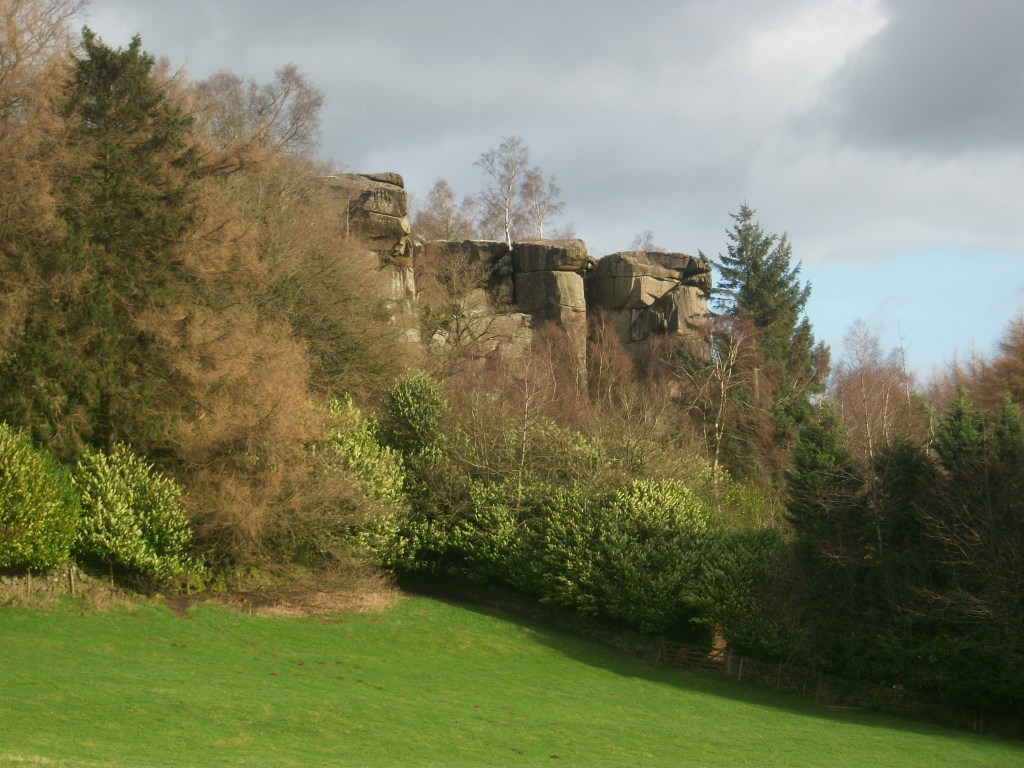
Between Buxton and Youlgreave, high up above the Derbyshire dales, Arbor Low is the largest henge monument in the north of England. The November morning I visited was bleak and grey, with a keen wind from the west and a temperature barely above freezing. Unsurprisingly I was the only visitor when I arrived, although another car pulled up in the layby shortly after. I walked up the farm track for several hundred metres to where an English Heritage board gave some rudimentary information. There are two related sites here: the circular henge and Gib Hill, apparently a tumulus, a field away to the west. Then I walked up to the farmyard, where a small sign asked for a modest £1 for using ‘private land’.

Many farms in the Peak District are tatty; this one looked particularly run-down. A woman was pushing a wheelbarrow full of firewood through the yard – nobody else was around. The cattle were still in the fields, so the stall block was empty. There was a sign advertising‘B & B’ by the roadside, but I couldn’t imagine anyone choosing to stay in such a bleak location. Presumably they earn a few pounds a week from visitors’ contributions, but there was no attempt to offer tourist fare such as teas or postcards.

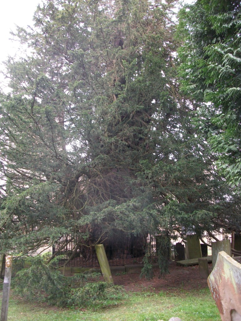
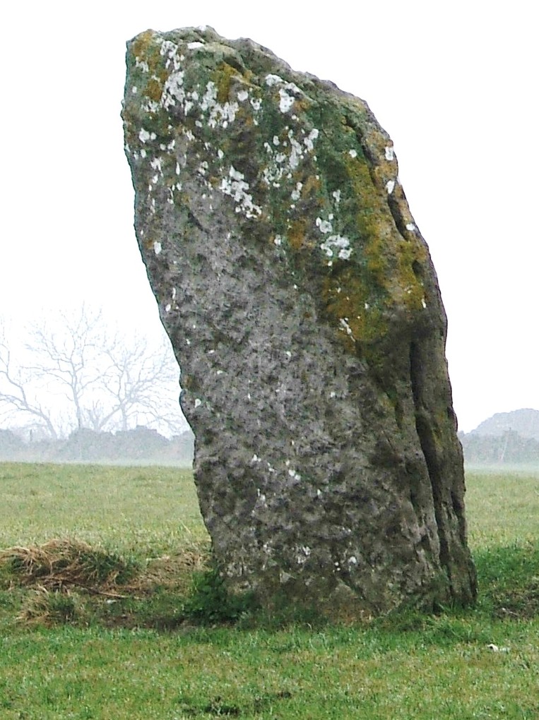
Beyond the farmyard Arbor Low is a circular bank containing a ditch and inside that over 40 stones, lying flat, with a few more stones at the centre. Impressive enough, especially given the situation, with a view of several miles in every direction. There are information boards at both the henge and the Gib Hill site, although these contain little actual information, beyond the standard visual recreations of scary looking people doing weird things. Apparently there has been no excavation here for a century, and so our knowledge of these places is even vaguer than usual with the prehistoric.

The contrast with the real Stonehenge is total. On Salisbury Plain coaches full of tourists, many from abroad, arrive every hour. There are lavish facilities for visitors, and a hefty £13.90 price tag to buy the timed tickets. Hundreds of visitors wander round the circle every hour. Scores of books and dozens of TV programmes have attempted to reveal the ‘secrets of the circle’. Yet, standing on the bank around the fallen stones, with an icy wind in my hair, I felt far closer to the past, whatever it contained, than I ever had in the south.

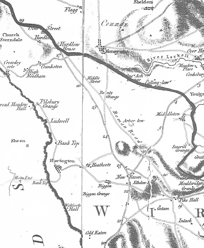
Burdett’s map of 1767 showing The Street north of Pikehall

Something not mentioned by English Heritage is that a Roman road ran through this area just 100 metres away, south east from Buxton, and that this probably followed the line of an older ridgeway. A henge monument on the scale of Arbor Low must have attracted visitors for (presumably) seasonal festivals from all over the district, and so the proximity of the henge to the road is not mere coincidence. It can be seen that the eighteenth-century turnpike did not follow the exact route of the older road, which remained in use until the time of Burdett’s map, but which has now disappeared except as a parish boundary. Overall the route presents a classic example of a road that may be at least four thousand years old, starting as a ridgeway serving the henge and other sites nearby, then being re-engineered by the Romans, and more recently re-routed as a turnpike road.

The Darley Mystery

St Helen’s, Darley Churchtown

Darley Churchtown is a small part of the large village of Darley Dale. Today it is easily by-passed as it lies off the A6, although it was on the line of the old Matlock-Bakewell turnpike. It has several curiosities, all centred on the church of St Helen’s. The most obvious is right outside the church porch: a huge yew tree, over thirty feet in circumference, and claimed to be anything up to 2,000 years old (see: The Sacred Yew, Chetan and Brueton). Even if this early date is taken with a pinch of salt, it may well have been growing before the Conquest, and would pre-date the existing church (which has a Norman font). It is certainly the largest of all the Derbyshire yews; other notable examples grow at Allestree and Doveridge.

Yew tree in St Helen’s churchyard

If you walk from the churchyard heading south, then take a field path to the right you find yourself walking along a reed-fringed dike, heading for the cricket ground at Darley Bridge. This winding path is still a parish boundary, which suggests it may be the old course of the Derwent, which has since shifted more to the west. This would mean that the church site was virtually an island, with the river running right beside it: even with the Derwent in its present course the church has often been flooded. Yet this is not the only church in this valley built on flood-prone sites: Duffield is another. Could this be an example of the belief that island sites were sacred places? An alternative possibility is that in the early church the river was used for baptism.

Another oddity can be found by walking from St Helen’s in the opposite direction, along the track north towards Rowsley. Just past the school is Abbey House, a substantial Victorian building. The Ordnance Survey map from 1896 marks ‘Remains of Abbey’ at this point, yet according to historians there never was an abbey at Darley Dale. Confusingly, the local abbeys were at Darley, just north of Derby, and at Dale near Ockbrook. So what was the origin of the idea of a Darley Dale abbey?  Curiously, the exact site of Derby’s Darley Abbey has never been identified, though it is presumed to have been on the site of Darley Park. That abbey was linked to St Helen’s Priory in the town, which has the same dedication as is found at Darley Churchtown. Perhaps the safest assumption would be to say that the religious site at Darley appears to be very ancient, quite possibly Saxon, that it could have been a semi-artificial island, and may well pre-date the abbey at Derby.

A walk on the Portway

The Portway as Islington Lane

This walk, which can stand alone or be incorporated into a longer route, gives a taste of one of Derbyshire’s oldest roads, and incorporates many features of historic (or even prehistoric) travel. Starting behind the Miners’ Standard pub above Winster (car parking generally possible opposite) , the track runs north between stone walls. Today the track is labelled as part of the Limestone Way, although Islington Lane, an older name, is a reminder of the miners’ settlement here in the boom days of lead mining. This old road was replaced by the Ashbourne turnpike, now the B5056, which zig zags down the slope to allow carriages an easier incline.

Looking towards Cratcliffe Rocks from the end of Dudwood Lane

After about a mile you cross the Elton road and continue on Dudwood Lane, downhill on what is now a tarmac surface. On the right is the site of the Portaway lead mine, once a substantial producer, which provides clear evidence for the route of the old road. At the bottom of the hill you bypass the cattle grid and start climbing towards Cratcliffe Rocks, with the twin peaks of Robin Hood’s Stride on the left. These rock outcrops must have provided clear landmarks for medieval travellers, and the path runs between them. Evidence has been found at the top of the Rocks of prehistoric habitation, probably to provide shelter for travellers: the summit certainly provides excellent views of the route. Another feature is the medieval hermit’s cave, found in the woods below, which is discussed in a previous blog (Hermits and their Hermitages, 6th August).

Cratcliffe Rocks

Now the track runs beside Robin Hood’s Stride, one of the many Derbyshire features named after this hero. Its striking profile with the rocky pinnacles also gave it the name ‘Mock Beggar’s Hall’. However, the most interesting features of this area are found on the other side of the path, on Harthill Moor, where the stone circle suggests a Neolithic dating. Known as Nine Stone Close, there are actually only four uprights, and there is a suggestion that they may have been re-erected quite recently. Less obvious is an example of cup-and-ring marking on a boulder, a Bronze Age feature not fully understood by archaeologists, but possibly associated with long-distance trackways.

Nine Stone Close

From here the walk can extended on the Limestone Way to Youlgreave, or even to Bakewell via Alport, but the simplest option is to head back towards the Miners’ Standard, where a good lunch and a decent pint can usually be found!

How old is Matlock?

St Giles, Matlock

Today it is easy to drive on the main roads through Matlock Bath or Matlock Bank without seeing Old Matlock, centred on St Giles Church and the handful of stone houses around it. But seen from Hall Leys park, the church is in a remarkable position, on top of a steep cliff, bounded by the Derwent on one side and the Bentley Brook on the other. Most of the church was rebuilt in the mid-nineteenth century, although the font is Norman. Yet it seems likely that this site has had some sacred significance since pre-Christian times, given the watery surroundings.

Pic Tor Lane

The road from here through Starkholmes and down to Cromford bridge is an old route, and the only road out of Matlock that was never turnpiked, and so remained toll-free. But another ancient way appears to run down Pic Tor Lane, past the old vicarage and under the railway bridge to the river. At this point there is geological evidence of a possible ford, and the route would have gone up Masson Hill along what is now St John’s Road and joined up with Salter’s Lane, which came via Leek and Hartington.

Pedestrian bridge under railway

The current Matlock bridge dates from the fourteenth century, but the position of the church supports the theory that the earlier crossing could have been here, further downstream. The significance of this route is further reinforced by the construction of the railway bridge and the pedestrian river bridge in the mid-nineteenth century, suggesting that this route was then seen as worth maintaining.

The story of the stones

Stone near Wirksworth-Brassington road about one mile west of Wirksworth

It seems likely that single standing stones like the one above, which is over two metres high, have been used as route markers for possibly thousands of years. Stone is readily quarried in north Derbyshire, and once erected they are extremely durable, although some may have been broken up when the commons were enclosed. But in an open, moorland landscape they would have clearly stated ‘here is the route’ and would have been visible a mile away.

No-one knows how many such stones survive today, and not all are marked on the OS map, unlike the stone illustrated. They can be confused with gateposts, but these are generally shorter and have holes bored in them to attach hinges. Some have been worked so that they have been roughly squared, although they have no inscription, as with the stone below, which can be found at SK 299521, just off the public footpath but clearly visible from it. The location is in a direct line from the top of Alport Height to the alignment of Prathall Lane, leading into Gorseybank, southeast of Wirksworth, which might have been the route of the Portway in early medieval times.

Looking north to Middleton and Cromford moors

A third stone near Wirksworth can be seen opposite the Malt Shovel Inn, near the crossroads of the Alfreton-Ashbourne turnpike with the route down to Belper from Bolehill, although it must be much older than these. It is marked on an early nineteenth century map as ‘menhir’ and may well indicate a very early route of the Portway, avoiding the steep descent into the town by circling it on the east and north sides. As with the other stones, this is on private land, but is clearly visible from the road.

In common with many other prehistoric and historic sites, we can never know the full story behind these enigmatic stones, but this basic supposition – that we are looking at ancient route markers – is supported by the use of similar stone markers (but with lettering) for guide stoops in the early eighteenth century and then the introduction of regular milestones on the turnpike roads.

Stone near the Malt Shovel pub