Gell the Roman?

When I was a child we were occasionally driven into Derbyshire as a holiday treat, and coming down the Via Gellia was one highlight of such trips. It seemed a very romantic route, winding and well-wooded within the steep-sided valley, with mysterious caves inviting exploration. Today the road seems a little less fascinating, more overgrown with trees, and with massive quarry trucks weaving round every bend, yet it is of historical interest in that we know (unusually) when and why it was built, and by whom.

Philip Gell the hunter

The Via Gellia is not the only road in Derbyshire to be named after a person; for instance there is the Sir William Hill near Eyam, but it must be a unique case of a Latinized family name! The Gell family had lived at Hopton Hall for generations, near where they had profitable quarries and lead mines. Philip Eyre Gell (1723-95) inherited the estate at the age of 16, but postponed marriage till he was 50, in 1773, when he married the 16-year-old Dorothy Milnes. Their first son, another Philip, was born in 1775.

Burdett’s map of 1791 shows a track from Cromford to the mill where the Bonsall Brook drops down the Clatterway, but nothing beyond that point. The building of the Via Gellia is generally dated to 1791/2, and was designed to allow carts of lead ore or stone to travel down from the Hopton area to the canal and lead smelters at Cromford. Nobody knows who gave it its name, but one possibility is Philip Gell’s second son Wiliam, an archaeologist who had visited the ruins of Pompeii. Perhaps his interest in Roman civilization and knowledge of Roman road names such as the Via Appia led him to christen his father’s road in Roman style, hinting at an improbable family history dating back over a thousand years?

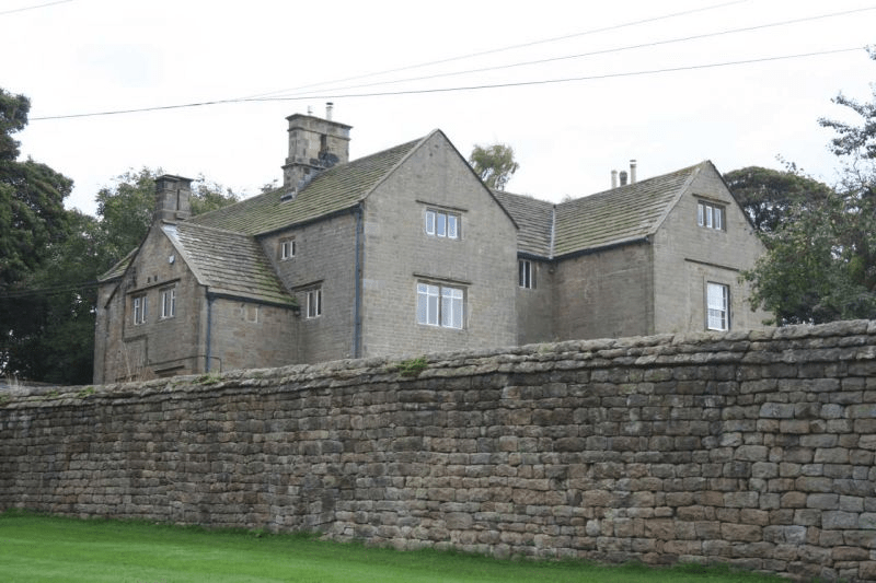
Tufa Cottage, situated about half-way down the route, must have been built by the mid-nineteenth century, originally for a gamekeeper on the Gell estate. Tufa is a kind of porous limestone found locally, with a distinctive coarse texture. Today it is notable for the cable car in the front garden!

Mr Wright paints Cromford

Wright: Arkwright’s Mill in the late eighteenth century

Paintings and prints can help us understand the development of the road system, and reveal historical features not shown on maps. As Matlock Bath became an established tourist attraction in the late 1700s, visitors were also keen to visit Arkwright’s mill just up the road at Cromford, and be impressed by the scale of the buildings. One of these ‘industrial tourists’ was Joseph Wright of Derby, who painted the mill both by day and at night, when the rows of candlelit windows must have been a remarkable sight in this very rural location. The painting above appears to have been made from a location close to the modern High Tor cafe by the Cromford crossroads, looking down the road towards Cromford Bridge. But this area has been radically changed by cutting through the Scarthin Rock, a process begun in 1817 but not finally completed in modern form until 1962. The painting clearly shows the mill leat on the far side of the road, which led to the aqueduct above the road (damaged quite recently and sadly never replaced). The Bonsall Brook is shown on the nearside of the road (not visible today), and the main building is taller than today’s mill. In the distance the tower of Crich Stand can be clearly seen, which at the time of the painting had been recently (1785) rebuilt in stone by Francis Hurt, a major local landowner.

Wright: Willersley Castle and Cromford Church

Another view of the area has the Matlock Bath road in the foreground, and is framed again by Scarthin Rock. It is difficult to find this viewpoint today due to the increase in tree cover: in Wright’s time the valley was quite bare. Both Cromford church and Willersley Castle must have been very recent when this was painted; in fact the church was not finished until 1797, the year of Wright’s death. The painting illustrates the first appearance of the church; the current porch was added in the mid-nineteenth century. Next to the bridge the small fishing house is clearly visible.

Wright: Cromford Mill by night

The third painting is an example of Wright’s interest in dramatically-lit night scenes. Although the view is from a similar spot to the first picture, the road now runs to the left of the mill, not the right. It must be assumed that this is artistic licence, since the road in the first picture is so clearly on the line of the present one. Clearly, the details of such pictures cannot be assumed to be reliable, but it’s worth noting that the two-storey building in the foreground, which is not shown in the first view, survives today in the same form.

The mystery of the milestone

Milestone near Tissington

Walking near Tissington the other day I stopped for a drink of water, and propped my walking pole on what I took for an old gatepost, embedded in the rather ragged hedge. Then I realised it wasn’t a gatepost, but was inscribed on the side facing the lane. The inscription was finely carved, in serif lettering, but was difficult to read, being partly covered in moss. I finally decided it reads, in part:

From

London

(illegible)

Miles

(Illegible)

Guide stoop above Winster

Clearly this was not a guide stoop, which, as the example above shows, were inscribed on all four sides with the distance to the nearest market towns. The Tissington stone seems to only show the distance to London – not the most useful information for the traveller here. Moreover, it is located on a lane running east to the ford and nearby Bradbourne Mill, which seems an unlikely route to London: the obvious way to the capital was via Ashbourne and Derby.

Distance marker, corner of town hall, Wirksworth

Another, much later example of a marker showing the distance from London is found in Wirksworth, by the town hall. This version also gives the mileage to key towns on local turnpike routes. Again few travellers would have needed to know how far they were from London, but the marker does link the local community to the prestige and glamour of the capital. Could this be the motive for the Tissington stone – to associate this remote village with the majesty of London?

Any better ideas welcome!

Dalesway

Onwards and upwards – bridge in Upper Wharfedale

I’ve just walked the Dalesway, an 80-mile route from Ilkley in Yorkshire to Bowness-on-Windermere in Cumbria. It took Rene and me seven days to walk the Way, averaging about 11 miles per day. Such a lengthy journey takes some organisation, because of the need to arrange overnight accommodation at the right intervals – not easy in the Pennines. But the experience – relatively unusual – gave me an insight into the lives of travellers in the pre-industrial world, who might be on the move for weeks, or even longer: people like drovers who would travel at the speed of their animals.

A break at Grassington

Walking in unknown country over long distances creates three main preoccupations. Firstly, am I on the right track? Getting lost is not just annoying, it also adds more miles to the day, and even with modern 1:25,000 maps and map apps it’s quite easily done! Secondly, travellers on foot need to concentrate on what’s under foot – boulders and bogs all need avoiding, and on some stretches this can demand your full concentration. Finally, you have to keep an eye open for threats, whether it’s a bad-tempered herd of bullocks or a menacing thunder cloud – and in the past these could have included footpads and robbers!

Railway viaduct at the head of Dentdale

As a result of all these, we found ourselves not just physically exhausted after a few days on the road but also mentally drained – rather surprising, as we had imagined that a trip like this would be quite relaxing! It certainly provides an insight into the historical experience, and fills me with admiration for the historic wayfarers strengths and resilience!

The Waters of Life and Death

Burycliffe Troughs, Elton

It is easy to forget the significance of a good water supply for both residents and travellers, something which is taken for granted today. But less than a century ago, up to 1940, the village of Elton was dependent for its water on Burycliffe Troughs, half a mile away, water which had to be laboriously carried by householders in buckets. Yet nearby Youlgrave had built its own water system in 1829, as indicated on its central cistern. Though this is not in use today, the village still maintains its independent supply, and provides it much cheaper than Severn Trent!

Youlgrave cistern

In nineteenth-century villages water was not usually piped to individual houses. Instead villagers collected it from wells scattered around, like this attractive example, also from Youlgrave, titled ‘The Gift’ and dated 1876. Similar examples can be found in many Derbyshire settlements.

The Gift, Youlgrave

Springs and wells had symbolic value in Christianity (and probably also in pagan beliefs). A late example of this is St John’s chapel in St John’s Road, Matlock Bath, a remarkable Arts and Crafts structure of 1895 built over a well, presumably a reference to St John as baptist. The stained glass windows also illustrate ‘The Waters of Life’ and ‘The Waters of Death’.

Well below St John’s chapel.

Many drinking troughs and wells can be found outside villages, as a critical part of the old transport infrastructure. The spring-fed example below, found near the top of the long climb out of Wirksworth and just below the Malt Shovel crossroads, would have provided a welcome drink for horses labouring up the incline, as well as for cattle and other animals being driven to and from market.

Drinking well on Wirksworth – Whatstandwell Road

Sadly, many of these wells have become choked with debris and allowed to dry up. It would be a positive addition to the landscape if they were cleaned and restored – and any passing horses would be very thankful.

What’s going on at Wingfield?

The window of the Great Hall

The ruins of Wingfield Manor are an impressive sight, on a hill overlooking the River Amber and above the village of South Wingfield. The manor was only a mile west of the old Roman road known as Ryknield Street, from Derby to Chesterfield and Sheffield, still a major route but now the A61. This road would have been convenient for the second owners of the Manor, the Talbot family, Earls of Shrewsbury, who also owned Sheffield Castle and Sheffield Manor.

The buildings were deliberately ruined during the Civil War to prevent their use by Royalist forces, after a Parliamentary siege in 1644. Since the eighteenth century the structure has been effectively abandoned, although substantial ruins have survived. The most famous occupant was Mary Queen of Scots, imprisoned here for some years from 1569, in the care of the sixth Earl of Shrewsbury and his wife, Bess of Hardwick.

Mary Queen of Scots – all dressed up and nowhere to go

Clearly such an extensive ruin with famous associations should attract flocks of visitors. The Manor is in the ‘care’ of English Heritage (“unlimited access to hundreds of historic places” – website) but is firmly shut up, as it has been for several years. Their web page says:  ‘currently closed for the safety of visitors, and no public access is allowed’.  A meaningless statement that explains nothing.

Over a hundred years ago no such restrictions applied. DH Lawrence paid a visit at Easter 1905 with a group of friends, a visit which he fictionalised in his novel Sons and Lovers:

‘The young folk were in raptures. They went in trepidation, almost afraid that the delight of exploring this ruin might be denied them’.

Back entrance to the Manor

However, despite the best efforts of English Heritage, it is possible to get a good view of some parts of the ruin by following the public footpath around the back. Starting from the village and heading south, follow the track downhill, beside the garden wall of Wingfield Hall. Cross the stream at the bottom and bear right uphill. The ruins of the Manor can be clearly seen on the right.

Surprising Bradbourne

All Saints churchyard with cross

Halfway between Brassington and Tissington is the small village of Bradbourne, with a population of just over a hundred. Yet the substantial church was once part of a priory, and was the centre of a network of local chapelries. The church tower, complete with elaborately carved doorway, is Romanesque. while in the churchyard is a rare Saxon cross from about 800, showing a crucifixion scene. Why would such a small settlement have such rich monuments?

Crosses of this date are quite rare in Derbyshire: Bakewell and Eyam have good examples. Clearly older than the church itself, they may have signalled the conversion of the area to Christianity, and formed a base for preaching before the church was built. It is possible that such crosses were more common, but many may have been destroyed during iconoclastic periods such as the Reformation. Wirksworth, only a few miles away, would probably be the local minster church.

Doorway to tower with a variety of carved creatures

There is little sign that Bradbourne was ever on a major route. According to the parish council website, the north eastern parish boundary was the course of the Roman road from Little Chester to Buxton, but no source is given for this claim. However, this is now good walking country; the Limestone Way runs about a mile to the north, and to the south Haven Hill (partly access land) offers a convenient circular walk.

The two Williams

St Anne’s, Beeley

Diaries can be a useful source in studying travel patterns in the past. William Hodkin was a farmer and general dealer at Beeley, on the Chatsworth estate in the mid-nineteenth century. He kept a diary, mainly of his farming work, from 1864 to 1866, which reveals the shape of his trading network. Although the station at Rowsley was open at this time he made relatively little use of the railway, either riding on horseback or travelling with a cart when collecting or selling livestock or deadstock.

During two and a half months April to June 1864 he travelled to Bakewell 13 times, to Calton Lees 5 times, and to Chesterfield, Beeley Moor and Rowsley 4 times each. Other trips took him to Ashford, Matlock and Edensor. Interestingly, the state of the roads is never discussed: presumably he knew them all so well that there seemed no need to mention it, although he does once mention that his horse had collapsed on the steep hill to Chesterfield.

Hilltop House, Beeley, one of William’s regular destinations

It has to be admitted that William Hodkin was no Pepys. A typical entry (Thursday July 5th, 1864) reads: ‘Went rabbitting in the morning, making bills out at night. Father not doing much Thomas thrashing John carting stone to the highways’. This last job is a reminder that the roads around Beeley were not then tarmaced, and were still maintained by local labour. His wife is only referred to as ‘The Mrs’, although there are frequent mentions of the weather, and the occasional reference to the vicar’s sermon shows that William did sometimes take time off.

William’s landlord, William Cavendish, 7th Duke of Devonshire

Defoe’s Derbyshire tour

Biography of Daniel Defoe author of "Robinson Crusoe"
An early tourist

Few people living in Derbyshire in the eighteenth century have left an account of their travels; clearly they didn’t feel any need to describe their everyday experiences. Therefore it is left to the handful of early tourists to provide an impression of journeying in the county three hundred years ago. Daniel Defoe was an early novelist and journalist who visited many English counties in the 1720s in order to produce his A Tour of England and Wales.

Beginning at Derby, he had clearly chosen a wet season for his visit, since he had to abandon plans to visit Ashbourne on account of ‘the river drowning the low-grounds by a sudden shower, and hastening to the Trent with a most outrageous stream’, a reminder that, not so long ago, travel was very much at the whim of the weather. There are other references to the Derwent as ‘a frightful creature when the hills load her current with water’.

Cave at Harborough Rocks

Defoe’s next stop was Wirksworth, which he found interesting due to the lead trade, despite the inhabitants being ‘a rude boorish kind of people’. The most remarkable part of this visit was an excursion to Harborough Rocks, which was called the Giant’s Tomb at that time. Here he found a lead miner’s family living in a cave, which had been lived in by his family for several generations. Defoe was both horrified, and impressed that people could cope with such crude conditions: ‘they seemed to live very pleasantly, the children look’d plump and fat’. Defoe’s party had a whip-round and gave the miner’s wife several shillings. (Today the cave can be visited quite easily by climbing up from the High Peak Trail).

Other items on his itinerary were more predictable: the Wonders of the Peak, and a focus on spas, which were just beginning to be significant destinations at this time. He is suitably impressed by Chatsworth, but comments about the moor above the house: ‘a waste and howling wilderness, over which, when strangers travel, they are obliged to take guides, or it would be next to impossible not to lose their way’. As for getting to Matlock (which he labels as a village), Defoe maintains that the warm springs would be worth visiting if access was not by ‘ a base, stony, mountainous road’ – presumably the route over Scarthin, which was eventually superseded by blasting the present road through the rocks at Cromford.

Nineteenth-century painting of High Tor, Matlock

The Stonehenge of the north?

Arbor Low

Between Buxton and Youlgreave, high up above the Derbyshire dales, Arbor Low is the largest henge monument in the north of England. The November morning I visited was bleak and grey, with a keen wind from the west and a temperature barely above freezing. Unsurprisingly I was the only visitor when I arrived, although another car pulled up in the layby shortly after. I walked up the farm track for several hundred metres to where an English Heritage board gave some rudimentary information. There are two related sites here: the circular henge and Gib Hill, apparently a tumulus, a field away to the west. Then I walked up to the farmyard, where a small sign asked for a modest £1 for using ‘private land’.

Many farms in the Peak District are tatty; this one looked particularly run-down. A woman was pushing a wheelbarrow full of firewood through the yard – nobody else was around. The cattle were still in the fields, so the stall block was empty. There was a sign advertising‘B & B’ by the roadside, but I couldn’t imagine anyone choosing to stay in such a bleak location. Presumably they earn a few pounds a week from visitors’ contributions, but there was no attempt to offer tourist fare such as teas or postcards.

Beyond the farmyard Arbor Low is a circular bank containing a ditch and inside that over 40 stones, lying flat, with a few more stones at the centre. Impressive enough, especially given the situation, with a view of several miles in every direction. There are information boards at both the henge and the Gib Hill site, although these contain little actual information, beyond the standard visual recreations of scary looking people doing weird things. Apparently there has been no excavation here for a century, and so our knowledge of these places is even vaguer than usual with the prehistoric.

The contrast with the real Stonehenge is total. On Salisbury Plain coaches full of tourists, many from abroad, arrive every hour. There are lavish facilities for visitors, and a hefty £13.90 price tag to buy the timed tickets. Hundreds of visitors wander round the circle every hour. Scores of books and dozens of TV programmes have attempted to reveal the ‘secrets of the circle’. Yet, standing on the bank around the fallen stones, with an icy wind in my hair, I felt far closer to the past, whatever it contained, than I ever had in the south.

Burdett’s map of 1767 showing The Street north of Pikehall

Something not mentioned by English Heritage is that a Roman road ran through this area just 100 metres away, south east from Buxton, and that this probably followed the line of an older ridgeway. A henge monument on the scale of Arbor Low must have attracted visitors for (presumably) seasonal festivals from all over the district, and so the proximity of the henge to the road is not mere coincidence. It can be seen that the eighteenth-century turnpike did not follow the exact route of the older road, which remained in use until the time of Burdett’s map, but which has now disappeared except as a parish boundary. Overall the route presents a classic example of a road that may be at least four thousand years old, starting as a ridgeway serving the henge and other sites nearby, then being re-engineered by the Romans, and more recently re-routed as a turnpike road.