All you ever wanted to know about paths

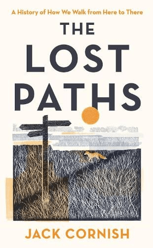
Jack Cornish is Head of Paths at the Ramblers, which must be an excellent qualification to write on the subject. His recent book, The Lost Paths, sets out to be ‘A History of How We Walk from Here to There’. Ambitious in scope, the 19 chapters include such familiar subjects as pilgrim routes and turnpikes, but also cover topics like the growth of railways and the effects of the new post-war towns on traditional paths. Some of his material, such as the enclosures of the eighteenth and nineteenth centuries, may be familiar to any reader with an interest in history, but other topics, for instance the loss of rights of way due to military requirements during the Second World War, are unusual.

The author has assembled a fascinating range of detail, such as the vogue for ‘pedestrianism’ in the nineteenth century, when large bets were put on improbable feats of walking, such as London to York and back in six days. But his concerns are not only historical, since he discusses the need to make access to the countryside more diverse and welcoming for minority groups. If anything, the reader may feel that he has tried to include too much: it is interesting to know how many bricks were used to build London’s first railway (six million) but not really relevant to the stated theme – there’s a certain loss of focus.

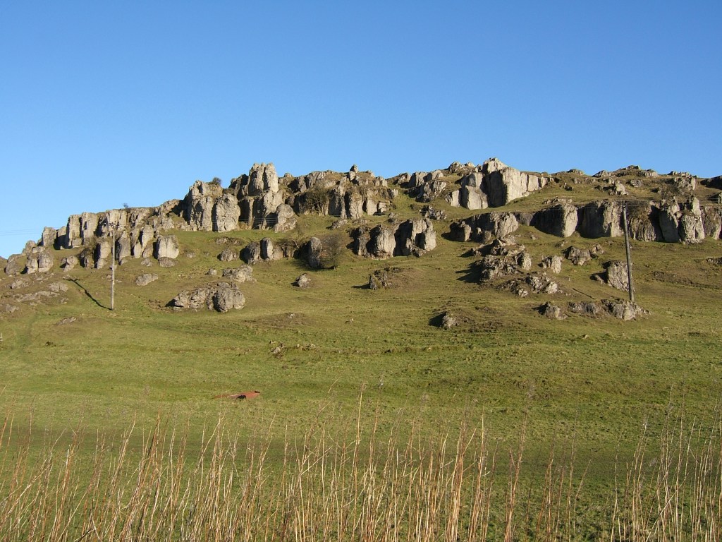
Yet his palette is impressively broad in terms of geography, and Derbyshire readers may enjoy his description of a walk from Cromford to Rowsley via Bonsall Moor, which he undertakes as a recreation of the ‘mystery hikes’ which were apparently popular between the wars – hikers would board a train for an unknown destination:

‘The drama of the landscape hits me quickly. Minutes after stepping off my train, my path takes me along the bottom of a massive cliff face. Trees grow up high, directly out of breaks in the rocks, their leaves rusting and falling to the ground’.

Cornish’s own involvement in the walking he writes about is clear, and he effectively balances these personal reports with the more historical details. He is also good at recounting disputes with landowners over rights of way, and sets the inevitable Kinder trespass story in the wider context of the long-standing struggles for access all over this country.

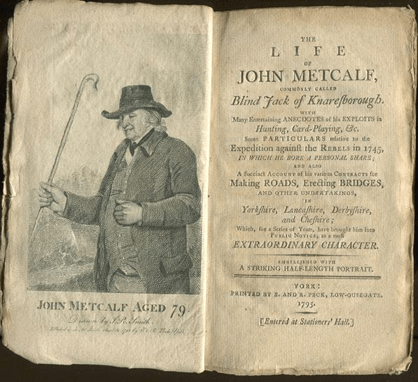
I would certainly recommend The Lost Paths to all fellow walkers, though with a couple of caveats. The title doesn’t really do justice to the scope of the book, which is much broader than it suggests, and the illustrations – small black and white engravings – add little beyond decoration.

What’s in a name?

Sign near Holbrook

There are several ‘portways’ in England, such as the route over the Long Mynd in Shropshire, but the Derbyshire Portway seems to be the longest and the best-researched. The route in Derbyshire was first suggested by Cockerton, an historian from Bakewell in the 1930s, who based his idea of a long-distance route on a string of ‘port’ place names such as Alport and Alport Height, which can be linked together in a roughly north-south alignment by existing tracks and paths. These place names are reinforced by references to a ‘Portwaye’ in some medieval documents and two Portway lead mines. Cockerton discussed the origin of the name ‘Portway’ at length, without coming to a definite conclusion. But it seems clear that the word is Anglo-Saxon, and was applied by them to pre-existing, non-Roman routes. Some have suggested an origin linked to ‘porter’, that is someone who carries, but then all roads are for carrying goods. The common Anglo-Saxon word for road was ‘way’, except for the old Roman roads which were ‘streets’. So a ‘portway’ was something special.

The line of the Portway running south from Cratcliffe Rocks, turnpike road to left

A ‘port’ suggests a place of safety and shelter, so I think a portway was a a long-distance route which had ‘ports’ for travellers at intervals of roughly ten miles. These might have been similar to the caravanserai found in the Middle East – defensive sites where wayfarers could sleep, cook and graze their animals overnight. In Derbyshire these are likely to have been on high ground for defence, and a string of probable sites can be identified, from north to south: Mam Tor, Fin Cop, Cratcliff Rocks, Harborough Rocks, Alport Height, Arbour Hill at Dale and Arbour Hill in Wollaton Park. It is noteworthy that three of these have a similar ‘arbour’ component, and a harbour of course is similar to a port.

Harborough Rocks, between Wirksworth and Brassington

Several of these sites, including Mam Tor, Fin Cop and Harborough, have been excavated and evidence of occupation, such as pottery, has been found. But permanent settlement in such high and waterless places seems unlikely, while the designation ‘hill fort’ is too vague. Far more likely that they served to protect tired travellers, and thus answered a question too rarely asked by pre-historians – how did merchants, drovers, priests, soldiers and pilgrims make lengthy journeys before the arrival of inns?

Romantic Buxton?

Arnold Bennett’s masterpiece, The Old Wives’ Tale, published in 1908, is set in the mid-nineteenth century, and tells the contrasting stories of two sisters, Sophia and Constance. The latter spends her life running the family drapers’ shop in Stoke on Trent, while her sister has a more adventurous life in Paris. When Constance marries, Buxton is chosen for their honeymoon, a relatively short ride on the then North Staffordshire Railway:

“They had a way of saying: ‘Yes, we always go to Buxton. We went there for our honeymoon, you know.” They had become confirmed Buxtonites, with views concerning St Anne’s Terrace, the Broad Walk and Peel’s Cavern. They could not dream of deserting their Buxton. It was the sole possible resort. Was it not the highest town in England? Well, then!

The man himself

Bennett, who was a francophile and had lived in France since 1903, was clearly being satirical at the expense of these provincial folk:

“They always stayed at the same lodgings, and grew to be special favourites of the landlady, who whispered of them to all her other guests as having come to her house for their honeymoon, and as never missing a year, and as being most respectable, superior people in quite a large way of business. Each year they walked out of Buxton station behind their luggage on a truck, full of joy and pride because they knew all the landmarks, and the lie of all the streets, and which were the best shops.”

Park views

However, any holiday would be a luxury for working people in the 1870s, and ten days in Buxton would demonstrate that Mr and Mrs Povey were prosperous folk. The spa waters of the town have attracted visitors since Roman times (and probably earlier), though tourists in the eighteenth century frequently complained of the quality of accommodation. It was not until the Dukes of Devonshire made serious investments, such as building The Crescent, and the arrival of the railway in 1863, that large number of visitors began arriving. Today a rejuvenated town still attracts holidaymakers, although unfortunately the excellent Museum and Art Gallery has been closed indefinitely due to the discovery of dry rot.

Peripatetic post people!

Old-model Postie

In the age of electronic messaging it is easy to forget the revolution in communication caused by the introduction of the penny post in 1840. This novel system of using stamps to pre-pay letters to anywhere in the country allowed working people, for the first time, to keep in touch with friends and relations, at a reasonable price. There was a huge increase in mail, and consequently post offices were opened in rural areas to organise the collection and delivery of letters. At this time country districts were more densely populated than today, and letters had to be delivered to widely scattered cottages and farms. Consequently, rural postmen (and women) were recruited, with routes of up to 15 miles, to be walked in all weathers for the delivery and collection of mail.

Hearts a’ fluttering…

When the new system was introduced the postmen tried to reduce their ‘walks’ by finding short cuts between the scattered houses, thereby opening up new paths in places. However, today there is little record of their remarkable work, although some posties were still delivering mail on foot up to the 1970s, despite the general introduction of bikes and later, vans. Derbyshire must have had dozens of such forgotten postmen, while in Cumbria Alan Cleaver has been collecting memories of their lives, as recently featured on BBC Radio 4 in ‘Open Country’.

A cheery wave

It’s hard to imagine anyone opting for a job today that involved a daily walk of 15 miles. Not only were letters delivered and collected daily, but the arrival of the post broke the intense isolation of much country life 150 years ago – there were cases of people sending letters to themselves, in order to have the postman call! Postmen were known to read letters out for folk who were illiterate, as well as bringing news from neighbours. Deliveries were even made on Christmas Day, as DH Lawrence recorded when living at Middleton by Wirksworth in 1918. Another notable change is the soaring cost of a stamp – compared with the Penny Black at one old penny, a modern second class stamp costs 85 new pence – 204 times more expensive!

See: https://www.bbc.co.uk/news/uk-england-cumbria-64452468

Millstoned

If you go down to the woods today …

The stone I found in my local woods recently is typical of the thousand-odd millstones scattered around the Peak District – and are used as a symbol for the National Park. Clearly fashioned from the gritstone of the ‘edge’ behind me, this example raises some intriguing questions: who made it? why was it abandoned? how was it transported?

On Stanage Edge

Both wind and water mills used pairs of millstones to grind grain between them; the stones were about 1.8 metres wide and each weighed nearly 2.5 tons. Millstone grit from North Derbyshire was considered the best material for these, and in the late seventeenth century a pair would cost about nine or ten pounds, reflecting the skill and effort required to make them. Most production seems to have been small-scale; perhaps providing winter work for farmers, and may have been concentrated in the Hathersage area and along the ‘edges’, but there is also documentary evidence of manufacture at Alderwasley, Crich and Holloway. However, in the eighteenth century, with rising standards of living, demand for white flour increased and milling this needed finer chert millstones. Quite suddenly, the traditional stones were unwanted, and this may account for the numbers that were abandoned – although some may have cracked or had other defects.

Keep them rolling …

One minor mystery is how such heavy, valuable objects were transported, given that they were sold all over England and exported to the Continent. The sites of the quarries were often remote from the nearest road, so they may have been rolled in pairs, fitted with a wooden axle, until they could be craned onto a cart. In 1676 a miller at North Elmshall paid seven shillings and sixpence for carrying his new stones 22 miles. At Baslow there were complaints about loads of millstones weakening the bridge over the Derwent, and fines for offenders, which suggests fairly heavy traffic. As with lead, Bawtry was the main inland port for shipping millstones, both for export and to other English regions. But perhaps the biggest mystery is how the semi-amateur masons were able to produce such precisely cut stones with the crudest of tools.

Come back, Blind Jack

John Metcalfe relaxing in Knaresborough

John Metcalf, known as ‘Jack’, was a pioneer road builder in Yorkshire and Derbyshire, despite being blind from the age of six. His remarkable career began in 1717, when he was born to a poor family in Knaresborough. He was given fiddle lessons as a source of future financial support, and at age 15 became fiddler at the Queen’s Head in Harrogate. Horse trading, swimming and diving were other occupations, while his detailed local knowledge gave him employment as a guide. Among other achievements he ran a carrier business, using a stagecoach which he drove himself.

Jack on a rare sunny day in Yorkshire

His career as a road builder began in 1765 when he tendered to build a section of turnpike road between Harrogate and Boroughbridge. Presumably his work as a carrier had given him insight into the problems of road maintenance, and his road engineering was based on the need for effective drainage, via a convex surface, into adequate culverts at the road side. He was also the first to find a way of laying a route through bogs, using floating rafts of ling and gorse as foundations. But his success must have also been down to effective calculation of costs when bidding for contracts, plus his man-management skills, such as being on site at 6 a.m. In total he was responsible for 180 miles of new or improved roads, mainly in Yorkshire but also in north Derbyshire, especially the roads around Buxton.

A well-stocked pub

Today Jack is remembered in his home town by a seated statue (top) outside the pub that bears his name. His road-building contemporaries, Thomas Telford and John MacAdam, are better-known, but his triumph over disability is quite remarkable. In old age he lived with one of his daughters, and at the age of 77 walked to York and told his life story to a publisher, who produced this volume (below).

Given the current state of Derbyshire roads, we might wish for Jack to get off his bench and come back to show us how to fill in the potholes …

Reading the stone

The stone in the north wall of St Mary’s, Wirksworth

The Wirksworth Stone must be one of the most remarkable examples of sculpture from the Saxon era in England. Discovered in 1820 face down, buried under the church floor, it is thought to have been the lid of a sarcophagus belonging to an early saint, possibly Betti. It dates from about 700 CE, and displays a sophisticated iconography which reveals a strong Eastern influence e.g. the use of the Greek cross with equal arms. Perhaps the most interesting question is who produced this work 1,300 years ago, and was it carried here or made on the spot?

St Mary’s in its oval churchyard

Clearly the present thirteenth-century building (above) was not the first on this site; in fact the name of the local river, Ecclesbourne, suggest a very ancient foundation, probably a minster church for the whole wapentake of Wirksworth. Just as churches were built by travelling stone masons we can assume that sculpture like this was the work of itinerant artists, who would also produce crosses like those at Bradbourne and Eyam. It is claimed that the Wirksworth stone shows the work of two masons, the one responsible for the lower half being more skilled than his (or her) workmate. Although overall the workmanship is somewhat crude, the scenes portrayed cover the whole range of Christian teaching.

The ascent of Christ, in mandala (detail)

The left hand side of the stone has been broken off, so originally there were ten scenes but now only eight are visible. It appears that the stone should be read vertically, top to bottom, rather than left to right like a modern comic strip. So the top left scene shows Christ washing the feet of the disciples, and the one below the Harrowing of Hell, when the crucified Christ is supposed to have descended into Hades. The next pair are clearly the Crucifixion (with four evangelists) paired with the Ascension below. The third scene on the top represents the death of the Virgin, and below this the Annunciation is shown, with Mary seated. The final scene on top is the Presentation of the infant Christ in the temple, and under this the disciples prepare for their preaching mission (note the figure in the boat). Overall, and assuming the missing section showed the Nativity and the Baptism of Christ, the whole panel presents a remarkable statement of fundamental Christian beliefs. The position of Wirksworth on the Derbyshire Portway reinforces the theory that this was the work of travelling craftsmen, bringing the essentials of their religion in pictorial form to the (presumably) illiterate of the Peak.

Highways and Byways in Derbyshire – a good read

My somewhat battered copy

Macmillan published the first book in their Highways and Byways series in 1898 and, remarkably, the last in 1948; a total of nearly 40 titles covering most of Britain. All are detailed guides with plentiful illustrations by respected illustrators. Well-bound in hard covers with gilt lettering, the series must have been popular as copies can still be bought quite cheaply from second-hand sources. The volume on Derbyshire was quite early, in 1905, written by JB Firth and illustrated by Nelly Erichsen, who was from a Danish family.

An inviting title page

The author, unusually, writes from the viewpoint of a walker, so that the reader can follow his progress in detail, which is especially interesting if the reader knows an area well. Clearly there are many changes to the scenery 120 years later; for instance at Ambergate then-triangular station: ‘the station becomes simply a hideous deformity, and the adjoining kilns of Bullbridge throw up fleecy masses of white clouded smoke’. In Edwardian fashion there are many digressions in the form of stories of famous folk who have lived locally, and Firth is not afraid of copious quotations of poetry, but these rather add to the book’s charm.

Another value of the book is the recording of otherwise lost data. For example, the footpath that runs uphill from Pentrich mill to Pentrich church (see map above) is today simply a field path. but in the 1900s was clearly more: ‘This broad track used to bear the name of Deadman’s Lane, not from any relics which have been found there but because by this way dead men were borne to their last resting place in Pentrich churchyard‘. Firth also says that higher up, near the church, the line of the Roman road, Ryknild Street, was still marked with hedges.

‘There is not a finer county in England than Derbyshire’

Jane Austen 1775-1817

A significant tourist industry has grown up around Jane Austen and Derbyshire. It is often claimed that she visited the county in 1811, stayed at the Rutland Arms in Bakewell, looked around Chatsworth and based Mr Darcy’s fictional house of Pemberley on this model. At least one film of Pride and Prejudice has used Chatsworth as a setting. However, there is no actual evidence that Jane ever visited the county, let alone wrote about it.

As it wascould this have been Pemberley?

In Pride and Prejudice the heroine, Elizabeth Bennet, is taken on a tour of the Peak District by her aunt and uncle. There is mention of Matlock, Chatsworth, Dovedale and the Peak as being the main attractions. They base themselves in ‘Lambton’, often taken to be Bakewell, from where Pemberley is a three-mile drive. When they visit the house its setting makes a positive impression on Elizabeth: ‘…it was a large handsome stone building, standing well on rising ground, and backed by a ridge of high, woody hills – and in front a stream of some natural importance is swelled into greater …’ . This description has encouraged the identification with Chatsworth, but there are three objections to the theory. First, as mentioned above, there’s no record of her visiting the area, second the description of the house is generic, and could apply to many mansions from this period. Landscape fashion from the eighteenth century had created dozens of similar park-like vistas and Austen would have seen engravings such as the one above. Finally Pride and Prejudice, although only published in 1813, was largely written in 1797, 11 years before her supposed visit to the county.

A post-chaise

The search for originals of fictional people and places is quite pointless, since it assumes that authors have no powers of invention. More interesting is the light that the story sheds on early tourists in the Peak. Even if she had never visited Derbyshire, Austen was well aware of the tourist sights, which wealthy travellers could best enjoy by hiring a chaise, a small light carriage for two or three people. Complete with driver, this would cost about a guinea a day, roughly £100 in modern money.

Mather’s Grave

Mathersgrave near Brackenfield

Just north of the Matlock-Alfreton road (A615), the hamlet of Mathersgrave commemorates both a family tragedy and a medieval mindset. Set in the retaining wall to a cottage garden is a block of stone inscribed ‘SM 1643’ and nearby is a guidestoop with three inscriptions: ‘Matlack (sic) Road’, ‘Bakewell Roade’ and ‘Alfreton Road 1730’. The presence of the guidestoop shows that this was a significant crossroads in the early eighteenth century; building the turnpike bypassed the junction.

Guidestoop and grave stone

Christian teaching in the Middle Ages insisted that suicide was a serious sin, and this was reinforced by English law which viewed it as a crime, punishable by the forfeit of property to the crown. Suicides were denied burial in consecrated churchyards, and thereby lost their chance of going to heaven. Instead they were buried at crossroads, where it was thought their spirits would be unable to choose the right route back to the land of the living, and so be unable to plague their kin. To make doubly sure, a stake might be driven through the heart of the sinner to further immobilise them. Incredibly, the last case of a crossroads burial was in 1823, while suicide remained a crime until 1961.

Trinity Chapel near Brackenfield

Apparently SM was Samuel Mather, a local man who had fathered an illegitimate daughter, and social condemnation forced him to kill himself, and possibly kill his wife also. (Details of the story are vague). This happened in 1716, so the date on the marker stone is wrong. This occurred well before the Matlock-Alfreton turnpike was constructed, and further evidence of the shift in road pattern is the romantic nearby ruin of Trinity Chapel. Half a mile to the north, (see map above), this was in use before Brackenfield Church was opened in 1857, but is now quite deserted. In the past this must have stood on a busy lane, but today is only reached by footpath.