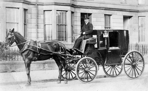
Comings and goings at Haddon

Desirable gentleman’s residence

Haddon Hall, near Bakewell on the River Wye is such a remarkably well-preserved late medieval house it has been irresistible to film makers. Firebrand, the story of Henry VIII and Katherine Parr, is currently on release, and previously Haddon has been the setting for two versions of Jane Eyre (involving burning the building down), Pride and Prejudice, and many others. In the mid-sixteenth century it was the home of Sir George Vernon (born 1503), whose steward kept an account book which gives us a glimpse of the network of transport links which sustained life in a great house at that time.

George Vernon at rest in Bakewell church

The accounts for the Christmas period 1564-5 include payments to entertainers as well as for food and drink. ‘The Earl of Worcester’s players, presumably a travelling theatre group, earned 14/3d (fourteen shillings and threepence), while ‘Wetton the minstrel and his fellows’ were paid over 30/- (nearly £600 in modern values). Hawkers must have been welcome visitors, since John Basford and ‘other hawkers’ were given a Christmas tip of 10/-. Drink was bought in huge quantities: the ‘tenants of Baslow’ were paid 12/3 for bringing a tun (supposed to be 250 gallons, but hard to believe this could be transported) of wine to the Hall, while a gallon of malmsey ‘for the cook’ cost only 2/-. Food was bought from various local markets, especially Chesterfield and Ashbourne, but also Lenton fair near Nottingham, and Derby. ‘Shoes for kitchen boys’ came from Bakewell (5/4), while 3 crannocks of salt cost 30/-, with carriage an extra 10/- (presumably carted from the ‘wiches’).

George Talbot, 6th Earl of Shrewsbury

The accounts also reveal regular travel between Haddon and Sheffield. ‘One of my mistress’s men’ was paid 2/- for carrying a letter to ‘my lord of Shrewsbury’ in Sheffield. At this time George Talbot was the Earl of Shrewsbury, who would soon (in 1567) marry Bess of Hardwick. On the 19th of September 1564 George Vernon had gone to Sheffield, presumably to visit Shrewsbury, and was provided with 10/- ‘to play at dice’. He must have gone with an entourage, since it cost 27/- to put them up in Sheffield for five nights. On the way home 4d was spent on ‘bread, cheese and drink’ for the men at Holmsfield, a village on a direct route from Sheffield to Haddon. Clearly a source like this raises as many questions as it answers, but nevertheless does give some fascinating insights into travel nearly 500 years ago.

Sources

Carrington, W. (1894) ‘Selections from the steward’s accounts preserved at Haddon Hall’. DAJ XVI pp 61-85

Hey, D. (2001) Packmen, Carriers and Packhorse Roads. Landmark pp 136-7

Driven by drovers

Well into the twentieth century herds of cattle or flocks of sheep were a common feature of rural roads. Even after the coming of the railways, farmers often had little alternative to walking their animals to and from markets. As towns such as Sheffield and Chesterfield grew, the demand for meat meant that beasts had to be walked from further afield. The major drove roads from Wales and Scotland to London passed around the Peak District, but within Derbyshire there was regular movement from upland grazing areas to the Derby and Nottingham markets.

Green lane near Minninglow

For more distant markets where better prices might be found, farmers entrusted their animals to a drover, a well-respected and licensed man who could take the animals to sale in good condition, and even more importantly, bring the cash home! Very few records of these men survive, but droving must have been a hard life, with a seasonal bent – busiest in the autumn when the grass stopped growing. A herd of a hundred cattle or more wouldn’t travel more than ten or twelve miles per day, and would have to be securely kept at night in a field with grazing and water. Drovers (and their essential dogs) would use the same routes regularly, and make arrangements with farmers and innkeepers en route, perhaps sleeping themselves in barns or outhouses. Identifying these routes today is difficult, but wide verges, such as can be seen in Minninglow lane above, may provide a clue, since the cows could have found some fodder on the hoof.

Bit of confusion

Drovers must have avoided turnpike roads where possible, not only to escape the tolls but also to save clashing with faster traffic. The foul state of the road surface after the passage of a hundred cattle can be imagined, especially in wet weather. The herds were not only taken directly to butchers, but were also driven to fairs such as Flash Fair above Beeley, which attracted buyers from a wide radius. One possible drove route identified by Dodd and Dodd runs from Hartington on the Staffordshire border to Biggin, Newhaven, Cardlemere Lane, Minninglow, Summer Lane near Wirksworth, Ambergate, Bullbridge and on to Nottingham. The first half of this provides a decent walk today, and is certainly more relaxing if you don’t have a hundred frisky bullocks to keep in order.

Sources:

Dodd and Dodd (1980) Peakland Roads and Trackways

Hey (2001) Packmen, Carriers and Packhorse Roads

On the road – in style

London Road, Derby in 1900

Although few people could have predicted it, in 1900 thousands of years of horse-drawn transport were coming to an end. Since the Bronze Age horses had provided the fastest means of movement, and thanks to better roads the range of vehicles increased dramatically in the nineteenth century, becoming more lightweight. For moving goods the two-wheeled tradesman’s cart, as seen above, was most common, but for personal transport there was a wide variety of choice. Many men and some women preferred the flexibility of riding, but for the elderly, or those who had never learned to ride, light, two-wheeled vehicles like gigs were an option in fine weather.

One lady owner

Readers of nineteenth-century novels may feel understandably confused by mention of phaetons, Broughams, Tilburys, Stanhopes, dogcarts and chaises. Clearly, only the wealthier classes could afford to keep any kind of carriage, as this would often mean stabling a horse and employing a driver. But there was considerable social prestige in keeping one’s own carriage, and savings could be made if the carriage could be driven by the owner and pulled by a single horse, such as with Tilburys, chaises and dogcarts.

A lightweight chaise, with folding hood

Richer folk could buy a four-wheeler which provided more protection from the weather but needed a pair of horses – an imposing status symbol. Examples include Clarences, Broughams and Victorias, the latter, of course, being the queen’s choice. No doubt she could afford the expense, which Charles Dickens in 1879 calculated at 45 guineas a month for keeping a two-horse carriage, including the coachman. In modern terms that is over £50,000 a year, which makes owning the flashiest car seem like a bargain!

A Brougham, named after a Lord Chancellor, Henry Brougham

Fixing a hole …

The Stonebreakers / Gustave Courbet 1858

Repairing holes in roads must have been one of the worst jobs in the pre-industrial world. Courbet was not the only artist attracted to the subject: his pair of stone breakers represent a class of unskilled labourers never previously regarded as a suitable subject for art, the viewer feels their dusty, sweaty toil . In contrast, John Brett’s The Stone Breaker (also 1858) portrays an almost idyllic scene; lovely weather, a handsome young lad on the job, and his dog amusing itself. The milestone in the corner (London 23) is a reminder that he is also filling in holes, and to do so required stone to be broken into small fragments to create an all-weather surface.

The Stone Breaker/ John Brett 1858

One of the earliest attempts to deal with the problem of road maintenance was made in 1555 when the Statute of Labour was passed, which gave responsibility for this to the parish. They were obliged to choose a Highway Surveyor, who had the unenviable task of getting all householders to work on the roads for four days a year (later increased to six). Farmers with horses and carts were also required to lend these to move stone. Clearly this system was unfair, since if the Great North Road ran through your parish there would be far more wear and tear than if, say, you lived in Bonsall. However, despite the drawbacks, roads were more or less kept open, and people and goods moved around. Even after the main routes were turnpiked from the mid-eighteenth century, unpaid labour was still required. This is shown locally in the diary of Rowsley farmer Mathew Gibbons, who records his father doing roadwork for six days in 1761-2.

That sinking feeling

Clearly this is not a problem that has gone away. A recent report states that potholes are the biggest worry for drivers today, which will surprise no-one who has tried driving or cycling on our Derbyshire roads in the last few years. Perhaps it’s time to go back to the parish system and get everyone out, once a month, for some DIY patching!

The name of the bridge

The Derwent Hotel at Whatstandwell Bridge, now The Family Tree

Whatstandwell must be one of the more bizarre place names in Derbyshire, mispelt on some old maps as ‘Hotstandwell’. In fact it commemorates Walter (Wat) Stonewell, who lived near the bridge, built by John de Stepul in 1391, according to records from Darley Abbey. The bridge was rebuilt in the late eighteenth century, and widened more recently. Although the bridge today carries the north/south A6, it was originally constructed for east/west traffic, moving between Crich, Wirksworth and beyond. Building a bridge here would have been a major expense, and John may have paid for it as an act of charity. Clearly the original bridge must have been narrower and more basic, but such an early date suggests the importance of this river crossing, which would have been a ford previously.

Causey between Whatstandwell and Crich

On the east side of the bridge there are two main routes which converge on the river crossing. The main road (B5035) climbs steeply over the canal and up towards Crich. This was part of the Nottingham to Newhaven turnpike of 1759, which eased the gradient of the climb up to Crich by adding a loop above Chasecliff farm. The original track can still be followed, climbing directly up the hillside, with a stone causey still visible in places, as shown above. The other route has been obscured by the building of the canal and railway, but can still be followed by taking the Holloway road towards Robin Hood and then taking the first path on the right. This leads up through Duke’s Quarry, named after the owner, the Duke of Devonshire, and this track would have carried stone to either the trains or barges. However, the path is much older than either types of transport, and continues up through pleasant, semi-wooded fields to Wakebridge.

The route to Shuckstone Cross

After crossing the Crich/Holloway road (currently closed) the track now runs to the left of Wakebridge Farm and climbs steadily to high ground at about 270 metres. As can be seen on the map, Shuckstone Cross in Shuckstone Field is the meeting point of at least five paths. Only the stone cross base now remains, but this is (possibly) marked with the destinations of the routes. The track from the bridge now continues northwards to meet the road, but can be walked to High Oredish and beyond that, Ashover. Although in practice it’s impossible to date routes such as these, the section from Wakebridge up to Shuckstone is exactly on the boundary of two of the historic Derbyshire hundreds, which suggest that it may have existed before the county was divided in the Saxon period.

Base of Shuckstone Cross

Derby at the crossroads

This early plan of the town of Derby, drawn about 1760, shows how small the town was 250 years ago. The central area is framed by the Derwent to the east and Markeaton Brook to the west, at that time still an open stream. The town is divided into five parishes: All Saints (now the cathedral), St Alkmund’s, St Peter’s, St Michael’s and St Werbergh’s. There is only one bridge (St Mary’s, still in use) giving access to the Nottingham road. The Silk Mill is shown, as are other signs of small-scale industry such as a ‘pot works’ and a ‘copper mill’. The urban core is surrounded by what look like orchards, but may be market gardens.

The second map, made at the same time, gives an equally vivid idea of the size of Derby then, when settlements like Chester Green or Darley were well outside the built-up area. The turnpike roads are clearly shown, with numbered miles. The London road runs through Osmaston, the Nottingham road goes past Spondon (or Spoondon), the Chesterfield road via Little Chester, and so on. By the second half of the eighteenth century regular coach services ran from the county town to all the major Midlands towns, and Derby was an important stage on the Manchester- London route, where passengers would spend the night.

The Old Bell Hotel, Sadler Gate

Road travel in the eighteenth century was transformed by both the use of steel springs on coaches after 1764, and the growth of the turnpike system. This is shown by the reduction in journey time on the Manchester to London route, from 62 hours (with two overnight stops) to 18 hours by the end of the century. ‘Flying Machines’ were advertised in the Derby Mercury in 1760 starting from Derby’s George Inn at a fare of £1-8 shillings. This is the equivalent of about £237 at modern values; a reminder that coach travel was not only uncomfortable but also very expensive. Among other Derby coaching inns were the Talbot and the Old Bell, the latter apparently the only survivor. Even on relatively smooth turnpikes, horses would soon tire, and would need changing regularly to maintain timing. By 1767 a coach left Derby three times a week at 9 pm and arrived in London by 7 pm the following day. Despite the (relative) speed, it’s easy to imagine the discomfort of this journey with only brief meal stops, and perhaps gain a new perspective on the comforts of travel on Midland Mainline!

Sources:

Burdett, P. (1791) Map of Derbyshire Derbyshire Archaeological Society

Twells, H. (1943) ‘Derby’s Flying Machines and earliest coaches’ DAJ 64: 64-82

All you ever wanted to know about paths

Jack Cornish is Head of Paths at the Ramblers, which must be an excellent qualification to write on the subject. His recent book, The Lost Paths, sets out to be ‘A History of How We Walk from Here to There’. Ambitious in scope, the 19 chapters include such familiar subjects as pilgrim routes and turnpikes, but also cover topics like the growth of railways and the effects of the new post-war towns on traditional paths. Some of his material, such as the enclosures of the eighteenth and nineteenth centuries, may be familiar to any reader with an interest in history, but other topics, for instance the loss of rights of way due to military requirements during the Second World War, are unusual.

The author has assembled a fascinating range of detail, such as the vogue for ‘pedestrianism’ in the nineteenth century, when large bets were put on improbable feats of walking, such as London to York and back in six days. But his concerns are not only historical, since he discusses the need to make access to the countryside more diverse and welcoming for minority groups. If anything, the reader may feel that he has tried to include too much: it is interesting to know how many bricks were used to build London’s first railway (six million) but not really relevant to the stated theme – there’s a certain loss of focus.

Yet his palette is impressively broad in terms of geography, and Derbyshire readers may enjoy his description of a walk from Cromford to Rowsley via Bonsall Moor, which he undertakes as a recreation of the ‘mystery hikes’ which were apparently popular between the wars – hikers would board a train for an unknown destination:

‘The drama of the landscape hits me quickly. Minutes after stepping off my train, my path takes me along the bottom of a massive cliff face. Trees grow up high, directly out of breaks in the rocks, their leaves rusting and falling to the ground’.

Cornish’s own involvement in the walking he writes about is clear, and he effectively balances these personal reports with the more historical details. He is also good at recounting disputes with landowners over rights of way, and sets the inevitable Kinder trespass story in the wider context of the long-standing struggles for access all over this country.

I would certainly recommend The Lost Paths to all fellow walkers, though with a couple of caveats. The title doesn’t really do justice to the scope of the book, which is much broader than it suggests, and the illustrations – small black and white engravings – add little beyond decoration.

What’s in a name?

Sign near Holbrook

There are several ‘portways’ in England, such as the route over the Long Mynd in Shropshire, but the Derbyshire Portway seems to be the longest and the best-researched. The route in Derbyshire was first suggested by Cockerton, an historian from Bakewell in the 1930s, who based his idea of a long-distance route on a string of ‘port’ place names such as Alport and Alport Height, which can be linked together in a roughly north-south alignment by existing tracks and paths. These place names are reinforced by references to a ‘Portwaye’ in some medieval documents and two Portway lead mines. Cockerton discussed the origin of the name ‘Portway’ at length, without coming to a definite conclusion. But it seems clear that the word is Anglo-Saxon, and was applied by them to pre-existing, non-Roman routes. Some have suggested an origin linked to ‘porter’, that is someone who carries, but then all roads are for carrying goods. The common Anglo-Saxon word for road was ‘way’, except for the old Roman roads which were ‘streets’. So a ‘portway’ was something special.

The line of the Portway running south from Cratcliffe Rocks, turnpike road to left

A ‘port’ suggests a place of safety and shelter, so I think a portway was a a long-distance route which had ‘ports’ for travellers at intervals of roughly ten miles. These might have been similar to the caravanserai found in the Middle East – defensive sites where wayfarers could sleep, cook and graze their animals overnight. In Derbyshire these are likely to have been on high ground for defence, and a string of probable sites can be identified, from north to south: Mam Tor, Fin Cop, Cratcliff Rocks, Harborough Rocks, Alport Height, Arbour Hill at Dale and Arbour Hill in Wollaton Park. It is noteworthy that three of these have a similar ‘arbour’ component, and a harbour of course is similar to a port.

Harborough Rocks, between Wirksworth and Brassington

Several of these sites, including Mam Tor, Fin Cop and Harborough, have been excavated and evidence of occupation, such as pottery, has been found. But permanent settlement in such high and waterless places seems unlikely, while the designation ‘hill fort’ is too vague. Far more likely that they served to protect tired travellers, and thus answered a question too rarely asked by pre-historians – how did merchants, drovers, priests, soldiers and pilgrims make lengthy journeys before the arrival of inns?

Romantic Buxton?

Arnold Bennett’s masterpiece, The Old Wives’ Tale, published in 1908, is set in the mid-nineteenth century, and tells the contrasting stories of two sisters, Sophia and Constance. The latter spends her life running the family drapers’ shop in Stoke on Trent, while her sister has a more adventurous life in Paris. When Constance marries, Buxton is chosen for their honeymoon, a relatively short ride on the then North Staffordshire Railway:

“They had a way of saying: ‘Yes, we always go to Buxton. We went there for our honeymoon, you know.” They had become confirmed Buxtonites, with views concerning St Anne’s Terrace, the Broad Walk and Peel’s Cavern. They could not dream of deserting their Buxton. It was the sole possible resort. Was it not the highest town in England? Well, then!

The man himself

Bennett, who was a francophile and had lived in France since 1903, was clearly being satirical at the expense of these provincial folk:

“They always stayed at the same lodgings, and grew to be special favourites of the landlady, who whispered of them to all her other guests as having come to her house for their honeymoon, and as never missing a year, and as being most respectable, superior people in quite a large way of business. Each year they walked out of Buxton station behind their luggage on a truck, full of joy and pride because they knew all the landmarks, and the lie of all the streets, and which were the best shops.”

Park views

However, any holiday would be a luxury for working people in the 1870s, and ten days in Buxton would demonstrate that Mr and Mrs Povey were prosperous folk. The spa waters of the town have attracted visitors since Roman times (and probably earlier), though tourists in the eighteenth century frequently complained of the quality of accommodation. It was not until the Dukes of Devonshire made serious investments, such as building The Crescent, and the arrival of the railway in 1863, that large number of visitors began arriving. Today a rejuvenated town still attracts holidaymakers, although unfortunately the excellent Museum and Art Gallery has been closed indefinitely due to the discovery of dry rot.

Peripatetic post people!

Old-model Postie

In the age of electronic messaging it is easy to forget the revolution in communication caused by the introduction of the penny post in 1840. This novel system of using stamps to pre-pay letters to anywhere in the country allowed working people, for the first time, to keep in touch with friends and relations, at a reasonable price. There was a huge increase in mail, and consequently post offices were opened in rural areas to organise the collection and delivery of letters. At this time country districts were more densely populated than today, and letters had to be delivered to widely scattered cottages and farms. Consequently, rural postmen (and women) were recruited, with routes of up to 15 miles, to be walked in all weathers for the delivery and collection of mail.

Hearts a’ fluttering…

When the new system was introduced the postmen tried to reduce their ‘walks’ by finding short cuts between the scattered houses, thereby opening up new paths in places. However, today there is little record of their remarkable work, although some posties were still delivering mail on foot up to the 1970s, despite the general introduction of bikes and later, vans. Derbyshire must have had dozens of such forgotten postmen, while in Cumbria Alan Cleaver has been collecting memories of their lives, as recently featured on BBC Radio 4 in ‘Open Country’.

A cheery wave

It’s hard to imagine anyone opting for a job today that involved a daily walk of 15 miles. Not only were letters delivered and collected daily, but the arrival of the post broke the intense isolation of much country life 150 years ago – there were cases of people sending letters to themselves, in order to have the postman call! Postmen were known to read letters out for folk who were illiterate, as well as bringing news from neighbours. Deliveries were even made on Christmas Day, as DH Lawrence recorded when living at Middleton by Wirksworth in 1918. Another notable change is the soaring cost of a stamp – compared with the Penny Black at one old penny, a modern second class stamp costs 85 new pence – 204 times more expensive!

See: https://www.bbc.co.uk/news/uk-england-cumbria-64452468