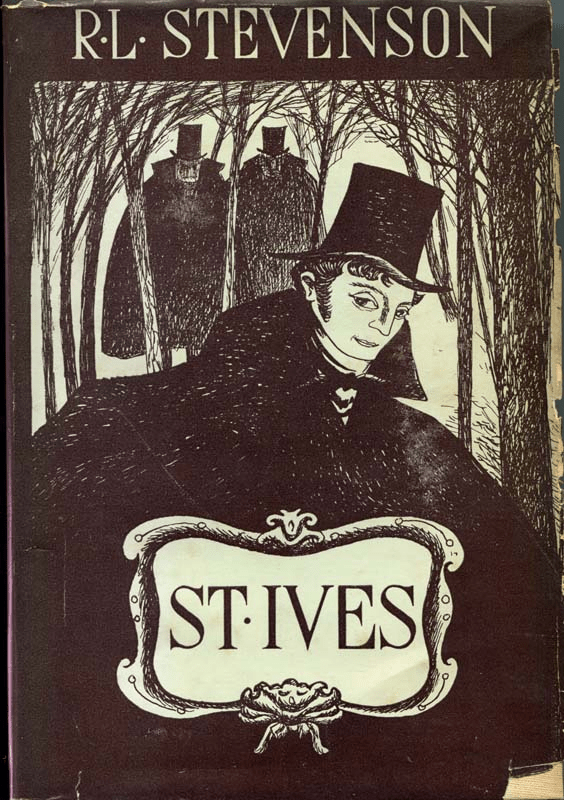
The last, unfinished novel by Robert Louis Stevenson, St Ives, is the exciting story of an escaped French prisoner of war in the Napoleonic period. After breaking out of prison in Edinburgh he heads south to England, first in company with a couple of drovers and then, over the border, on the Great North Road. On the way he gives us a rare picture of travel in the early nineteenth century:
The main roads of England are incomparable for excellence, of a beautiful smoothness, very ingeniously laid down, and so well kept that in most weathers you could take your dinner … off them. On them, to the note of the bugle, the mail did its sixty miles a day; innumerable chaises whisked after the bobbing postboys …
The drovers who help the hero flee Scotland are portrayed as taciturn, rough and hardy characters, but totally honest and self-reliant. They follow their droving trails through the hills, well away from the main roads, which is the ideal route for an escaped prisoner. Once in England St Ives stays at roadside inns, where visitors were expected to join the general conversation around the dining table, on subjects like:
… the country, the state of the roads, the business interest of those who sat down with me, and the course of public events …
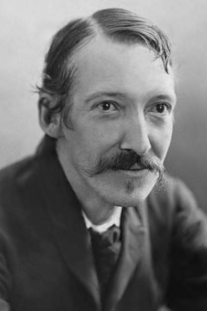
R L Stevenson
and:
I came to the model of a good old-fashioned English inn, and was attended on by the picture of a pretty chambermaid. We had a good many pretty passages as she waited table or warmed my bed for me with a devil of a brass warming pan … and as she was no less pert than she was pretty, she may be said to have given rather better than she took.
In this, and most of his other stories such as Treasure Island or Kidnapped, Stevenson is using a classic model – the traveler’s tale, which was already three hundred years old. Beginning in Spain with novels such as Cervantes’ Don Quixote, a little later Bunyan’s Pilgrim’s Progress, then in the eighteenth century many novels in Britain and France like Candide or Tom Jones, this was an incredibly popular genre. Sometimes called ‘picaresque’, from the Spanish word ‘picaro’, a disreputable, wandering character, these novels all consist of a series of adventures linked together by a journey, adventures in which the hero meets a variety of people.
Still in printafter 350 years
Given the scarcity of other material, these stories are one of the best sources for historians of travel. Not only do they give an insight into the mechanics of travel in the past, as for example in The Pickwick Papers, where we can ride past a turnpike gate, but they also illustrate contemporary attitudes towards, for instance, inn keepers or chambermaids, as in the example above, in which Stevenson may be lightly satirising such conventions. Today it has become fashionable to talk about ‘my journey’ as a pretentious synonym for ‘my life’, but clearly this conflation is far from being a novelty!
‘But it’s real England – the hard pith of England’, Lawrence wrote to Rolf Gardiner in 1926. He was referring to the hill country of the Derbyshire and Nottinghamshire border, near his birthplace at Eastwood, going on to offer to ‘walk it with you one day’. Various walks described in Sons and Lovers explore this area. One of the most arduous took place on an Easter Monday, when, aged nineteen, Paul (i.e. Lawrence) organised a walking party of family and friends, including his sister and Miriam.
We also have his sister Ada’s description of the real walk, which took place in 1905, and which she recorded in her Early Life of D.H. Lawrence. Parts of her account show an interesting discrepancy with his fictional version. For instance, Sons and Lovers portrays the young people as feeling rather nervous when they enter Alfreton Church, but according to Ada they held a mock service:
He said we must sing a hymn or two, and threatened awful punishments if anyone laughed or treated the occasion lightly. I played the organ and we sang. After the boys had explored the belfry we set off for Wingfield.
It is not difficult to follow their route today, starting from Alfreton station. It is a modern, utilitarian structure, but is on a busy main line and offers direct trains to Liverpool, Manchester, Sheffield, Norwich and Nottingham. The service between here and Paul’s starting point, Langley Mill (fictionally Sethley Bridge), still runs today.
It was great excitement to Miriam to catch a train at Sethley Bridge, amid all the bustle of the Bank Holiday crowd. They left the train at Alfreton.
The station is at the eastern edge of Alfreton, and it’s quite a long trek up Mansfield Road to the High Street. To the north of this route was the location of Alfreton Colliery, closed in 1967, and short terraces of what must have been miners’ houses lead downhill towards its site. On one corner is the Station Hotel, a bulky redbrick structure which was probably serving miners as Paul’s party passed by.
Paul was interested in the street and in the colliers with their dogs. Here was a new race of miners.
Wingfield Manor in a romantic mist
There are no details given of how the party went from here to Wingfield Manor, but the obvious route is to take the stone-flagged alley to the corner of the churchyard and then follow the green lane westwards. By the church the view of the hills, with Crich church spire and Crich Stand so clearly visible, shows that Paul really had no need of a map.
The green lane dwindles to a field path, but the route is clear, and after about a mile’s walk through deserted pasture you come out at the hamlet of Oakerthorpe, nearly opposite the impressive white bulk of the Peacock, an old coaching inn. This was the junction of two turnpike roads, one of which, running north, followed Ryknild Street, the old Roman road from Derby to Chesterfield.
The footpath continues heading west, beside the new houses, and then crosses the Midland Mainline on a wide wooden bridge. There’s a splendid view of the Amber valley from here, with South Wingfield church in the foreground and Wingfield Manor in the hazy distance. It’s a short walk down to the narrow river and then into the churchyard, frequently flooded and even more remote from the settlement than the one at Alfreton. Why, in the thirteenth century, was this damp spot chosen for a church, when the bulk of the village was on higher ground and nearly a mile distant?
South Wingfield is a village without a centre; everything, including the Manor, seems to be on the periphery. Wingfield Manor was apparently the focus of Paul’s expedition, with over a page devoted to a description of the ruins:
It was past midday when they climbed the steep path to the manor. All things shone softly in the sun, which was wonderfully warm and enlivening. … The young folk were in raptures. They went in trepidation, almost afraid that the delight of exploring this ruin might be denied them.
They were lucky not to make this visit today, since public access to Wingfield Manor has for years been limited to a few hours each month, for pre-booked parties only. This extraordinary restriction on access by the custodian, English Heritage, to one of the most important monuments in the East Midlands, which had been open to the public for over a century, has never been properly explained. Built by Ralph Cromwell in the 1440s, and used by the Earl of Shrewsbury to imprison Mary Queen of Scots in the sixteenth century, it is both highly picturesque and historically important. Despite this, it is now effectively out of bounds to the public, who will be denied the pleasures felt by Paul and Miriam:
Round the broken top of the tower the ivy bushed out, old and handsome. Also, there were a few chill gillivers, in pale cold bud. … The tower seemed to rock in the wind. They looked over miles and miles of wooded country, and country with gleams of pasture.
Round the back
Fortunately there is a public footpath which runs around the back of the Manor and allows you to get fairly close to the buildings. It was here that the initial physical contact between Paul and Miriam is described:
She held her fingers very still among the strings of the bag, his fingers touching; and the place was golden as a vision.
The path comes out on a narrow road, Park Lane, which I followed uphill to Park Head. Paul’s exact route into Crich is uncertain, but there are clear field paths from here. Unsurprisingly, his party was now ‘straggling’, like the village itself:
At last they came into the straggling grey village of Crich. Beyond the village was the famous Crich Stand that Paul could see from the garden at home.
But this was not the same Stand that we see today, which was built as a war memorial to the Sherwood Foresters in 1923. At the turn of the century a shorter tower stood on the site, which had been built in the mid-nineteenth century but had become derelict by the time of Paul’s visit. However, at a height of nearly 1,000 feet, and on the edge of the Pennines, the view was and is magnificent: ‘They saw the hills of Derbyshire fall into the monotony of the Midlands that swept away south.’
The view of the Stand from Paul’s house at Eastwood has been mentioned before in the novel, and to some extent it represents for him the wider world, outside the mundane surroundings of his birthplace, in the same way that the Manor represents history and pageantry. In a perhaps related way, the name Crich, which suggested the literal horizon of Lawrence’s view throughout boyhood, was later used by him for the mine-owning family in Women in Love. From here the walk went downhill, metaphorically as well as literally:
They went on, miles and miles, to Whatstandwell. All the food was eaten, everybody was hungry, and there was very little money to get home with.
Ada Lawrence provided more detail of this section of the walk in her memoir. Apparently they continued on to Holloway, and then back to Whatstandwell, possibly by the canal tow path. On the first part of this route the view over the Derwent valley is spectacular, stretching from the towers of Riber Castle in the north to Alderwasley Hall and Alport Height further south. Arriving in Whatstandwell:
They managed to procure a loaf and a currant loaf, which they hacked into pieces with shut-knives, and ate sitting on the wall near the bridge, watching the bright Derwent rushing by, and the brakes from Matlock pulling up at the inn.
The Derwent river, the wall and the inn (now The Family Tree) are all still there, but it would now be difficult to buy any bread in the village as the last shop closed many years ago. The ‘brakes’ would have been horse-drawn carriages used for short outings, since this village was a recognised holiday spot, offering tea gardens with views of the valley.
The final leg of their walk was to Ambergate Station to get the train home, about two miles from Whatstandwell Bridge. At that time it would have been possible to walk along the road, now the busy A6, but today the tow path of the Cromford Canal offers a more peaceful alternative. The station at Ambergate would then have been much busier than the present unmanned halt; a hundred years ago it was one of the very few triangular stations in the country, and offered services to Nottingham, Derby, Sheffield and Manchester.
Paul was now pale with weariness. … Miriam understood, and kept close to him, and he left himself in her hands.
Their itinerary gives an interesting insight into levels of fitness then. The distance from Alfreton to Ambergate via Holloway is at least twelve miles, depending on route, but in addition they would all have had to walk to the station at Langley Mill (about two miles each way), and Miriam and her brother Geoffrey perhaps two more miles to their farm. So the minimum length of the walk was about sixteen miles – not exceptional, but quite impressive.
Despite being close to the busy A52 Derby to Ashbourne road, Brailsford church, All Saints, is unusually isolated, west of the village, and nearer to Ednaston. But the map shows it at the centre of no less than six footpaths and bridle ways, one of which is now waymarked as ‘Centenary Way’ but known locally as the Coffin Path, linking the church to both villages.
The south side of the church
All Saints, which has some Norman work, is set in a well-wooded graveyard; near the south porch is an impressive yew tree, which may be nearly as old as the church itself. But the oldest thing here must be the stump of a cross, dug up after (presumably) being hidden at the Reformation (see my previous post on crosses). This fragment has been dated to the tenth century, though such dating is not an exact science.
Brailsford Cross
The cross, the yew and the church itself all suggest that this has been a sacred site for over a thousand years, while the pattern of footpaths shows that it has been used for burials by both Ednaston and Brailsford villagers. Today, it may be hard to understand the importance once attached to burial in holy ground, but belief in resurrection in the Medieval period was strong. The wealthy were remembered by marble plaques inside the church, while humbler folk at least had the comfort of the churchyard.
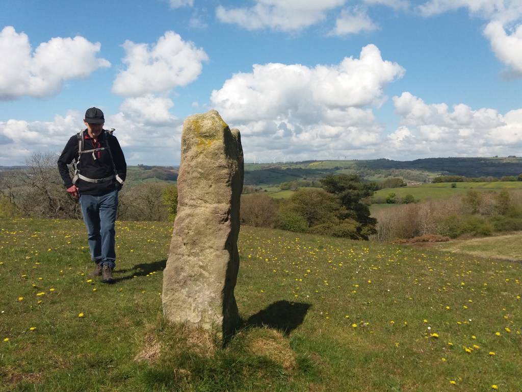
Derbyshire has plenty of stone, as shown by its characteristic dry-stone walls, and walkers may find pillars of stone, like the example above, set in the landscape for no apparent reason. Impossible to date, and clearly not redundant gateposts, they can only be assumed to mark some long-lost route. In other places there does seem to be a link to an old track, as with the large stone below, less than a mile above Wirksworth on the Brassington road, on the line of the Portway.
Again, it’s impossible to date a megalith like this, but clearly a lot of trouble was taken to erect what must have been a route marker. Given that many stones like these have been re-used for building, and others deliberately destroyed as symbols of paganism, we can imagine a prehistoric landscape well populated with such pillars. Surviving stone circles reinforce the idea of stones having power and importance, and this may have continued into the early Christian period, from about 600 CE.
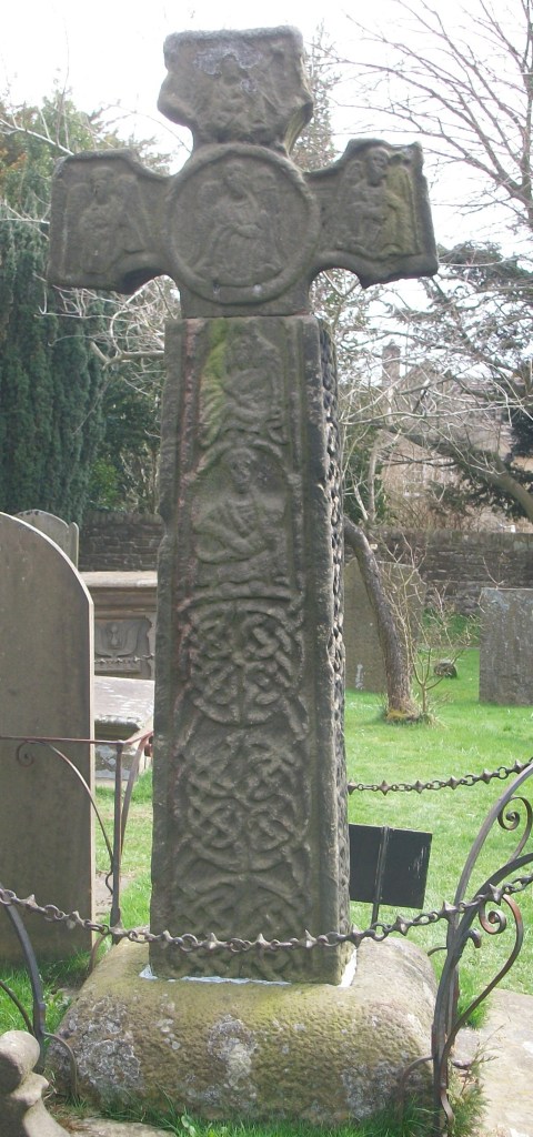
Cross in Bradbourne churchyard
Presumably the first Christian missionaries set up ‘crosses’ like this example in Bradbourne as symbols of the new beliefs; although badly worn a crucifixion scene can be found near the base. Similar crosses can be seen at Bakewell church (found on Beeley Moor) and Stapleford, on the Portway in Nottinghamshire. Although referred to as crosses they are actually simple carved pillars, which suggests an attempt to Christianize a pagan symbol.
Stapleford Cross, with scrollwork and saint.
Both of these monuments are thought to date from the ninth century, far older than the church they adjoin. The cross was only adopted as a Christian symbol in 692 CE, and one of the earliest examples of the ‘new’ pattern can be seen at Eyam churchyard (part of the shaft appears to be missing). It is always possible that these crosses were moved into the churchyards at some point, and they may originally have been route markers.
Celtic scrollwork at Eyam
In Medieval Britain crosses became more common and varied: wayside crosses, boundary crosses, market crosses and later, memorial crosses. In some cases they may have had the dual role of showing the way and indicating the next pilgrim shrine; this cross base at Cross Lane near Dethick seems to mark a route that extended south to Shuckstone Cross, only a mile away, and beyond. These (now lost) crosses would have protected travellers as well as guiding them to the holy places.
Cross base near Dethick with anti-theft device
See: Sharpe, N. ( 2002) Crosses of the Peak District, Landmark
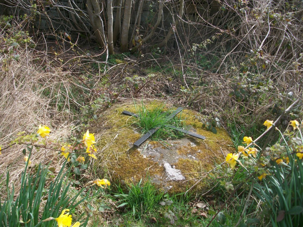
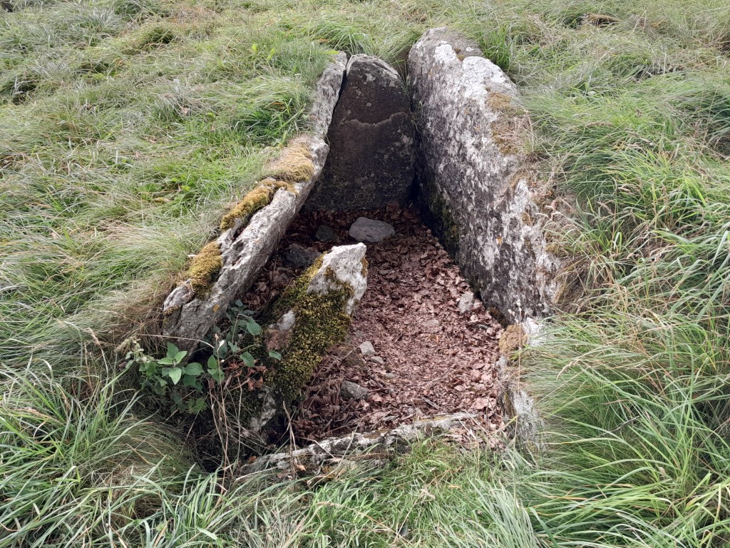
The double ring of beech trees that mark Minninglow hilltop (at about 370 metres above sea level) form a distinctive landmark that can be recognised from far away. Today it can be accessed by permissive footpaths from the High Peak Trail and another unnamed lane that runs east-west below it. But the story of Minninglow relates to another, much older route that lies a few hundred metres to its north.
One of the graves
Like many prehistoric sites in Derbyshire, Minninglow was first excavated by Thomas Bateman in 1843. He found that it contained a Neolithic chamber tomb, about 4,000 years old, as well as two Bronze Age barrows. There were also finds showing some activity in Roman times. This shows that the site had been significant for people for thousands of years. Today it is widely assumed that prehistoric people buried their dead in communal or individual tombs, often in high places, as an assertion of their right to live there. The dead were a kind of marker, suggesting the generations who had farmed this land. And what better place to bury the dead than a hilltop next to an ancient route?
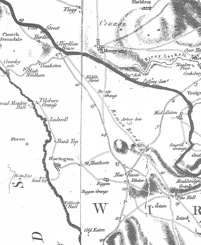
Burdett’s map of 1791 shows that the Roman road was then still in use
The Street, as the ‘Roman’ road to Buxton is now called, may well be much older, although refurbished during the Roman occupation. This is suggested by the number of ‘lows’ (from the Anglo-Saxon ‘hlaw’ meaning ‘high place’) and tumuli found near the route, including Arbor Low, Derbyshire’s most significant prehistoric monument – the OS map shows 17 between Longcliffe and Arbor Low. Burdett’s map, above, has the Street clearly marked, while today its only trace is the line of the parish boundary, which peters out just east of Minninglow. When parishes were first created what better marker than a road that was already thousands of years old?
The film of the book The Salt Path was released in the spring, adding to the fame of its author, who called herself Raynor Winn. This bestseller is the story of how she and her husband, called Moth, lost their Welsh home at the same time as he was diagnosed with a degenerative disease. Remarkably, the couple set off for a 600-mile walk on the South West Coastal Path, which led to massive book sales and a film deal. An inspiring, heart-warming story – until an Observer journalist starting probing some of her claims:
Whatever the truth of the claims and counter-claims in this affair, it is clear that many people were deceived, especially the editors at Penguin (‘unflinchingly honest’ – website) and the producers of the film. How could so many smart people fail to ask some pretty basic questions?
Salters Lane between Matlock and Bonsall
The book is presumably called The Salt Path because they followed a coastal route, the South West Coastal Path, created in the 1970s, which also offers some stunning scenery for the film. But much older Saltways cross Derbyshire, possibly dating from Roman times, which carried packhorse traffic from the salt pits of the Cheshire ‘wiches’ (such as Northwich) to towns like Chesterfield and Sheffield. Various routes can be followed using place names such as Saltergate, Saltersford and Saltsich; for instance the route from Leek via Hartington, Pikehall, Bonsall, Matlock and Ashover. These names are a reminder of the essential nature of salt in the medieval economy, not only for cooking but also for preserving meat and making ceramics.
The Peak District Pilgrimage Trail – Ilam to Eyam
The gullibility of those concerned with The Salt Path fiasco – including readers and viewers – can perhaps be explained by an atavistic faith in the power of pilgrimage, which the Coast Path certainly provided. There is a widespread belief in the benefit, spiritually and health-wise, of stepping out of ordinary life and setting off for a distant goal with few possessions. The most famous example is the Santiago Pilgrimage, now attempted by millions annually, while on a lesser scale the Peak Pilgrimage trail from Ilam to Eyam is a 39-mile (‘soul-healing’) route taking in a selection of historic churches.
John Ogilby produced the first practical road map of England in 1675; a strip map which showed landmarks to guide the traveller, such as hills and rivers. The map above gives his route from Derby to Manchester, starting with Derby on the top right. In the next strip the section via Hognaston and Brassington can be seen, leading on to the old Roman road, then still in use, past Pikehall (Pikeham on map) and on to Buxton. The first stage of this itinerary became Derbyshire’s first turnpike road, the Shardlow to Brassington turnpike of 1720.
The Gate today: clearly older than the date on the porch
Today Brassington is a well-kept but rather isolated village, without a shop or cafe, but still having two pubs: The Miners Arms and The Gate. The former is a reminder of the glory days of the eighteenth century when some, at least, grew wealthy on lead mining, the latter must mark the end of the early turnpike; the last tollgate going north, since the Roman road lay on limestone, and was still passable after over 1,500 years! This is confirmed by Tollbar Cottage opposite. However, the Manchester route that Ogilby describes was too hilly for laden coaches, especially in bad weather, and by 1738 a newer, low-level turnpike via Ashbourne was in use, less direct but faster overall. There are other ‘Gate’ pubs in Derbyshire, all presumably marking a turnpike tollgate: for instance at Tansley, Swanwick and Belper.
St JamesChurch, Brassington
St James Church must be the oldest building in the village: the tower and parts of the nave are impressively Romanesque. Although Brassington was originally part of Bradbourne parish, there was clearly a sizable congregation here in medieval times. Although it is dangerous to assume that church dedications have remained unchanged, St James is known as Santiago in Spanish, and he was the focus of the main West European pilgrimage routes in the middle ages. Could the dedication at Brassington suggest that the church wanted to be linked to the attraction of the saint’s burial in Galicia?
Sources:
Dodd A. & Dodd E., Peakland Roads and Tracks, 1980
In 1917 the recently married Ethel Ward (1894-1986) became a 23-year-old widow on the death in combat of her husband, Henry Gallimore. She came from a wealthy Sheffield family; her mother was connected to the Bassetts of licorice fame, while her father was successful in the steel industry . The family suggested that Ethel should try to overcome her grief by walking on the nearby moors; a remedy that seems surprisingly modern a century later. This led to Ethel becoming aware of the need to preserve the natural landscape on the western fringes of the city, and in 1924 she helped to establish the Sheffield Association for the Protection of Rural Scenery, which later became part of the Council for the Preservation of Rural England (CPRE).
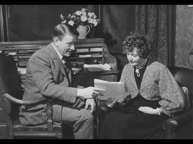
Gerald and Ethel in later life
In 1927 the 750-acre Longshaw estate, owned by the Duke of Rutland, came up for sale, and Ethel campaigned to raise funds for its purchase and protection from development. She was successful, and in 1931 the estate was given to the National Trust, who still run it today. In this decade she also helped to acquire land which became part of Sheffield’s green belt, the first British city to have one. By 1936 Ethel felt that she needed an assistant; her advert was answered by a young Manchester architect, Gerald Haythornthwaite, and they were married within a year.
On the Longshaw estate
During and after the second world war Ethel was closely involved with the CPRE and contributed to the creation of the Peak District National Park in 1951, Britain’s first. Today she is sometimes described as a forgotten figure, yet this seems a little exaggerated given that two books have recently been published about her (see below), a wood is named after her, there is a blue plaque near the site of her family home and, most impressively, a collection of 95 Peak District ‘summits’ have been collectively called ‘The Ethels’, similar to (but lower than) Scotland’s Munros. She and Gerald are buried in Crooke’s Cemetery in Sheffield.
Sources:
Ethel: The biography of countryside pioneer Ethel Haythornthwaite, Helen Mort, 2024
It’s difficult to get lost today. Google maps will display every street in the city, and spell out your quickest route, while in the country apps such as OS Maps will tell you exactly where on the path you are standing. The appeal of this technology is obvious – not just saving time, but also removing the fear that you’re heading the wrong way, into the unknown. In Derbyshire and the Peak District, with thousands of miles of footpaths, this reluctance to risk being lost results in crowds of visitors heading for the same honeypots such as Dovedale, Mam Tor, or the Cromford Canal, with predictable results.
The delights of a day in the country
It has been argued that the experience of getting lost can be valuable for our development, and we can cope better with that fear if we develop a strong sense of direction. Moreover, research has shown that the more children are allowed to roam freely, the better sense of direction they acquire. Although there must be marked individual variation, it seems that children today are restricted to a much small radius of ‘free movement’ – perhaps a few hundred yards – instead of the miles that children wandered away from home in previous generations. Of course, it can be argued that there is good reason for the restriction, but if children are barely allowed out of sight of their home they have little possibility of feeling lost – and then finding their way back.
Call Social Services?
How do we get a sense of direction? Moving through a landscape we notice and memorise a series of landmarks, while the position of the sun should provide an additional bearing (provided it’s at least partly visible). To return, the landmarks are revisited. The second time you make the journey, the landmarks are stored in your memory, even after a gap of months or years, as most walkers have found. Our nomadic ancestors, travelling through an unmapped countryside thousands of years ago, must have achieved an advanced ability to find their way, using perceptions unknown to us.
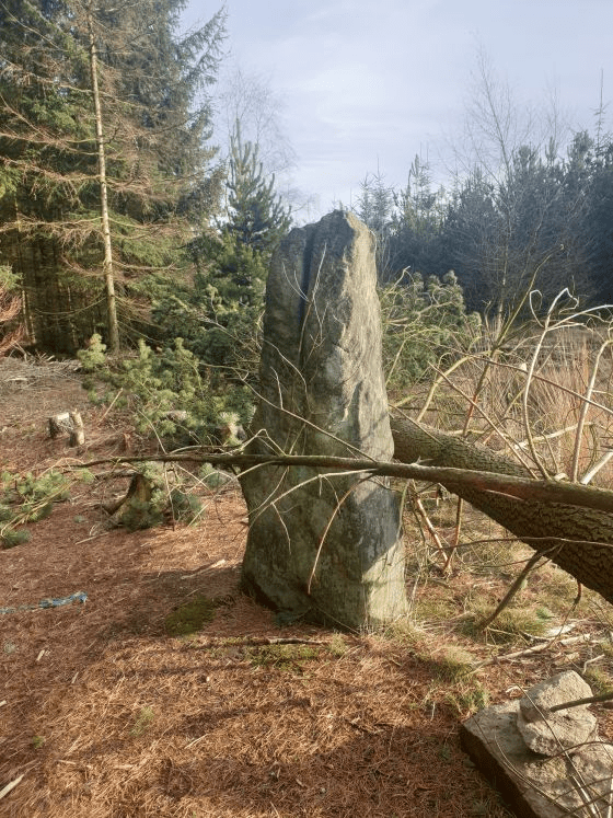
A recent Time Team programme reports an excavation on Farley Moor north of Matlock, where a single standing stone is thought to have possibly been part of a larger Bronze Age site. The researchers were able to date the site to 3,700 years ago, on the strength of radio carbon dating of charcoal fragments. But what is not clear is whether other stones in the vicinity were part of the monument or just erratic boulders. The stone is in a recent clearing in the Forestry Commission’s Farley Wood, which was planted about 50 years ago. One significant discovery was that below the stone there is a natural spring, so that the stone could have been a marker of this useful source, which might have been more significant when the water table was higher.
The timeless team
Although a good number of stone circles have survived in the Peak District, there is evidence that others have been lost, either through stone robbery or deliberate destruction by landowners who felt they were pagan symbols. However, it does not follow that every standing stone was part of a circle. Others were simply waymarks, such as the stone above Wirksworth on the route of the Portway. It is difficult to imagine the landscape in this area before the conifers were planted, but the ‘Moor’ name suggests an open and fairly treeless area in which a waymark would have been valued, especially if it also marked a spring. There was an ancient route which crossed the Derwent at Darley Bridge and headed up the hillside towards Chesterfield – was this connected?
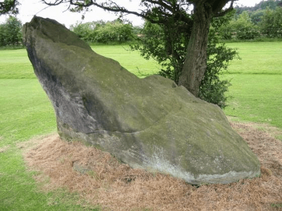
The Cuckoo Stone
Despite centuries of speculation we really have no idea of the purpose or use of stone circles. Theories range from astronomical temples to assertions of tribal land ownership. Whether the Farley Moor stone is a circle or a solitary waymark, it is curious that in the vicinity are other named stones, such as The Cuckoo Stone on Matlock golf course or the Wire Stone half a mile to the north. While these both appear to be natural rock outcrops, the fact that they are named suggests that traditionally they were important landscapes features.