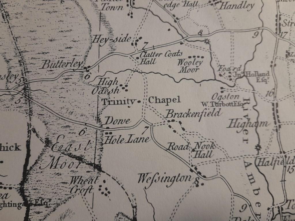
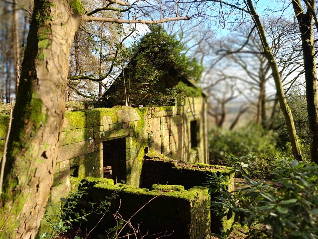
The evocatively-named Coldharbour Lane runs along a ridge to High Oredish, and then becomes a holloway, dropping and twisting down to Brackenfield village. The views to the east are spectacluar, with Ogston Reservoir in the middle distance. Before the lane loses height, a public footpath is signed leading downhill though fields, then into a pine plantation. Here among the trees, are the ruins of Trinity Chapel, once Brackenfield’s church, despite being so far from the centre of the village.
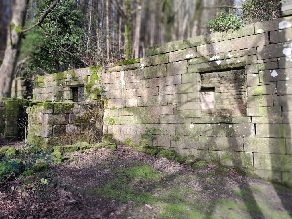
The chapel, well-built of dressed stone, was apparently a rebuild in the sixteenth century of an earlier structure, constructed as a monument to Hugh Willoughby’s wife. All that remains today are the stone walls and gable ends, but the interior was originally divided in half by a screen, which was taken, in 1857, to the new parish church at the other end of the village. After this opened the chapel was abandoned, although there is believed to have been a village pilgrimage to the site on Trinity Sunday (first Sunday after Pentecost), which was only discontinued in 1997.
The obvious question is why a chapel was built here in the first place, so remote from people, today only accessible by a muddy footpath? But if we go back in time by removing the pine plantation, we have a site with spectacular views to the east, perhaps the ideal spot for a hermit to do whatever hermits do. And this is reinforced by the spring and drinking trough found by the path, the same water re-appearing at another trough by the road below. This supply would have been critical for any inhabitant, and in fact the village website claims that into the 1930s villagers had to walk to the roadside source in times of drought, since it was the only reliable well in the parish.
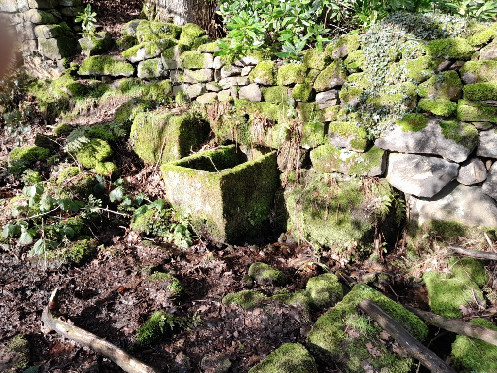
The chapel’s trough
Leaving the chapel, the footpath continues through a grassy field to the road to Ashover Hay. At the moment (late February) the path is edged with blue crocuses – not a native British flower – so planted by someone, for some reason. Mysterious …
Source: https://www.brackenfield.org/trinity-chapel-from-white-carr-lane