Despite being close to the busy A52 Derby to Ashbourne road, Brailsford church, All Saints, is unusually isolated, west of the village, and nearer to Ednaston. But the map shows it at the centre of no less than six footpaths and bridle ways, one of which is now waymarked as ‘Centenary Way’ but known locally as the Coffin Path, linking the church to both villages.
The south side of the church
All Saints, which has some Norman work, is set in a well-wooded graveyard; near the south porch is an impressive yew tree, which may be nearly as old as the church itself. But the oldest thing here must be the stump of a cross, dug up after (presumably) being hidden at the Reformation (see my previous post on crosses). This fragment has been dated to the tenth century, though such dating is not an exact science.
Brailsford Cross
The cross, the yew and the church itself all suggest that this has been a sacred site for over a thousand years, while the pattern of footpaths shows that it has been used for burials by both Ednaston and Brailsford villagers. Today, it may be hard to understand the importance once attached to burial in holy ground, but belief in resurrection in the Medieval period was strong. The wealthy were remembered by marble plaques inside the church, while humbler folk at least had the comfort of the churchyard.
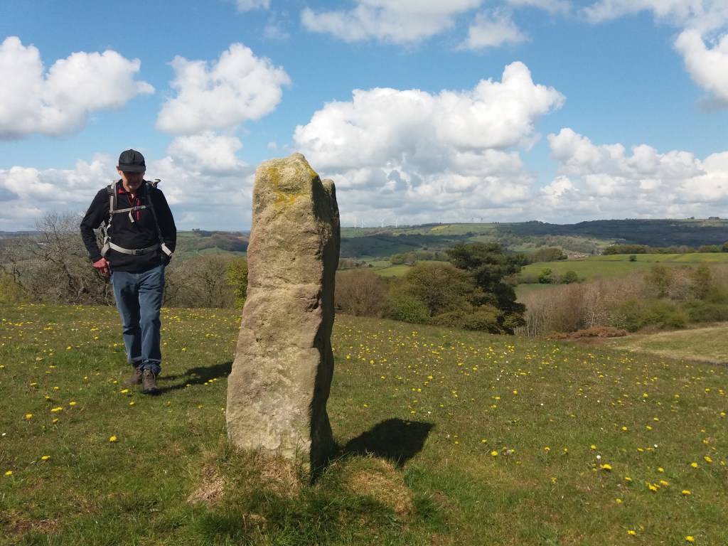
Derbyshire has plenty of stone, as shown by its characteristic dry-stone walls, and walkers may find pillars of stone, like the example above, set in the landscape for no apparent reason. Impossible to date, and clearly not redundant gateposts, they can only be assumed to mark some long-lost route. In other places there does seem to be a link to an old track, as with the large stone below, less than a mile above Wirksworth on the Brassington road, on the line of the Portway.
Again, it’s impossible to date a megalith like this, but clearly a lot of trouble was taken to erect what must have been a route marker. Given that many stones like these have been re-used for building, and others deliberately destroyed as symbols of paganism, we can imagine a prehistoric landscape well populated with such pillars. Surviving stone circles reinforce the idea of stones having power and importance, and this may have continued into the early Christian period, from about 600 CE.
Cross in Bradbourne churchyard
Presumably the first Christian missionaries set up ‘crosses’ like this example in Bradbourne as symbols of the new beliefs; although badly worn a crucifixion scene can be found near the base. Similar crosses can be seen at Bakewell church (found on Beeley Moor) and Stapleford, on the Portway in Nottinghamshire. Although referred to as crosses they are actually simple carved pillars, which suggests an attempt to Christianize a pagan symbol.
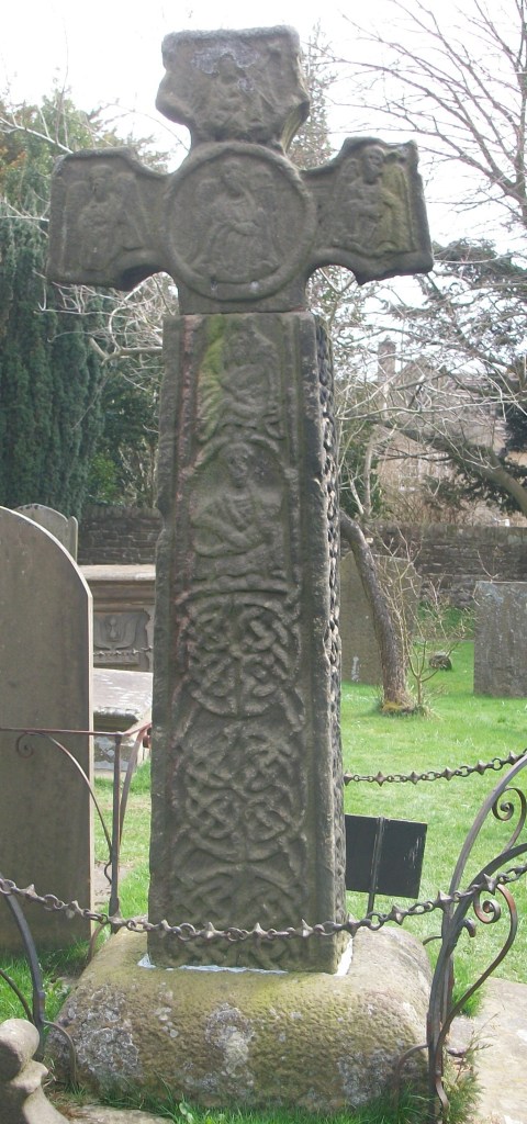
Stapleford Cross, with scrollwork and saint.
Both of these monuments are thought to date from the ninth century, far older than the church they adjoin. The cross was only adopted as a Christian symbol in 692 CE, and one of the earliest examples of the ‘new’ pattern can be seen at Eyam churchyard (part of the shaft appears to be missing). It is always possible that these crosses were moved into the churchyards at some point, and they may originally have been route markers.
Celtic scrollwork at Eyam
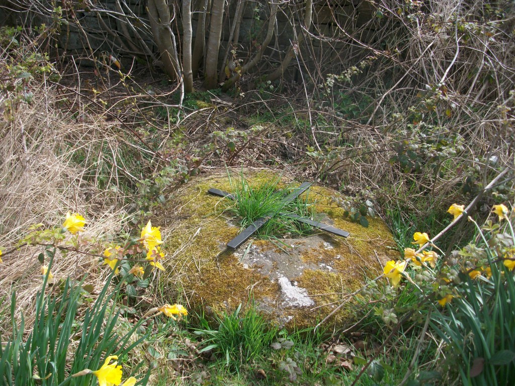
In Medieval Britain crosses became more common and varied: wayside crosses, boundary crosses, market crosses and later, memorial crosses. In some cases they may have had the dual role of showing the way and indicating the next pilgrim shrine; this cross base at Cross Lane near Dethick seems to mark a route that extended south to Shuckstone Cross, only a mile away, and beyond. These (now lost) crosses would have protected travellers as well as guiding them to the holy places.
Cross base near Dethick with anti-theft device
See: Sharpe, N. ( 2002) Crosses of the Peak District, Landmark
The double ring of beech trees that mark Minninglow hilltop (at about 370 metres above sea level) form a distinctive landmark that can be recognised from far away. Today it can be accessed by permissive footpaths from the High Peak Trail and another unnamed lane that runs east-west below it. But the story of Minninglow relates to another, much older route that lies a few hundred metres to its north.
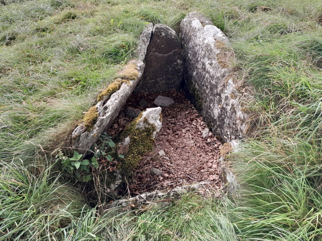
One of the graves
Like many prehistoric sites in Derbyshire, Minninglow was first excavated by Thomas Bateman in 1843. He found that it contained a Neolithic chamber tomb, about 4,000 years old, as well as two Bronze Age barrows. There were also finds showing some activity in Roman times. This shows that the site had been significant for people for thousands of years. Today it is widely assumed that prehistoric people buried their dead in communal or individual tombs, often in high places, as an assertion of their right to live there. The dead were a kind of marker, suggesting the generations who had farmed this land. And what better place to bury the dead than a hilltop next to an ancient route?
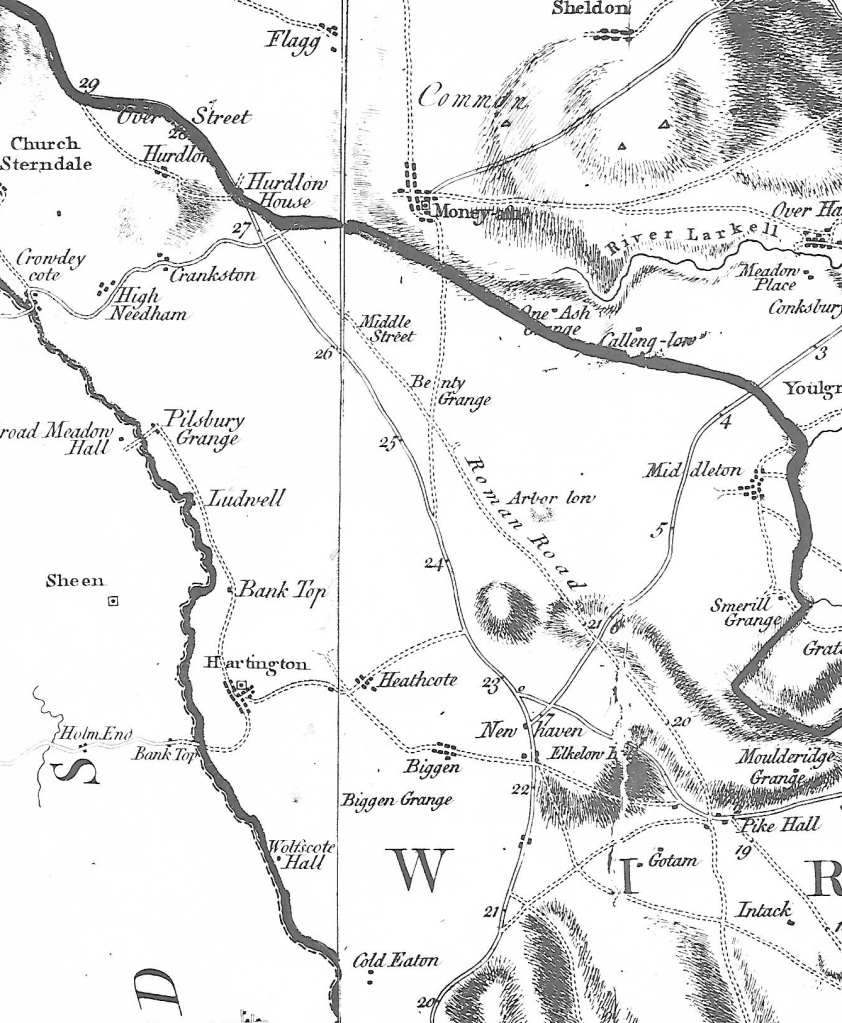
Burdett’s map of 1791 shows that the Roman road was then still in use
The Street, as the ‘Roman’ road to Buxton is now called, may well be much older, although refurbished during the Roman occupation. This is suggested by the number of ‘lows’ (from the Anglo-Saxon ‘hlaw’ meaning ‘high place’) and tumuli found near the route, including Arbor Low, Derbyshire’s most significant prehistoric monument – the OS map shows 17 between Longcliffe and Arbor Low. Burdett’s map, above, has the Street clearly marked, while today its only trace is the line of the parish boundary, which peters out just east of Minninglow. When parishes were first created what better marker than a road that was already thousands of years old?