
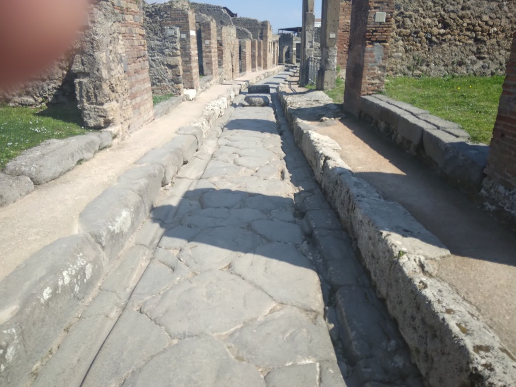
A street in the ruins of Pompeii
Pompeii may provide us with a good idea of what a Roman road looked like. Until its destruction in 79 CE Pompeii was a medium-sized town with good public facilities such as baths and temples – and well-paved streets complete with raised pavements. The photo shows the ‘crazy paving’ surfacing, kerb stones and also the ruts worn in the stone by carts with iron-rimmed wheels. In the distance blocks can be seen in the roadway to allow pedestrians to cross without getting too muddy. Perhaps the most surprising feature is the narrowness of both road and pavement – you wonder what happened when two carts met, or was there a one-way system?
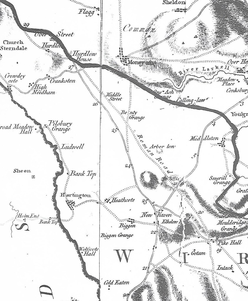
Burdett’s Derbyshire map of 1767 showing The Street north of Pike Hall
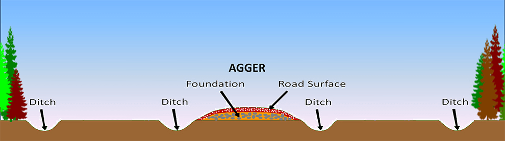
The Street, the Roman road that ran between Wirksworth and Buxton, is one of the best examples of a Roman road in Derbyshire. Clearly marked as such on Burdett’s map, it was still in use in the eighteenth century before the Ashbourne-Buxton turnpike was built, although today there is little visible evidence of its route. The Romans would have used whatever building material was available, so in the Peak District there was plentiful stone for foundations and kerbs, although the surface was probably something like gravel. Their roads were generally constructed on an agger, a raised platform about two or more metres wide.
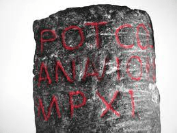
Roman milestone found in Buxton. It gives the distance to Navio as 11 miles.
The Street has been thoroughly researched by the Wirksworth Archaeological Society and various sections have been excavated. There has been endless debate about the southern destination of this route, and their research establishes that it reached Wirksworth, although the route beyond is unknown. The excavations also found that the road was no wider than two metres in places, so it should be seen as a relatively minor route, just wide enough for one wheeled vehicle. Given the number of pre-Roman sites which lie next to the Street, such as Arbor Low and Minninglow, it seems that the Romans actually followed and engineered a prehistoric route rather than create a brand-new road.
The theory
Although it is claimed that some stretches of Roman road survive in the Peak, for example near the Snake Pass, in fact it is impossible to know if these fragments are medieval or earlier. In general, over the last two thousand years almost all traces have vanished, due to weathering (stone tends to sink into the ground under its own weight; ditches fill up) and robbery of stone for wall or barn building.
Source:
The Street: A re-evaluation of the Roman road from Buxton to Wirksworth.
Wirksworth Archaeological Society, 2019
