Harboro’ Rocks seen from the High Peak Trail
A couple of miles west of Wirksworth, just above the High Peak Trail, Harboro’ Rocks are a distinctive limestone outcrop rising to 379 metres. The summit offers a splendid view of Carsington Water to the south and the Via Gellia valley to the north, while providing practice pitches for climbers. The Rocks have been the subject of several archaeological digs, the latest reported in the Derbyshire Archaeological Journal (Makepeace 1990 and 2004). According to these, evidence was found of a Late Bronze Age or Early Iron Age settlement: pottery fragments, domestic animal bones, a flint tool and a button. There is also a remarkable cave in which Daniel Defoe found a lead-ming family living in 1720, and which clearly could have been occupied in prehistoric times.

Cave at Harboro’
However, this picture ignores three factors. First, why should anyone settle on such a bleak and elevated spot, with no source of water? The thesis also fails to mention that the Rocks are near the junction of two important ancient routes: The Street, which was engineered by the Romans over an older ridgeway and ran from Wirksworth to Buxton, and the Portway, which headed north from Harboro’ towards Mam Tor and beyond. Finally, the name ‘Harboro” goes back to at least c. 1200 CE and may mean ‘shelter’ or ‘fortified place’, according to Cameron (1959). What must be significant is that this name crops up on two other hilltops along the Portway’s route: Arbour Hill outside Dale and another Arbour Hill in Wollaton.
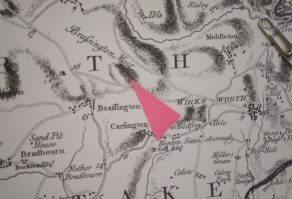
Burdett’s map of 1762 showing roads west of Wirksworth and position of the Rocks (arrowed)
So my suggestion is that this was not the site of a Bronze Age ‘settlement’, but could have been a fortified campsite for travellers on these two important routes. This would account for the sparse nature of the finds from the excavations – people were travelling light. Similar to the caravanserai found in the Middle East, these campsites seem to have been spaced every six or seven miles along the Portway and would have given the travellers some security for themselves and their animals when they stopped for the night. The next, going southeast, is Alport Height, and to the north, Cratcliffe Rocks.
Inns for travellers were part of the Roman road system, but I doubt whether any were provided in such a backward area as Derbyshire. We can only guess how these campsites were organised; whether locals sold water and provisions to travellers, and how they were maintained. However, there is enough evidence to suggest that these places provided vital protection for long-distance wayfarers until the growth of towns and the development of the modern inn during the medieval period.