Diaries can be a useful source in studying travel patterns in the past. William Hodkin was a farmer and general dealer at Beeley, on the Chatsworth estate in the mid-nineteenth century. He kept a diary, mainly of his farming work, from 1864 to 1866, which reveals the shape of his trading network. Although the station at Rowsley was open at this time he made relatively little use of the railway, either riding on horseback or travelling with a cart when collecting or selling livestock or deadstock.
During two and a half months April to June 1864 he travelled to Bakewell 13 times, to Calton Lees 5 times, and to Chesterfield, Beeley Moor and Rowsley 4 times each. Other trips took him to Ashford, Matlock and Edensor. Interestingly, the state of the roads is never discussed: presumably he knew them all so well that there seemed no need to mention it, although he does once mention that his horse had collapsed on the steep hill to Chesterfield.
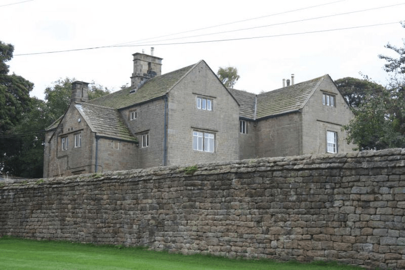
Hilltop House, Beeley, one of William’s regular destinations
It has to be admitted that William Hodkin was no Pepys. A typical entry (Thursday July 5th, 1864) reads: ‘Went rabbitting in the morning, making bills out at night. Father not doing much Thomas thrashing John carting stone to the highways’. This last job is a reminder that the roads around Beeley were not then tarmaced, and were still maintained by local labour. His wife is only referred to as ‘The Mrs’, although there are frequent mentions of the weather, and the occasional reference to the vicar’s sermon shows that William did sometimes take time off.
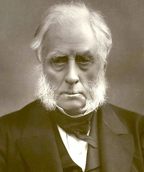
William’s landlord, William Cavendish, 7th Duke of Devonshire
Few people living in Derbyshire in the eighteenth century have left an account of their travels; clearly they didn’t feel any need to describe their everyday experiences. Therefore it is left to the handful of early tourists to provide an impression of journeying in the county three hundred years ago. Daniel Defoe was an early novelist and journalist who visited many English counties in the 1720s in order to produce his A Tour of England and Wales.
Beginning at Derby, he had clearly chosen a wet season for his visit, since he had to abandon plans to visit Ashbourne on account of ‘the river drowning the low-grounds by a sudden shower, and hastening to the Trent with a most outrageous stream’, a reminder that, not so long ago, travel was very much at the whim of the weather. There are other references to the Derwent as ‘a frightful creature when the hills load her current with water’.
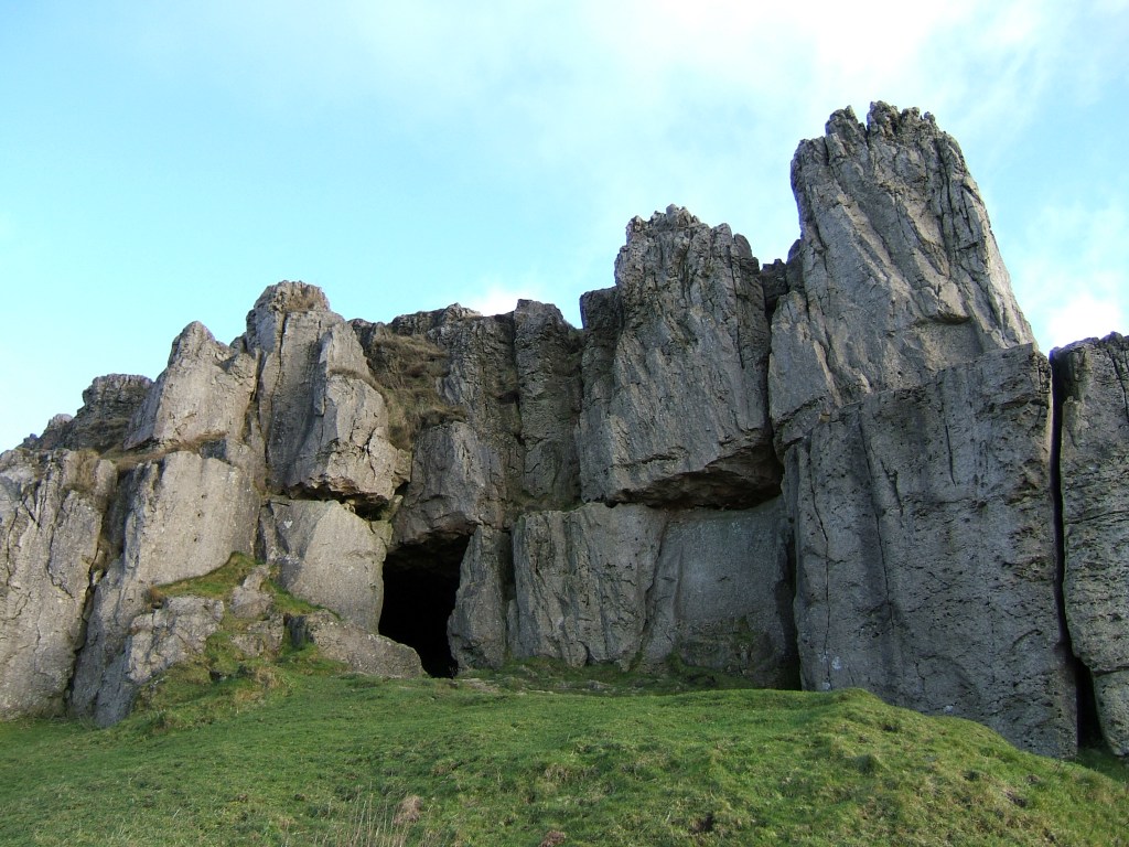
Cave at Harborough Rocks
Defoe’s next stop was Wirksworth, which he found interesting due to the lead trade, despite the inhabitants being ‘a rude boorish kind of people’. The most remarkable part of this visit was an excursion to Harborough Rocks, which was called the Giant’s Tomb at that time. Here he found a lead miner’s family living in a cave, which had been lived in by his family for several generations. Defoe was both horrified, and impressed that people could cope with such crude conditions: ‘they seemed to live very pleasantly, the children look’d plump and fat’. Defoe’s party had a whip-round and gave the miner’s wife several shillings. (Today the cave can be visited quite easily by climbing up from the High Peak Trail).
Other items on his itinerary were more predictable: the Wonders of the Peak, and a focus on spas, which were just beginning to be significant destinations at this time. He is suitably impressed by Chatsworth, but comments about the moor above the house: ‘a waste and howling wilderness, over which, when strangers travel, they are obliged to take guides, or it would be next to impossible not to lose their way’. As for getting to Matlock (which he labels as a village), Defoe maintains that the warm springs would be worth visiting if access was not by ‘ a base, stony, mountainous road’ – presumably the route over Scarthin, which was eventually superseded by blasting the present road through the rocks at Cromford.
Between Buxton and Youlgreave, high up above the Derbyshire dales, Arbor Low is the largest henge monument in the north of England. The November morning I visited was bleak and grey, with a keen wind from the west and a temperature barely above freezing. Unsurprisingly I was the only visitor when I arrived, although another car pulled up in the layby shortly after. I walked up the farm track for several hundred metres to where an English Heritage board gave some rudimentary information. There are two related sites here: the circular henge and Gib Hill, apparently a tumulus, a field away to the west. Then I walked up to the farmyard, where a small sign asked for a modest £1 for using ‘private land’.
Many farms in the Peak District are tatty; this one looked particularly run-down. A woman was pushing a wheelbarrow full of firewood through the yard – nobody else was around. The cattle were still in the fields, so the stall block was empty. There was a sign advertising‘B & B’ by the roadside, but I couldn’t imagine anyone choosing to stay in such a bleak location. Presumably they earn a few pounds a week from visitors’ contributions, but there was no attempt to offer tourist fare such as teas or postcards.
Beyond the farmyard Arbor Low is a circular bank containing a ditch and inside that over 40 stones, lying flat, with a few more stones at the centre. Impressive enough, especially given the situation, with a view of several miles in every direction. There are information boards at both the henge and the Gib Hill site, although these contain little actual information, beyond the standard visual recreations of scary looking people doing weird things. Apparently there has been no excavation here for a century, and so our knowledge of these places is even vaguer than usual with the prehistoric.
The contrast with the real Stonehenge is total. On Salisbury Plain coaches full of tourists, many from abroad, arrive every hour. There are lavish facilities for visitors, and a hefty £13.90 price tag to buy the timed tickets. Hundreds of visitors wander round the circle every hour. Scores of books and dozens of TV programmes have attempted to reveal the ‘secrets of the circle’. Yet, standing on the bank around the fallen stones, with an icy wind in my hair, I felt far closer to the past, whatever it contained, than I ever had in the south.
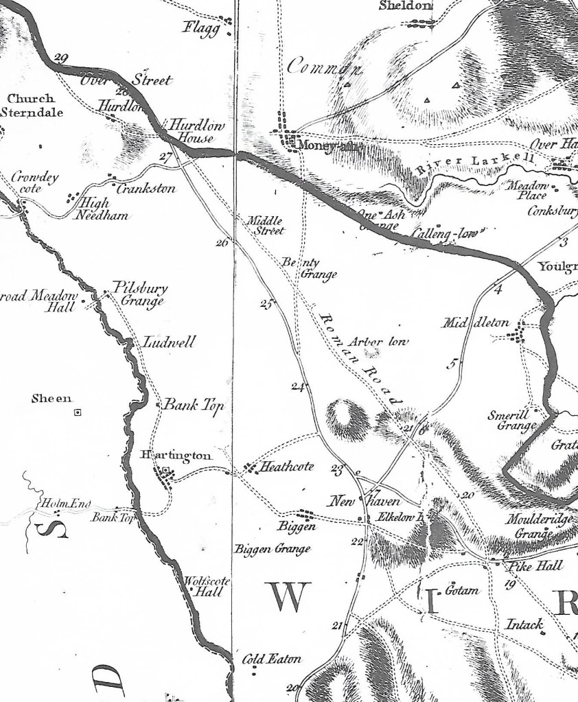
Burdett’s map of 1767 showing The Street north of Pikehall
Something not mentioned by English Heritage is that a Roman road ran through this area just 100 metres away, south east from Buxton, and that this probably followed the line of an older ridgeway. A henge monument on the scale of Arbor Low must have attracted visitors for (presumably) seasonal festivals from all over the district, and so the proximity of the henge to the road is not mere coincidence. It can be seen that the eighteenth-century turnpike did not follow the exact route of the older road, which remained in use until the time of Burdett’s map, but which has now disappeared except as a parish boundary. Overall the route presents a classic example of a road that may be at least four thousand years old, starting as a ridgeway serving the henge and other sites nearby, then being re-engineered by the Romans, and more recently re-routed as a turnpike road.