The style of stiles

Since the nineteenth century stiles have been a familiar feature of the rural landscape, providing a bucolic focus for pictures of simple country folk or lovers’ trysts. Before the enclosure of moors and commons stiles weren’t needed, but with the arrival of hedges and dry stone walls access was needed for pedestrians. ‘Stile’ comes from the old German word ‘stigel’ which means to climb or go over.

Squeeze stile near Alport Height

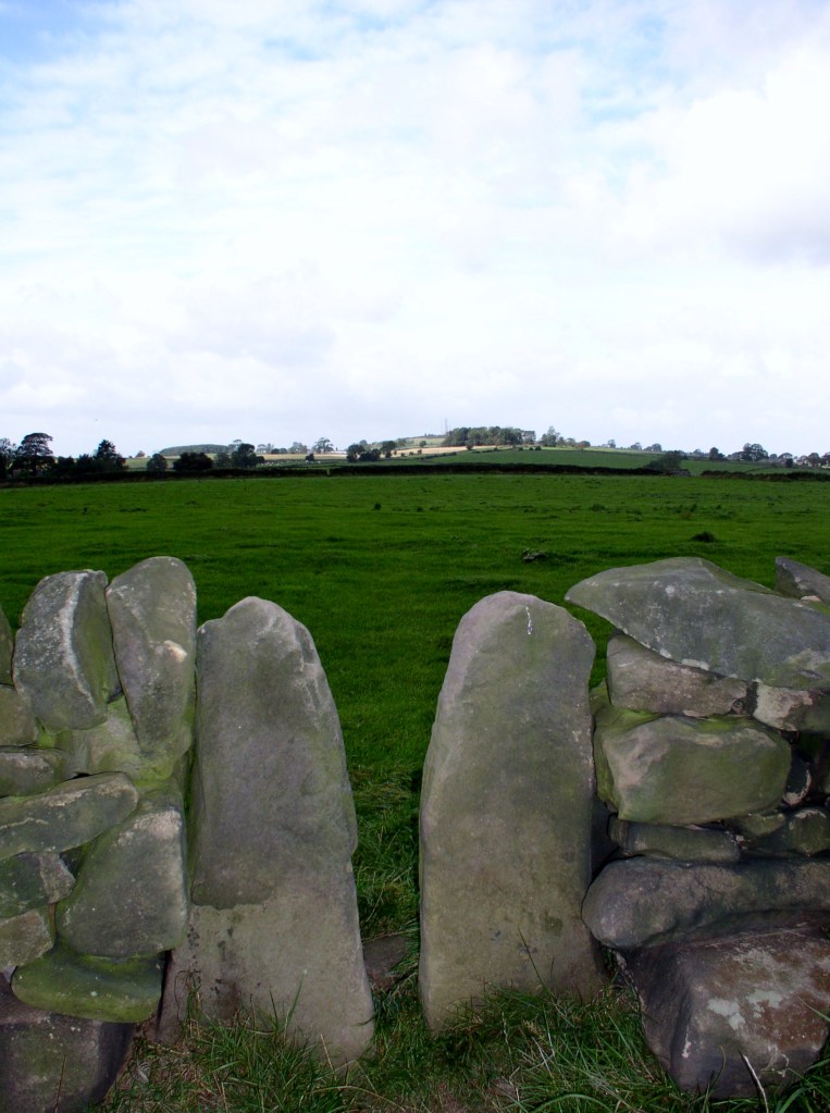
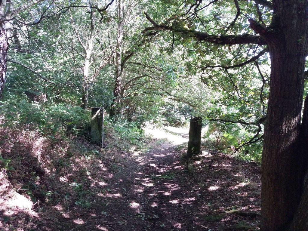
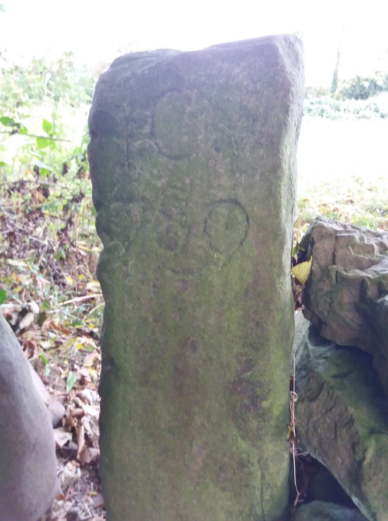
Squeeze stiles are a distinctive feature of the Derbyshire landscape. They are simple to pass through, but clearly are only effective if too narrow for sheep to slip between, and so can prove quite tricky for the overweight! They have the advantage of clearly marking the route of a path, so that when entering a field you can normally see the next stile ahead, and aim for that. Very occasionally the stile stones are dated, as in the example below at Lea, which suggests that this area was enclosed about 1780.

Other types of stile are with wooden steps, or stone steps let into a wall. Both can be more difficult for walkers if not well-maintained, and an upright wooden post should be provided for hand support. Dogs can also find stiles tricky, so the ideal model has a dog gate which can be raised when needed. But today there is a move to replace stiles with gates, more convenient for elderly walkers but also requiring more maintenance – and easily left open.

Stile and gate near Holbrook

Beyond their practical function, stiles can be seen as fossilised markers of footpaths, possibly 250 years old in many cases, but indicating routes that were in existence before the enclosures and which had to be preserved subsequently. In places the paths they serve could be medieval, and may once have been a long-distance road, now merely a Sunday ramble.

Lea Road: A sorry, soggy story

Gateposts in Bow Wood show that this was more than a path

The tendency of Derbyshire roads, over time, has been a shift from high-level routes to more convenient ways in the valleys, with gentler gradients. A good example is the road from Cromford Bridge to Lea Bridge, which in medieval times ran past the site of Cromford Station and then turned uphill at Wood End, away from the Derwent, and ran past Castletop farm and through Bow Wood and down to the Lea Brook. This route can still be followed on foot, taking the path just past the railway bridge, up through the wood, and then joining the old track beyond the house.

However, when the Cromford Bridge and Langley Mill Turnpike Trust was established, an easier route was selected, following the river up to what is now High Peak Junction, and then turning north east to Lea Bridge, at that time quite an industrial complex. This new road went on to Holloway, Crich, Bull Bridge and Codnor Gate (where until recently the turnpike was commemorated by the Gate pub).

The road had a tendency to flood in very wet weather, especially near the Cromford railway bridge, but remained a useful route for over two hundred years. But following heavy rain in November 2019, the river had undercut the bank and part of the road collapsed in January 2020, causing the council to close the road the next day.

The road today

In the nearly two years since the road closure the residents of Lea Bridge and Holloway have had no direct access to Cromford or Matlock, and so have had to make lengthy detours on narrow lanes, such as the route over Riber hill. What they find most annoying is the lack of any sense of urgency in re-opening this critical route. Derbyshire County Council and their contractors, Eurovia, have produced a variety of excuses for the prolonged closure, claiming that there have been further landslips. Yet on a a warm dry autumnal day like today no-one is working on the site, while the road, for some reason, is even closed to walkers and cyclists.

They shall not pass

Given that the old turnpike road was engineered by men with wheelbarrows and picks, it seems incredible that today, with modern equipment, we are incapable of repairing a few hundred yards of road in less than two years.

Saints and sinners

Carving of pilgrim, Youlgrave church

This figure from Youlgrave church is thought to represent a pilgrim, with his (or her) staff and waist-hung satchel. We often think of pilgrimage in terms of the great medieval shrines of Christianity such as Santiago or Canterbury, but during the high middle ages (about 1100 – 1300 CE) many pilgrimages must have been more local, perhaps within a day’s journey of the pilgrim’s home. In Derbyshire, abbeys such as Dale as well as churches like St Alkmund’s in Derby would have attracted pilgrims. The main draw was the burial place of a saint or the ownership of a holy relic, such as a flask of Mary’s milk.

Sarcophagus in DerbyMuseum

Pilgrims hoped that being close to the remains of a holy person would benefit them in some way. Many were seeking a cure for an illness, often with the belief that a particular saint would help with certain conditions. Others might be making the journey as a penance, to compensate for some crime or misdemeanor. St Alkmund was a local saint who was murdered in Derby in the eighth century, and whose impressive stone sarcophagus can be seen in Derby Museum – the (rebuilt) church was demolished to make way for the city’s ring road.

St Bertram’s church, Ilam

Another local saint, although actually in Staffordshire, is St Bertram at Ilam near Ashbourne. He also lived in the Saxon period, becoming a hermit after his wife and child were eaten by wolves. One unusual feature of the church is that the shrine of the saint has survived, perhaps due to the remote location of the village. Most aspects of pilgrimage, such as shrines and relics, were removed during the Protestant Reformation of the sixteenth century. Yet although discouraged, pilgrimage was hard to suppress, and saw an effective revival in the growth of spa towns such as Buxton in the eighteenth century.

Ex-votos, Passau, Bavaria

In Britain there are few relics of pilgrimage, but in Catholic areas of Europe such as Spain or Bavaria it is possible to find displays of ex-votos such as the example above. These are often small paintings of a miracle rescue or healing brought about by the local saint, and given to the church in thanksgiving. In other places models of the afflicted body part, such as arm, foot or head, are displayed. Clearly, in an age of very limited medical knowledge, making a pilgrimage was often seen as an effective remedy.

The story of the lane

Hearthstone Lane near Castle Top farm

It is rare to find a historic written description of a Derbyshire road: most literate people in the past took the state of the roads for granted. Therefore it’s especially interesting to have an account of Hearthstone Lane, which runs north from Castle Top farm to Riber, and is today a bridle path. This was written by Alison Uttley, who was brought up at the farm in the late nineteenth century, in her memoir ‘Ambush of Young Days’. She says:

This latter was the old highway, dating from long before any of the roads in the valley. We knew, from family tradition, that the packhorses travelled along it, and that lead from the Roman mines in the hills was once carried down its winding slopes on ponies’ backs. It wandered up to the crest of the hills, cutting through some of our fields, and then it followed the high ridge, between two stone walls, with the land dropping on either side to two valleys. This hill road was grass-covered, and only horses and cows went along it in those days, with sometimes a countryman who was visiting us, the pig-killer, the mole-catcher, the hedger or the thatcher’.

Higher up Hearthstone Lane

Less than a mile from Castle Top farm is the site of an old cottage, easy to miss if you haven’t read Uttley: ‘The Boggart House was sinister, ghostly, and I crept up on tiptoes, although the grass in the lane hid all sound.There were stories about this cottage, which was said to be haunted. I had no fear of the ghost, but of one of the inhabitants. A man and his wife lived there, a good couple, living the most lonely life imaginable … But with them dwelt their son, who had had an accident in the quarries, long ago. He had two noses, it was said, and this is what alarmed me’. Today there are still gooseberry bushes growing in what was their garden, but it seems extraordinary that a family could have lived there, so remote even from a well.

The site of the Boggart House

The Lane is partly a ridgeway, as Uttley appreciated, and the highest point, before it drops down towards Riber, is called Bilberry Knoll. In the field here are a collection of large stones, and it is thought that these are the remains of a megalithic structure which once crowned this hilltop. Given the names of many roads in the vicinity (Holestone, Cuckoostone, etc) it seems likely that this was the Hearthstone (or Heartstone?) after which the Lane was named. Many of these prehistoric sites were destroyed by puritanical landowners who saw them as idolatrous, pagan remains, and this may have been the case here.

Bilberry Knoll