Walkers, hikers or ramblers?

Squeeze style on path to Alport Height

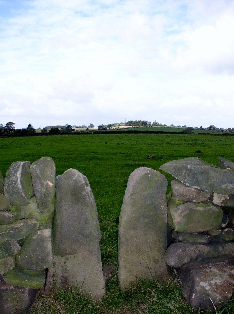
Many of our field paths were created by people walking to work, possibly in mines or mills. With the enclosure of moors and commons in the late eighteenth or early nineteenth centuries and the building of drystone walls to delineate the new fields, these routes became fossilised, often marked by a series of squeeze stiles, as on the path above. Today the mills and mines have gone, yet the paths are kept open by walkers – a leisure activity that would probably have surprised the mill hands of Arkwright’s day.

Matlock Bath’s Swiss-style station

Walking for pleasure became popular from the mid-nineteenth century, as some workers in the industrial cities of Sheffield and Manchester gained a half-day holiday on Saturday and were able to take advantage of the new railway lines to escape from the smoky cities into the hills of Derbyshire, Yorkshire and Lancashire. At first the focus was on the Dark Peak moors, especially Kinderscout, which became a regular scene of conflict between walkers and the gamekeepers employed by the Duke of Devonshire, who owned much of the moors.

PNFS signpost near Alderwasley

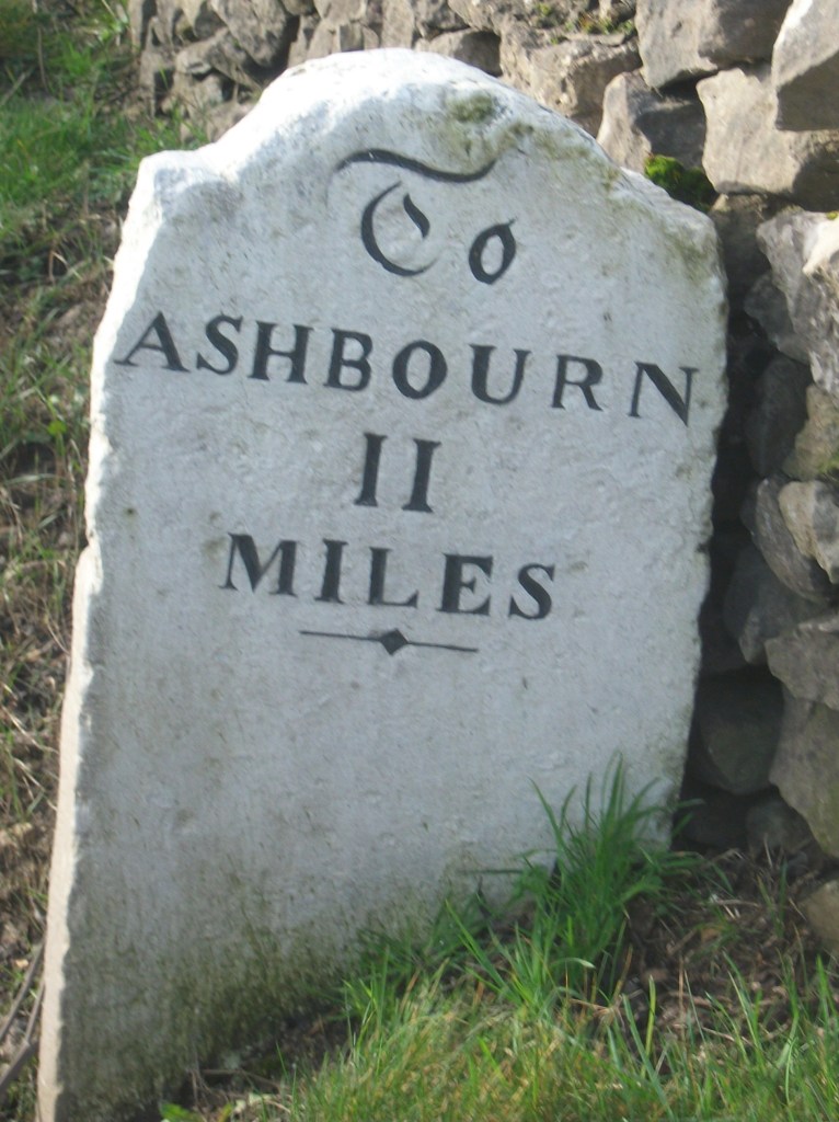
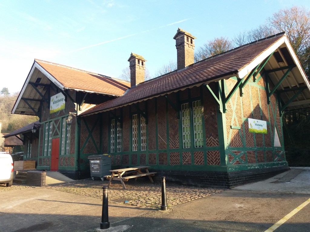
The Manchester Association for the Preservation of Ancient Public Footpaths was founded as early as 1826, and Manchester remained a centre for the defence of workers’ interests, notably establishing the first public library (1852) and the first cooperative society (Rochdale, 1844). In 1894 the Peak District and Northern Counties Footpath Preservation Association (thankfully abbreviated now to Peak & Northern) was formed, and is still doing excellent work defending walkers’ rights and interests, notably through over 500 steel signs like the one above.

The Hemlock Stone today

The inter-war Kinderscout mass trespass has been widely publicised, but it was far from typical of the experience of many walkers in the Derbyshire hills. In general farmers and landowners have respected public rights of way and co-existed succesfully with ramblers. Perhaps a more typical walk is described by DH Lawrence in his Bildungsroman novel Sons and Lovers. Here, a party of friends and family, mostly connected with the Eastwood Congregationalists, set out to walk from Eastwood to the Hemlock Stone in Bramcote Hills one Bank Holiday. The walk actually took place at Easter 1905, and is an example of the way young people at that time, with little spare cash but plenty of energy, enjoyed their precious free time. The connection exemplified there between nonconformity, radical thought and hiking is interesting, and worth exploring further.

Milestoned?

Milestone from Bakewell to Ashbourne turnpike, near Winster

As might be expected, the Romans were the first to use milestones in Britain. Theirs were usually stone cylinders, and a fragment of one is in Buxton Museum. Clearly, they had two useful functions: not only did they tell travellers how far they had to go, but at the same time they provided reassurance that they were on the right road. Unsurprisingly, no Roman milestones survive in situ, and they were not seen here again until the eighteenth century.

Milestone near Matlock Bath

The turnpike trusts seem to have re-introduced milestones on their routes, with each trust using a slightly different style, as seen in the two examples above. Spelling of place names is also non-standardized. Many of these survive, and provide a useful indicator of the routes of different trusts. For instance, on the Alfreton to Ashbourne route, between Crich and Carsington almost all the stones are still in place, although sometimes they are hidden in the undergrowth.

Milepost at Fritchley

In the early nineteenth century some trusts began using iron, possibly because it was cheaper to letter. The above example is on the Cromford to Langley Mill turnpike near Fritchley, and gives more information than the earlier models.

This super-milepost is also made of iron, and is found opposite the Red Lion in Wirksworth. Unusually, it has the name of the iron founders (Harrison of Derby) at the base. Wirksworth was on the route of the Nottingham to Newhaven turnpike, and horses were probably changed at the Red Lion. Newhaven was an important turnpike junction, where coaches would join the Ashbourne to Buxton road.

Finally, it’s worth noting that although today few people use milestones for travel, we still talk about them in everyday conversation, as in ‘she had reached a critical milestone in her life …’. Perhaps a reminder that, at least for pedestrians, every milestone passed was an achievement!

A trip to London in the 1660s

Renishaw Hall, home of the Sitwell family

The reality of travel for the wealthy in the 1660s is illustrated by Sir George Sitwell’s description of his ancestor’s annual visits to London from Renishaw Hall, at Eckington near Sheffield. This was usually at the end of April, when the roads were again passable:

His plans were laid a month or six weeks in advance, and a week or ten days before starting a box or trunk of clothes was sent on by carrier. He left Renishaw at seven o’clock in the morning, attired in a riding suit, top boots, a horseman’s cloak and a ‘mounteroe’ or Spanish travelling cap, of velvet. Pistols were borne in the holsters, for Sherwood was a noted haunt of highwaymen’.

He was accompanied by a footman, dressed in livery, carrying more clothes. It was a four day journey; the first night spent at Nottingham, the second at Harborough, and the third at Dunstable, with an average stage of about thirty miles.

‘In London, Mr Sitwell frequented the Greyhound Inn in Holborn …. and there he paid about eight shillings and fourpence a week for chamber rent and washing, and eighteen shillings and eightpence for hay and corn for his horses. Food and minor expenses came to about £1 6s. 8d. a week.

His stay in London usually lasted about a fortnight, and allowed him to meet family and friends as well as attending to business at his lawyer’s. He was also able to keep in touch with the political world via his cousin, Roger Allestry, an MP. But the fact that this trip required spending eight days on the road well illustrates the reality of seventeenth century life.

Sir George Sitwell, ‘Country Life in the Seventeenth Century’, in ‘Memorials of old Derbyshire’, 1907, Ed. C. Cox

The name of the lane

Road name near Holbrook

Although name signs like this are relatively modern, roads have been named for hundreds of years, and today road names are a useful resource for historians. We do not know what names the Romans actually gave their routes, but after their departure they were called ‘streets’ as in Ryknild Street, which ran from Derby to Chesterfield. Many place names e.g. ‘Stretton’ reflect this. Anglo-Saxons used the noun ‘way’ for their roads, and this survives in many expressions such as ‘highway’ and ‘byway’. The word ‘road’ was not common until the seventeenth century, and may be derived from the verb ‘rode’.

The most obvious type of name gives the destination of the road, hence Chesterfield Road or Brassington Lane. Another refers to some feature found on the road, either natural or man-made, such as Chapel Lane or Cuckoostone Lane. In the case of an ancient route like Hearthstone Lane, running from Cromford to Riber, there is no obvious Stone, raising the question ‘Where was it?’

Hermitage Walk, Nottingham

This sign in The Park in Nottingham is a valuable clue that the ‘Walk’ led to an ancient group of caves (now inaccessible) that contained a rock-cut chapel. Other names refer to the state of the road: Long Lane, Marsh Lane, New Road. In this last case, the name suggests that there is an ‘old road’ that could be investigated.

Many road names refer to natural features using archaic vocabulary. ‘Shaw’ or ‘Carr’ names are common in Derbyshire, and mean a wood on a steep slope, as in Leashaw, Upper Holloway. ‘Sitch’ is Anglo-Saxon for a small stream. ‘Well’ endings as in Bakewell suggest a natural spring.

A few names refer to an individual, either familiarly in ‘Samuel’s Lane’ or more grandly with ‘Via Gellia’, named by Anthony Gell, the road developer, after himself in pseudo-Roman style.

Road sign on the Ridgeway near Heage

But there will always be names that elude discovery, or can only be the subject of wild guesswork. What’s the story behind Lickpenny Lane, for instance, or the Clatterway at Bonsall? Or did Wapentake Lane near Kirk Ireton really lead to the site of the ancient Wapentake?